The best road cycling routes around Tazacorte
4.5
(90)
1,540
riders
49
rides
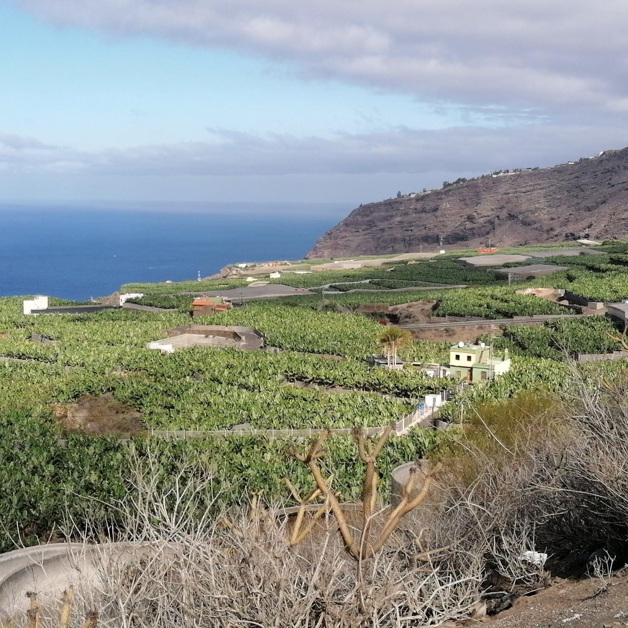
Road cycling around Tazacorte, located on the western coast of La Palma, offers diverse terrain characterized by dramatic volcanic landscapes and significant elevation changes. The region features well-paved roads that traverse lush banana plantations, pine forests, and coastal areas. Cyclists encounter routes with substantial climbs, providing challenging experiences alongside scenic views of the Aridane Valley and the Atlantic coastline. This varied topography makes Tazacorte a notable destination for road cyclists seeking demanding routes.
Best road cycling routes around Tazacorte
- The…
Last updated: October 5, 2026
4.7
(10)
120
riders
51.3km
03:08
1,420m
1,420m
Hard road ride. Very good fitness required. Mostly well-paved surfaces and easy to ride.
4.5
(6)
86
riders
48.6km
02:32
910m
910m
Hard road ride. Very good fitness required. Mostly well-paved surfaces and easy to ride.

4.5
(2)
44
riders
55.1km
03:42
1,790m
1,790m
Hard road ride. Very good fitness required. Mostly well-paved surfaces and easy to ride.
5.0
(2)
26
riders
Moderate road ride. Good fitness required. Mostly well-paved surfaces and easy to ride.
19
riders
114km
06:57
3,060m
3,060m
Hard road ride. Very good fitness required. Some segments of this route may be unpaved and difficult to ride.
Get access to more routes and recommendations from other explorers.
Already have an account?
Our route recommendations are based on thousands of hikes, rides, and runs completed by other people on komoot.
Start today with a free account
Your next adventure awaits.

Other adventures around Tazacorte

Tips from the Community

It's always important to know where you can refill drinking water on La Palma!
0
0

The taxi still costs €51, and they're already waiting there. With four passengers, you can split the price accordingly, so it's worth the wait. The climb without a taxi takes about 2.5 hours. I'm glad I took the taxi.
2
0

Perfectly smooth asphalt and stunning experience to ride so close the fresh lava fields
0
0

The Caldera de Taburiente Visitor Center is a facility intended to offer information, education and guidance to visitors wishing to explore the Caldera de Taburiente National Park, located on the island of La Palma, in the Canary Islands. This center provides an introduction to the geology, flora, fauna and history of the park, as well as practical information on hiking trails, points of interest and conservation regulations. It usually has interactive exhibits, audiovisuals, maps, information panels, and trained staff to answer questions and provide assistance to visitors. https://www.youtube.com/watch?v=y5w7bNH22mU
1
0
Los Canarios is the capital of the municipality of Fuencaliente, on the island of La Palma (Canary Islands, Spain). It is located at 700 m above sea level. n. m., in a hole surrounded by volcanic cones covered with pine forests. The population center is more concentrated on both sides of the main road, and outside it it is more spread out. The fact that it is far from other population centers, that it is the southernmost town on the island, and that it is almost immersed in dense pine forests, gives it an aspect of isolation. At a certain time, the cultivation of cereals, fruit trees and vineyards was important in its surroundings. Nowadays, the vineyard is still important, plus the small self-sufficiency orchards. https://www.youtube.com/watch?v=sfeasyaLpV8
0
0
On clear days you can see Teide, El Hierro and La Gomera, you can't miss it https://www.youtube.com/watch?v=UqwZv4OZQ8k
1
0
From this viewpoint you can see panoramic views of the main population center of Fuencaliente, Los Canarios, and the San Antonio Volcano. To the right of this volcanic cone, on its slope, you can see the Roque Teneguía spot. This Roque is a testimony of the ancient volcanism of the region, on which there is a station of rock engravings of the aborigines of the Island.
1
0
Frequently Asked Questions
How many road cycling routes are available around Tazacorte?
Tazacorte offers a wide selection of road cycling routes, with over 35 routes available. These routes cater primarily to moderate and difficult ability levels, providing diverse challenges across the region's volcanic landscapes.
What kind of terrain can I expect on road cycling routes in Tazacorte?
Road cycling in Tazacorte features highly varied terrain, characterized by dramatic volcanic landscapes and significant elevation changes. You'll encounter well-paved roads traversing lush banana plantations, dense pine forests, and scenic coastal areas, often with substantial climbs and breathtaking views of the Aridane Valley and the Atlantic coastline.
What do other cyclists say about road cycling in Tazacorte?
The road cycling routes in Tazacorte are highly rated by the komoot community, with an average score of 4.5 stars from more than 50 reviews. Cyclists often praise the challenging climbs, stunning panoramic views, and the unique experience of riding through volcanic terrain and along the dramatic coastline.
Are there any notable viewpoints or landmarks along the road cycling routes?
Yes, many routes offer spectacular viewpoints and pass by significant landmarks. You can enjoy panoramic scenery from spots like the Mirador del Time and Las Hoyas Viewpoint. Other notable features include the impressive Las Angustias Gorge and the dramatic cliffs visible from the Punta Lava Lighthouse. You might also pass by the Lomo de Tagasaste Viewpoint or Los Roques Viewpoint.
Can I see any unique natural features while cycling in Tazacorte?
Absolutely. The region is rich in unique natural features. You can cycle past the striking black sand beaches near Puerto Tazacorte, witness the dramatic cliffs formed by lava flows, and experience the impressive Las Angustias Gorge. Some routes may even offer glimpses of the Colorful Waterfall, a truly unique sight.
What is the best time of year to go road cycling in Tazacorte?
Tazacorte benefits from a mild climate year-round, making it an ideal location for road cycling in any season. The consistently pleasant weather ensures comfortable riding conditions, allowing you to enjoy the diverse landscapes throughout the year.
Are there any circular road cycling routes available?
Yes, Tazacorte offers several excellent circular road cycling routes. A popular option is the Puerto de Tazacorte Beach – El Time Viewpoint loop from Las Norias, a challenging 34.4-mile (55.4 km) ride. Another favorite is the Balcón Taburiente Restaurant – Los Brecitos Viewpoint loop from Tazacorte, which covers 24.3 miles (39.1 km) with significant elevation gain.
Are there options for very challenging road cycling routes in Tazacorte?
Yes, Tazacorte is well-suited for experienced cyclists seeking significant challenges. Many routes feature substantial climbs, with some hard rides requiring very good fitness and featuring over 1,500 meters of elevation gain. For instance, the LP 109 – Las Mimbreras Picnic Area loop from Time is a demanding 70.9-mile (114.1 km) route with over 3,000 meters of ascent.
Are there any facilities like huts or shelters near the routes?
Yes, there are several huts and shelters in the vicinity of Tazacorte that can be useful during longer rides. Notable options include Refugio del Pilar and Refugio de Tinizara, which can provide a resting point or shelter.
Are there any easy road cycling routes for beginners in Tazacorte?
While Tazacorte is known for its challenging terrain, the region's 38 road cycling routes are predominantly moderate to difficult. There are no routes specifically classified as easy, as the volcanic landscape inherently involves significant elevation changes. Cyclists new to the area or with less experience should be prepared for climbs and descents.
What are some longer road cycling routes for experienced riders?
For experienced riders looking for extended challenges, Tazacorte offers several long-distance routes. The Mirador Los Canarios – Tigalate–Mazo Cycling Route loop from Monumento Natural de los Volcanes de Aridane is a very demanding 97.7-mile (157.1 km) route with over 4,000 meters of elevation gain. Another significant option is the LP 109 – Las Mimbreras Picnic Area loop from Time, spanning 70.9 miles (114.1 km).
Are there any routes that combine coastal views with climbs?
Many routes in Tazacorte beautifully combine dramatic coastal views with challenging climbs. The El Time Viewpoint – Puerto de Tazacorte Beach loop from Tazacorte is a prime example, offering a 33.0-mile (53.1 km) ride through volcanic terrain and along stunning coastal stretches, often completed in about 3 hours 16 minutes.
Most popular attractions around Tazacorte

Get inspired with the komoot mobile app


Explore more
Browse the best Road cycling routes in other regions.
