The best walks and hikes around La Victoria De Acentejo
4.3
(9706)
35,977
hikers
619
hikes
Hiking trails around La Victoria de Acentejo are located in the northern part of Tenerife, offering a diverse range of natural landscapes. The region features extensive pine and laurel forests, dramatic coastal cliffs, and deep ravines. Terrain varies from humid forest paths to agricultural routes through vineyards and chestnut groves, providing varied elevations and surfaces for hikers.
Best hiking trails around La Victoria De Acentejo
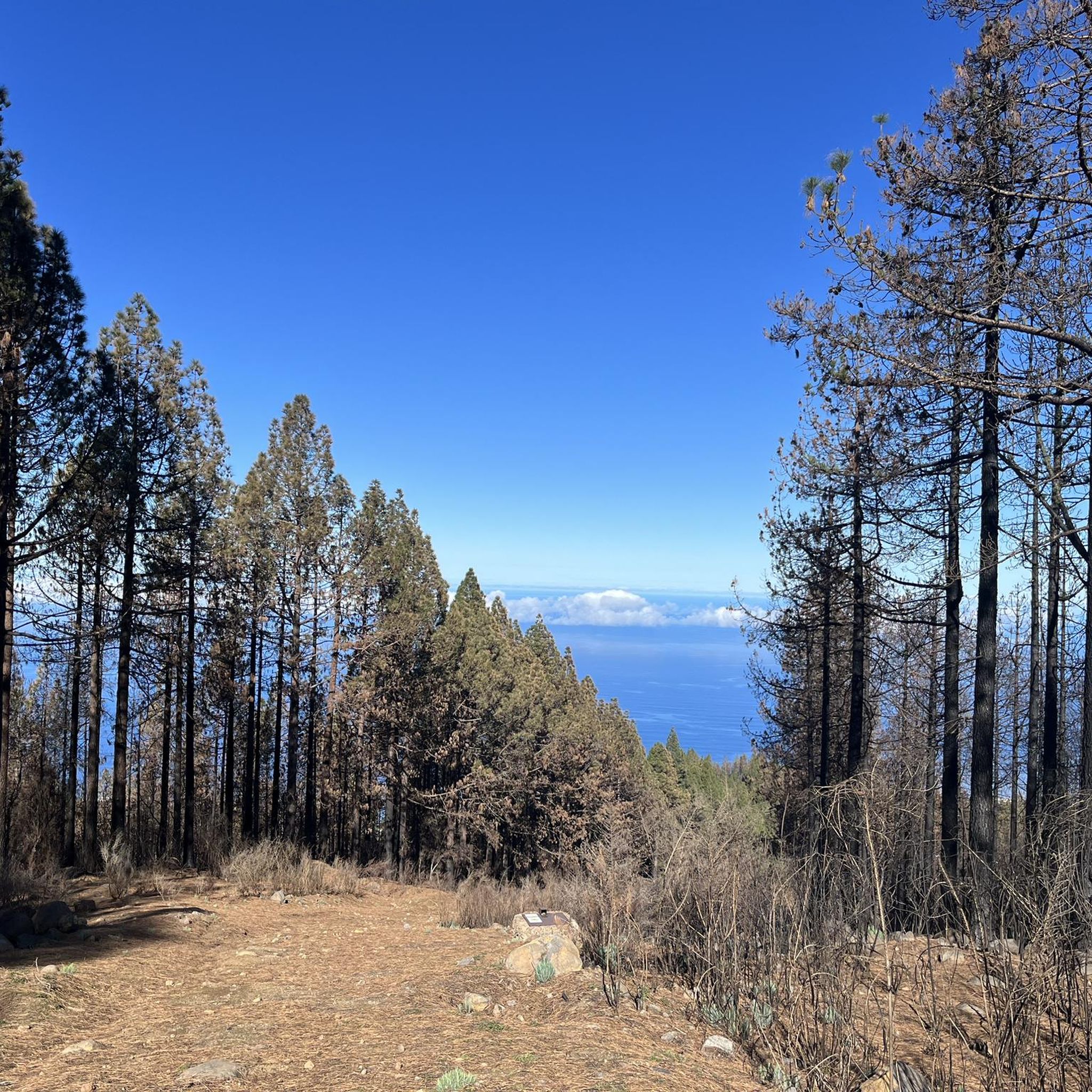
- The most popular hiking route is Fire-Scarred Pine Trees – Burnt Forests of Las Lagunetas…
Last updated: May 28, 2026
4.4
(66)
204
hikers
Moderate hike. Good fitness required. Easily-accessible paths. Suitable for all skill levels.
3.9
(37)
153
hikers
Easy hike. Great for any fitness level. Easily-accessible paths. Suitable for all skill levels.

Sign up for free
4.4
(48)
134
hikers
8.05km
02:49
420m
410m
Moderate hike. Good fitness required. Mostly accessible paths. Sure-footedness required.
4.7
(16)
45
hikers
8.95km
03:01
400m
400m
Hard hike. Good fitness required. Sure-footedness, sturdy shoes and alpine experience required.
4.8
(19)
61
hikers
Moderate hike. Good fitness required. Easily-accessible paths. Suitable for all skill levels.
Get access to more routes and recommendations from other explorers.
Sign up for free
Already have an account?
Our route recommendations are based on thousands of hikes, rides, and runs completed by other people on komoot.
Start today with a free account
Your next adventure awaits.
Login or Signup
Popular around La Victoria De Acentejo


Tips from the Community

A beautiful hike from Puerto de la Cruz, Tenerife. The trail begins along the road with stunning views of the Atlantic Ocean and its towering cliffs and waves. Later, you'll reach vast banana plantations and Bollullo beach. At the end of the hike, there's a small rest area with fantastic views across the entire coastline. Highly recommended.
1
0
A beautiful hike from Puerto de la Cruz, Tenerife. The trail begins along the road with stunning views of the Atlantic Ocean and its towering cliffs and waves. Later, you'll reach vast banana plantations and Bollullo beach. At the end of the hike, there's a small rest area with fantastic views across the entire coastline. Highly recommended.
1
0

Small park, but not really worth the detour. On the other side of the road, there are some footpaths through Canarian flora leading to the edge of the ravine.
0
0

Just crazy
0
0
An interesting coastal village
0
0


Living for individualists with your own natural pool on the doorstep
0
0

The surroundings of Laja de Piedra are unrivalled. The trails that lead here are full of native flora, allowing any nature lover to jog through a dreamlike landscape.
0
0
Frequently Asked Questions
How many hiking trails are available in La Victoria de Acentejo?
There are over 620 hiking trails in La Victoria de Acentejo, offering a wide variety of options for all skill levels. This includes 282 easy routes, 285 moderate routes, and 54 difficult routes.
What kind of terrain can I expect on hikes in La Victoria de Acentejo?
The terrain in La Victoria de Acentejo is incredibly diverse. You can expect to traverse lush forests, dramatic coastal cliffs, and deep ravines. Trails range from humid forest paths, including ancient laurel forests and pine forests, to agricultural routes winding through vineyards and chestnut groves. Higher elevations feature protected pine and laurel forests, while coastal areas offer rugged, geomorphic landscapes.
What makes La Victoria de Acentejo a unique hiking destination?
La Victoria de Acentejo stands out due to its rich biodiversity and well-preserved natural landscapes. It boasts several protected areas like the Paisaje Protegido de Las Lagunetas, with its extensive pine and laurel forests, and the Paisaje Protegido de Costa de Acentejo, known for its stunning cliff scenery. The area also features unique ecosystems, from misty cloud forests to drier volcanic terrains, offering a glimpse into Tenerife's geological history and endemic flora.
What do other hikers say about the trails in La Victoria de Acentejo?
The routes in La Victoria de Acentejo are highly rated by the komoot community, with an average score of 4.3 stars from over 9,000 reviews. Hikers often praise the diverse landscapes, from the tranquility of the forests to the breathtaking coastal views, and the variety of trails suitable for different abilities.
Are there easy hiking options suitable for beginners or families?
Yes, there are numerous easy hiking options perfect for beginners and families. For instance, the La Gigantesca Sculpture – Plaza del Mirador loop from Santa Úrsula is an easy 3.8-mile (6.0 km) path with accessible terrain and pleasant views. Many of the 282 easy routes available are suitable for a relaxed outing.
Can I find challenging routes in the area?
Absolutely. For those seeking a challenge, there are 54 difficult routes available. An example is the Hiking loop from Cordillera Dorsal, which is 5.6 miles (8.9 km) long with significant elevation gain, offering a more strenuous experience.
Are there any circular hiking routes?
Yes, many of the trails in La Victoria de Acentejo are circular, allowing you to start and end at the same point. Popular examples include the Fire-Scarred Pine Trees – Burnt Forests of Las Lagunetas loop and the View of El Caletón – El Jagre Trail loop, both offering diverse scenery in a convenient loop format.
What natural features or protected areas can I explore?
You can explore several significant protected natural spaces. These include the Paisaje Protegido de Las Lagunetas, known for its extensive pine and laurel forests, and the Paisaje Protegido de Costa de Acentejo, characterized by its beautiful cliff landscapes. The deep ravines of Barranco de Acentejo and Barranco Hondo are also notable for their endemic flora and fauna.
Are there any notable viewpoints or landmarks along the trails?
Yes, the region offers several stunning viewpoints and landmarks. You can find panoramic views of the north of the island and even Mount Teide from various points within the Paisaje Protegido de Las Lagunetas. The View of Teide from Portillo del Topo is a popular highlight. The El Gaitero Fire Lookout Tower loop also leads to a lookout tower offering expansive vistas. Along the coast, the Los Roques coastal rock formation is a striking natural monument.
Are the hiking trails in La Victoria de Acentejo dog-friendly?
Many trails in La Victoria de Acentejo are suitable for hiking with dogs, especially those in the forested areas. However, it's always recommended to keep your dog on a leash, particularly in protected natural areas, to protect local wildlife and ensure a pleasant experience for all hikers. Check specific trail regulations before you go.
What is the best time of year to hike in La Victoria de Acentejo?
La Victoria de Acentejo offers pleasant hiking conditions year-round due to Tenerife's mild climate. However, the spring and autumn months (April-May and September-November) are often considered ideal, with comfortable temperatures and lush vegetation. During summer, higher elevation trails provide cooler temperatures, while coastal walks are enjoyable in the cooler parts of the day.
Is public transport available to reach trailheads?
Public transport options, primarily local bus services (guaguas), connect La Victoria de Acentejo with other towns on Tenerife. Some routes may have stops near trailheads or within reasonable walking distance. It's advisable to check the local TITSA bus schedules and routes in advance to plan your journey to specific starting points.
Are there any coastal walks or beaches accessible from the trails?
Yes, the Paisaje Protegido de Costa de Acentejo offers stunning coastal walks with dramatic cliff landscapes. While not all coastal areas are suitable for swimming due to strong currents, you can enjoy the natural beauty of spots like Los Roques Beach and the Los Roques coastal rock formation. The Barranco Hondo ravine also offers a trail leading to the coast, where you can see the Roque de la Playa.
Most popular routes around La Victoria De Acentejo
Most popular attractions around La Victoria De Acentejo

Get inspired with the komoot mobile app


Explore more
Browse the best Hikes in other regions.
