The best road cycling routes around Mont-Louis
4.3
(63)
5,636
riders
48
rides
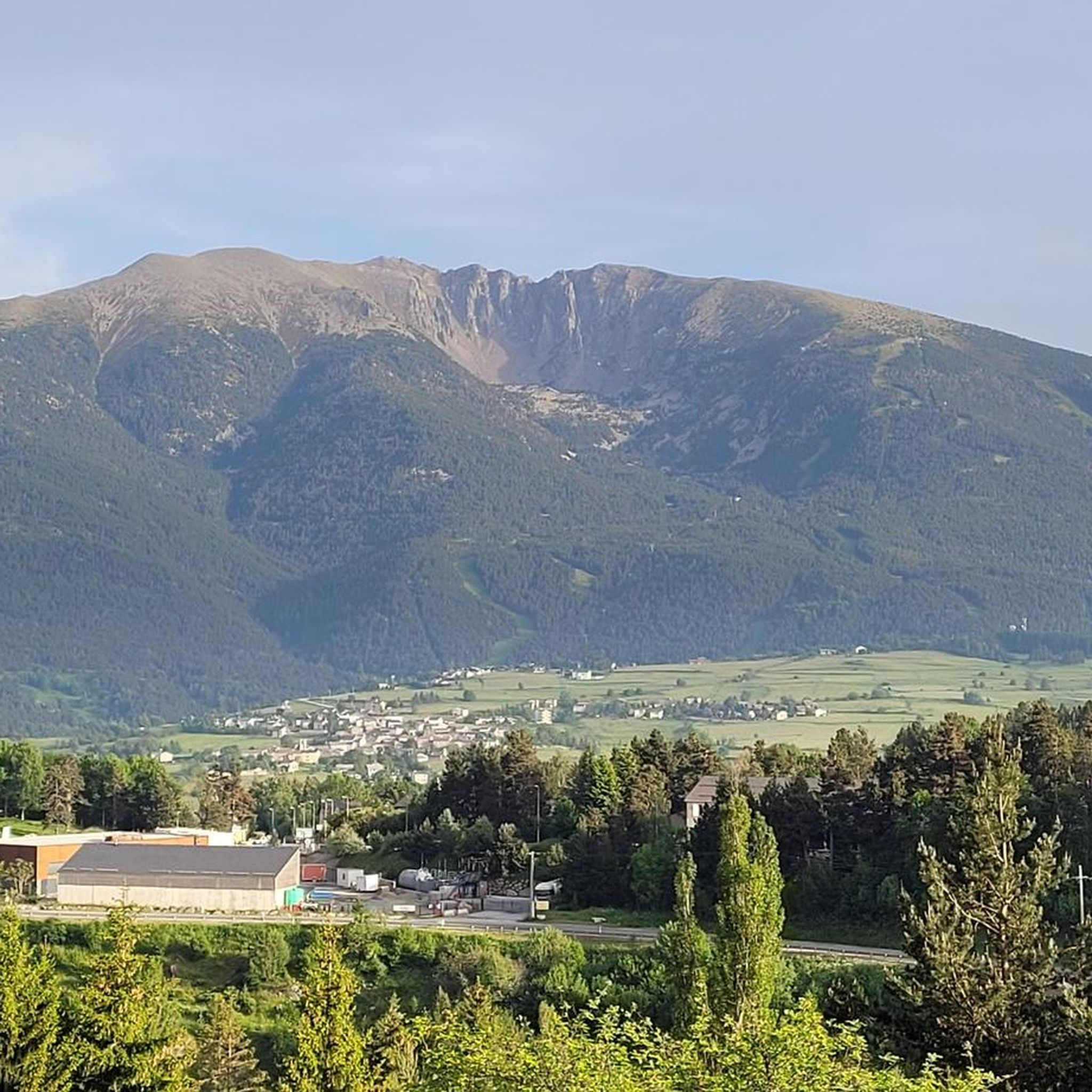
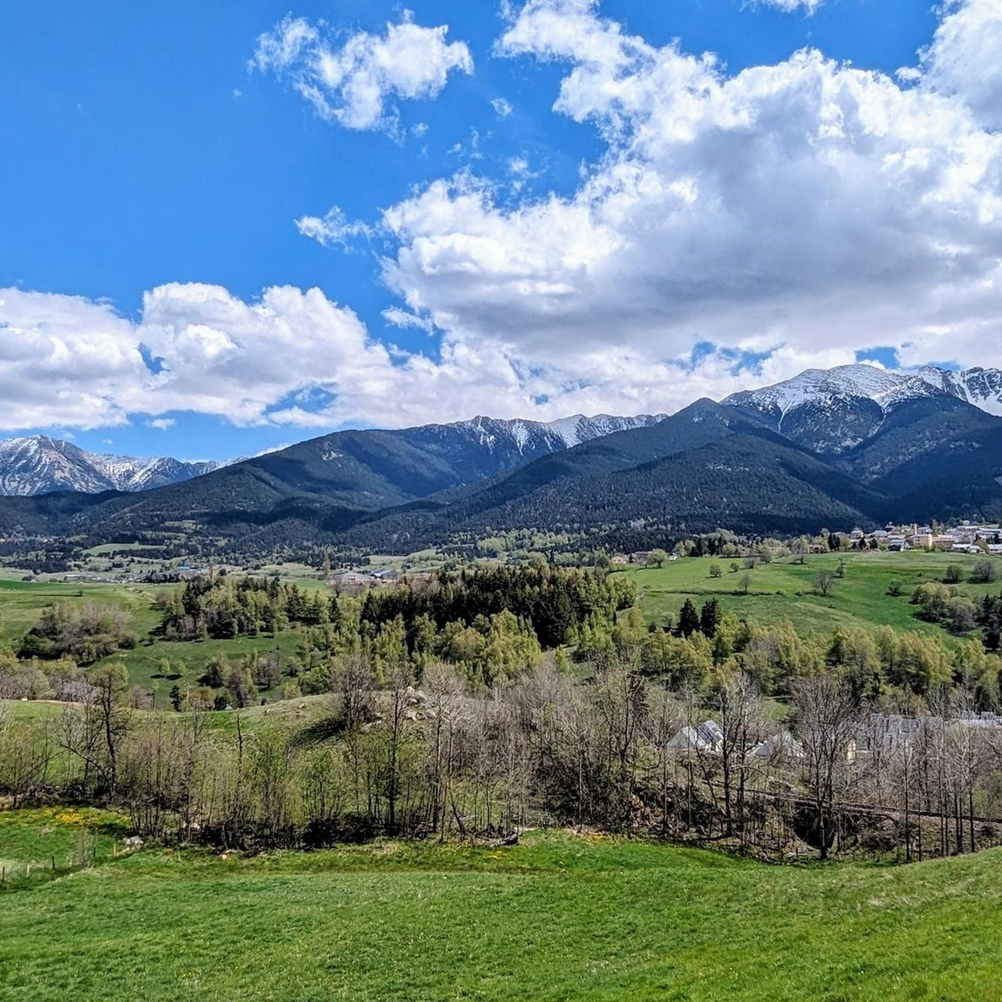
Road cycling routes around Mont-Louis are situated in the heart of the Catalan Pyrenees, a region characterized by its challenging mountainous terrain and significant elevation changes. The area features numerous mountain passes, known as cols, which are central to many road cycling routes. Mont-Louis is also nestled within the Parc Naturel Régional des Pyrénées Catalanes, offering scenic rides through preserved landscapes. The roads are generally well-paved, providing a solid foundation for varied cycling experiences.
Best road cycling routes around Mont-Louis
…Last updated: July 1, 2026
1
riders
14.9km
01:00
400m
400m
Cycle Towards the peak of la Tosse, a moderate 9.3-mile (14.9 km) road cycling route in the Parc Naturel Régional des Pyrénées Catalanes.
4.7
(3)
540
riders
95.6km
04:52
1,560m
1,560m
Hard road ride. Very good fitness required. Some segments of this route may be unpaved and difficult to ride.

Sign up for free
5.0
(2)
244
riders
35.1km
01:46
600m
600m
Moderate road ride. Good fitness required. Mostly well-paved surfaces and easy to ride.
100
riders
Moderate road ride. Good fitness required. Mostly well-paved surfaces and easy to ride.
3.0
(1)
66
riders
29.2km
01:31
460m
460m
Moderate road ride. Good fitness required. Mostly well-paved surfaces and easy to ride.
Get access to more routes and recommendations from other explorers.
Sign up for free
Already have an account?
Our route recommendations are based on thousands of hikes, rides, and runs completed by other people on komoot.
Start today with a free account
Your next adventure awaits.
Login or Signup
Tips from the Community

It's an ideal spot for a picnic. It's also an ideal place for groups of cyclists supported by vans, as there's plenty of space here to relax and not disturb anyone. The lake is at an elevated point, so accessing it from La Llagonne or Les Angles requires a steep climb, always at a lower gradient.
0
0


Well, starting from Font Romeu and breaking legs from Mont Louis
0
0

magnificent landscapes, restoration on the bouillouses
0
0

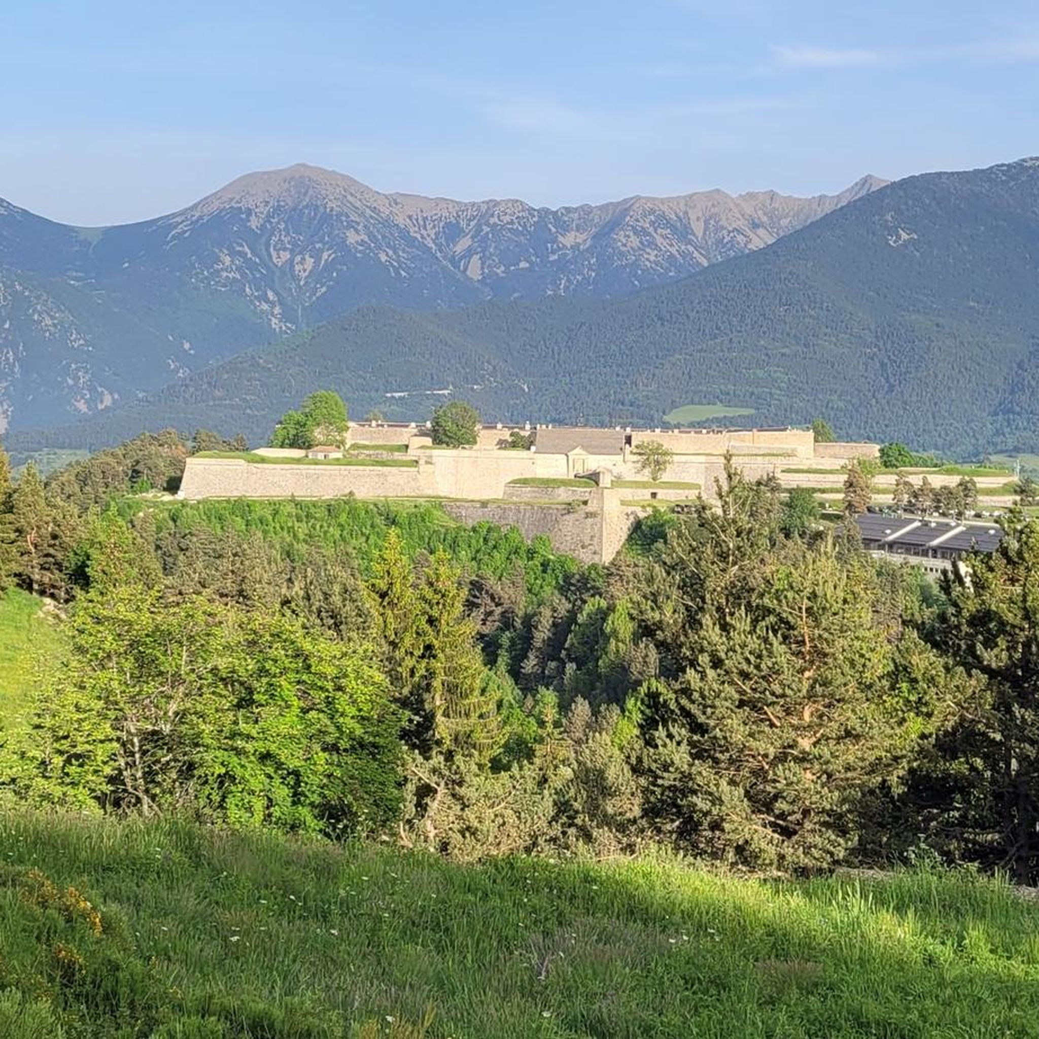
If you are not sitting on the racer and driving through beautiful countryside, you could visit the castle
0
0
The Col de la Calvaire de Font Romeu is a mountain pass in French Cerdanya, next to the town and ski resort of Font Romeu. This port connects the Bolquère valley with the Cerdanya valley. The port is within the same town of Font Romeu, next to the station's ski lifts. There are many slopes to reach Col de la Calvaire: - the western slope that starts from Ur is approximately 16 km and crosses the town of Targasone and the Col d'Egat. It is a very steep climb along a road in perfect condition, although on holidays there is a lot of traffic. - The southern slope starts from Llívia and crosses Estavar and joins the previous one at the Col d'Egat. Unlike the first, the first section of the climb is very hard, with several horseshoe curves and with wonderful views of the entire Cerdanya and the Tosa d'Alp. - The eastern slope stops at Olette, and after approximately 28 km it reaches the top of the pass, passing through the town of Mont-Louis and Bolquère. It is a very steep climb, like the first, on a road in perfect condition but with a lot of traffic. I don't like going up here. - the eastern slope that starts from Olette and passes through the Col de la Perche, reaching the town of Font-Romeu and from there to the top. Of all the slopes, the one I like the most is the slope that starts from Llívia and crosses Estavar.
0
0
This is the beginning of the Port de Pailhères on its eastern side, in Usson-les-Bains. It is worth stopping because there is a sign that commemorates the first climb of the Tour de France in 2003 and indicates the main information about the port.
0
0
Frequently Asked Questions
How many road cycling routes are available around Mont-Louis?
Mont-Louis offers a diverse network of over 45 road cycling routes. These routes cater to various skill levels, including 6 easy, 26 moderate, and 15 difficult options, ensuring there's a ride for every cyclist.
What natural features can I expect to see along road cycling routes in Mont-Louis?
Road cycling in Mont-Louis takes you through the stunning Catalan Pyrenees, offering breathtaking mountain vistas. You'll encounter high-altitude lakes such as Lake Matemale and Estany de la Pradella, and dramatic landscapes within the Parc Naturel Régional des Pyrénées Catalanes. The iconic Mount Canigou often provides a majestic backdrop to your rides.
Are there any historical landmarks or points of interest to visit while cycling?
Absolutely. Mont-Louis itself is a UNESCO World Heritage site, famous for its 17th-century Vauban fortifications, which you can explore. You can also visit the unique Mont-Louis Solar Furnace, the world's first, to learn about solar energy. The region is dotted with picturesque villages, adding to the historical charm.
Are there challenging climbs for experienced road cyclists in Mont-Louis?
Yes, Mont-Louis is renowned for its challenging mountainous terrain and significant elevation changes, making it ideal for experienced cyclists. Routes often incorporate notable mountain passes (cols) like the Col de la Llose and the Col de la Perche (1,579 m). For instance, the Mijanès – Col de la Perche (1,579 m) loop from Mont-Louis - La Cabanasse is a difficult 95.6 km path featuring substantial climbing.
Are there easier road cycling options for beginners or less experienced riders?
While the region is known for its challenging climbs, there are easier road cycling options available. The network includes 6 routes classified as easy, offering less strenuous alternatives. Additionally, the Vélosud (V81) provides a long-distance route along the Pyrenees foothills with moderate slopes and greenways, which can be accessed for shorter, more relaxed rides.
What do other road cyclists say about their experience in Mont-Louis?
The road cycling routes around Mont-Louis are highly rated by the komoot community, with an average score of 4.3 stars from over 80 reviews. Cyclists frequently praise the stunning mountain scenery, the challenge of the cols, and the well-paved roads that lead through the preserved landscapes of the Catalan Pyrenees.
Is there public transport available that accommodates cyclists in the Mont-Louis area?
Yes, the historic 'Little Yellow Train' (Petit Train Jaune) offers a scenic way to explore the French Pyrénées-Orientales and can be useful for cyclists. It often accommodates bikes, allowing for flexible travel and access to different starting points or for companions. You can find more information on its services at visit-occitanie.com.
Are there circular road cycling routes available in Mont-Louis?
Yes, many road cycling routes in Mont-Louis are designed as loops, allowing you to start and finish in the same location. Examples include the Col de la Perche (1,579 m) – Llo Pass loop from Bolquère-Eyne and the Col de la Perche (1,579 m) – Beautiful mountain road loop from Bolquère-Eyne, which offer varied distances and challenges.
What is the best time of year for road cycling in Mont-Louis?
Given its high altitude and mountainous terrain, the best time for road cycling in Mont-Louis is typically from late spring through early autumn (May to October). During these months, the weather is generally more stable, and mountain passes are clear of snow, offering optimal conditions for tackling the climbs and enjoying the scenery.
Are there options for long-distance or multi-day road cycling tours from Mont-Louis?
For those seeking longer adventures, Mont-Louis is situated near the Vélosud (V81), a 650 km cycling route along the Pyrenees foothills. This route provides opportunities for multi-day excursions with moderate slopes and greenways, offering a different experience from the more intense mountain passes. You can learn more about the Vélosud at francevelotourisme.com.
Where can I find parking when starting a road cycling route in Mont-Louis?
Mont-Louis and its surrounding villages, such as La Cabanasse and Bolquère-Eyne, typically offer public parking areas where you can leave your vehicle before starting your ride. It's advisable to check local signage for any specific parking regulations or fees, especially in peak season.
Is Mont-Louis suitable for family-friendly road cycling?
While many routes involve significant climbs, Mont-Louis does offer some easier road cycling options that could be suitable for families with older children or those looking for a more relaxed pace. For younger children or less experienced family members, exploring the greenways of the Vélosud or shorter, flatter sections around the lakes might be more appropriate than tackling the major cols.
Most popular routes around Mont-Louis
Most popular attractions around Mont-Louis

Get inspired with the komoot mobile app


Explore more
Browse the best Road cycling routes in other regions.
