The best MTB trails around Abancourt
4.4
(280)
1,087
riders
147
rides
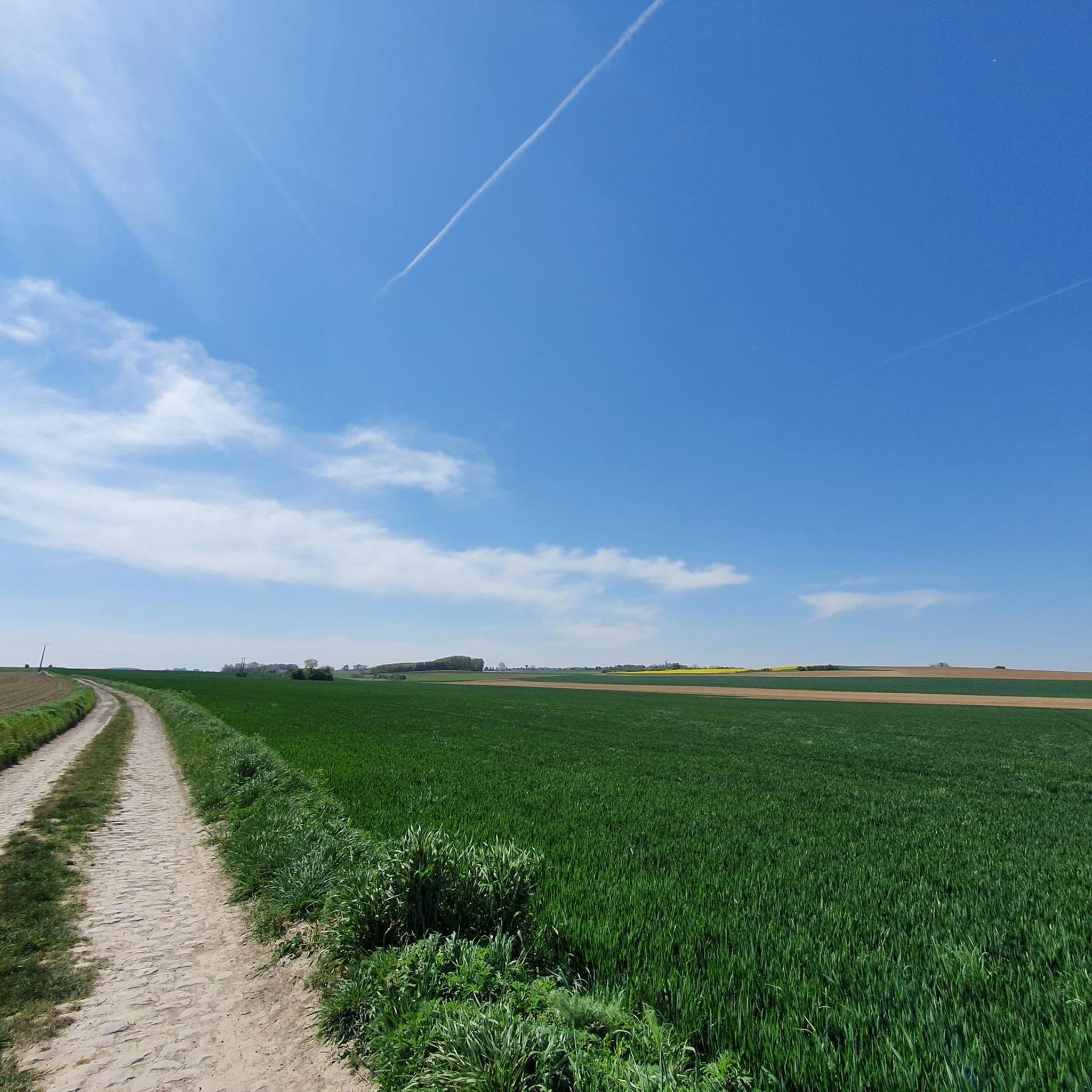
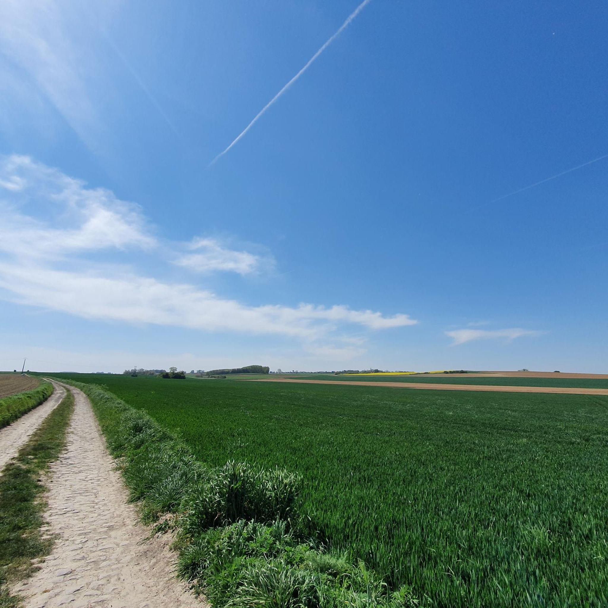
Mountain biking around Abancourt, France, offers routes through a landscape characterized by agricultural fields, gentle forest strips, and waterways. The region encompasses two communes, one in Oise with elevations up to 222m, and another in Nord with lower elevations between 36m and 70m. While not a mountainous area, the terrain provides opportunities for cycling along canal paths, greenways, and through rural settings. These routes are generally suitable for less technical mountain biking or gravel riding on unpaved roads and forest…
Last updated: June 26, 2026
4.7
(6)
43
riders
40.1km
02:31
130m
130m
Moderate mountain bike ride. Good fitness required. Suitable for all skill levels.
4.6
(5)
29
riders
Moderate mountain bike ride. Good fitness required. Suitable for all skill levels.

Sign up for free
4.2
(11)
20
riders
Moderate mountain bike ride. Good fitness required. Advanced riding skills necessary.
3.7
(9)
24
riders
31.3km
01:51
70m
70m
Easy mountain bike ride. Great for any fitness level. Suitable for all skill levels.
5.0
(3)
11
riders
48.4km
02:56
160m
160m
Moderate mountain bike ride. Good fitness required. Suitable for all skill levels.
Get access to more routes and recommendations from other explorers.
Sign up for free
Already have an account?
Our route recommendations are based on thousands of hikes, rides, and runs completed by other people on komoot.
Start today with a free account
Your next adventure awaits.
Login or Signup
Tips from the Community

Hello, is it exclusively mountain biking or accessible by gravel please? It makes me want to do it anyway ☺️
0
0


beautiful mountain bike playground
0
0
beautiful path
0
0

La Fabriq', along the Scarpe, craft beer tasting!
0
0

Exactly Phifou Barzo, this place offers a green setting, with walking paths for pedestrians and cyclists 😎.
0
0
Frequently Asked Questions
How many mountain bike trails are available around Abancourt?
There are nearly 150 mountain bike trails around Abancourt, offering a wide range of options for different skill levels. This includes 39 easy routes, over 100 moderate routes, and a few more challenging trails for experienced riders.
What kind of terrain can I expect on mountain bike trails in Abancourt?
The terrain around Abancourt is characterized by agricultural landscapes, gentle forest strips, and waterways. You'll find opportunities for cycling along canal paths, greenways, and through rural settings. The routes are generally suitable for less technical mountain biking or gravel riding on unpaved roads and forest tracks, rather than challenging singletracks.
Are there any easy mountain bike trails suitable for beginners in Abancourt?
Yes, Abancourt offers 39 easy mountain bike routes, perfect for beginners or those looking for a more relaxed ride. These trails typically feature gentler terrain and less elevation gain, making them accessible for a wider range of riders.
What are some notable landmarks or points of interest near the mountain bike trails?
While mountain biking, you can explore several interesting landmarks. Near Abancourt (Nord), you might encounter the Ecluse de Thun Leveque, a historical monument surrounded by a park. Other nearby attractions include the Belfry of Cambrai and Porte Notre-Dame de Cambrai. For a unique historical site, consider visiting the stone that grows.
Are there any family-friendly mountain bike routes in Abancourt?
Many of the 39 easy routes around Abancourt are suitable for families. These trails often follow canal paths or greenways, providing a safe and enjoyable experience for riders of all ages. The generally gentle terrain makes it a good area for family outings.
Can I bring my dog on the mountain bike trails in Abancourt?
While specific regulations can vary, many of the rural paths, forest tracks, and greenways around Abancourt are generally dog-friendly, especially if your dog is well-behaved and kept on a leash. Always be mindful of local signage, agricultural areas, and other trail users.
What is the best time of year to go mountain biking in Abancourt?
The best time for mountain biking in Abancourt is typically during the spring, summer, and early autumn months (April to October). During these periods, the weather is generally milder and drier, making for more pleasant riding conditions on the unpaved paths and forest tracks.
Are there any circular mountain bike routes around Abancourt?
Yes, many of the mountain bike routes around Abancourt are designed as loops. For example, you could try the moderate Oisy-le-Verger Marshes – Jetty on the Aubigny Marsh loop from Brunémont, which offers scenic views of marshlands and waterways.
What do other mountain bikers say about the trails in Abancourt?
The mountain bike trails in Abancourt are highly rated by the komoot community, with an average score of 4.4 stars from over 280 reviews. Riders often praise the tranquil rural settings, the extensive network of paths along canals, and the accessibility for various skill levels.
Are there any long-distance mountain bike routes in the Abancourt area?
Yes, there are several longer routes for those seeking a more extensive ride. For instance, the moderate The stone that grows – Roost-Warendin Slag Heap 138 loop from Aubigny-au-Bac covers over 74 kilometers and takes approximately 4 hours 34 minutes to complete.
Is there public transport access to mountain biking areas near Abancourt?
Abancourt (Oise) has a train station, which can provide access to the general area. For Abancourt (Nord), it is located closer to urban centers like Cambrai and Douai, which have public transport links. While specific trailheads might require further travel, using public transport to reach the general vicinity is possible, especially for routes along greenways or canal paths.
Where can I find parking for mountain bike trails in Abancourt?
Parking availability varies by trailhead. Many routes start from villages or towns where public parking might be available. For routes along canals or greenways, look for designated parking areas near access points. It's advisable to check the specific route details on komoot for parking recommendations for your chosen trail.
Most popular routes around Abancourt
Most popular attractions around Abancourt

Get inspired with the komoot mobile app


Explore more
Browse the best MTB trails in other regions.
