The best running trails around La Penne-Sur-Huveaune
4.4
(336)
12,734
runners
16
runs
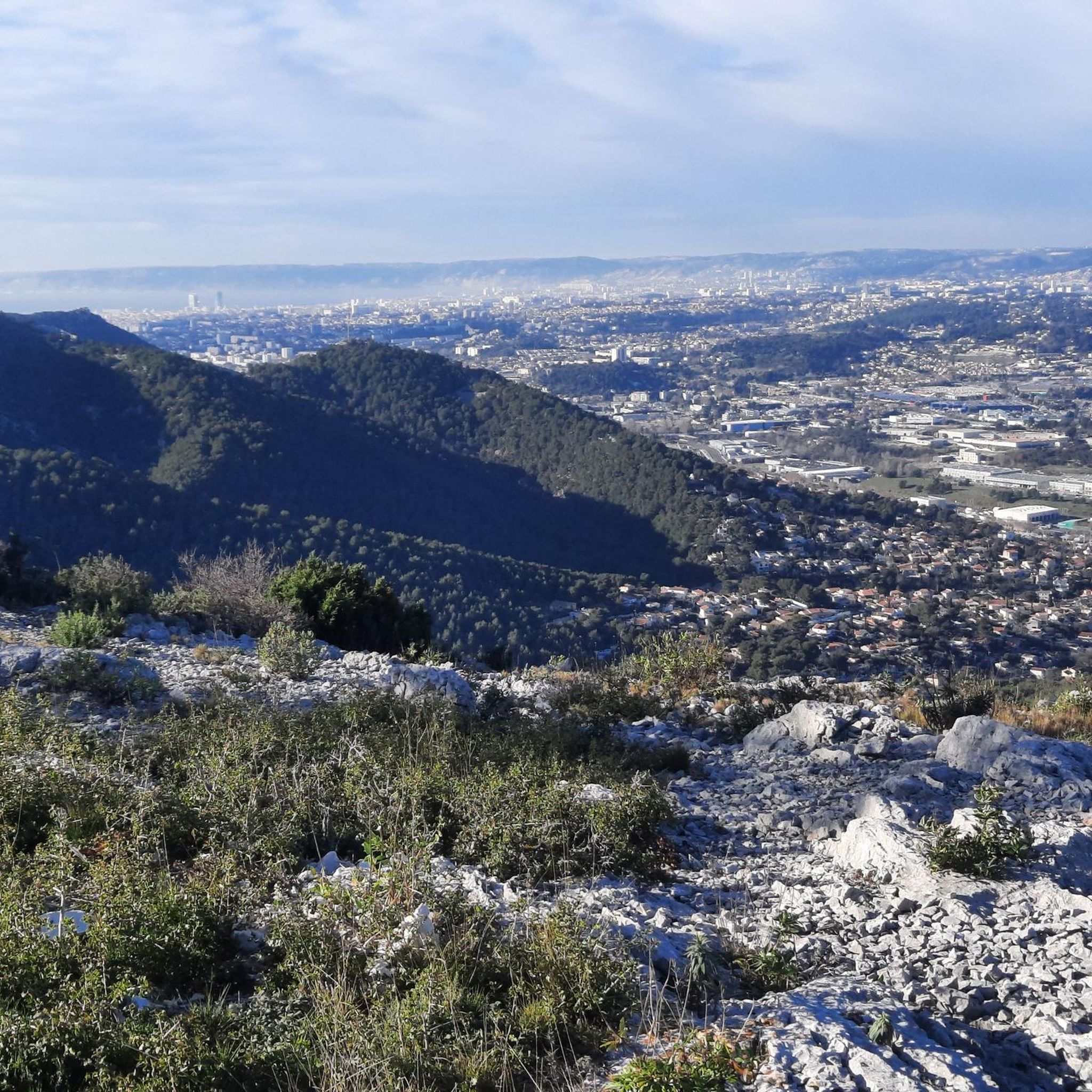
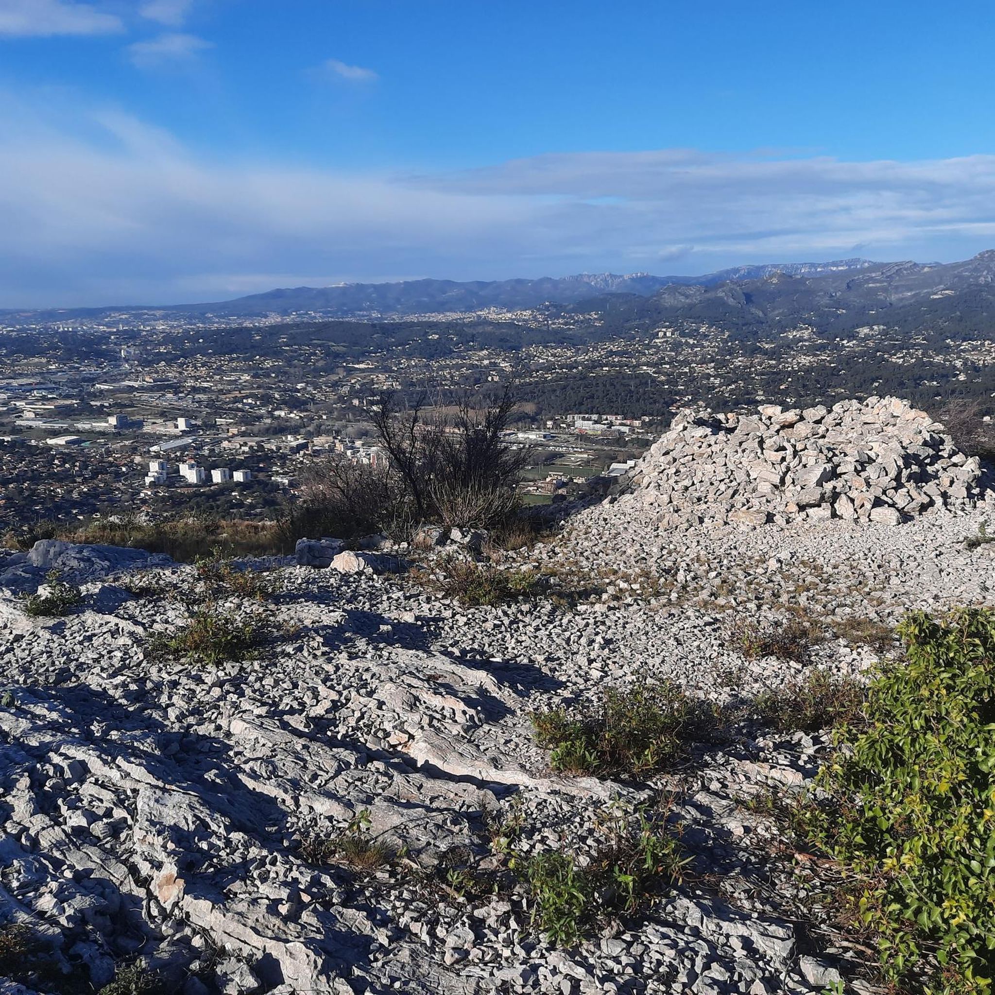
Jogging around La Penne-Sur-Huveaune offers access to diverse natural landscapes, including the Huveaune River valley and the foothills of the Sainte-Baume massif. The region features a mix of paved riverbanks, forest paths, and trails through the Garlaban Hills. Runners can find routes that traverse varied terrain, from gentle riverside loops to more challenging ascents within the surrounding hills. This area provides opportunities for running amidst green oaks, pine trees, and scenic viewpoints.
Best jogging routes around La Penne-Sur-Huveaune
- The most popular jogging route is Huveaune River Loop from La Penne-sur-Huveaune, a 6.2 miles (10.0 km) trail that takes 1 hour 3 minutes to complete. This route follows the paved banks of the Huveaune River, offering views of the Sainte-Baume massif.
- Another top favourite among local runners is Château de la Reynarde loop from La Penne sur Huveaune, a moderate 7.8 miles (12.5 km) path. This route explores the area around Château de la Reynarde, featuring varied terrain and local scenery.
- Local runners also love the Château Régis loop from La Penne-sur-Huveaune, a 4.7 miles (7.6 km) trail leading through the local landscape around Château Régis, often completed in about 49 minutes.
- Jogging around La Penne-Sur-Huveaune is defined by the Huveaune River, the Garlaban Hills, and extensive forest paths. The network offers options for easy, moderate, and difficult ability levels.
- The routes in La Penne-Sur-Huveaune are highly rated by the komoot community with an average score of 4.3 stars from over 290 reviews. More than 12,000 runners have used komoot to explore La Penne-Sur-Huveaune's varied terrain.
Last updated: August 30, 2026
36
runners
10.0km
01:03
40m
40m
Moderate run. Good fitness required. Mostly paved surfaces. Suitable for all skill levels.
2.0
(1)
24
runners
12.0km
01:17
130m
130m
Moderate run. Good fitness required. Mostly paved surfaces. Suitable for all skill levels.

Sign up for free
3.3
(3)
24
runners
7.64km
00:49
100m
100m
Moderate run. Good fitness required. Mostly paved surfaces. Suitable for all skill levels.
4.0
(1)
21
runners
13.6km
01:45
390m
390m
Hard run. Very good fitness required. Mostly paved surfaces. Suitable for all skill levels.
22
runners
8.84km
01:12
350m
350m
Hard run. Very good fitness required. Mostly paved surfaces. Suitable for all skill levels.
Get access to more routes and recommendations from other explorers.
Sign up for free
Already have an account?
Our route recommendations are based on thousands of hikes, rides, and runs completed by other people on komoot.
Start today with a free account
Your next adventure awaits.
Login or Signup

Tips from the Community

The Huveaune is a river which has its source in the Sainte-Baume massif and flows into the Mediterranean Sea in Marseille. Its bed is often dry.
0
0
Located on an old Roman road (the N8) between Aubagne and Marseille, the town benefits from a rich built heritage. The Pennelus (or Penelle), listed as a historic monument, bears witness to the long history of La Penne-sur-Huveaune, whose current name appeared as early as 1212 in the archives of Saint-Victor Abbey. In the old center, a stone's throw from the Roman monument, you can also discover its church and its stained glass windows, construction of which began in 1711.
0
0
Frequently Asked Questions
How many running routes are available around La Penne-sur-Huveaune?
There are over 15 dedicated running routes in the La Penne-sur-Huveaune area, catering to various fitness levels. These routes explore diverse landscapes, from riverside paths to the foothills of the Sainte-Baume massif.
Are there easy jogging routes suitable for beginners or a relaxed run?
Yes, the area offers several easy jogging routes. While specific easy routes are not detailed in the top selections, the region's diverse terrain includes pleasant forest walks and sections along the Huveaune River that are generally flat and accessible, perfect for a peaceful stroll or a gentle jog.
What kind of terrain can I expect on the running trails in La Penne-sur-Huveaune?
You can expect a variety of terrain, including paved riverbanks along the Huveaune River, forest paths winding through green oaks and pine trees, and trails through the Garlaban Hills. Some routes, especially those venturing into the Sainte-Baume massif foothills, will feature more challenging ascents and varied natural surfaces.
Are there any challenging running trails for experienced runners?
Absolutely. For experienced runners seeking a challenge, routes like La Candolle – La Penne-sur-Huveaune loop from La Penne sur Huveaune offer significant elevation gain over 13 kilometers. Another demanding option is the La Candolle loop from La Penne-sur-Huveaune, which covers 8.8 kilometers with substantial climbs.
Can I find circular running routes in La Penne-sur-Huveaune?
Yes, many of the popular running routes in the area are circular. For example, the scenic Huveaune River Loop from La Penne-sur-Huveaune is a 10-kilometer circular trail that follows the riverbanks, offering views of the Sainte-Baume massif.
What are some scenic viewpoints or landmarks I can see while running?
Many routes offer picturesque views. The Huveaune River Loop from La Penne-sur-Huveaune provides views of the Sainte-Baume massif. The Garlaban Hills offer unique viewpoints, and some trails provide magnificent panoramas of the Huveaune valley. While not directly on these routes, the nearby Calanques National Park features stunning coastal views, including highlights like Port-Pin Beach and View of the Port Miou calanque.
Are there running routes that pass by historical sites or châteaux?
Yes, some routes incorporate local landmarks. The Château de la Reynarde loop from La Penne sur Huveaune explores the area around the Château de la Reynarde, offering varied terrain and local scenery. Another option is the Château Régis loop from La Penne-sur-Huveaune, which leads through the landscape surrounding Château Régis.
What do other runners say about the trails in La Penne-sur-Huveaune?
The running routes in La Penne-sur-Huveaune are highly regarded by the komoot community, with an average score of 4.3 stars from over 290 reviews. Runners often praise the diverse natural landscapes, the mix of river paths and forest trails, and the opportunities to explore the region's scenic beauty.
Is La Penne-sur-Huveaune a good place for trail running?
Yes, La Penne-sur-Huveaune is an excellent destination for trail running. Its proximity to the Sainte-Baume massif and the Garlaban Hills means there are extensive hiking trails that double as fantastic opportunities for trail running, offering varied terrain from dense forests to scrubland and limestone cliffs.
Are there any specific rules or recommendations for running along the Huveaune River?
When running along the Huveaune River, especially on forest paths, you may encounter information boards reminding visitors of rules to protect the sensitive riparian environment. It's always recommended to stay on marked paths and respect local regulations to preserve the natural beauty of the area.
Can I find routes suitable for a longer distance run?
Certainly. For those looking for longer runs, routes like the Château de la Reynarde loop from La Penne sur Huveaune cover approximately 12.5 kilometers, while the challenging La Candolle – La Penne-sur-Huveaune loop from La Penne sur Huveaune extends to about 13 kilometers, providing ample distance for endurance training.
Most popular routes around La Penne-Sur-Huveaune
Most popular attractions around La Penne-Sur-Huveaune

Get inspired with the komoot mobile app


Explore more
Browse the best Running Trails & Routes in other regions.
