Attractions and Places To See around Targassonne - Top 20
Best attractions and places to see around Targassonne, a commune in the Cerdagne region of the Pyrénées-Orientales department in southern France. Situated at an average altitude of 1,200 meters, the area is known for its natural features, including granite landscapes and proximity to the Pyrenees. It offers diverse outdoor experiences, from bouldering to mountain exploration.
Best attractions and places to see around Targassonne
- The most popular attractions is Summit of Pic Carlit, a summit that culminates at 2,921 meters.…
Last updated: August 16, 2026
Lake Bouillouses
Highlight • Lake
Translated by Google •
Tip by

Summit of Pic Carlit
Highlight • Summit
Translated by Google •
Tip by

Sign up now to discover places like this
Get recommendations on the best single tracks, peaks, & plenty of other exciting outdoor places.
Sign up for free
Col de la Perche (1,579 m)
Highlight • Mountain Pass
More information: quaeldich.de/paesse/col-de-la-perche
Translated by Google •
Tip by

Col du Calvaire (Font-Romeu)
Highlight • Mountain Pass
Translated by Google •
Tip by

Bouillouses Refuge
Highlight • Mountain Hut
Summer and winter alike, you will find 19 places in …
Showing Translation
Tip by

Sign up for free to discover even more attractions around Targassonne.
Sign up for free
Already have an account?
Start today with a free account
Your next adventure awaits.
Login or Signup

Tips from the Community


Well, starting from Font Romeu and breaking legs from Mont Louis
0
0


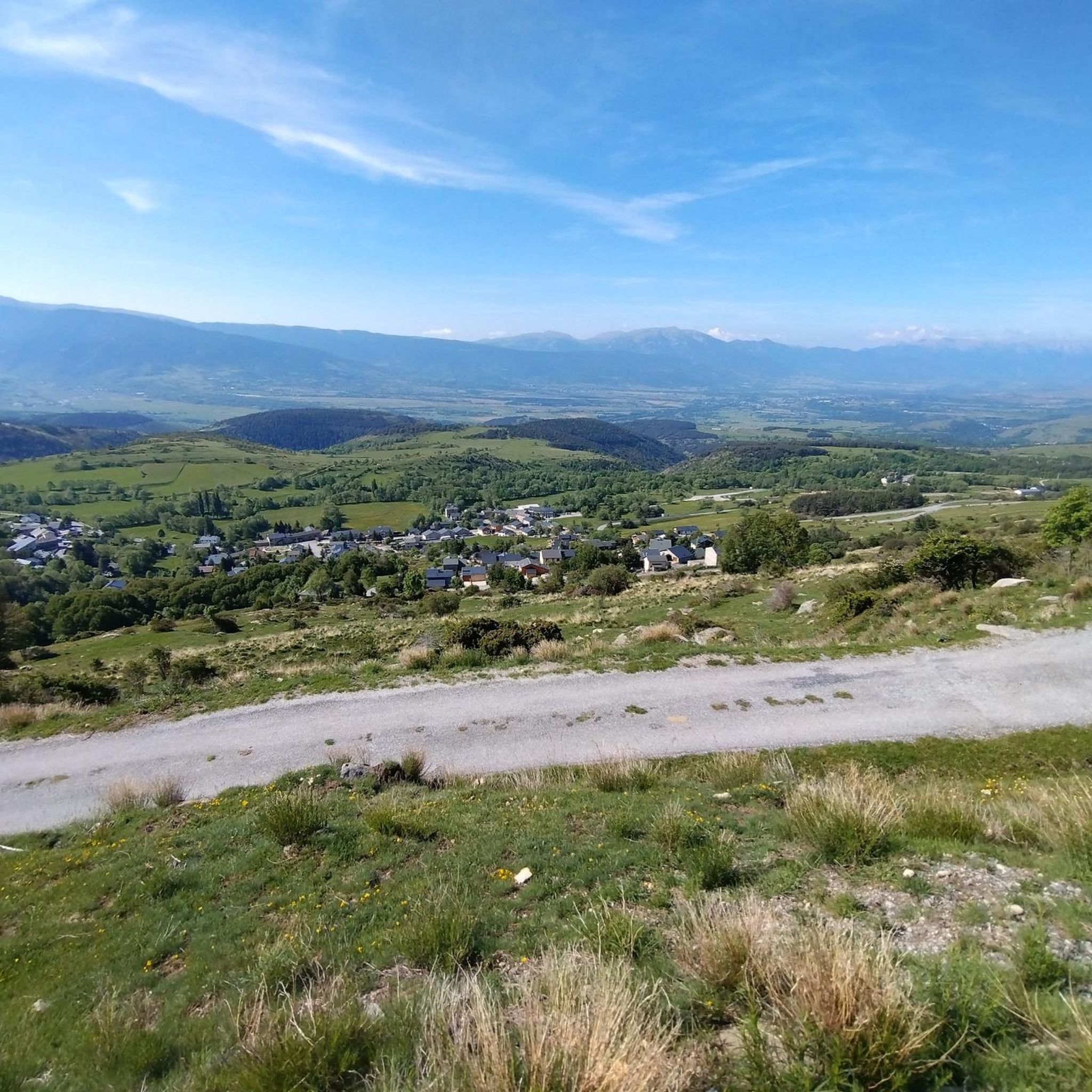
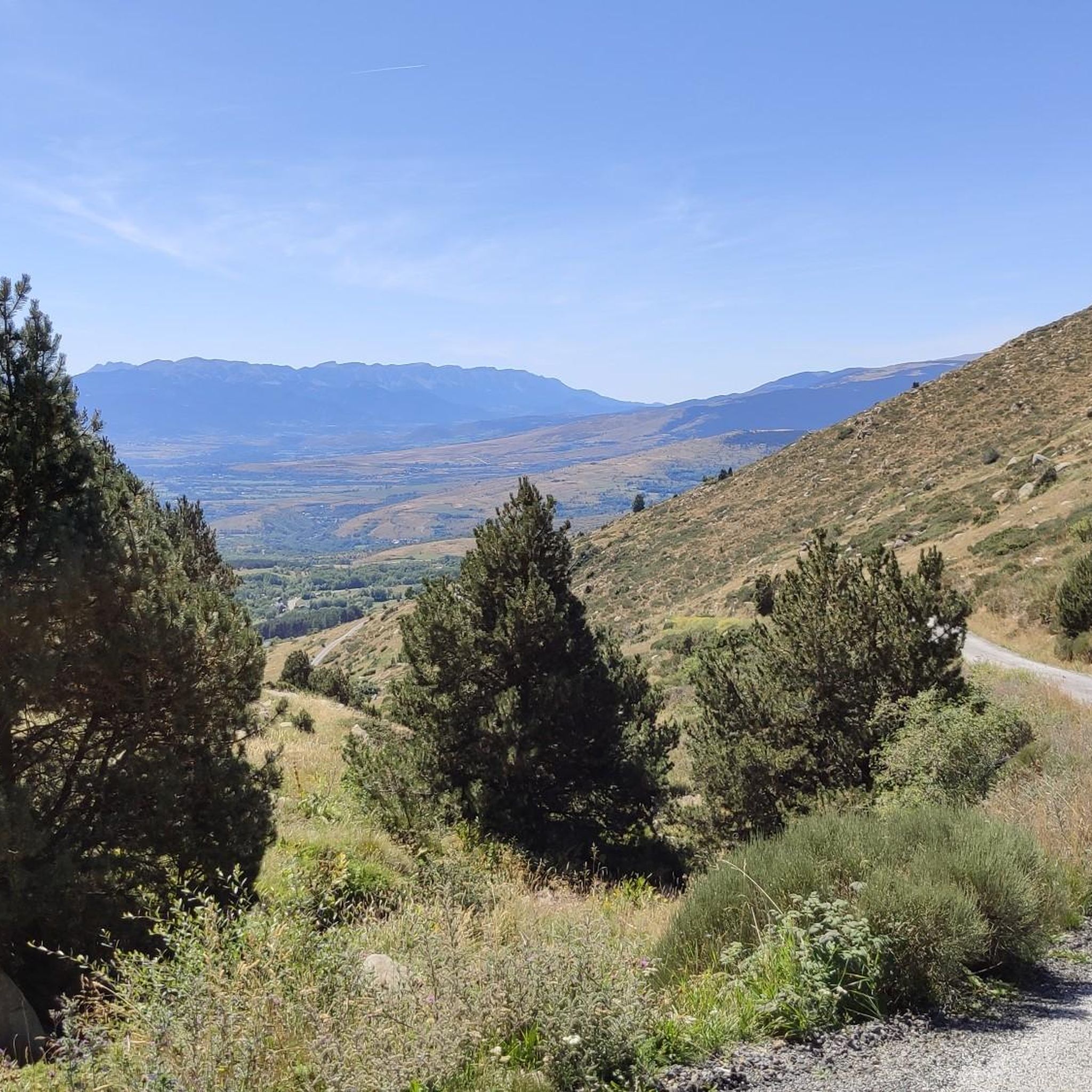
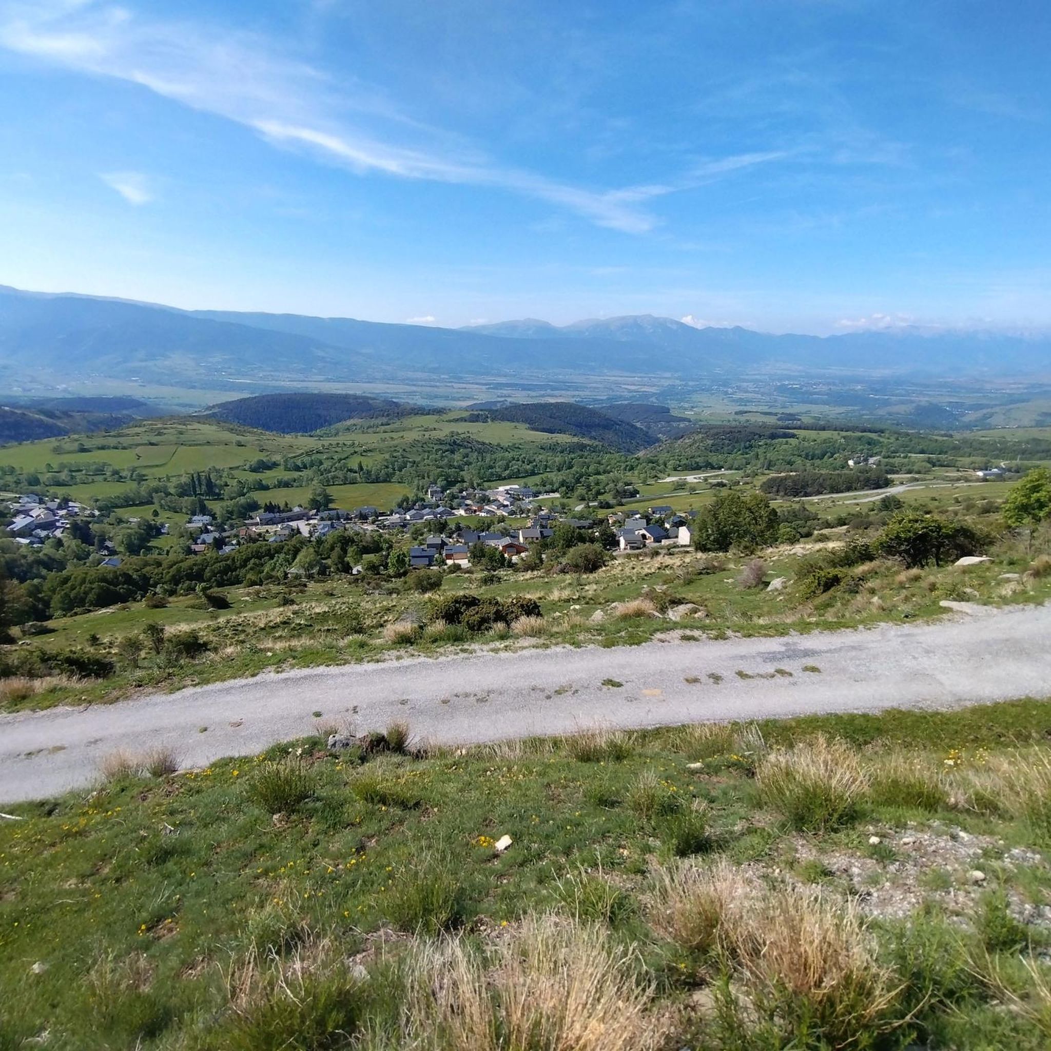
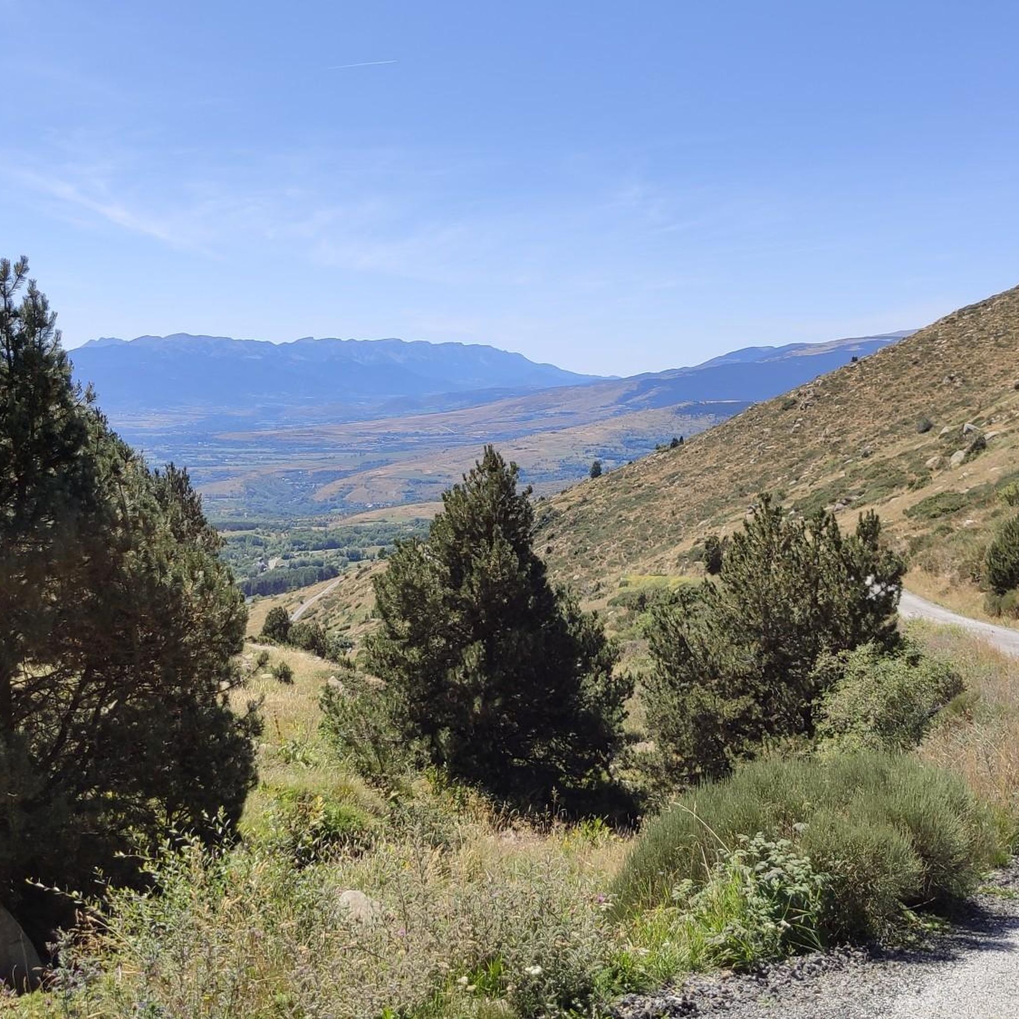
The Col de la Calvaire de Font Romeu is a mountain pass in French Cerdanya, next to the town and ski resort of Font Romeu. This port connects the Bolquère valley with the Cerdanya valley. The port is within the same town of Font Romeu, next to the station's ski lifts. There are many slopes to reach Col de la Calvaire: - the western slope that starts from Ur is approximately 16 km and crosses the town of Targasone and the Col d'Egat. It is a very steep climb along a road in perfect condition, although on holidays there is a lot of traffic. - The southern slope starts from Llívia and crosses Estavar and joins the previous one at the Col d'Egat. Unlike the first, the first section of the climb is very hard, with several horseshoe curves and with wonderful views of the entire Cerdanya and the Tosa d'Alp. - The eastern slope stops at Olette, and after approximately 28 km it reaches the top of the pass, passing through the town of Mont-Louis and Bolquère. It is a very steep climb, like the first, on a road in perfect condition but with a lot of traffic. I don't like going up here. - the eastern slope that starts from Olette and passes through the Col de la Perche, reaching the town of Font-Romeu and from there to the top. Of all the slopes, the one I like the most is the slope that starts from Llívia and crosses Estavar.
0
0

Carlit Peak is part of the Capcir granite massif, which is dotted with 27 lakes and small lakes in the Occitanie region, northwest of Font-Romeu. Its summit is located at 2921 meters, allowing you to observe an immense panorama (from Canigó to the Central Pyrenees).
1
2
Beautiful refuge to rest and gain strength, the starting point of an emblematic route that visits multiple lakes and can culminate with the imposing Carlit.
1
0

Culminating at 1,579 meters above sea level, the Col de la Perche can be climbed by four routes in total. Each of them includes relatively gentle slopes. At the top, the view of the surrounding area is splendid and rewards your efforts!
0
0

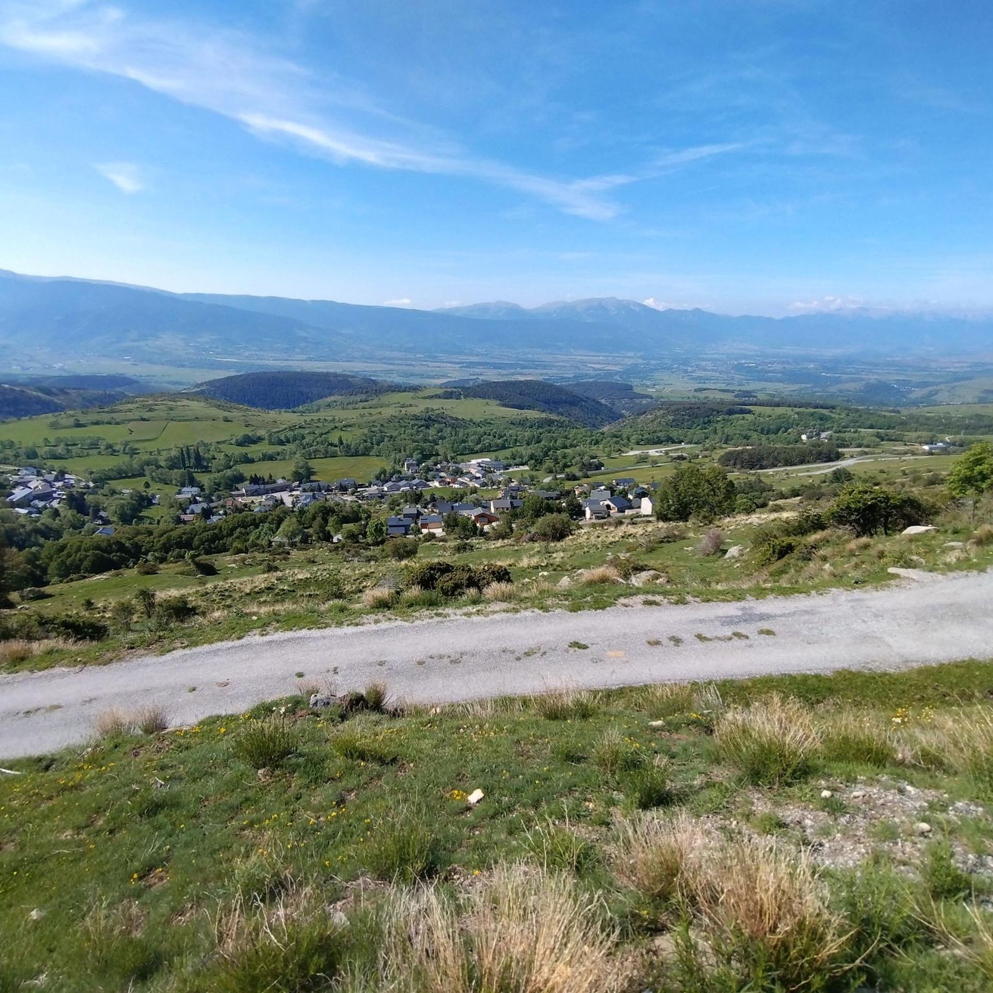
It's probably not the most spectacular pass in the Pyrenees, but it has its charms. Its position, in the middle of the Catalan Pyrenees natural park, makes it a privileged passage for admiring 360° of the mountains, valleys and plains of this protected area. If you pass by, take the time to look around for yourself and enjoy the view.
0
0
Frequently Asked Questions
What natural attractions can I explore around Targasonne?
Targasonne is surrounded by remarkable natural beauty. You can visit Lake Bouillouses, a large lake at 2,016 meters altitude within the Natural Park of the Catalan Pyrenees. Another significant natural feature is the Chaos de Targasonne, known for its unique landscape of over 1000 granite blocks. The Reserve Naturelle d'Eyne, also called "The Valley of Flowers," offers exceptional ecological diversity.
Are there opportunities for bouldering near Targasonne?
Yes, Targasonne is renowned as a significant bouldering destination. The Chaos de Targasonne is considered one of the best bouldering areas in Southern Europe, offering over 1000 boulder problems suitable for all skill levels, from beginners to experienced climbers. Crashpads can be rented locally.
What are some popular hiking destinations in the area?
For hikers, the region offers numerous trails. A popular and challenging destination is the Summit of Pic Carlit, which culminates at 2,921 meters and provides extensive panoramas over the valley and its many lakes. The area around Lake Bouillouses also offers extensive hiking opportunities, including routes that visit other surrounding ponds.
Can I find challenging mountain climbs around Targasonne?
Absolutely. The Summit of Pic Carlit, at 2,921 meters, is a challenging climb offering magnificent views of the surrounding lakes and mountains. The last 150 meters can be technical for less experienced climbers, making it a rewarding ascent for those seeking a strenuous outdoor experience.
Are there any historical or cultural sites to visit in Targasonne?
Targasonne is home to two Romanesque churches: the parish church Saint-Saturnin and the old church Saint-Vincent de Vilalta, though the latter is now disused. These offer a glimpse into the region's historical and architectural heritage.
What kind of cycling routes are available near Targasonne?
The area around Targasonne is excellent for cycling. You can find a variety of routes, including gravel biking and road cycling. For example, there are challenging road cycling loops like the Col de la Creu – Col de la Llose loop from Font-Romeu-Odeillo-Via. You can explore more options on the Road Cycling Routes around Targassonne guide or the Gravel biking around Targassonne guide.
Are there any family-friendly activities or attractions?
While specific family-friendly attractions are not detailed, the natural environment offers many opportunities for families. Easy walks around Lake Bouillouses (with restricted summer access by bus to manage crowds) or exploring the less challenging bouldering sectors at Chaos de Targasonne can be enjoyable for families. Nearby Font-Romeu also offers various outdoor activities.
What is the best time of year to visit Targasonne for outdoor activities?
The region is suitable for outdoor activities throughout the year. Summer (July and August) is popular for hiking and exploring lakes, though access to some areas like Lake Bouillouses is regulated. Winter offers opportunities for skiing and other snow sports, given Targasonne's altitude and proximity to ski resorts.
Where can I find accommodation or places to eat near the attractions?
The Bouillouses Refuge, located near Lake Bouillouses, offers dormitory accommodation and a catering service. It's also possible to pitch a tent in designated bivouac areas. For more options, nearby towns like Font-Romeu-Odeillo-Via offer a variety of accommodations and dining choices.
What unique landmarks can I see in Targasonne?
A notable landmark in Targasonne is the Themis Solar Power Tower. This research and development center is a visible structure showcasing solar energy innovation in the region.
Are there options for running trails around Targasonne?
Yes, there are several running trails available. You can find routes like the Running loop from Égat or the Ruins of Llívia Castle loop from Targasonne. For more detailed information and route options, refer to the Running Trails around Targassonne guide.
What are the views like from the mountain passes?
Mountain passes in the region offer spectacular panoramic views. For instance, Col de la Perche (1,579 m) provides 360° views of the mountains, valleys, and plains of the Catalan Pyrenees natural park. Similarly, Col du Calvaire (Font-Romeu) offers wonderful views of the entire Cerdanya valley.
Most popular routes around Targassonne
Most popular attractions around Targassonne

Get inspired with the komoot mobile app


Explore more
Still not found the Highlight you’re looking for? See guides of the top attractions in other regions:
