The best cycling routes around Saint-Mandrier-Sur-Mer
4.2
(1102)
14,306
riders
11
rides
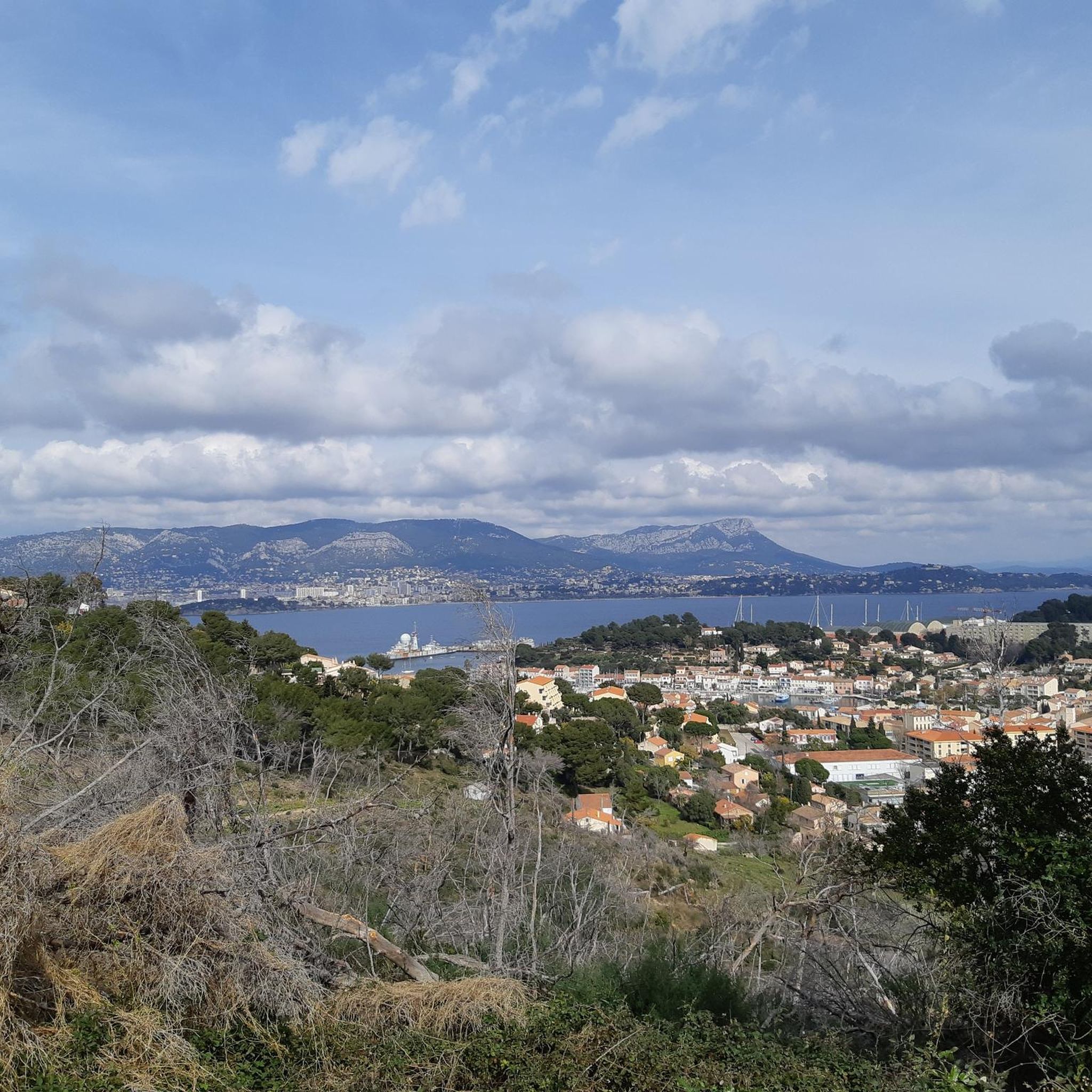
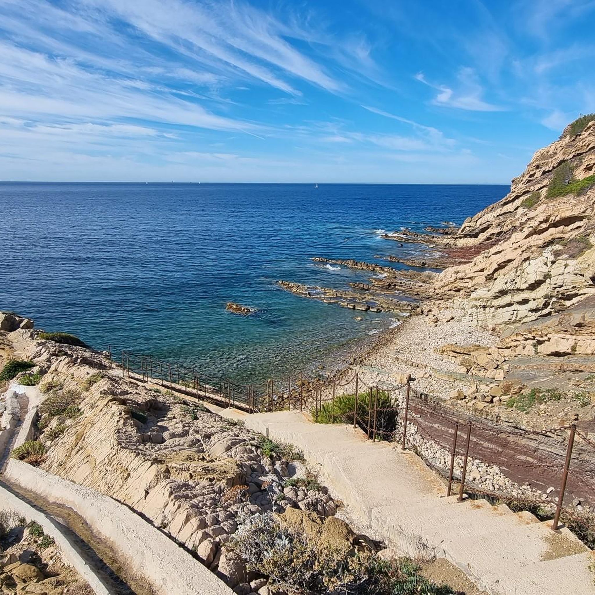
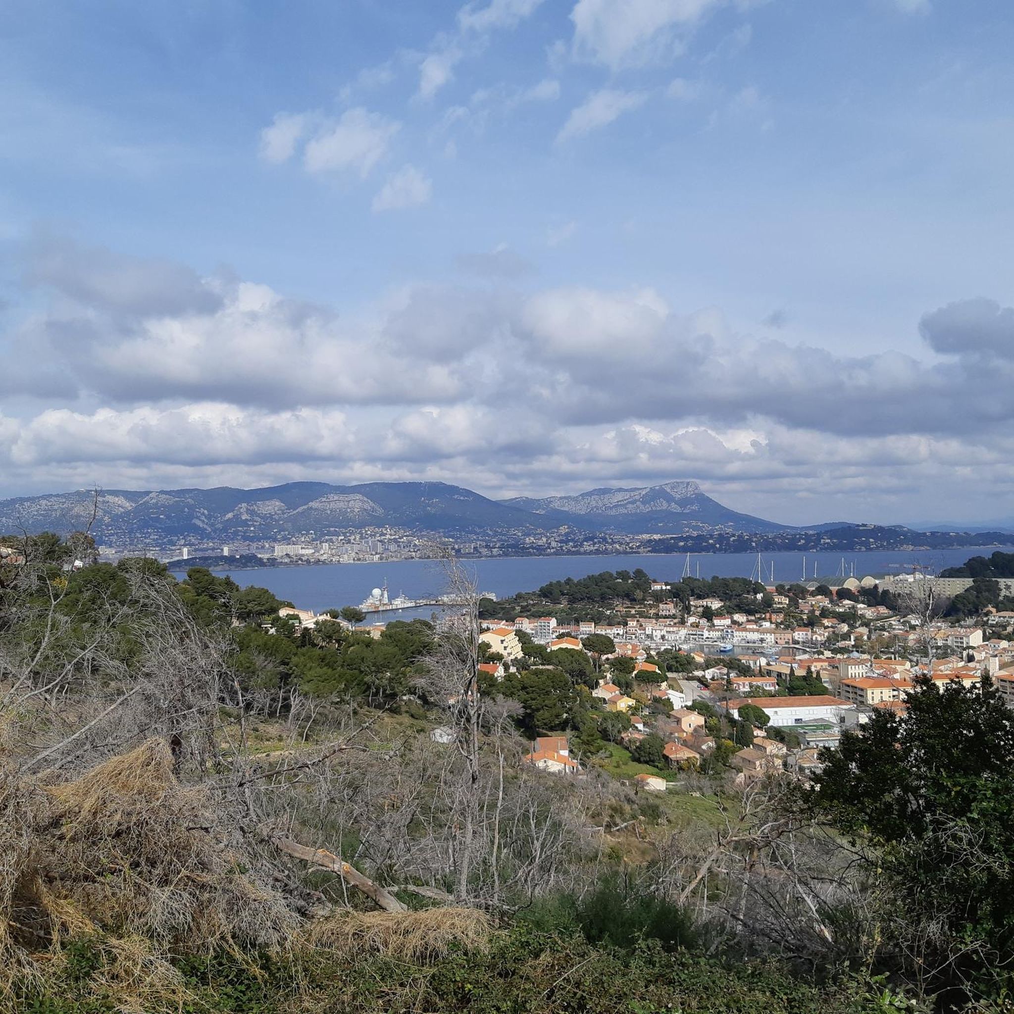
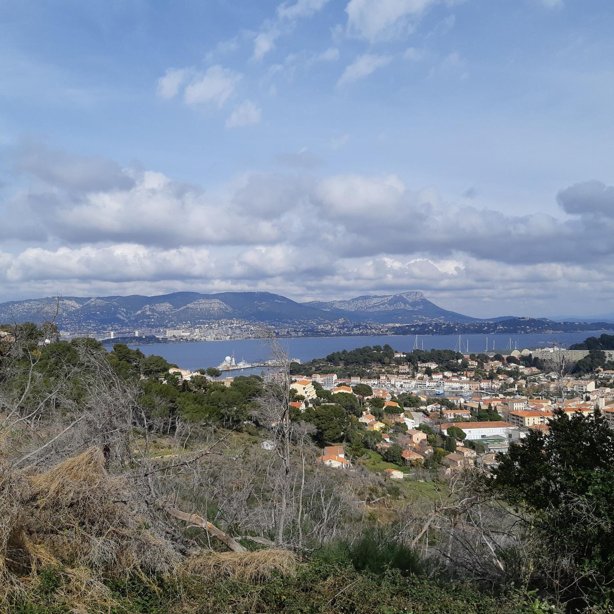
Touring cycling around Saint-Mandrier-Sur-Mer offers diverse routes across a unique peninsula setting in Provence-Alpes-Côte d'Azur. The region is characterized by its azure Mediterranean coastline, featuring pristine beaches and rugged cliffs, particularly around the Cap Sicié massif. Cyclists can explore a mix of flat coastal roads and more challenging routes through pine forests and hills, providing varied terrain for all skill levels. Strategic viewpoints like Notre-Dame du Mai offer panoramic vistas of the Toulon harbor and surrounding islands.
Best touring cycling routes around Saint-Mandrier-Sur-Mer
- The most popular touring cycling route is Le Brusc ferry pier – Gaou Island loop from Saint-Mandrier-sur-Mer, a 22.6 miles (36.4 km) trail that takes 2 hours 21 minutes to complete. This difficult route offers extensive coastal views and varied terrain.
- Another top favourite among local touring cyclists is View of Toulon – Notre-Dame-du-Mai Chapel loop from Saint-Mandrier-sur-Mer, a difficult 18.3 miles (29.4 km) path. This route features significant elevation gain and rewarding views over Toulon and the surrounding seascape.
- Local touring cyclists also love the View of Toulon – Le Brusc ferry pier loop from Saint-Mandrier-sur-Mer, a 23.5 miles (37.9 km) trail leading through coastal landscapes and offering panoramic views, often completed in about 2 hours 35 minutes.
- Touring cycling around Saint-Mandrier-Sur-Mer is defined by scenic coastal paths, pine forests, and rugged cliffs, with routes catering to both leisurely rides and more challenging climbs. The network offers options for different ability levels, from moderate to difficult.
- The routes in Saint-Mandrier-Sur-Mer are highly rated by the komoot community with an average score of 4.2 stars from over 780 reviews. More than 10,800 touring cyclists have used komoot to explore Saint-Mandrier-Sur-Mer's varied terrain.
Last updated: June 27, 2026
4.3
(47)
484
riders
36.1km
02:18
430m
430m
Moderate bike ride. Good fitness required. Mostly paved surfaces. Suitable for all skill levels.
5.0
(12)
125
riders
29.3km
02:07
580m
580m
Hard bike ride. Very good fitness required. Mostly paved surfaces. Suitable for all skill levels.

Sign up for free
4.0
(2)
30
riders
31.0km
01:55
240m
240m
Moderate bike ride. Good fitness required. Mostly paved surfaces. Suitable for all skill levels.
3.5
(2)
42
riders
43.0km
02:37
350m
350m
Moderate bike ride. Good fitness required. Mostly paved surfaces. Suitable for all skill levels.
5.0
(3)
18
riders
20.8km
01:18
120m
120m
Easy bike ride. Great for any fitness level. Mostly paved surfaces. Suitable for all skill levels.
Get access to more routes and recommendations from other explorers.
Sign up for free
Already have an account?
Our route recommendations are based on thousands of hikes, rides, and runs completed by other people on komoot.
Start today with a free account
Your next adventure awaits.
Login or Signup

Tips from the Community


Tourist information, guided tours, good deals and leisure ticketing for the Provence Méditerranée destination. The office is marked “Accueil Vélo”.
0
0

The Levant Bridge, also called the Chantiers Bridge, was erected in 1917. The objective of this work was to allow the railway to access the site of the former shipyards from La Seyne station. It is now possible to climb the bridge tower to enjoy a panoramic viewpoint over the entire Toulon harbor.
0
0
If you are looking for tourist information, ideas for guided tours, good ticket deals for the many leisure activities in the Provence Méditerranée destination, you are in the right place. Also note that the information office is certified Accueil Vélo.
3
0
The beach is located below the road which really makes it a small, quiet beach protected from noise. Before going down to enjoy the water, you can admire the superb panorama of the six-fournaise coast, the bay and, in the distance, the Bec de l'Aigle de La Ciotat.
1
0
The beach is bordered by a beautiful pedestrian promenade and a protected cycle path. It is called by the locals Brutal beach. This nickname comes from the waves which offer good conditions for practicing board sports. But you can also enjoy the seafront in a more peaceful way by taking advantage of the shops and the numerous terraces.
3
0

The island of Embiez is a land of paradise easily accessible all year round, 12 minutes by boat from the charming port of Brusc. The island can be visited on foot or by bike! The island and its establishments are accessible to people with reduced mobility.
3
0
Find all the practical information and great tips for discovering Provence Méditerranée! The Six-Fours tourist office is marked ACCUEIL VELO.
1
0
Frequently Asked Questions
How many touring cycling routes are available around Saint-Mandrier-sur-Mer?
There are over 10 touring cycling routes documented around Saint-Mandrier-sur-Mer on komoot, offering a variety of experiences for different skill levels. These routes are highly rated by the komoot community, with an average score of 4.2 stars.
What kind of terrain can I expect when touring cycling in Saint-Mandrier-sur-Mer?
You can expect a diverse range of terrain. The region is known for its azure Mediterranean coastline, featuring pristine beaches and rugged cliffs, particularly around the Cap Sicié massif. Routes include flat coastal roads, as well as more challenging paths through pine forests and hills, offering varied experiences for all skill levels.
Are there touring cycling routes suitable for beginners in Saint-Mandrier-sur-Mer?
Yes, Saint-Mandrier-sur-Mer offers several routes suitable for beginners. There are 4 easy touring cycling routes available, perfect for those looking for a more relaxed ride. These routes often feature less elevation gain and provide a gentle introduction to the area's beautiful scenery.
Where can I find more challenging touring cycling routes in the Saint-Mandrier-sur-Mer area?
For more challenging rides, explore the routes that venture into the Cap Sicié massif or feature significant elevation changes. For example, the View of Toulon – Notre-Dame-du-Mai Chapel loop from Saint-Mandrier-sur-Mer is a difficult route with rewarding views over Toulon and the seascape. There are 3 difficult touring cycling routes in total.
Are there any circular touring cycling routes in Saint-Mandrier-sur-Mer?
Yes, many of the touring cycling routes in Saint-Mandrier-sur-Mer are designed as loops, allowing you to start and end at the same point. A popular option is the Le Brusc ferry pier – Gaou Island loop from Saint-Mandrier-sur-Mer, which offers extensive coastal views.
What are some scenic viewpoints I can reach by touring bike in Saint-Mandrier-sur-Mer?
The region is rich with scenic viewpoints. Strategic points like Notre-Dame du Mai offer breathtaking 360-degree panoramas encompassing Toulon harbor, the Embiez archipelago, and on clear days, views stretching from Marseille to Porquerolles. The View of Toulon – Notre-Dame-du-Mai Chapel loop from Saint-Mandrier-sur-Mer specifically highlights these rewarding views.
What attractions or landmarks can I see along the touring cycling routes?
Along your routes, you can discover several interesting landmarks and natural features. The Notre dame du mai offers stunning views, and the coastal path itself provides access to charming coves and beaches like Plage de Sainte-Asile. You might also pass by the quaint fishing port of Saint-Mandrier with its colorful houses.
Are there any routes that go through forests or natural areas?
Absolutely. The area features beautiful pine forests and rugged cliffs, particularly around the Cap Sicié massif and Janas Forest. The route The forest of janas – Beach loop from Coste Chaude is a great option for experiencing these natural environments.
What is the best time of year for touring cycling in Saint-Mandrier-sur-Mer?
The Provence-Alpes-Côte d'Azur region generally enjoys a Mediterranean climate, making spring and autumn ideal for touring cycling. The weather is typically mild and pleasant, avoiding the intense heat of summer while still offering plenty of sunshine. This allows for comfortable rides and clear views of the stunning coastal and inland landscapes.
What do other touring cyclists enjoy the most about touring cycling in Saint-Mandrier-sur-Mer?
The area is highly rated by the komoot community, with an average score of 4.2 stars from over 780 reviews. Reviewers often praise the unique blend of coastal charm, varied terrain, and stunning vistas, particularly the panoramic views from strategic points like Notre-Dame du Mai and the diverse cycling experiences offered by both flat coastal roads and challenging forest paths.
Are there any touring cycling routes that offer views of Toulon?
Yes, several routes provide excellent views of Toulon and its beautiful harbor. The View of Toulon – Notre-Dame-du-Mai Chapel loop from Saint-Mandrier-sur-Mer and the View of Toulon – Le Brusc ferry pier loop from Saint-Mandrier-sur-Mer are specifically designed to showcase these rewarding views over the city and the expansive harbor.
Can I find routes that combine coastal scenery with other points of interest?
Many routes in Saint-Mandrier-sur-Mer offer a combination of coastal scenery and access to other points of interest. For instance, the Bonnegrâce Beach – Pont Levant loop from Saint-Mandrier-sur-Mer allows you to enjoy beautiful beaches while exploring the local area.
Most popular routes around Saint-Mandrier-Sur-Mer
Most popular attractions around Saint-Mandrier-Sur-Mer

Get inspired with the komoot mobile app


Explore more
Browse the best Cycling routes in other regions.
