The best MTB trails around Durlinsdorf
4.4
(212)
850
riders
117
rides
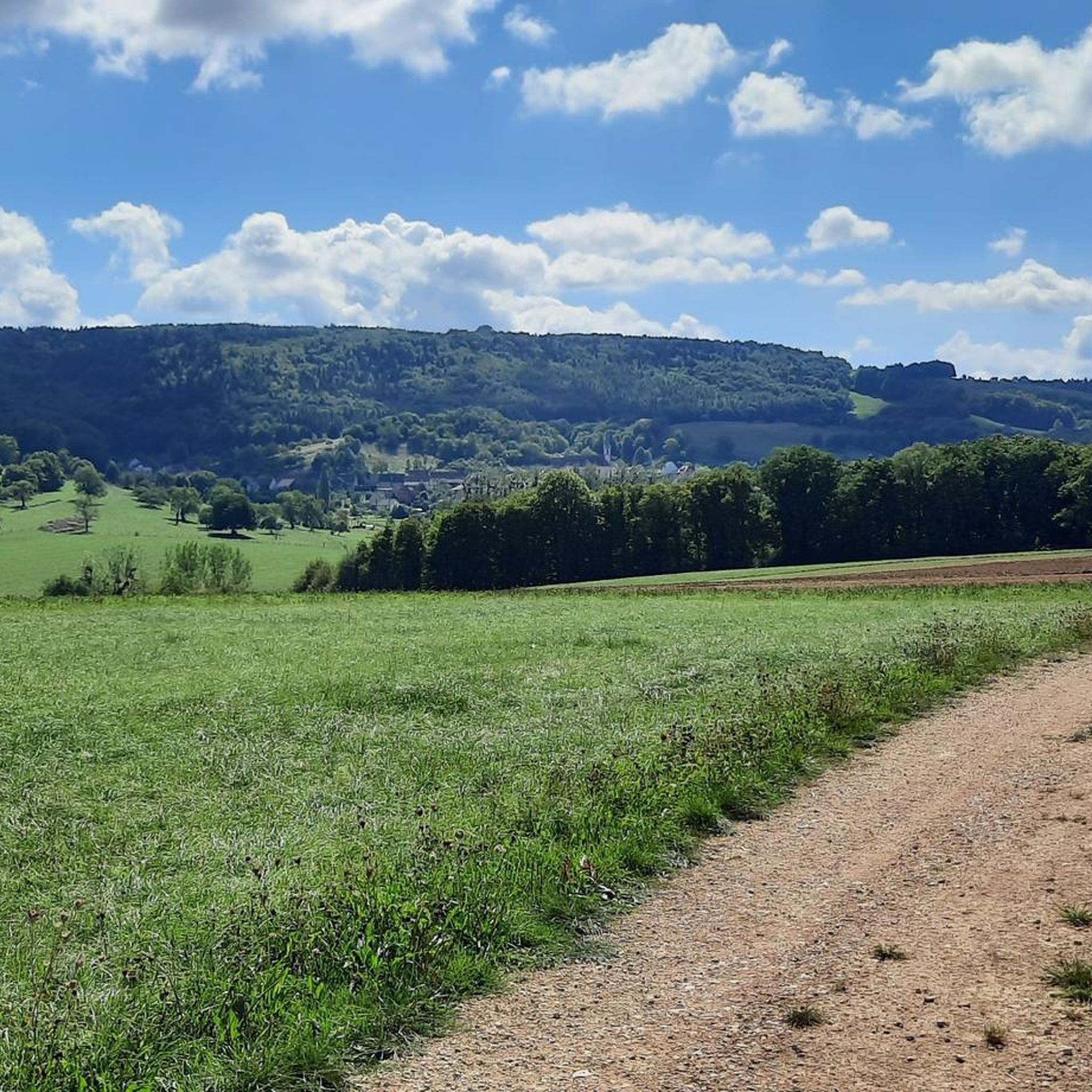
Mountain biking around Durlinsdorf features a landscape characterized by rolling hills, dense woodlands, and open agricultural areas, providing varied terrain for cyclists. The region offers a mix of ascents and descents, with some routes reaching elevations of over 600 meters. Trails often follow established paths through forests and past historical points of interest, making for engaging rides.
Best mountain bike trails around Durlinsdorf
- The most popular mountain bike trail is MTB track no. 9: The Grumbach loop, a 13.3 miles (21.4 km) trail that takes 1 hour 38 minutes to complete. This moderate route winds through varied forest and open sections.
- Another top favourite among local mountain bikers is Circuit VTT n°8 : Le Chemin de Saint-Jacques, a moderate 6.8 miles (11.0 km) path. This route offers a mix of forest tracks and rural scenery, ideal for a shorter ride.
- Local mountain bikers also love the Church of St. James the Greater – View of Ferrette loop from Kœstlach, a 27.5 miles (44.3 km) trail leading through historical areas and offering expansive views, often completed in about 3 hours 48 minutes.
- Mountain biking around Durlinsdorf is defined by rolling hills, extensive forest tracks, and scenic viewpoints. The network offers options for various ability levels, from easier paths to more challenging climbs.
- The routes in Durlinsdorf are highly rated by the komoot community with an average score of 4.4 stars from over 200 reviews. More than 800 mountain bikers have used komoot to explore Durlinsdorf's varied terrain.
Last updated: July 7, 2026
4.6
(5)
34
riders
21.4km
01:39
160m
150m
Moderate mountain bike ride. Great for any fitness level. Advanced riding skills necessary.
4
riders
11.0km
00:49
70m
70m
Moderate mountain bike ride. Great for any fitness level. Advanced riding skills necessary.

Sign up for free
5.0
(2)
24
riders
44.3km
03:49
690m
690m
Moderate mountain bike ride. Good fitness required. Advanced riding skills necessary.
3.5
(2)
8
riders
19.2km
01:53
410m
410m
Moderate mountain bike ride. Good fitness required. Advanced riding skills necessary.
2.0
(1)
4
riders
59.6km
03:37
450m
450m
Moderate mountain bike ride. Good fitness required. Suitable for all skill levels.
Get access to more routes and recommendations from other explorers.
Sign up for free
Already have an account?
Our route recommendations are based on thousands of hikes, rides, and runs completed by other people on komoot.
Start today with a free account
Your next adventure awaits.
Login or Signup

Other adventures around Durlinsdorf

Tips from the Community

Beautiful cycle path here we are still on the EV6
0
0

A very nice hike and view from the tower. There are signs at the top pointing out the sights you can see in the distance. It wobbles slightly at the very top.
0
0

No idea why I didn't write anything about this...🤔😅
0
1

This region has hundreds of small fishponds, once created by monks in the Middle Ages. Today they form a patchwork of water, reeds and forest – a paradise for birds, cyclists and those seeking peace and quiet. You cycle along quiet banks, see herons take flight and enjoy local specialities such as fried carp along the way.
6
0
Right next to the Largue cycle path lies this cosy nature centre in Altenach. You will find a short educational walk, a playground, picnic benches and a small exhibition about the nature of Alsace. Ideal to stretch your legs, have a bite to eat or go exploring with children. Free admission and open on Sunday afternoons in the summer months.
7
1

Metal tower with steep stairs. Good railing for safe climbing up and down. The top level is accessible via a vertical ladder. Also easy to use, but only if you can handle the height.
0
0

The Rossberg Tower, 20 m high, offers an exceptional panorama at its summit. You can see the Jura, the Black Forest, the Vosges and, on a clear day, the Bernese Alps.
1
0
Frequently Asked Questions
How many mountain bike trails are available around Durlinsdorf?
There are over 120 mountain bike trails around Durlinsdorf, offering a wide range of options for different skill levels. You'll find 18 easy routes, 68 moderate routes, and 35 difficult routes to explore.
Are there easy mountain bike trails suitable for beginners in Durlinsdorf?
Yes, Durlinsdorf offers 18 easy mountain bike trails perfect for beginners or those looking for a relaxed ride. These routes typically feature less challenging terrain and elevation changes.
What kind of terrain can I expect on mountain bike trails in Durlinsdorf?
The terrain around Durlinsdorf is characterized by rolling hills, dense woodlands, and open agricultural areas. Trails often follow established paths through forests, providing a mix of ascents and descents. Some routes reach elevations of over 600 meters.
Are there any challenging mountain bike trails for experienced riders?
Yes, for experienced riders seeking a challenge, Durlinsdorf has 35 difficult mountain bike trails. These routes often feature more significant elevation gains and technical sections. An example is the Roman remains – Church of St. James the Greater loop from Kœstlach, which covers 25.9 km with considerable climbing.
Are there circular mountain bike routes available in Durlinsdorf?
Many of the mountain bike trails in Durlinsdorf are circular, allowing you to start and end at the same point. For instance, the popular MTB track no. 9: The Grumbach loop is a 21.4 km circular route through varied forest and open sections.
What can I see along the mountain bike trails around Durlinsdorf?
The trails often pass by historical points of interest and offer expansive views. Notable attractions in the wider region include the historic Ferrette Castle, the serene Lucelle Lake, and the unique Dwarves' Grotto. You might also encounter various mountain passes like the Blochmont Pass.
What do other mountain bikers enjoy most about Durlinsdorf's trails?
The mountain bike trails in Durlinsdorf are highly rated by the komoot community, with an average score of 4.4 stars from over 200 reviews. Riders often praise the varied terrain, the extensive forest tracks, and the scenic viewpoints that make for engaging rides.
Are there any moderate mountain bike routes for intermediate riders?
Yes, Durlinsdorf has a large selection of 68 moderate mountain bike routes. These trails provide a good balance of challenge and enjoyment. A popular choice is Circuit VTT n°8 : Le Chemin de Saint-Jacques, a 11.0 km path offering a mix of forest tracks and rural scenery.
What is the typical length and duration of mountain bike trails in Durlinsdorf?
Trail lengths vary significantly. You can find shorter routes like the 11.0 km Circuit VTT n°8 : Le Chemin de Saint-Jacques, which takes about 49 minutes, to longer, more challenging rides such as the 44.3 km Church of St. James the Greater – View of Ferrette loop from Kœstlach, typically completed in about 3 hours 48 minutes.
Are there mountain bike routes that pass by lakes or water features?
Yes, some routes in the Durlinsdorf area offer views of or pass near lakes. The Lucelle Lake is a notable water feature in the region, and other lakes like Étangs de Bonfol and Lützel Reservoir near Lucelle are also nearby, potentially accessible via some trails.
Can I find mountain bike trails that offer historical insights?
Absolutely. Many routes in Durlinsdorf lead through historical areas. For example, the Church of St. James the Greater – View of Ferrette loop from Kœstlach takes you past significant landmarks and offers expansive views, connecting you with the region's heritage.
Most popular routes around Durlinsdorf
Most popular attractions around Durlinsdorf

Get inspired with the komoot mobile app


Explore more
Browse the best MTB trails in other regions.
