The best walks and hikes around Langensulzbach
4.5
(9788)
37,693
hikers
12
hikes
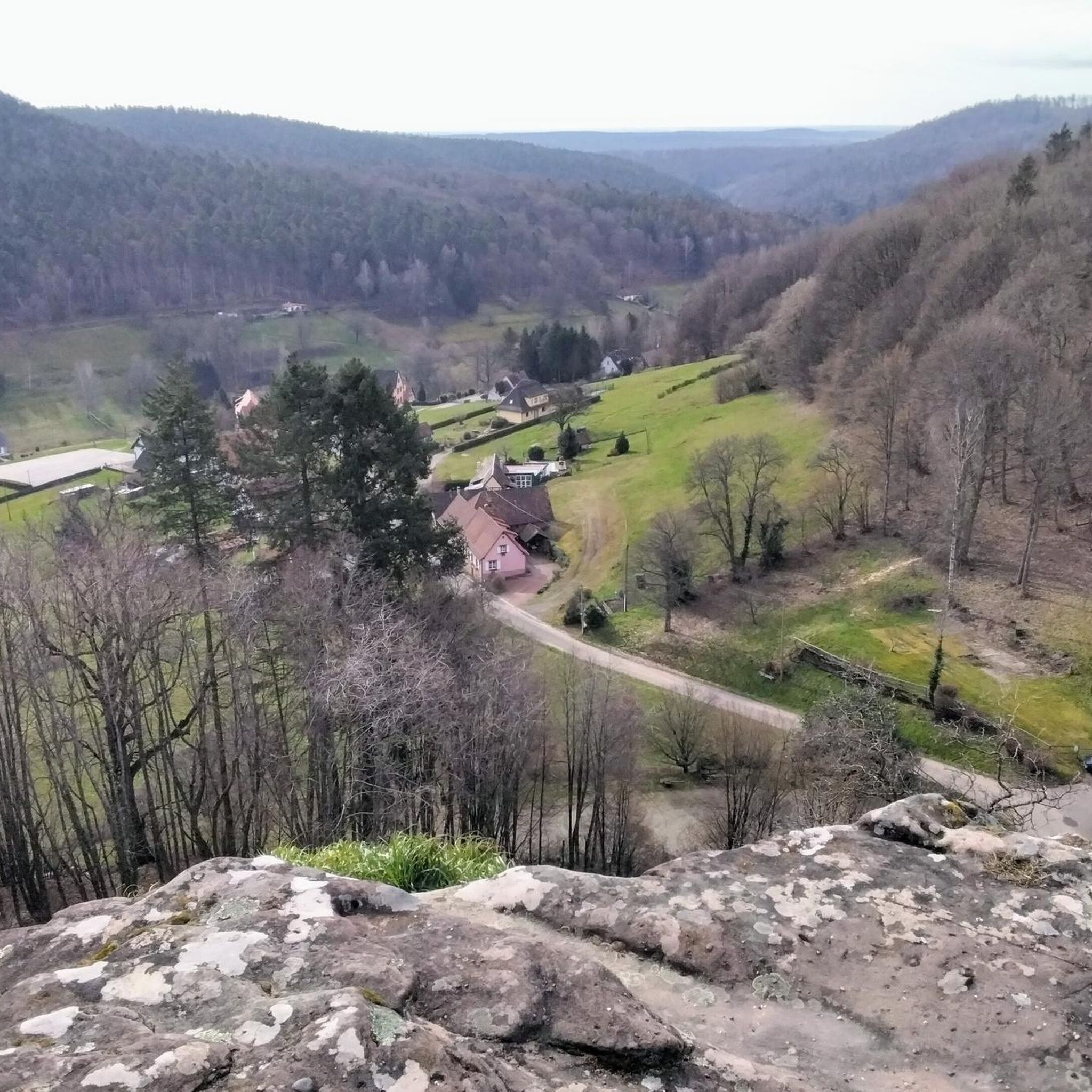
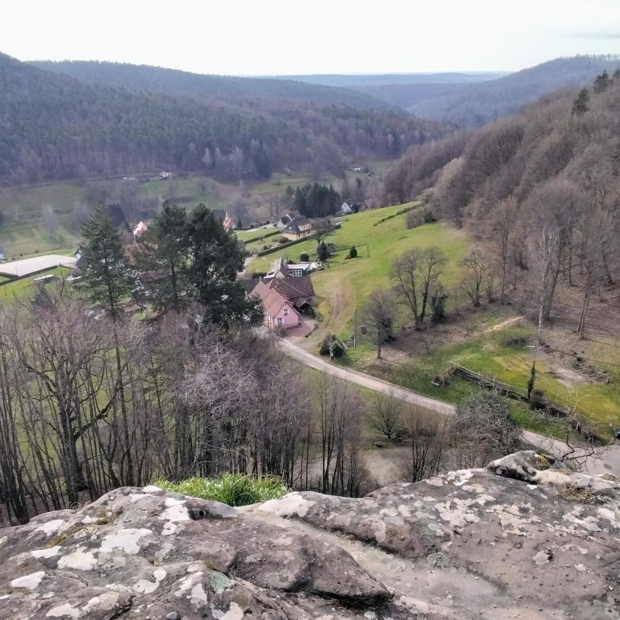
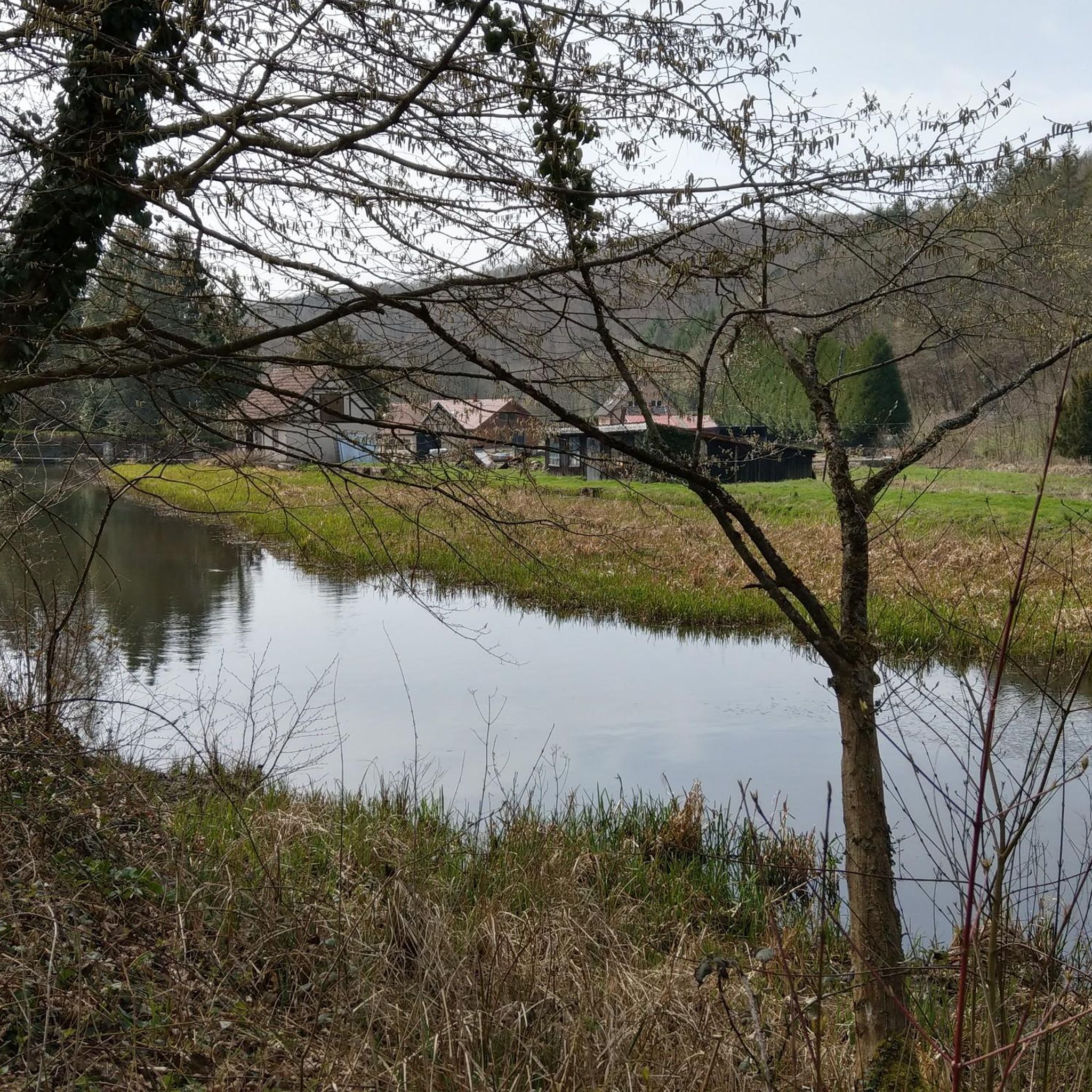
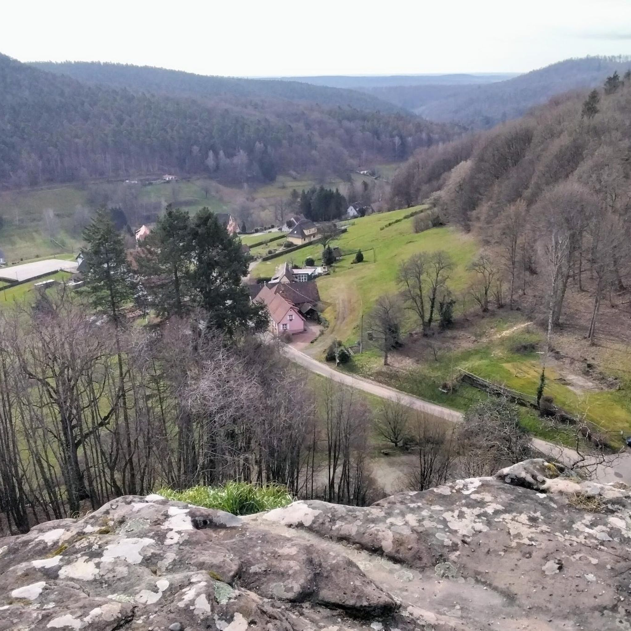
Hiking around Langensulzbach offers access to the natural landscapes of the Bas-Rhin department in northeastern France. The region is characterized by extensive woodlands, including light-flooded pine forests and areas rich in birch, hazel, and oak trees. It is situated within the Northern Vosges mountains, featuring varied topography with rounded summits and river valleys such as the Soultzthal. Imposing sandstone formations also contribute to the geological diversity of the area.
Best hiking trails around Langensulzbach
- The most popular hiking route is…
Last updated: May 14, 2026
4.2
(5)
18
hikers
15.9km
04:22
270m
270m
Moderate hike. Good fitness required. Easily-accessible paths. Suitable for all skill levels.
3.5
(4)
15
hikers
12.1km
03:20
210m
210m
Moderate hike. Good fitness required. Easily-accessible paths. Suitable for all skill levels.

Sign up for free
4.7
(3)
18
hikers
11.1km
03:02
180m
180m
Moderate hike. Good fitness required. Easily-accessible paths. Suitable for all skill levels.
4.5
(2)
5
hikers
14.0km
03:43
160m
150m
Moderate hike. Good fitness required. Easily-accessible paths. Suitable for all skill levels.
3.0
(1)
12
hikers
Hard hike. Very good fitness required. Easily-accessible paths. Suitable for all skill levels.
Get access to more routes and recommendations from other explorers.
Sign up for free
Already have an account?
Our route recommendations are based on thousands of hikes, rides, and runs completed by other people on komoot.
Start today with a free account
Your next adventure awaits.
Login or Signup

Tips from the Community

Lion eats eagle on a spit. On the pedestal, plaques were obviously removed.
0
0

last section from the Au Cheval Blanc parking lot to the Wittschlössel and back over the Gabelfels
0
0
Tour from P at Au Cheval Blanc back over Gabelfels
0
0


A wonderfully imposing building
0
0
A very impressive lion in the landscape
0
0
Frequently Asked Questions
What types of hiking trails can I expect around Langensulzbach?
The region offers a diverse network of trails, ranging from easy strolls to more challenging mountain paths. You'll find routes primarily through lush forests, featuring light-flooded pine, birch, hazel, and oak trees. The topography includes varied sections of the Northern Vosges mountains, with rounded summits, picturesque river valleys like the Soultzthal, and imposing sandstone formations.
How many hiking routes are available in Langensulzbach, and what are their difficulty levels?
There are over 10 hiking routes around Langensulzbach listed in this guide. The majority are moderate, with 9 moderate routes, 2 easy routes, and 2 difficult routes, catering to various fitness levels.
Are there any family-friendly hiking trails in the area?
Yes, Langensulzbach offers several options suitable for families. There are 2 easy routes that provide a gentler experience through the natural landscapes. These trails are perfect for enjoying the serene environment of the Palatinate Forest-North Vosges Biosphere Reserve with children.
Can I find circular hiking routes around Langensulzbach?
Absolutely. Many of the trails around Langensulzbach are designed as circular routes, allowing you to start and end in the same location. An example is the Saegemuehle – Étang de la Nonnenhardt loop from Langensoultzbach, which offers views of local ponds and forest sections.
What natural features or landmarks can I see along the hiking trails?
While hiking, you can explore the rich biodiversity of the Palatinate Forest-North Vosges Biosphere Reserve, including ancient woodlands and unique sandstone cliffs. The region is also dotted with historical sites. For example, you might encounter impressive structures like the Wegelnburg Castle Ruins or Fleckenstein Castle, often integrated into the hiking paths.
What do other hikers enjoy most about the trails in Langensulzbach?
The trails in Langensulzbach are highly rated by the komoot community, with an average score of 4.5 stars from over 9,500 reviews. Hikers often praise the lush forests, varied terrain, and the well-maintained network of paths that allow for immersive experiences in the Northern Vosges mountains.
Is Langensulzbach a good destination for dog-friendly hiking?
Yes, the natural landscapes and extensive trail networks within the Palatinate Forest-North Vosges Biosphere Reserve make Langensulzbach a great place for hiking with dogs. Most trails are suitable for well-behaved dogs on a leash, allowing them to enjoy the diverse environment alongside you.
Are there any long-distance or challenging hikes available?
For those seeking a more challenging experience, there are difficult routes available, such as the Steinbach Farm – Wittschlössel Ruins loop from Réserve biologique intégrale de la Vallée du Trautbach. This route covers a significant distance and elevation, offering a rewarding trek through the region's rugged beauty.
What is the best time of year to go hiking in Langensulzbach?
The region is beautiful year-round, but spring and autumn offer particularly pleasant conditions for hiking, with mild temperatures and vibrant natural colors. The lush forests are especially inviting during these seasons. Summer is also popular, though some trails might be warmer.
Are there any trails that offer panoramic views?
Yes, the varied topography of the Northern Vosges mountains provides numerous opportunities for expansive views. Many trails lead to elevated points or pass by historical castle ruins, which are often perched on rocky outcrops, offering commanding vistas of the surrounding forests, valleys, and even the Alsatian plain.
Is there parking available near the trailheads in Langensulzbach?
While specific parking details vary by trailhead, Langensulzbach, as a commune within a popular hiking region, generally offers designated parking areas for hikers. It's advisable to check local signage or route descriptions for the most convenient parking options near your chosen starting point.
Can I reach the hiking trails around Langensulzbach using public transport?
Langensulzbach is a commune in the Bas-Rhin department, and while public transport options exist within the Grand Est region, direct access to all trailheads might require some planning. For detailed information on bus or train connections to Langensulzbach and nearby villages, it's recommended to consult local transport schedules.
Most popular routes around Langensulzbach
Most popular attractions around Langensulzbach

Get inspired with the komoot mobile app


Explore more
Browse the best Hikes in other regions.
