The best walks and hikes around Baumbiedersdorf
4.6
(373)
1,827
hikers
12
hikes
Hiking around Baumbiedersdorf offers trails through a landscape characterized by historical fortifications, particularly those of the Maginot Line. The region features a mix of woodlands and rolling terrain, providing varied scenery for outdoor activities. These hiking trails often incorporate remnants of military history within a natural setting.
Best hiking trails around Baumbiedersdorf
- The most popular hiking route is Ouvrage de Bambesch – Maginot Line loop from Bambiderstroff, a 9.6 miles (15.4 km) trail that takes 4 hours 11 minutes…
Last updated: July 5, 2026
5.0
(4)
25
hikers
15.4km
04:11
220m
220m
Moderate hike. Good fitness required. Easily-accessible paths. Suitable for all skill levels.
5.0
(2)
4
hikers
8.60km
02:21
140m
140m
Moderate hike. Good fitness required. Easily-accessible paths. Suitable for all skill levels.

Sign up for free
5.0
(2)
6
hikers
8.98km
02:28
140m
140m
Moderate hike. Good fitness required. Easily-accessible paths. Suitable for all skill levels.
1
hikers
8.66km
02:22
130m
130m
Moderate hike. Good fitness required. Easily-accessible paths. Suitable for all skill levels.
5
hikers
3.71km
00:59
30m
30m
Easy hike. Great for any fitness level. Easily-accessible paths. Suitable for all skill levels.
Get access to more routes and recommendations from other explorers.
Sign up for free
Already have an account?
Our route recommendations are based on thousands of hikes, rides, and runs completed by other people on komoot.
Start today with a free account
Your next adventure awaits.
Login or Signup



Tips from the Community

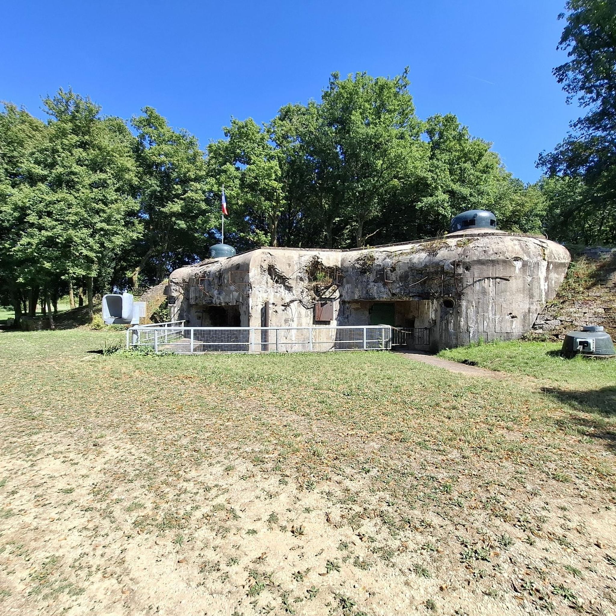
The Einseling fortification is a single-block fortified structure of the Maginot Line located in the fortified sector of Faulquemont, between the communes of Bambiderstroff and Longeville-lès-Saint-Avold. Its name comes from the Finselingerberg hill on which it is built. When it was projected by the CORF in the 1930s, the army used old German maps where the Gothic script annotations were misinterpreted: the F in Finseling was transformed into an E.
1
0


The Maginot Line: The French Wall | ARTE https://youtu.be/Bvtxa08ysgc For those who would like to know more about the Maginot Line: de.wikipedia.org/wiki/Liste_der_Ouvrages_der_Maginot-Linie
1
0

This work is part of the fortifications of the infamous Maginot line. It is made up of three combat blocks, one of which serves as the entrance. It is possible to visit the interior two Sundays a month. The opening dates are available on the book's website: https://www.lebambesch.com/visiter-le-bambesch/.
3
0
Frequently Asked Questions
How many hiking trails are available around Baumbiedersdorf?
There are 14 hiking routes around Baumbiedersdorf, offering a mix of easy and moderate trails through woodlands and rolling terrain. These routes often incorporate historical fortifications of the Maginot Line.
Are there easy hiking trails suitable for beginners in Baumbiedersdorf?
Yes, Baumbiedersdorf offers 4 easy hiking routes, perfect for beginners or those looking for a relaxed walk. These trails allow you to enjoy the region's natural beauty and historical sites without significant challenge.
What kind of historical sites can I explore while hiking in Baumbiedersdorf?
The hiking trails around Baumbiedersdorf are characterized by historical fortifications, particularly those of the Maginot Line. You can explore remnants of this significant military history within a natural setting. Notable highlights include the Maginot Line itself, and specific structures like the Ouvrage de Bambesch, which is featured on several routes.
Are there any circular hiking routes in Baumbiedersdorf?
Many of the trails in Baumbiedersdorf are circular, allowing you to start and end at the same point. For example, the Ouvrage de Bambesch – Maginot Line loop from Bambiderstroff is a popular circular route exploring historical fortifications.
What do other hikers say about the trails in Baumbiedersdorf?
The trails in Baumbiedersdorf are highly rated by the komoot community, with an average score of 4.6 stars from over 300 reviews. Hikers often praise the unique combination of natural woodlands and the historical significance of the Maginot Line fortifications.
What are some notable landmarks or attractions near the hiking trails?
Beyond the Maginot Line fortifications, you can discover several interesting landmarks. These include the Croix de Porcelette, the Lorraine American Cemetery and Memorial, and the Saint-Nabor Abbey Church of Saint-Avold. For scenic views, consider visiting the Rocher de l’Edelweiss.
Are there any family-friendly hiking options in Baumbiedersdorf?
While specific family-friendly routes aren't highlighted, the region offers 4 easy trails that could be suitable for families with children. These routes generally have less elevation gain and shorter distances, making them more accessible.
What is the typical duration for a moderate hike in Baumbiedersdorf?
Moderate hikes in Baumbiedersdorf typically range from about 2 to 4 hours. For instance, the Ouvrage de Bambesch – Bambesch loop from Bambiderstroff is an 8.6 km trail that takes approximately 2 hours 21 minutes to complete.
Can I find longer hiking routes for a full day out?
Yes, for a longer outing, consider the Ouvrage de Bambesch – Maginot Line loop from Bambiderstroff. This route is 15.4 km long and typically takes around 4 hours 11 minutes, providing a more extensive exploration of the area.
What are the main characteristics of the landscape around Baumbiedersdorf?
The landscape around Baumbiedersdorf is characterized by a mix of woodlands and rolling terrain. This provides varied scenery for outdoor activities, often with the historical fortifications of the Maginot Line integrated into the natural setting.
Are there any challenging hiking trails in Baumbiedersdorf?
The trails in Baumbiedersdorf are categorized as easy or moderate, with no routes specifically designated as difficult. The moderate trails offer a good workout with some elevation changes, but they are generally accessible to most hikers.
Is Baumbiedersdorf a good destination for a historical hiking experience?
Absolutely. Baumbiedersdorf is an excellent destination for historical hiking, as its trails are deeply intertwined with the Maginot Line fortifications. You can walk through and around these significant historical sites, gaining insight into the region's past while enjoying the natural surroundings.
Most popular routes around Baumbiedersdorf
Most popular attractions around Baumbiedersdorf

Get inspired with the komoot mobile app


Explore more
Browse the best Hikes in other regions.
