Top 20 Mountain Passes around Valmeinier
Best mountain passes around Valmeinier are found in the French Alps, a region known for its high-altitude routes and challenging climbs. Valmeinier is situated near iconic passes that connect the Savoie and Hautes-Alpes departments. The area features a landscape of rugged peaks, forested ascents, and historic routes. These mountain passes serve as key links between valleys and offer diverse experiences for outdoor enthusiasts.
Best mountain passes around Valmeinier
- The most popular mountain pass is Col du Galibier, a mountain…
Last updated: May 14, 2026
Col du Galibier
Highlight • Mountain Pass
Translated by Google •
Tip by

Col du Télégraphe
Highlight • Mountain Pass
Translated by Google •
Tip by
Sign up now to discover places like this
Get recommendations on the best single tracks, peaks, & plenty of other exciting outdoor places.
Sign up for free
Ascent to the Col du Télégraphe from Saint-Michel-de-Maurienne
Highlight (Segment) • Climb
Translated by Google •
Tip by

Mollard Pass
Highlight • Mountain Pass
Translated by Google •
Tip by

Col de la Vallée Étroite
Highlight • Mountain Pass
Translated by Google •
Tip by

Sign up for free to discover even more mountain passes around Valmeinier.
Sign up for free
Already have an account?
Start today with a free account
Your next adventure awaits.
Login or Signup
Other adventures around Valmeinier

Tips from the Community

Even more beautiful downhill
2
0


near the Thabor refuge
0
0

A fantastic mountain, making this climb was very challenging, the asphalt is in excellent condition and the gradients are regular.
14
0

https://youtu.be/Kl8aY-ksp7c?si=lv9_5ko1gQxpJgSM A classic during the Alpine Crossing to the south, as it's well-ridden. The steep downhill section isn't that long and can be pushed without difficulty, so I had no problem with it.
0
0
I must say that this climb is no joke with its gradients, very beautiful.
19
0
After the Galibier, if that's not enough for you, you can also get the Tèlègraphe.
20
1
The Col du Galibier from Briançon is a climb located in the Grand Briançonnais region. This climb is 34.8 kilometers long, with a positive elevation gain of 1,398 meters. The Col du Galibier from Briançon has an average gradient of 4%.
24
1
Frequently Asked Questions
How challenging are the mountain passes around Valmeinier?
The mountain passes around Valmeinier offer a range of challenges. Passes like the Col du Galibier are legendary for their demanding climbs, reaching high altitudes and featuring significant elevation gains, making them a formidable challenge for cyclists and experienced hikers. The Col du Télégraphe serves as a challenging prelude to the Galibier, with a consistent gradient through forested areas. Other passes, like Mollard Pass, offer quieter roads and scenic routes that can be less strenuous but still provide a rewarding experience.
When is the best time to visit the mountain passes near Valmeinier?
The best time to visit the mountain passes around Valmeinier is typically from late May to mid-October. During this period, the passes are generally free of snow and open to traffic, making them ideal for cycling, driving, and hiking. The summer months offer pleasant weather, though conditions can change rapidly at higher altitudes.
What kind of views can I expect from the mountain passes?
The mountain passes around Valmeinier offer spectacular panoramic views. From the summit of the Col du Galibier, you can enjoy breathtaking 360-degree vistas of the surrounding Alpine peaks, including the Écrins massif. Mollard Pass provides stunning views of the jagged Aiguilles d'Arves. Even lower passes like the Col du Télégraphe offer picturesque settings, often winding through dense forests.
Are there historical sites to explore on these mountain passes?
Yes, several mountain passes in the Valmeinier region have historical significance. The Col du Télégraphe is named after the historic Fort du Télégraphe, built between 1885 and 1893, which played a role during the Battle of the Alps in 1940. This fort offers panoramic views and can be visited in summer. The Col de la Vallée Étroite, located at the foot of Mount Thabor, was part of the Maginot Line between 1928 and 1940.
What outdoor activities can I do near the mountain passes around Valmeinier?
The mountain passes around Valmeinier are a hub for various outdoor activities. Cycling is extremely popular, especially on iconic routes like the Col du Galibier and Col du Télégraphe. You can also find numerous hiking and mountain biking trails. For specific routes, explore guides such as MTB Trails around Valmeinier, Running Trails around Valmeinier, and Cycling around Valmeinier.
Are there family-friendly options among the mountain passes?
While many passes offer challenging terrain, some sections or nearby areas can be family-friendly. For example, the forested climb of the Col du Télégraphe provides shade and a consistent gradient, which can be manageable for families with older children or those looking for a less extreme experience. Shorter walks or scenic drives to viewpoints can also be enjoyed by families. Always check specific route details for suitability.
Where can I find parking for mountain pass hikes or cycling routes?
Parking is generally available at the base of the major ascents or in nearby villages. For instance, to tackle the Col du Télégraphe and Col du Galibier, you can often find parking in Saint-Michel-de-Maurienne or Valloire. For other passes, parking is usually available at trailheads or designated areas in the closest towns. It's advisable to check local information for specific parking locations before your visit.
What do visitors enjoy most about the mountain passes in Valmeinier?
Visitors to Valmeinier's mountain passes highly appreciate the challenging climbs, especially the legendary status of the Col du Galibier as a Tour de France route. The breathtaking panoramic views from the summits, the well-maintained asphalt roads, and the sense of accomplishment after conquering a high-altitude pass are frequently mentioned. The quiet, scenic routes through forests, like those found on Mollard Pass, are also a favorite.
Are there cafes or restaurants directly on the mountain pass routes?
While full-service restaurants might be limited directly on the highest, most remote passes, you can often find refreshments and meals at key points. For example, the Relais du Télégraphe near the Col du Télégraphe offers refreshments and meals. In the villages at the base of the passes, such as Valloire or Saint-Michel-de-Maurienne, you'll find a wider selection of cafes, restaurants, and accommodation options.
Can I access the mountain passes around Valmeinier in winter?
Most high-altitude mountain passes around Valmeinier, including the Col du Galibier, are typically closed during winter due to heavy snow. They usually open from late May to mid-October. While some lower roads might remain accessible, winter conditions make many passes impassable for vehicles and challenging for hiking or cycling. Always check current road conditions and weather forecasts before planning a winter visit.
What is the <a href="https://www.komoot.com/highlight/2259163" target="_blank" rel="noopener">Mollard Pass</a> known for?
The Mollard Pass, at an altitude of 1,638 meters, is known for its stunning views of the jagged peaks of the Aiguilles d'Arves. It offers quiet roads and numerous hairpin bends through the forest, making it a particularly beautiful and less-trafficked climb, especially when approached from Villargondran.
What is the significance of the <a href="https://www.komoot.com/highlight/1356621" target="_blank" rel="noopener">Col de la Vallée Étroite</a>?
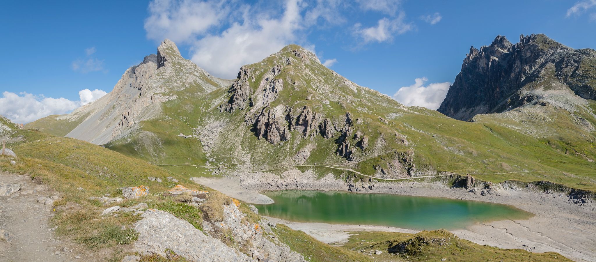
The Col de la Vallée Étroite, situated at 2,438 meters at the foot of Mount Thabor, is marked by a cross and holds historical significance as part of the Maginot Line between 1928 and 1940. Today, it serves as a crossroads for mountain enthusiasts, offering a starting point for descents into the eponymous valley.
Most popular routes around Valmeinier
Most popular attractions around Valmeinier

Get inspired with the komoot mobile app


Explore more
See even more epic mountain passes by checking out these guides around Valmeinier:
