The best walks and hikes around Villaroux
4.5
(362)
3,898
hikers
230
hikes
Hiking around Villaroux offers diverse landscapes, from mountainous terrain to serene lake areas, situated in the Savoie department of France. The region is characterized by its Alpine massifs, providing varied elevations and natural environments. Hikers can explore wooded areas, rocky high-altitude environments, and trails near several lakes. Proximity to the Chartreuse Regional Natural Park and Massif des Bauges Regional Natural Park further enhances the hiking opportunities.
Best hiking trails around Villaroux
- The most popular hiking route is Lac de Sainte…
Last updated: May 20, 2026
5.0
(2)
73
hikers
4.24km
01:06
30m
30m
Easy hike. Great for any fitness level. Easily-accessible paths. Suitable for all skill levels.
4.9
(8)
54
hikers
8.53km
02:42
330m
330m
Moderate hike. Good fitness required. Easily-accessible paths. Suitable for all skill levels.

Sign up for free
5.0
(2)
56
hikers
3.37km
00:53
30m
30m
Easy hike. Great for any fitness level. Easily-accessible paths. Suitable for all skill levels.
9
hikers
7.33km
02:11
220m
220m
Moderate hike. Good fitness required. Easily-accessible paths. Suitable for all skill levels.
8
hikers
14.4km
04:26
440m
440m
Moderate hike. Good fitness required. Mostly accessible paths. Sure-footedness required.
Get access to more routes and recommendations from other explorers.
Sign up for free
Already have an account?
Our route recommendations are based on thousands of hikes, rides, and runs completed by other people on komoot.
Start today with a free account
Your next adventure awaits.
Login or Signup


Tips from the Community

It is a surprise to arrive at this vertical rock face, the quarry, with the clear view on the left, dominating Detrier below and the Moutaret further to the left. It is a beautiful little valley that can only be seen from above. From there, a hiking trail leads to the chapel of Ste Marguerite before going back down to Arvillard on the other side of Mont Pézard.
0
0

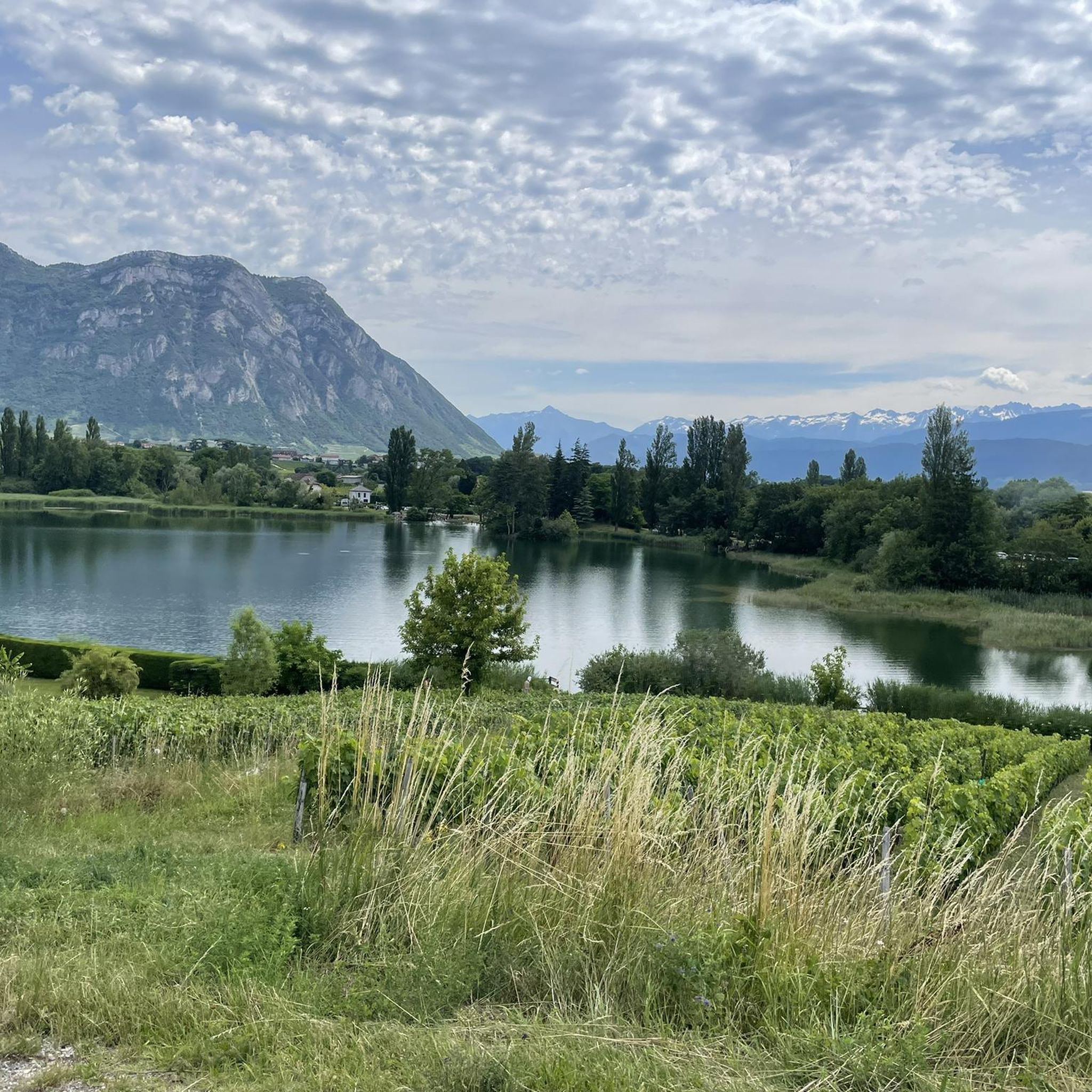
The Lac de Sainte Hélène, a natural lake fed by the Coisetan stream, is a preserved area where the banks remain wild. A landscaped path accessible to people with reduced mobility allows you to go around the lake away from the banks. Ideal picnic point and departure point for hikes. No swimming.
3
0
Frequently Asked Questions
How many hiking trails are available around Villaroux?
Villaroux offers a wide variety of hiking experiences, with over 220 routes available. These range from easy walks to more challenging mountain routes, catering to different ability levels.
What kind of terrain can I expect when hiking in Villaroux?
The region around Villaroux is characterized by its diverse and mountainous terrain, nestled within the Savoie department of France. You'll encounter Alpine massifs, transitioning from wooded areas to rocky, high-altitude environments. Many trails also feature picturesque lakes and offer expansive views of valleys and surrounding mountain ranges like the Bauges and Chartreuse.
Are there easy hiking options suitable for beginners or casual walkers in Villaroux?
Yes, Villaroux has numerous easy trails perfect for beginners or those seeking a relaxed walk. For instance, the Lac de Sainte Hélène loop from Sainte-Hélène-du-Lac is an easy 2.5-mile route offering pleasant lake views, typically completed in just over an hour.
Are there any family-friendly hikes in the Villaroux area?
While specific family-friendly routes aren't detailed in the provided data, the region's easy trails are generally suitable for families. The Lac de Sainte Hélène loop from Sainte-Hélène-du-Lac is an easy option that could be enjoyed by families. The Mont Pezard area is also noted for offering a family-friendly hike with varied interests, including flora, a quarry, and a chapel, culminating in a beautiful panorama.
Can I find circular hiking routes around Villaroux?
Yes, many of the trails around Villaroux are designed as loops, allowing you to start and end at the same point. Examples include the popular Lac de Sainte Hélène loop from Sainte-Hélène-du-Lac, the Lac Saint Clair – La carrière loop from Détrier, and the La Bathie track loop from Villaroux.
What are some notable natural features or landmarks to see on hikes near Villaroux?
Villaroux is rich in natural beauty. You can explore several picturesque lakes such as Lac de Sainte Hélène, Lake Saint-André, and Lac de la Thuile. The region also features prominent mountain passes like Marocaz Pass and Col de Cochette (587 m), offering stunning views.
Are there any trails that offer panoramic views of the region?
Absolutely. The mountainous terrain around Villaroux provides numerous opportunities for breathtaking panoramas. Hikers can enjoy expansive views of the Chambéry valley, the Bauges summits, and parts of the Chartreuse and Belledonne massifs. The Mont Pezard hike, for example, culminates in a beautiful panorama of the Val Gelon. You can also find specific viewpoints like the View of Lake Saint-André and the Belledonne Range.
What do other hikers enjoy most about the trails in Villaroux?
The trails in Villaroux are highly rated by the komoot community, with an average score of 4.5 stars from over 400 reviews. Hikers often praise the diverse landscapes, from serene lake areas to challenging mountain paths, and the well-maintained routes that cater to all fitness levels. The stunning views and natural beauty of the regional parks are frequently highlighted.
Are there any longer or more challenging hikes for experienced trekkers?
Yes, for experienced trekkers, Villaroux offers more demanding routes. While not explicitly listed in the top routes, the region is known for hard mountaineering routes, some exceeding 5 hours or 3,000 ft of elevation gain, requiring good fitness and alpine experience. The Grande Montagne d'Arvillard is featured in several challenging loops, indicating its importance for more experienced hikers.
What is the best time of year to go hiking in Villaroux?
Given its Alpine massif environment, the best time for hiking in Villaroux is typically from spring through autumn when the weather is milder and trails are clear of snow. Summer offers warm conditions, while spring and autumn provide pleasant temperatures and vibrant scenery. Winter hiking might be possible on lower elevation trails, but higher routes would require appropriate gear and experience for snowy conditions.
Are there any historical sites or points of interest along the hiking trails?
Yes, some trails incorporate historical elements. For instance, the Tower – Château de Montmayeur loop from Villaroux takes you past a tower and the Château de Montmayeur, offering a glimpse into the local heritage while you hike.
Most popular routes around Villaroux
Most popular attractions around Villaroux

Get inspired with the komoot mobile app


Explore more
Browse the best Hikes in other regions.
