The best walks and hikes around Durfort-Lacapelette
4.5
(200)
1,406
hikers
73
hikes
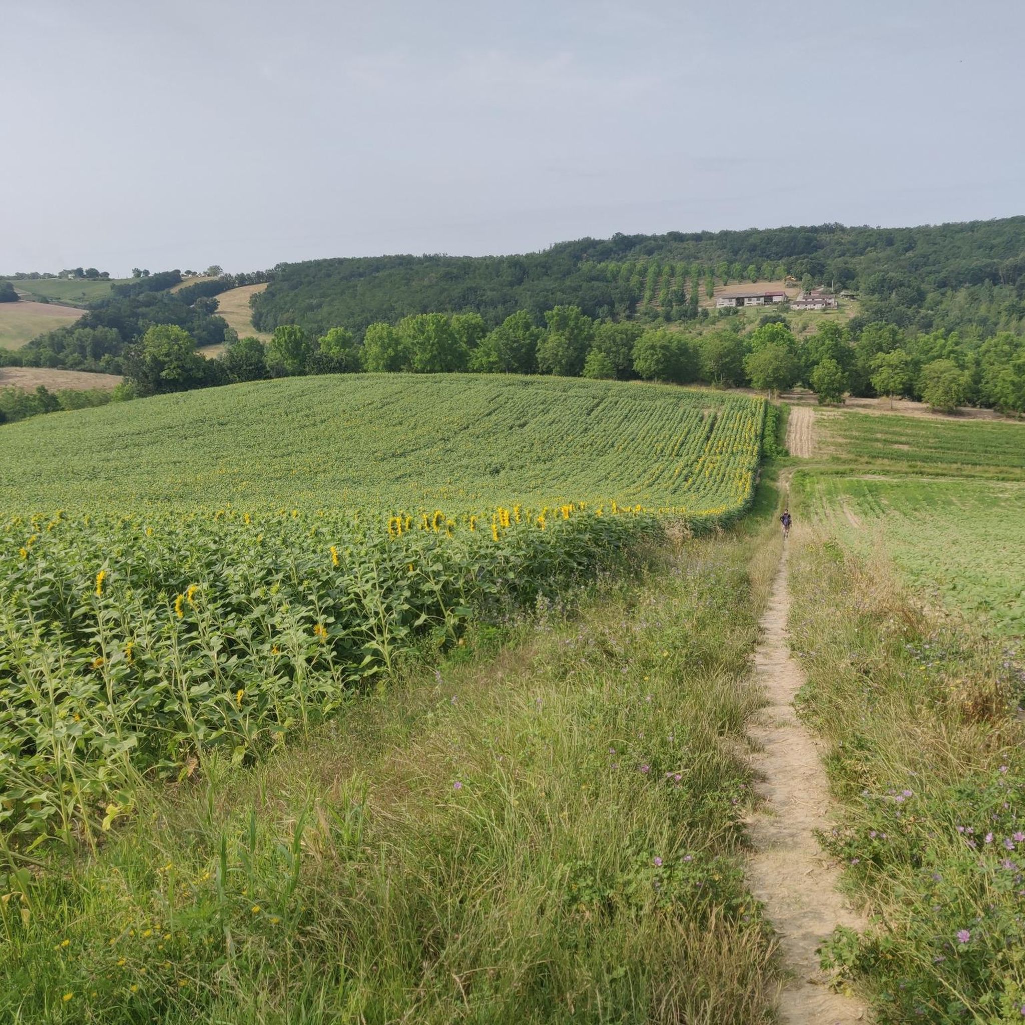
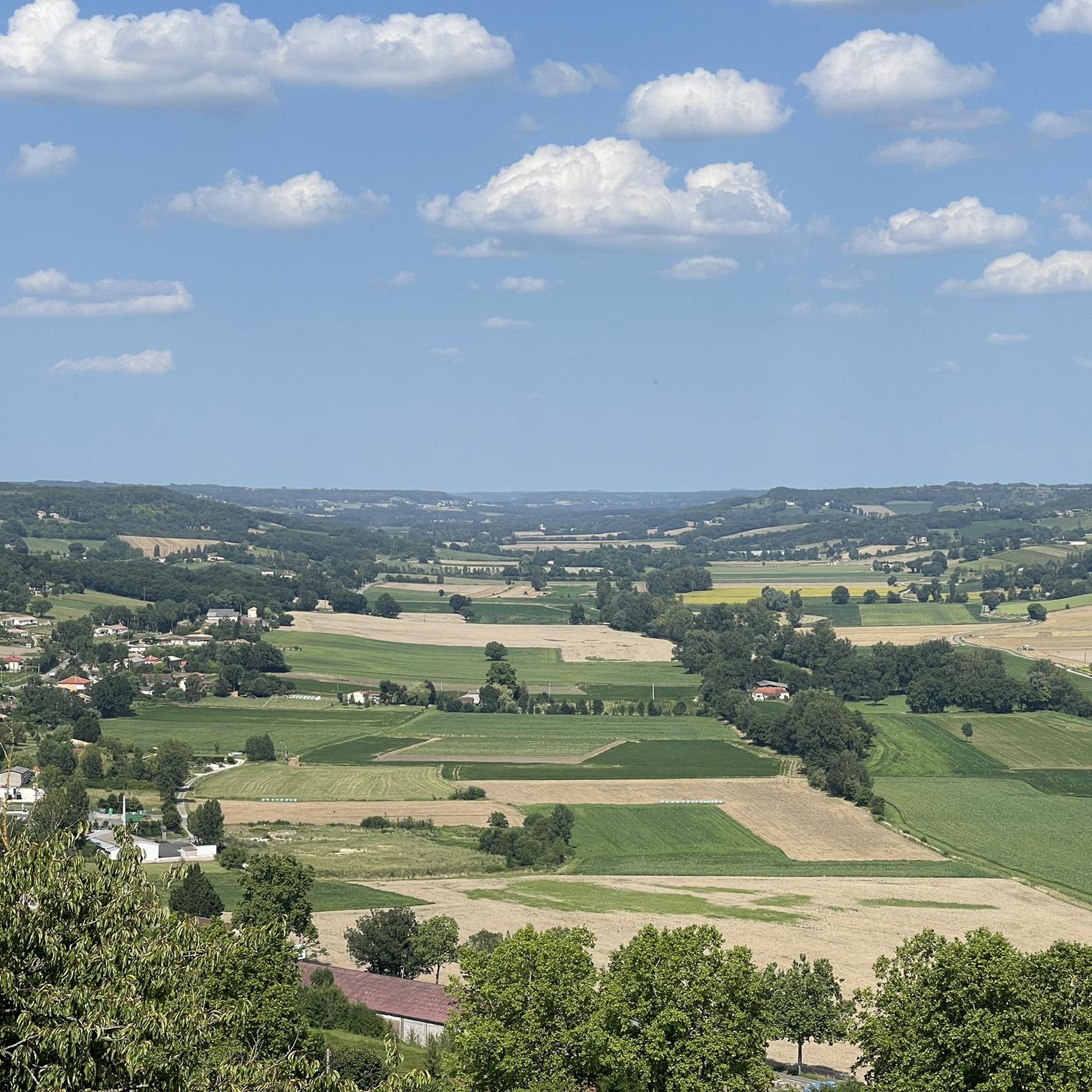
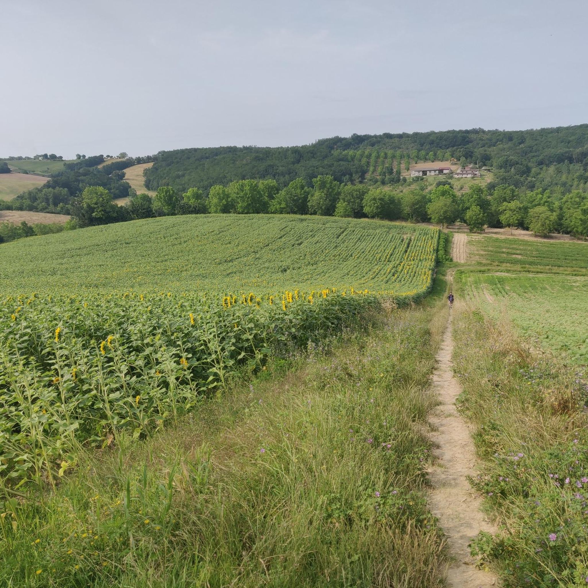
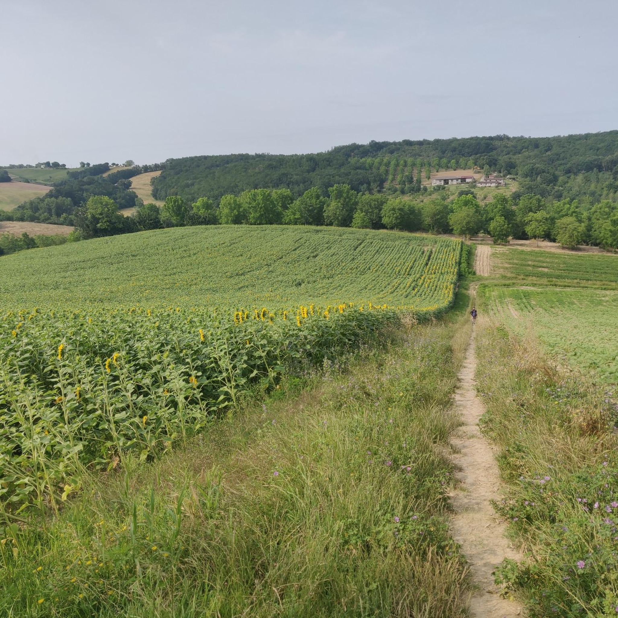
Hiking around Durfort-Lacapelette offers diverse landscapes situated between the "Quercy Blanc" and the plains of the Tarn and Garonne rivers. The region features rolling hills, fertile plains, and river valleys, with elevations ranging from 91 to 205 meters. Hikers can expect paths winding through orchards, sunflower fields, and vineyards, characterized by the white limestone of the Quercy Blanc. The Barguelonne river also forms part of the natural scenery.
Best hiking trails around Durfort-Lacapelette
- The most popular hiking route is Beautiful…
Last updated: July 8, 2026
4.8
(21)
123
hikers
26.5km
07:22
490m
490m
Hard hike. Very good fitness required. Easily-accessible paths. Suitable for all skill levels.
4.8
(9)
74
hikers
Hard hike. Very good fitness required. Easily-accessible paths. Suitable for all skill levels.

Sign up for free
4.4
(10)
49
hikers
20.2km
05:31
310m
310m
Hard hike. Very good fitness required. Easily-accessible paths. Suitable for all skill levels.
4.8
(4)
35
hikers
29.5km
08:18
610m
610m
Hard hike. Very good fitness required. Easily-accessible paths. Suitable for all skill levels.
3.0
(1)
43
hikers
19.0km
05:27
460m
460m
Hard hike. Very good fitness required. Easily-accessible paths. Suitable for all skill levels.
Get access to more routes and recommendations from other explorers.
Sign up for free
Already have an account?
Our route recommendations are based on thousands of hikes, rides, and runs completed by other people on komoot.
Start today with a free account
Your next adventure awaits.
Login or Signup
Tips from the Community

Small, pretty church (unfortunately closed) on a hill in Saint Martin. In front of the church there is a nice rest area under an old, shady oak tree.
2
0
Small pilgrim restaurant right on the Camino. Ideal for a coffee☕️or a cold drink. There is also a 'free' water point outside. They also serve snacks.
2
0
The chapel is called: Chapelle de Saint-Sernin-du-Bosc de Lauzerte Next to the chapel there is a drinking water point💦.
1
0

The Abbey of Moissac is a UNESCO World Heritage Site, great frescoes in the entrance portal and a unique cloister with many biblical scenes and saints' stories in the capitals
0
0
Great medieval frescoes and a unique cloister
0
0

Beautiful abbey. There is also a hostel for pilgrims attached, where you can also find the stamp to put on your credentials.
4
0

It looks great and you seem to be able to hear something with it. Unfortunately I couldn't bring it to life...
1
0

A nice stop on the road, very pretty. In addition, it offers a special rate for itinerant cyclists: reduced rate "eco-travellers"
0
0
Frequently Asked Questions
How many hiking trails are available around Durfort-Lacapelette?
There are over 70 hiking routes in the Durfort-Lacapelette area, offering a wide range of experiences from easy strolls to challenging long-distance paths. The komoot community has explored over 73 tours here.
What kind of terrain can I expect on hikes in Durfort-Lacapelette?
The landscape around Durfort-Lacapelette is diverse, situated between the 'Quercy Blanc' and the Tarn and Garonne river plains. You'll find rolling hills, fertile plains, and river valleys. Paths often wind through orchards, sunflower fields, vineyards, and areas characterized by white limestone. The region's elevation ranges from 91 to 205 meters, providing varied topography.
Are there any easy hiking trails suitable for beginners or casual walkers?
Yes, the area offers 30 easy routes, perfect for a relaxed walk. These trails often traverse agricultural land, providing pleasant scenery without significant elevation gain.
Are there any challenging hikes for experienced trekkers?
For experienced hikers, there are 10 difficult routes available. These often involve longer distances and more significant elevation changes, such as the Beautiful view of Lauzerte – Beautiful rest area loop from Rouchet, which covers over 25 km with substantial ascents.
What are some notable landmarks or viewpoints I can see while hiking?
Many trails offer stunning vistas, particularly of the medieval bastide town of Lauzerte. You might also encounter historical features like pigeonniers (dovecoats) and small, pretty churches on hillsides. The Place des Cornières de Lauzerte is a notable historical site nearby. The 'Circuit du Malpas' offers views of the Tarn river plain and its meanders.
Are there any circular walks available in Durfort-Lacapelette?
Yes, many of the routes in the area are circular, allowing you to start and end at the same point. For example, the Beautiful rest area – Beautiful view of Lauzerte loop from Maroune is a moderate circular route offering great views.
What do other hikers enjoy most about hiking in Durfort-Lacapelette?
The area is highly rated by the komoot community, with an average score of 4.4 stars from over 140 reviews. Hikers often praise the diverse landscapes, the peaceful atmosphere, and the charming views of the surrounding countryside and historic towns like Lauzerte.
Is Durfort-Lacapelette part of any long-distance pilgrimage routes?
Yes, Durfort-Lacapelette is notably situated on the Camino de Santiago (GR 65), also known as the Via Podiensis. This makes it a significant stop for pilgrims and offers opportunities for longer, more challenging excursions.
What natural features can I expect to see on the trails?
Beyond the cultivated fields of sunflowers and vineyards, you'll encounter the Barguelonne river forming the northern border of the commune. The white limestone of the Quercy Blanc region is also a defining natural characteristic. Keep an eye out for local wildlife such as hares, partridges, roe deer, and wild boars.
Are there any specific attractions or points of interest near the hiking routes?
Yes, several interesting spots are close by. You could visit the historic town of Moissac, known for its Saint Peter's Abbey Church and Cloister. The Cacor Canal Bridge is another engineering marvel worth seeing. You might also spot a typical local dovecote, which are historical features of the region.
What is the best time of year to go hiking in Durfort-Lacapelette?
The region's landscapes, with orchards and sunflower fields, are particularly vibrant in spring and summer. However, the varied terrain and generally mild climate make it suitable for hiking through much of the year. Spring and autumn offer pleasant temperatures for longer walks.
Are there options for accommodation near the trails?
Given its location on the Camino de Santiago, the area has established infrastructure for hikers and pilgrims, including gîtes (guesthouses) along the route, providing convenient places to stay.
Most popular routes around Durfort-Lacapelette
Most popular attractions around Durfort-Lacapelette

Get inspired with the komoot mobile app


Explore more
Browse the best Hikes in other regions.
