The best running trails around Brouvelieures
3.7
(31)
538
runners
80
runs
Jogging around Brouvelieures offers access to a diverse landscape within the Vosges department of France. The region features tranquil forests, serene rivers, and notable rock formations, providing varied terrain for running. Well-maintained forest roads and trails wind through dense woodlands, offering natural surfaces and shade. The presence of the Mortagne River and nearby ponds enhances the scenic beauty of many running routes.
Best jogging routes around Brouvelieures
- The most popular jogging route is Pointhaie Rocks Loop, a 3.8 miles…
Last updated: July 5, 2026
4.0
(2)
11
runners
6.17km
00:44
130m
130m
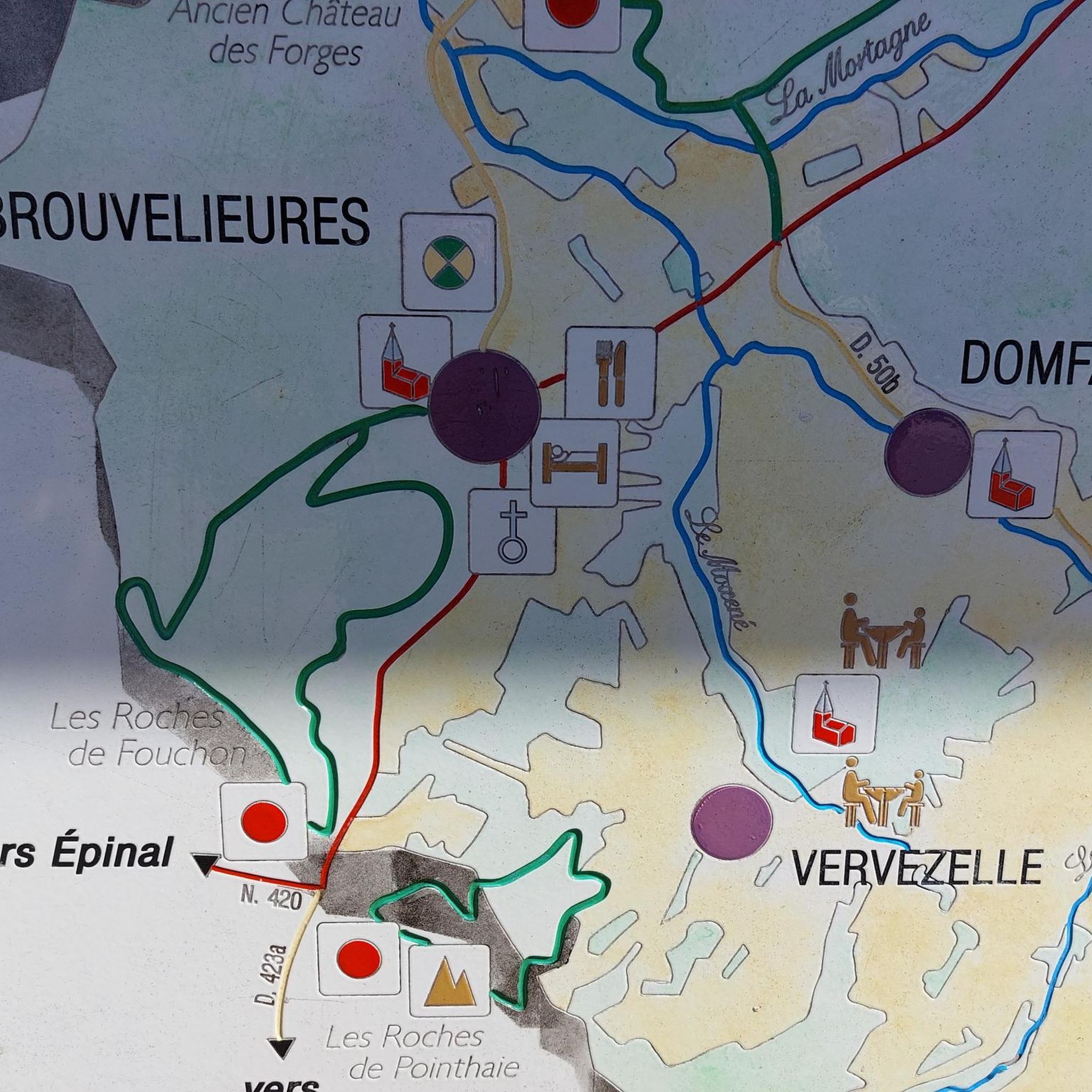
Jog this moderate 3.8-mile loop from Bruyères, passing tranquil Pointhaie Ponds and climbing to Pointhaie Rocks for panoramic views.
5.0
(1)
45
runners
9.94km
01:13
220m
220m
Moderate run. Good fitness required. Mostly paved surfaces. Suitable for all skill levels.

Sign up for free
30
runners
10.6km
01:17
240m
240m
Moderate run. Good fitness required. Mostly paved surfaces. Suitable for all skill levels.
15
runners
27.4km
03:22
620m
620m
Hard run. Very good fitness required. Sure-footedness, sturdy shoes and alpine experience required.
1.0
(1)
14
runners
5.73km
00:40
140m
140m
Moderate run. Good fitness required. Mostly paved surfaces. Suitable for all skill levels.
Get access to more routes and recommendations from other explorers.
Sign up for free
Already have an account?
Our route recommendations are based on thousands of hikes, rides, and runs completed by other people on komoot.
Start today with a free account
Your next adventure awaits.
Login or Signup

Tips from the Community

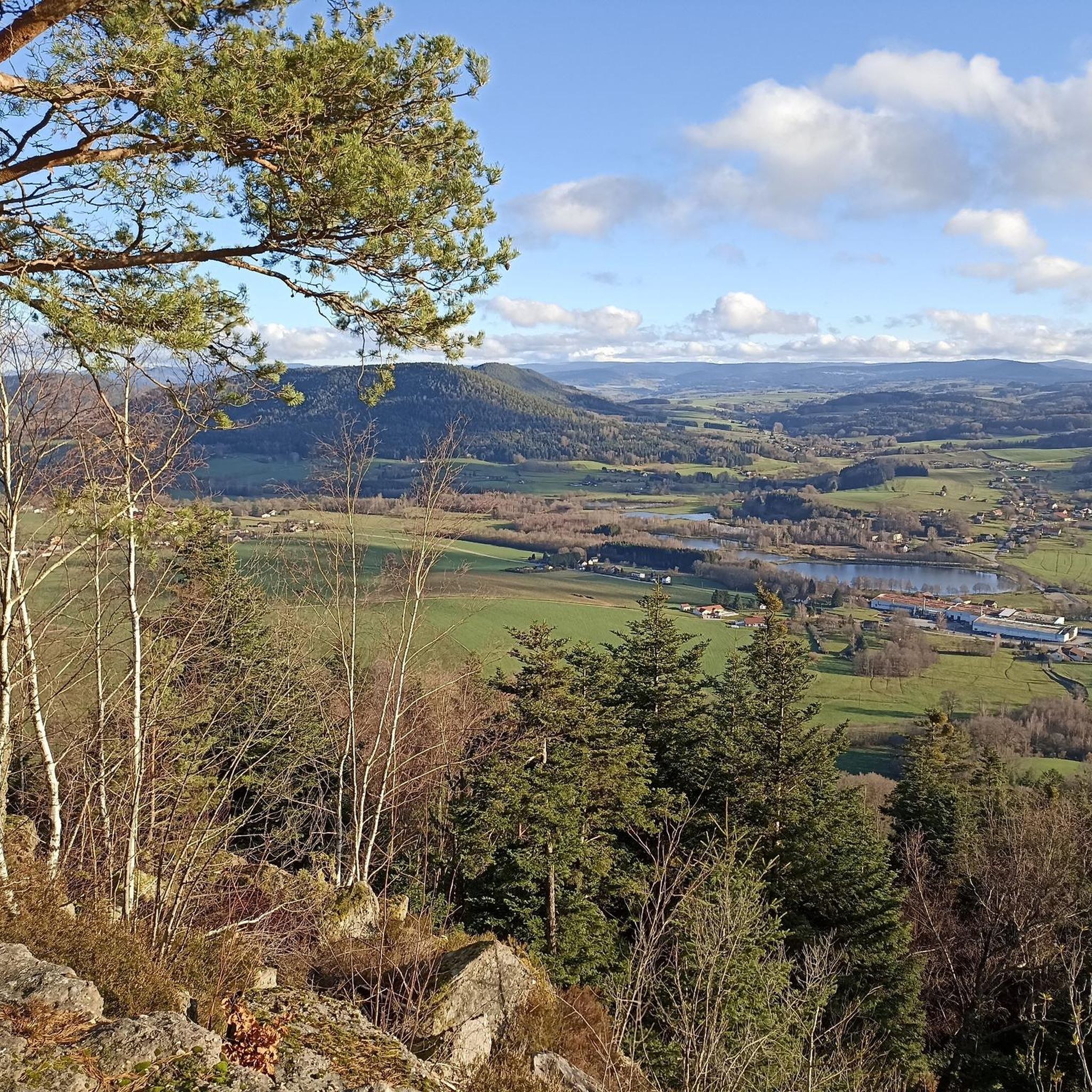
Nicknamed "The Lookout", this 15-meter-high sandstone tower dates from 1900. It is located on the Avison mountain (altitude of 593 meters) and offers a beautiful view of the surrounding peaks.
0
0

A beautiful pond to run around in, with some eye-catching wooden carvings.
2
0
These sandstone rocks are 15 meters high and the view from the top of these rocks is magnificent.
2
0
These sandstone rocks are 15 meters high and the view from the top of these rocks is magnificent.
2
0

Frequently Asked Questions
How many running routes are available around Brouvelieures?
There are over 60 running routes available around Brouvelieures, offering a wide variety of options for different fitness levels and preferences. The komoot community has explored these trails over 400 times.
What kind of terrain can I expect on running trails in Brouvelieures?
The running trails in Brouvelieures primarily feature tranquil forest roads and natural paths, winding through dense woodlands. You can expect soft, natural surfaces that are often easier on joints than pavement. Some routes also incorporate varied terrain with impressive rock formations, such as the Roche de Contimpierre, providing a mix of challenges and scenic views.
What do other runners say about the trails in Brouvelieures?
The running routes in Brouvelieures are highly rated by the komoot community, with an average score of 3.9 stars from over 20 reviews. Runners often praise the quiet, forested environments, the serene rivers, and the impressive rock formations that make for a visually stimulating experience.
Are there routes suitable for beginners in Brouvelieures?
Yes, Brouvelieures offers several easy running routes perfect for beginners or those looking for a relaxed jog. While most routes are moderate, there are at least 3 easy trails available, providing gentle inclines and well-maintained paths through the scenic Vosges landscape.
Are there any circular running routes in the area?
Many of the running routes around Brouvelieures are circular, allowing you to start and finish at the same point. For example, the popular Pointhaie Rocks Loop and the Pointhaie Pond loop from Vervezelle are excellent circular options that take you through diverse landscapes.
Can I bring my dog on the running trails in Brouvelieures?
Generally, the natural trails and forest roads in the Vosges region, including around Brouvelieures, are dog-friendly. However, it's always recommended to keep your dog on a leash, especially in forested areas where wildlife may be present, and to respect local regulations. The tranquil environment is ideal for running with your canine companion.
Are there family-friendly running options in Brouvelieures?
Yes, the easier and moderate routes in Brouvelieures are suitable for families. The well-maintained forest paths and relatively gentle inclines on some trails make them enjoyable for all ages. The natural surroundings provide a great opportunity for children to explore while you run.
What natural landmarks or points of interest can I see while running?
While running in Brouvelieures, you can encounter several natural landmarks. The Pointhaie Rocks are a notable feature on several routes, offering impressive rock formations. You might also run along the serene Mortagne River or pass by water features like the Pointhaie Pond. The region is also home to the magnificent Roche de Contimpierre, a sandstone conglomerate rock with a natural cavern.
Are there any routes that follow rivers or pass by water features?
Yes, several running routes in Brouvelieures offer scenic views of water features. The forest road between Brouvelieures and Autrey notably follows the Mortagne River. Additionally, the Pointhaie Pond loop from Vervezelle takes you past a beautiful pond, providing a refreshing atmosphere during your run.
Is parking available near the trailheads in Brouvelieures?
While specific parking details for every trailhead are not always listed, Brouvelieures and its surrounding villages typically offer public parking areas. Given the region's focus on outdoor activities, you can generally find convenient parking close to popular starting points for running routes.
How can I access the running trails using public transport?
Public transport options directly to specific trailheads in Brouvelieures might be limited. It's advisable to check local bus schedules for connections to Brouvelieures or nearby towns like Bruyères. From the village centers, many trails are accessible within a short walk or by combining with a local taxi service.
When is the best time of year to go running in Brouvelieures?
The best time to go running in Brouvelieures is generally from spring through autumn (April to October). During these months, the weather is milder, and the forests are vibrant. Summer offers pleasant shade from the trees, while autumn provides stunning foliage. Winter running is possible, but trails may be slippery or covered in snow, requiring appropriate gear.
Most popular routes around Brouvelieures
Most popular attractions around Brouvelieures

Get inspired with the komoot mobile app


Explore more
Browse the best Running Trails & Routes in other regions.
