The best walks and hikes around Brouvelieures
4.5
(263)
1,147
hikers
60
hikes
Hiking around Brouvelieures offers access to the natural landscapes of the Vosges region. The area is characterized by rolling hills, dense woodlands, and notable rock formations, providing varied terrain for outdoor activities. Trails often lead through forests and past small bodies of water, with gentle elevation changes. The region provides a setting for exploring natural features on foot.
Best hiking trails around Brouvelieures
- The most popular hiking route is The Rocks of Pointhaie Trail, a 3.8 miles (6.2 km)…
Last updated: July 2, 2026
4.7
(38)
128
hikers
6.17km
01:44
130m
130m
Easy hike. Great for any fitness level. Easily-accessible paths. Suitable for all skill levels.
4.6
(9)
49
hikers
2.63km
00:45
60m
60m
Easy hike. Great for any fitness level. Easily-accessible paths. Suitable for all skill levels.

Sign up for free
4.8
(13)
35
hikers
5.92km
01:41
140m
140m
Easy hike. Great for any fitness level. Easily-accessible paths. Suitable for all skill levels.
4.5
(13)
76
hikers
6.88km
01:57
150m
150m
Easy hike. Great for any fitness level. Easily-accessible paths. Suitable for all skill levels.
4.8
(4)
27
hikers
4.04km
01:10
100m
100m
Easy hike. Great for any fitness level. Easily-accessible paths. Suitable for all skill levels.
Get access to more routes and recommendations from other explorers.
Sign up for free
Already have an account?
Our route recommendations are based on thousands of hikes, rides, and runs completed by other people on komoot.
Start today with a free account
Your next adventure awaits.
Login or Signup

Tips from the Community

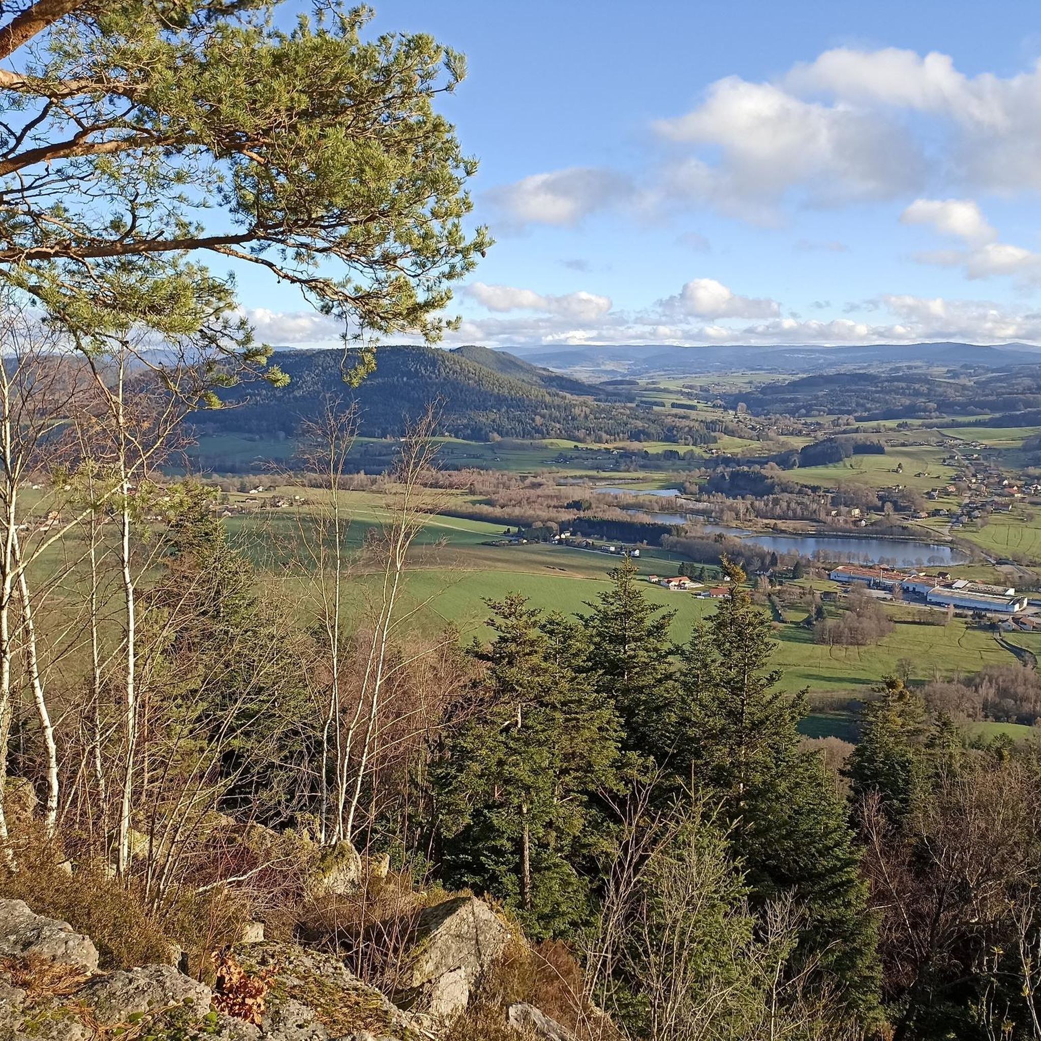
Nicknamed "The Lookout", this 15-meter-high sandstone tower dates from 1900. It is located on the Avison mountain (altitude of 593 meters) and offers a beautiful view of the surrounding peaks.
0
0

A beautiful pond to run around in, with some eye-catching wooden carvings.
2
0
These sandstone rocks are 15 meters high and the view from the top of these rocks is magnificent.
2
0
These sandstone rocks are 15 meters high and the view from the top of these rocks is magnificent.
2
0

Small fun trail of Bruyères ideal with children. But not accessible by stroller.
0
0

A great idea : having a forest path illustrated with big metal ants and short information about ants. Fun to do with kids, I imagine, and a nice forest walk if you stop by.
1
0
Frequently Asked Questions
How many hiking trails are available around Brouvelieures?
There are over 50 hiking trails around Brouvelieures, offering a variety of options for exploring the region's natural landscapes. The komoot community has recorded 56 routes in total.
What kind of difficulty can I expect from the hiking trails in Brouvelieures?
The trails around Brouvelieures are predominantly easy to moderate. Out of 56 routes, 28 are rated as easy, 26 as moderate, and only 2 are considered difficult, making the area accessible for various fitness levels.
Are there circular hiking routes in Brouvelieures?
Yes, many of the trails in Brouvelieures are circular, allowing you to start and end at the same point. For example, the Pointhaie Rocks loop from Bruyères is an easy 2.9-mile (4.7 km) circular path offering views of the Pointhaie Rocks.
Are there family-friendly hiking trails in Brouvelieures?
Many of the easy-rated trails are suitable for families. The region's gentle elevation changes and well-defined paths through forests and past ponds make for pleasant family outings. The Ant Mountain loop from Bruyères is a shorter, easy option.
Are dogs allowed on the hiking trails in Brouvelieures?
Generally, dogs are welcome on trails in the Vosges region, especially when kept on a leash. It's always a good idea to check local signage for specific restrictions, particularly in nature reserves or protected areas. The forested paths around Brouvelieures are popular with dog walkers.
What natural features or landmarks can I see while hiking in Brouvelieures?
The region is known for its distinctive rock formations and forested areas. A prominent feature is the Pointhaie Rocks, which can be explored on trails like The Rocks of Pointhaie Trail. You'll also encounter small ponds and extensive woodlands.
When is the best time of year to hike in Brouvelieures?
Spring and autumn are generally ideal for hiking in Brouvelieures, offering pleasant temperatures and beautiful scenery with blooming flora or vibrant fall foliage. Summer can also be enjoyable, especially in the shaded forest areas, while winter hiking is possible but requires appropriate gear for potentially snowy or icy conditions.
Is Brouvelieures accessible by public transport for hikers?
While Brouvelieures itself is a smaller commune, nearby larger towns like Bruyères may offer more public transport connections. From there, you might need to consider local bus services or a short taxi ride to reach specific trailheads. It's advisable to check regional transport schedules in advance.
Where can I find parking for hiking trails in Brouvelieures?
Parking is typically available near the starting points of popular trails or in the villages surrounding Brouvelieures, such as Bruyères or Vervezelle. Look for designated parking areas or roadside spots where permitted. Many trailheads are easily accessible by car.
What do other hikers say about the trails in Brouvelieures?
The hiking trails in Brouvelieures are highly regarded by the komoot community, with an average rating of 4.6 out of 5 stars from over 200 reviews. Hikers frequently praise the quiet woodlands, well-marked paths, and the unique rock formations like the Pointhaie Rocks.
Are there any longer hiking routes for experienced hikers near Brouvelieures?
While many trails are shorter, there are options for longer walks. For example, the Pointhaie Pond – Pointhaie Rocks loop from Bruyères is a 4.3-mile (6.9 km) trail that combines forest walking with natural landmarks, offering a more extended experience than some of the shorter loops.
Most popular routes around Brouvelieures
Most popular attractions around Brouvelieures

Get inspired with the komoot mobile app


Explore more
Browse the best Hikes in other regions.
