The best running trails around Saint-Seine-L'Abbaye
3.0
(1)
64
runners
22
runs
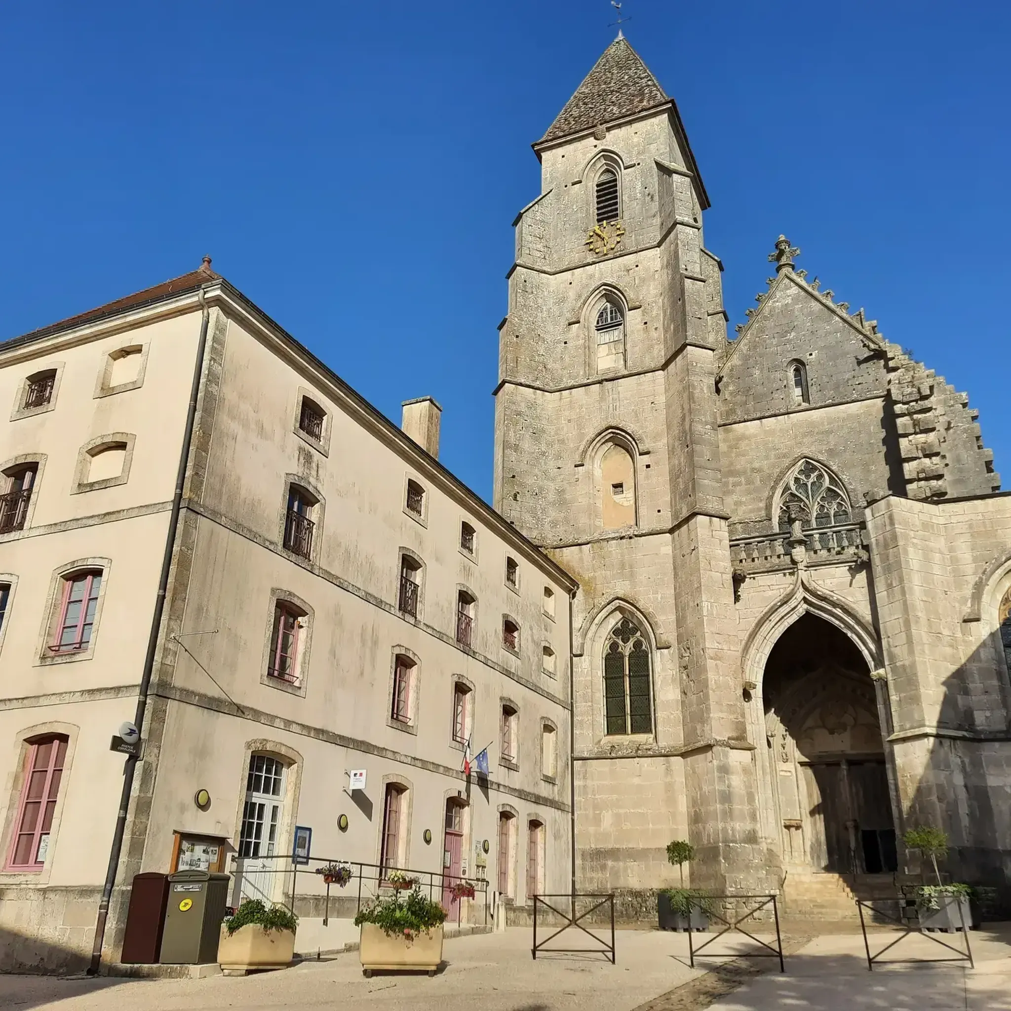
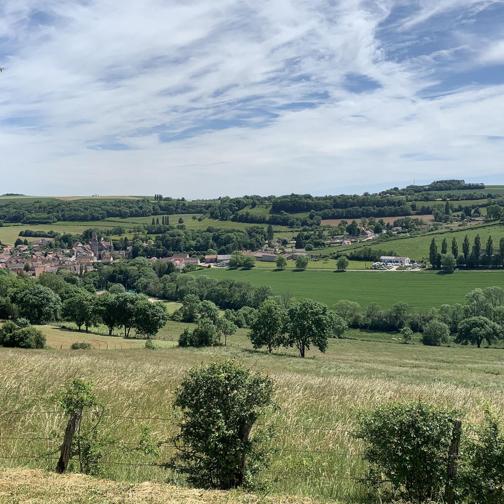
Jogging around Saint-Seine-L'Abbaye offers a variety of routes through the region's natural landscape. The area is characterized by its river valleys, including the source of the Seine, and features rolling hills and woodlands. Situated on a limestone plateau, the village provides picturesque natural surroundings with routes winding through fields. These running routes offer opportunities to explore the local terrain, with varying elevations suitable for different fitness levels.
Best jogging routes around Saint-Seine-L'Abbaye
- The most popular jogging route is Source-Seine Promenade…
Last updated: November 3, 2026
3.0
(1)
7
runners
16.6km
02:01
220m
220m
Jog the Source-Seine Promenade, a difficult 10.3-mile (16.6 km) route with 710 feet (216 metres) of elevation gain near Dijon.
16
runners
11.4km
01:26
210m
210m
Moderate run. Good fitness required. Mostly paved surfaces.

5
runners
16.2km
02:08
480m
480m
Hard run. Very good fitness required. Mostly paved surfaces.
4
runners
11.4km
01:23
180m
180m
Moderate run. Good fitness required. Mostly paved surfaces.
5
runners
10.4km
01:13
170m
170m
Moderate run. Good fitness required. Mostly paved surfaces.
Get access to more routes and recommendations from other explorers.
Already have an account?
Our route recommendations are based on thousands of hikes, rides, and runs completed by other people on komoot.
Start today with a free account
Your next adventure awaits.


Tips from the Community

A bucolic, clean, well-maintained, and shaded spot, with tables and trash cans for picnicking. It's officially a Paris commune, but it looks nothing like Paris.
0
0

There's a signposted and very beautiful circular trail that includes the source of the Seine. Learn more on the official website here: https://www.cotedor-randonnee.com/
1
0
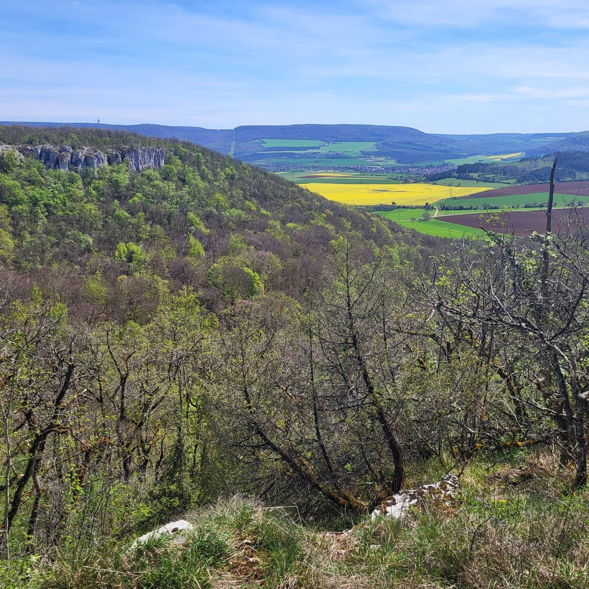
The Celerons viewpoint is accessible via a narrow path that branches off from the hiking trail. Caution! The path runs right along the edge of the cliffs. However, the view over the Combe des Vaux des Roches gorge and its foothills is fantastic and worth the short detour.
3
0

Wikipedia reports: "The source of the Seine is located on the plateau of Langres, 25 km north-west of Dijon in the Côte-d'Or department in the Bourgogne-Franche-Comté region, 470 m above sea level. A special feature is that the sources of the Seine were the property of the city of Paris from 1864 onwards. An artificial grotto was built a year later to protect the main source and a statue of a nymph was erected to symbolize the river. Paris has since returned the property to the region. Near the source are the remains of a Gallo-Roman temple in which a Dea Sequana (Latin goddess of the Seine) was worshipped. The archaeological finds from this are now in the archaeological department of the Musée des Beaux-Arts in Dijon."
2
1

The Seine is a river 777 km long and flows into the English Channel.
4
0

Here we find a clearing with a cave and a sculpture around the source of the Seine. The large lawn near the grotto is ideal for playing Frisbee or having a picnic. Wooden tables are also available.
0
0

This is where one of France's most famous rivers begins. With its meadows and picnic benches, it is a perfect stopover for your race.
2
0
Walking up to this point, the view opens up to a sea of greenery and cliffs.
6
2
Frequently Asked Questions
What is the general difficulty level of running routes around Saint-Seine-L'Abbaye?
The running routes in Saint-Seine-L'Abbaye are primarily categorized as moderate to difficult. There are 15 moderate routes and 5 difficult routes, offering varied terrain and elevation changes suitable for runners looking for a challenge.
Are there any running routes suitable for beginners or families with young children?
While there are no routes explicitly classified as 'easy', many of the moderate routes could be suitable for beginners or families who are accustomed to longer distances and some elevation. For example, the Source of the Seine loop from Source-Seine is a moderate 7-mile (11.3 km) trail that offers beautiful scenery without extreme climbs.
What kind of terrain can I expect on the jogging trails in this region?
The jogging trails around Saint-Seine-L'Abbaye are characterized by river valleys, including the source of the Seine, rolling hills, and dense woodlands. You can expect a mix of natural paths, forest tracks, and some paved sections, often with significant elevation changes.
Are the running routes in Saint-Seine-L'Abbaye dog-friendly?
Most natural trails in the Saint-Seine-L'Abbaye area are dog-friendly, allowing you to enjoy your run with your canine companion. It's always recommended to keep dogs on a leash, especially near wildlife or livestock, and to carry waste bags to maintain the cleanliness of the trails.
Are there any challenging running routes for experienced runners?
Yes, for experienced runners seeking a challenge, there are several difficult routes. The Running loop from Francheville is an 11-mile (17.8 km) path with significant elevation changes, winding through the local countryside and providing a demanding workout.
What are the typical distances and durations for running routes in Saint-Seine-L'Abbaye?
Running routes in the area vary in length, with many falling between 6 to 11 miles (10 to 18 km). Durations typically range from 1 hour 20 minutes to over 2 hours, depending on the route's length and elevation profile, as well as your running pace.
Are there any circular running routes available?
Yes, many of the running routes in Saint-Seine-L'Abbaye are circular, allowing you to start and finish at the same point. The Running loop from La Casquette is a good example, offering a moderate 6.4-mile (10.4 km) loop.
What interesting sights or natural landmarks can I see along the running trails?
The region offers several natural landmarks. You might encounter the Source of the Seine, or enjoy panoramic views from spots like the Panorama of the Baulme‑la‑Roche Rocks or Celerons viewpoint. Some routes also pass by geological features such as the Gouffre du creux Percé.
Is public transport available to access the running routes?
Saint-Seine-L'Abbaye is a rural area, and public transport options to specific trailheads might be limited. It's generally advisable to plan your trip by car, as many routes start from villages or parking areas. Always check local transport schedules if you plan to rely on public services.
What is the best time of year to go jogging in Saint-Seine-L'Abbaye?
Spring and autumn are generally the most pleasant seasons for jogging in Saint-Seine-L'Abbaye, with mild temperatures and beautiful natural scenery. Summer can be warm, especially in the midday sun, while winter runs may require appropriate gear for colder, potentially muddy or icy conditions.
Are there any running routes that start directly from Saint-Seine-l'Abbaye village?
Yes, you can find routes that start directly from the village. The Running loop from Saint-Seine-l'Abbaye is a moderate 5.9-mile (9.4 km) route that begins and ends in the village, making it convenient for local runners or those staying nearby.
What do other runners say about jogging in Saint-Seine-L'Abbaye?
The running routes in Saint-Seine-L'Abbaye are recommended by the komoot community, with an average score of 3.0 stars. Over 40 runners have used komoot to explore the varied terrain, often praising the natural beauty and the diverse challenges offered by the trails.
Most popular routes around Saint-Seine-L'Abbaye
Most popular attractions around Saint-Seine-L'Abbaye

Get inspired with the komoot mobile app


Explore more
Browse the best Running Trails & Routes in other regions.
