The best road cycling routes around La Côte-Saint-André
4.3
(116)
1,507
riders
19
rides
Road cycling routes around La Côte-Saint-André offer varied terrain across the Isère region of France. The area features significant elevation changes, including climbs to passes like Col de Châtain and Lachard Pass, alongside more moderate routes through vineyards and around lakes. Cyclists can find quiet roads traversing countryside landscapes, providing diverse challenges and scenic viewpoints.
Best road cycling routes around La Côte-Saint-André
- The most popular road cycling route is Tour in the ponds of Nord Isère, a 31.7 miles (51.1 km) trail that takes 2 hours 34 minutes to complete. This route explores the scenic pond areas of Nord Isère.
- Another top favourite among local road cyclists is Route de Beausoleil – Pondside passage loop from Gillonnay, a difficult 56.3 miles (90.6 km) path. This route features extensive pondside passages and significant elevation gains.
- Local road cyclists also love the Longechenal Church – Château Louis XI loop from La Côte-Saint-André, a 31.9 miles (51.4 km) trail leading through historical landmarks and countryside, often completed in about 2 hours 22 minutes.
- Road cycling around La Côte-Saint-André is defined by varied terrain, including challenging climbs, serene vineyards, and picturesque lakes. The network offers options for easy, moderate, and difficult ability levels.
- The routes in La Côte-Saint-André are highly rated by the komoot community with an average score of 4.3 stars from over 70 reviews. More than 1,200 road cyclists have used komoot to explore La Côte-Saint-André's varied terrain.
Last updated: October 30, 2026
4.0
(3)
13
riders
51.1km
02:34
580m
570m
Moderate road ride. Good fitness required. Mostly well-paved surfaces and easy to ride.
5.0
(1)
69
riders
101km
05:04
1,450m
1,450m
Hard road ride. Very good fitness required. Mostly well-paved surfaces and easy to ride.

5.0
(3)
31
riders
48.6km
02:24
620m
620m
Moderate road ride. Good fitness required. Mostly well-paved surfaces and easy to ride.
4.5
(2)
16
riders
36.0km
01:34
270m
270m
Easy road ride. Mostly well-paved surfaces and easy to ride.
21
riders
48.3km
02:12
310m
310m
Moderate road ride. Good fitness required. Mostly well-paved surfaces and easy to ride.
Get access to more routes and recommendations from other explorers.
Already have an account?
Our route recommendations are based on thousands of hikes, rides, and runs completed by other people on komoot.
Start today with a free account
Your next adventure awaits.
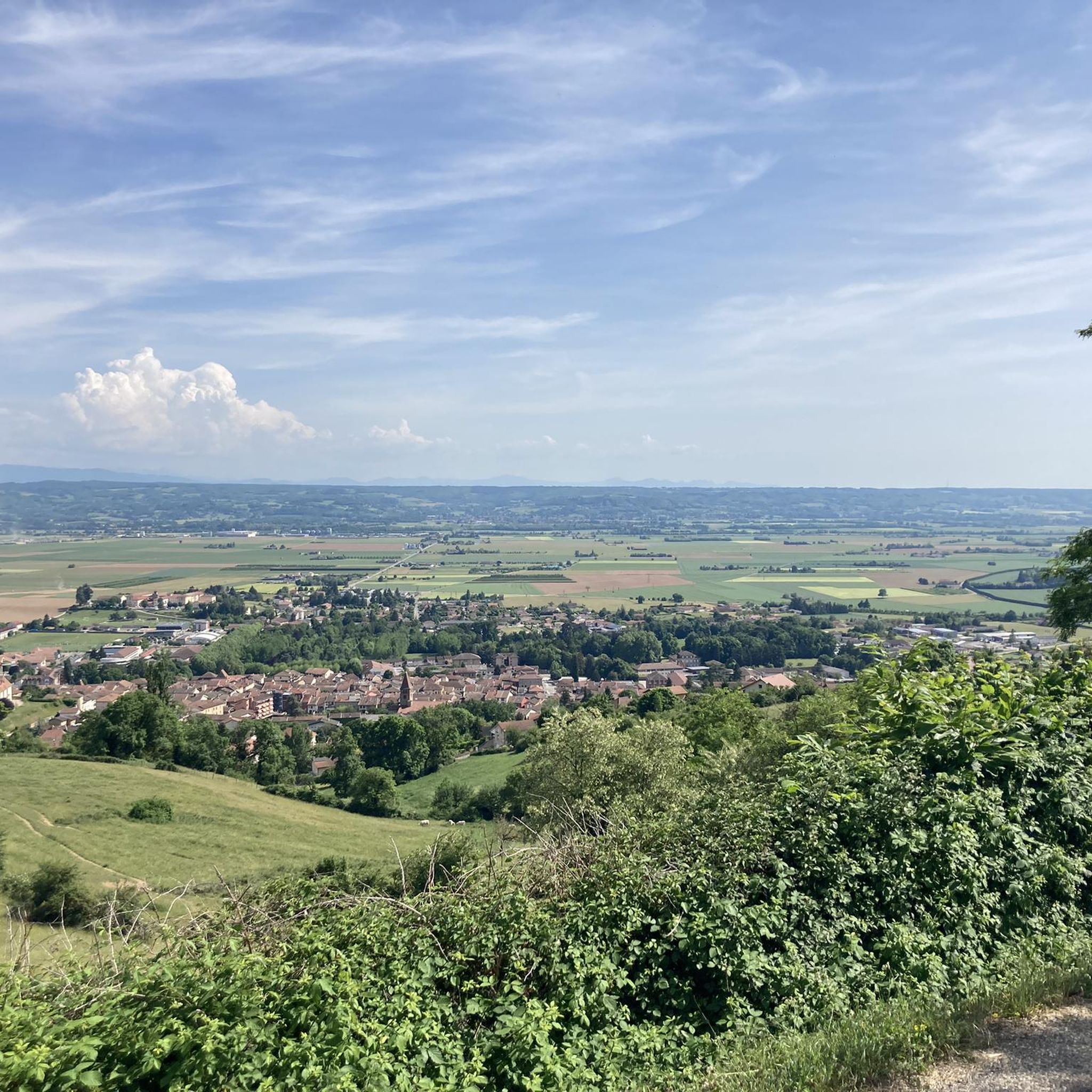
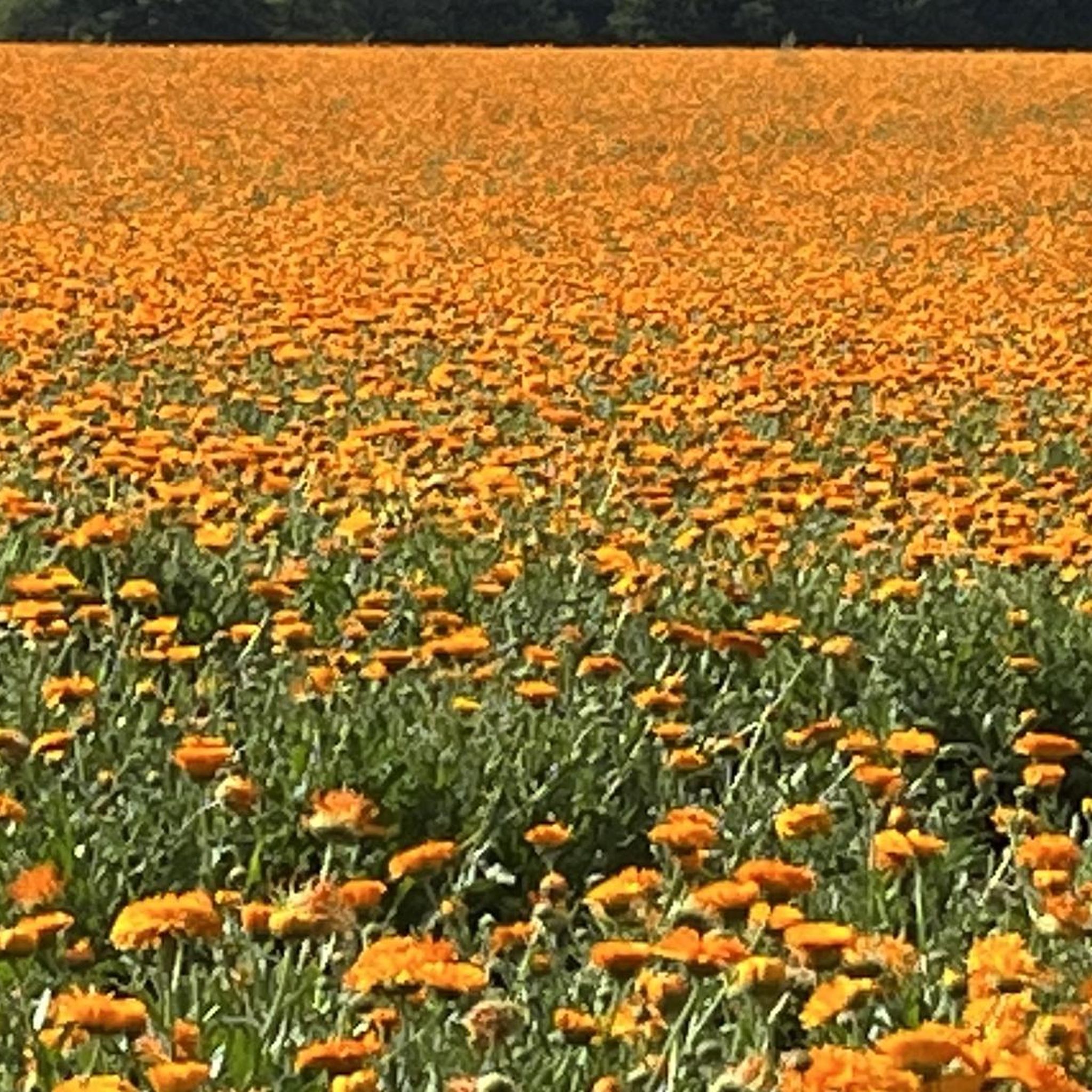

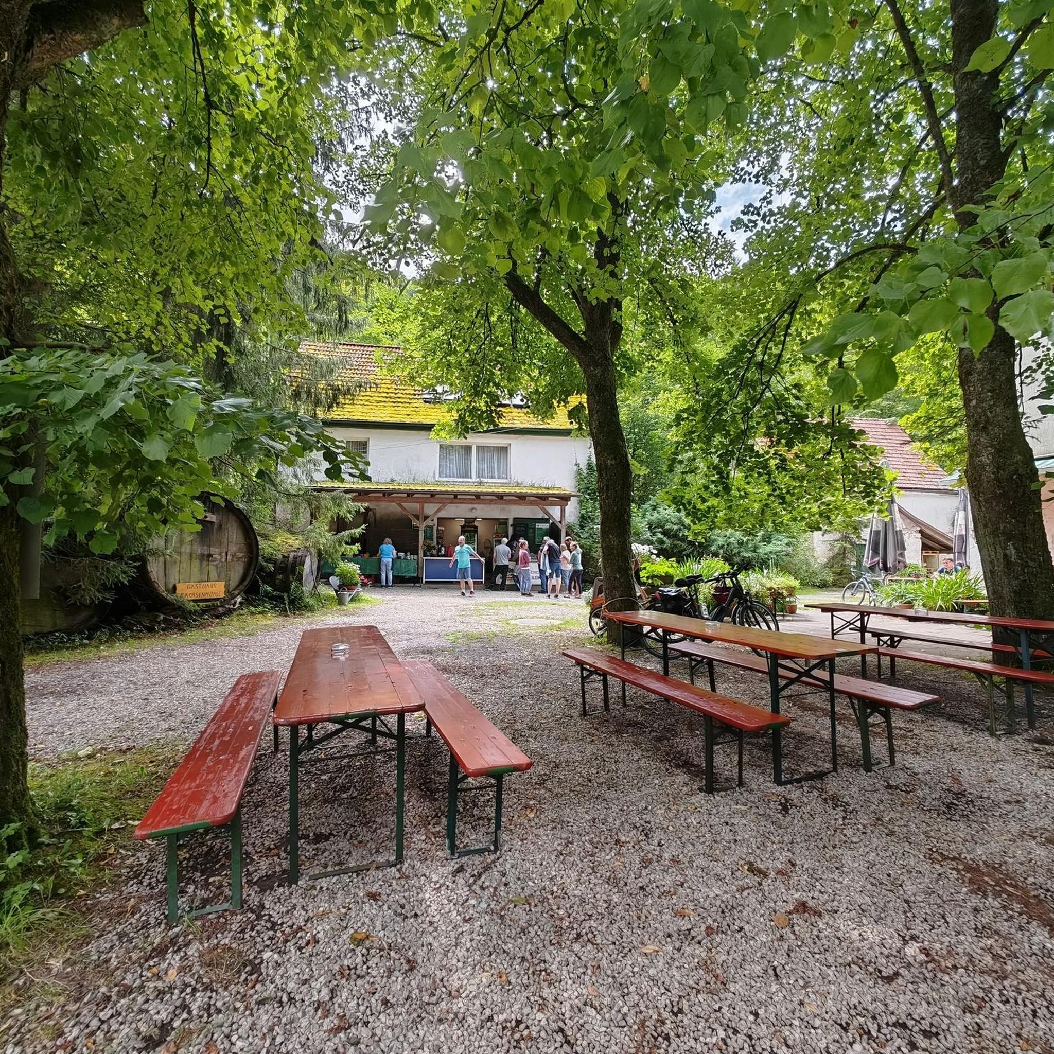
Tips from the Community

Medieval origins (11th - 12th centuries): The religious site is of very ancient origin. From the end of the 11th century, several religious buildings are mentioned in the commune. The Saint-Pierre church itself is cited under the name "ecclesia de Anos" in the famous cartulary of Saint Hugues (Bishop of Grenoble). In the Middle Ages, the church was directly dependent on the priory of Saint-Laurent of Grenoble, as attested by an official terrier dating from 1497 under the name "ecclesia Sancti Petri de Fortaressia".
0
0
Considered by local cyclists to be the most demanding pass in the Chambarans, it mainly connects the Isère valley to the commune of La Forteresse.
0
0
Considered by local cyclists to be the most demanding pass in the Chambarans, it mainly connects the Isère valley to the municipality of La Forteresse.
0
0

Here is the route for the ascent of the Col de Parménie starting from Tullins
1
0
Here is the route for the ascent of the Col de la Croix de Toutes Aures starting from Charubin, the variant passing via the Route de Saint-Marcellin
1
0
Here is the route for the ascent of the Col des Crozes from Les Eydoches
1
0

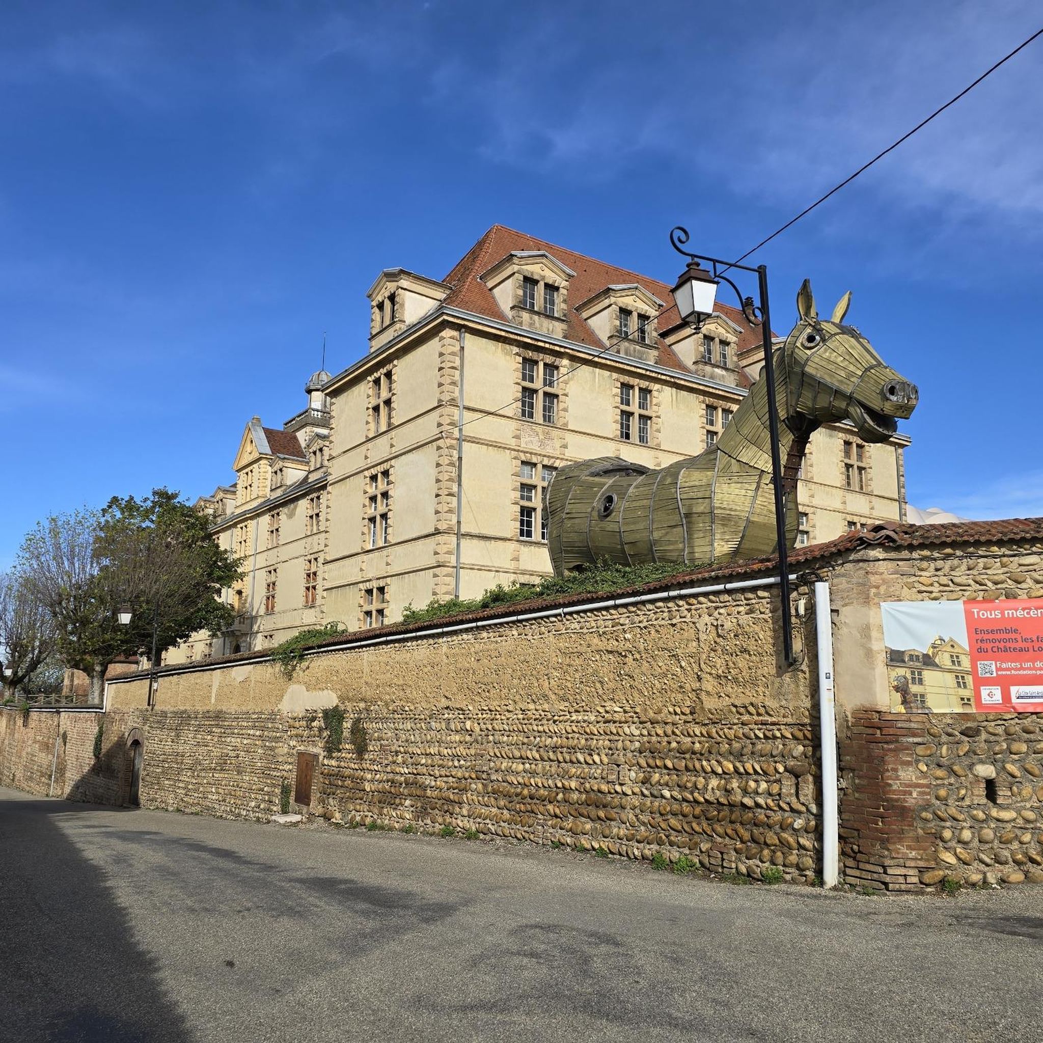
In 1869, the Marist Brothers purchased the castle and its grounds. They raised the body of the central building by one floor. The castle was then acquired by the city in 1906. In 1914, it became a military hospital and from 1940 to 1960, a modern college. The castle now houses a music school and meeting rooms. Many areas are vacant. The Ministry and the public agency for cultural cooperation (aida) conducted a feasibility study for the establishment of a European Cultural Exchange Center in the building. If you take a walk in the park in the afternoon, you can hear the musicians practicing.
6
0
Official referenced collar
0
0
Frequently Asked Questions
How many road cycling routes are available around La Côte-Saint-André?
There are over 160 road cycling routes around La Côte-Saint-André, offering a wide range of options for different skill levels and preferences.
What kind of terrain can I expect on road cycling routes in La Côte-Saint-André?
The region offers varied terrain, from significant elevation changes with climbs to passes like Col de Châtain and Lachard Pass, to more moderate routes through serene vineyards and around picturesque lakes. You'll find quiet roads traversing countryside landscapes, providing both challenging ascents and scenic, flatter sections.
Are there road cycling routes suitable for beginners or those seeking an easier ride?
Yes, La Côte-Saint-André offers 25 easy road cycling routes. These routes often explore the picturesque countryside and lake areas, providing a more relaxed experience without extensive climbs. For example, the Tour in the ponds of Nord Isère is a moderate option that is popular and manageable.
Where can I find challenging road cycling routes with significant climbs?
For advanced cyclists, La Côte-Saint-André features 41 difficult routes with significant elevation gains. These routes often include climbs to passes like Col de Châtain (684 m) and Lachard Pass (695 m), as well as the climb to La Côte-Saint-André itself. The Route de Beausoleil – Pondside passage loop from Gillonnay is a challenging 90.6 km path with over 1100 meters of elevation gain.
What are some scenic highlights or landmarks I can see along the road cycling routes?
Many routes offer scenic views of vineyards, lakes, and the surrounding countryside. You can also pass by historical landmarks such as Château Louis XI, which is part of the Longechenal Church – Château Louis XI loop from La Côte-Saint-André. Other notable sights in the area include Notre-Dame-du-Mont Chapel and The old market hall.
Are there any circular road cycling routes available?
Yes, many of the road cycling routes around La Côte-Saint-André are designed as loops, allowing you to start and end at the same point. Examples include the Longechenal Church – Château Louis XI loop from La Côte-Saint-André and the Grand-Lemps Pond – Longechenal Church loop from Gillonnay.
What do other road cyclists say about the routes in La Côte-Saint-André?
The road cycling routes in La Côte-Saint-André are highly rated by the komoot community, with an average score of 4.3 stars from over 70 reviews. Cyclists often praise the varied terrain, the serene countryside, and the rewarding panoramic views from higher elevations.
What is the best time of year for road cycling in La Côte-Saint-André?
The spring, summer, and early autumn months generally offer the most favorable weather conditions for road cycling in La Côte-Saint-André. During these seasons, you can enjoy pleasant temperatures and the full beauty of the vineyards and lakes. Always check local weather forecasts before heading out.
Are there family-friendly road cycling options in the area?
While many routes involve elevation changes, there are easier routes that can be suitable for families with older children or those comfortable with moderate distances. Look for routes described as 'easy' or 'moderate' that traverse flatter sections around lakes or through the countryside, such as those exploring the pond areas of Nord Isère.
Is parking available near the road cycling routes?
Parking is generally available in and around La Côte-Saint-André, as well as in smaller villages that serve as starting points for routes. Specific parking information can often be found on individual route pages or by checking local municipality websites.
Can I find cafes or places to stop for refreshments along the routes?
Many routes pass through or near villages where you can find cafes, bakeries, or small shops for refreshments. La Côte-Saint-André itself offers various amenities. Planning your route in advance and checking for points of interest can help you identify suitable stops.
What are the typical distances and durations for road cycling routes here?
Route distances vary significantly, from shorter rides of around 50 km (30 miles) taking about 2.5 hours, to longer, more challenging routes exceeding 90 km (55 miles) which can take over 4.5 hours to complete. For example, the Château Louis XI – Ancienne Tuilerie Bertrand loop from Gillonnay is a moderate 61.4 km route.
Most popular routes around La Côte-Saint-André
Most popular attractions around La Côte-Saint-André

Get inspired with the komoot mobile app


Explore more
Browse the best Road cycling routes in other regions.
