The best road cycling routes around La Bollène-Vésubie
4.8
(42)
2,065
riders
26
rides
Road cycling routes around La Bollène-Vésubie traverse a mountainous territory in the French Alps, characterized by deep valleys, extensive forests, and challenging climbs. The region features sustained gradients and numerous hairpin bends, particularly on ascents to high mountain passes. This terrain provides significant elevation gain, making it a destination for demanding road cycling.
Best road cycling routes around La Bollène-Vésubie
- The most popular road cycling route is Col de Turini from Lantosque - Mercantour National Park, a 30.2 miles…
Last updated: October 3, 2026
4.6
(9)
172
riders
48.6km
03:12
1,550m
1,540m
Hard road ride. Very good fitness required. Mostly well-paved surfaces and easy to ride.
5.0
(6)
156
riders
69.9km
04:50
2,440m
2,440m
Hard road ride. Very good fitness required. Mostly well-paved surfaces and easy to ride.

5.0
(1)
287
riders
95.1km
06:24
3,130m
3,130m
Hard road ride. Very good fitness required. Mostly well-paved surfaces and easy to ride.
5.0
(4)
108
riders
95.7km
05:14
2,000m
2,000m
Hard road ride. Very good fitness required. Mostly well-paved surfaces and easy to ride.
5.0
(2)
130
riders
48.0km
02:52
1,250m
1,270m
Hard road ride. Very good fitness required. Mostly well-paved surfaces and easy to ride.
Get access to more routes and recommendations from other explorers.
Already have an account?
Our route recommendations are based on thousands of hikes, rides, and runs completed by other people on komoot.
Start today with a free account
Your next adventure awaits.
Popular around La Bollène-Vésubie


Other adventures around La Bollène-Vésubie


Tips from the Community

Nice lively town center, with nice opportunities to get a quick bite and take a break.
0
0

An S2 branches off to the right, but not very flowy to ride, stones, steep up and down, but partly beautiful view
0
0

Small town accessible by train, a good starting point or stopover for a hike. Also has a campsite...
0
0

excellent route early in the morning in summer
0
0
Corniche road. Magnificent views of the Mediterranean, Nice... At the Col du Farguet, views of the Mercantour. To reach the Col de Braus, gravel road accessible to classic electric bikes (not mountain bikes)
0
0

Crossing point to reach the ruins of Rocasparviera
0
0

The Col Saint-Martin Pass, or Col de la Colmiane, is a mountain pass in the Southern Alps located at an altitude of 1,500 meters in the Alpes-Maritimes department of France. It provides a year-round road link between the Tinée Valley to the west and the Vésubie Valley to the east.
0
0
The Col Saint-Martin Pass, or Col de la Colmiane, is a mountain pass in the Southern Alps located at an altitude of 1,500 meters in the Alpes-Maritimes department of France. It provides a year-round road link between the Tinée Valley to the west and the Vésubie Valley to the east.
0
0
Frequently Asked Questions
What is the general difficulty level for road cycling routes around La Bollène-Vésubie?
Road cycling around La Bollène-Vésubie is primarily known for its challenging mountainous terrain. The region features numerous demanding ascents, including the legendary Col de Turini, which is an "Hors Catégorie" climb. Out of the 31 routes available, 22 are classified as difficult, 8 as moderate, and only 1 as easy, making it an ideal destination for experienced cyclists seeking significant elevation gains and sustained gradients.
Are there any particularly challenging road cycling routes for experienced cyclists?
Absolutely. The area is renowned for its demanding climbs. One of the most iconic is the ascent to Col de Turini from Lantosque - Mercantour National Park, which features significant elevation gain and challenging gradients. Another top choice is the Saint-Martin Pass – Col de la Colmiane loop from La Bollène-Vésubie, offering varied ascents and descents through mountainous terrain.
What kind of landscapes and natural features can I expect to see while cycling?
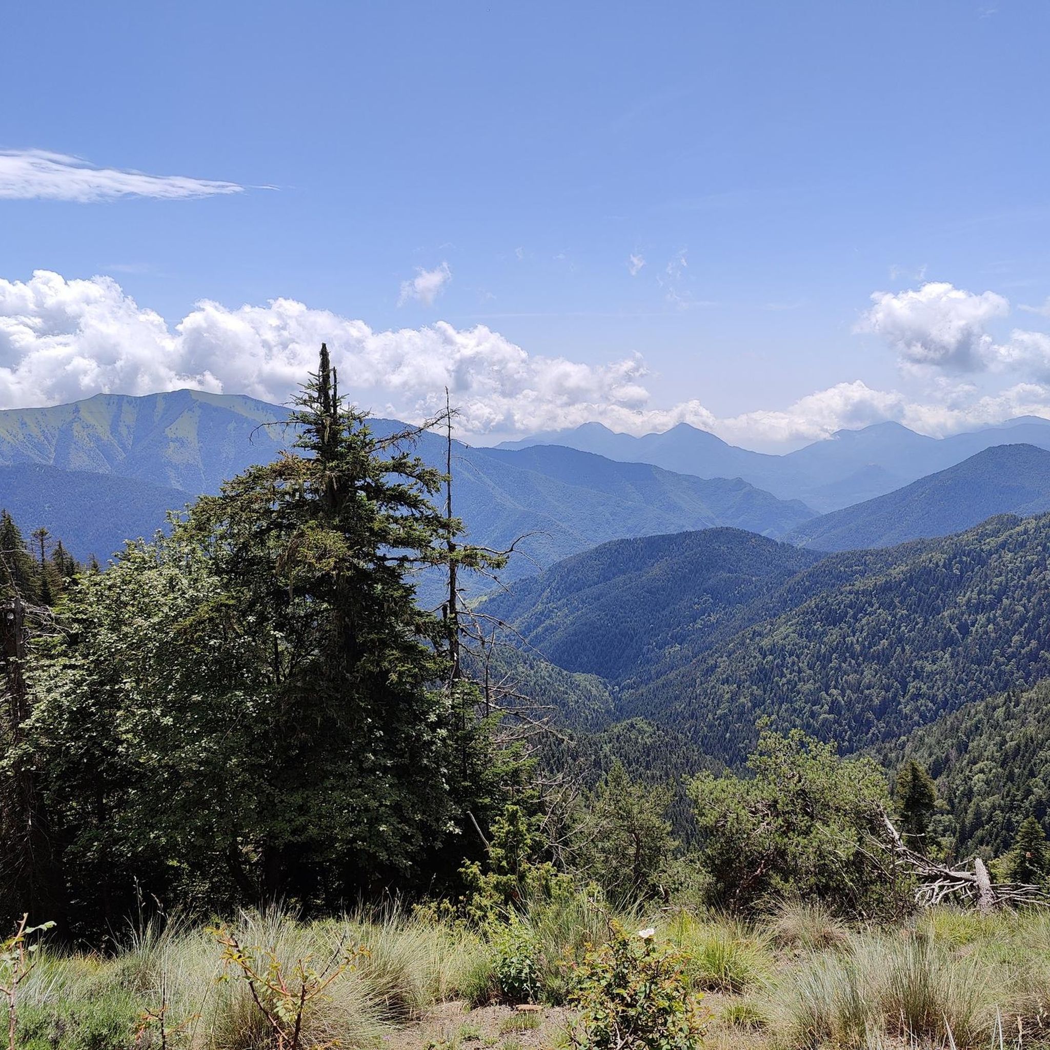
The routes around La Bollène-Vésubie traverse a stunning mountainous territory within the French Alps. You'll cycle through deep valleys, extensive forests of larch, pine, and spruce, and enjoy panoramic views of the picturesque Vésubie valley. Higher up, views open towards the Turini forest, the Vallée des Merveilles, and the Mercantour National Park, with glimpses of the Mediterranean Sea on clear days.
Are there any notable landmarks or points of interest along the road cycling routes?
Yes, several points of interest enhance the cycling experience. You'll encounter famous mountain passes like Col de Turini and Brouis Pass (879 m). The village of La Bollène-Vésubie itself is a historical gem with narrow, stepped streets. You might also pass by Notre-Dame de la Ménour and Its Hairpin Bends, offering unique architectural and scenic views.
What do other road cyclists enjoy most about cycling in La Bollène-Vésubie?
The area is highly rated by the komoot community, with an average score of 4.9 stars from over 30 reviews. Cyclists frequently praise the challenging mountain passes, the breathtaking panoramic views, and the immersive experience of riding through deep valleys and extensive forests. The variety of routes, from moderate to very difficult ascents, is also a highlight.
Are there any circular road cycling routes available?
Yes, there are several excellent circular routes. For instance, the Saint-Martin Pass – Col de la Colmiane loop from La Bollène-Vésubie is a popular difficult path. Another option is the Col à Utelle – Madonna of Utelle loop from Lantosque, which also offers a rewarding circular journey through the Vésubie valley.
What is the best time of year for road cycling in La Bollène-Vésubie?
The region's mountainous nature means that spring, summer, and early autumn generally offer the most favorable conditions for road cycling. During these seasons, the weather is typically milder, and the high mountain passes are clear of snow, allowing access to the full range of routes. Always check local weather forecasts before heading out, especially for higher elevations.
Are there any routes that offer views of the Vésubie gorges?
Yes, for those interested in dramatic gorge views, the The Vésubie gorges – La Roquette-sur-Var loop from Lantosque is an excellent choice. This route takes you through the stunning Vésubie gorges, showcasing the deep valleys and impressive natural formations of the region.
How many road cycling routes are there in total around La Bollène-Vésubie?
There are over 30 road cycling routes available around La Bollène-Vésubie on komoot, offering a wide range of options for different skill levels, though the majority are geared towards experienced cyclists due to the challenging terrain and significant elevation gains.
Can I find routes that are around 50 km in length?
Many routes in the area are approximately 50 km long, making them ideal for a substantial day ride. Examples include the Col de Turini from Lantosque - Mercantour National Park (48.6 km) and the Col à Utelle – Madonna of Utelle loop from Lantosque (49.4 km). These routes offer a good balance of distance and challenging climbs.
What are the options for parking when starting a road cycling route?
While specific parking locations for each trailhead are not detailed, La Bollène-Vésubie, as a village, typically offers public parking areas. For routes starting from nearby towns like Lantosque, similar parking facilities would be available. It's advisable to check local signage upon arrival for the most convenient and appropriate parking spots.
Most popular routes around La Bollène-Vésubie
Most popular attractions around La Bollène-Vésubie

Get inspired with the komoot mobile app


Explore more
Browse the best Road cycling routes in other regions.
