The best walks and hikes around Banca
4.5
(1171)
8,095
hikers
282
hikes
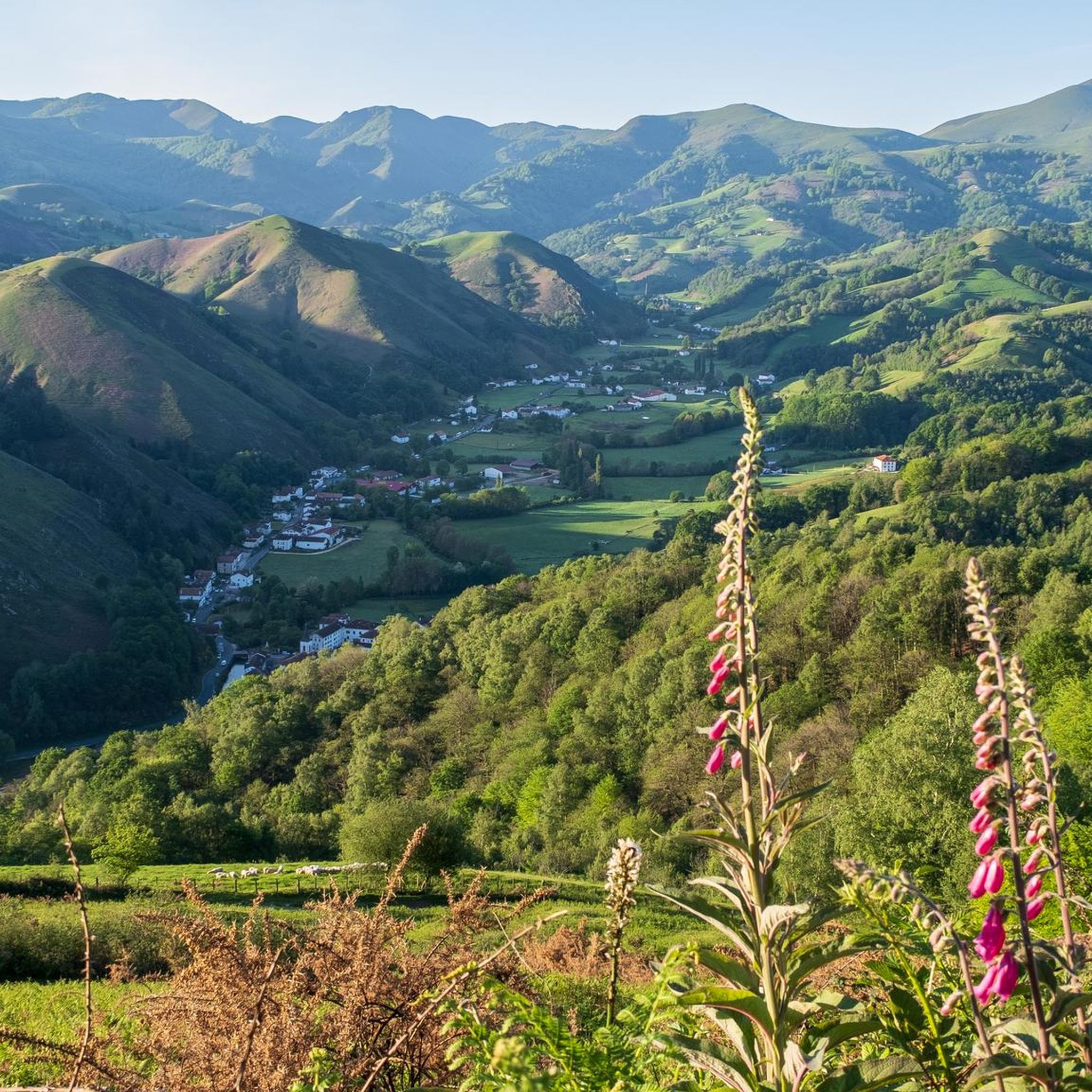
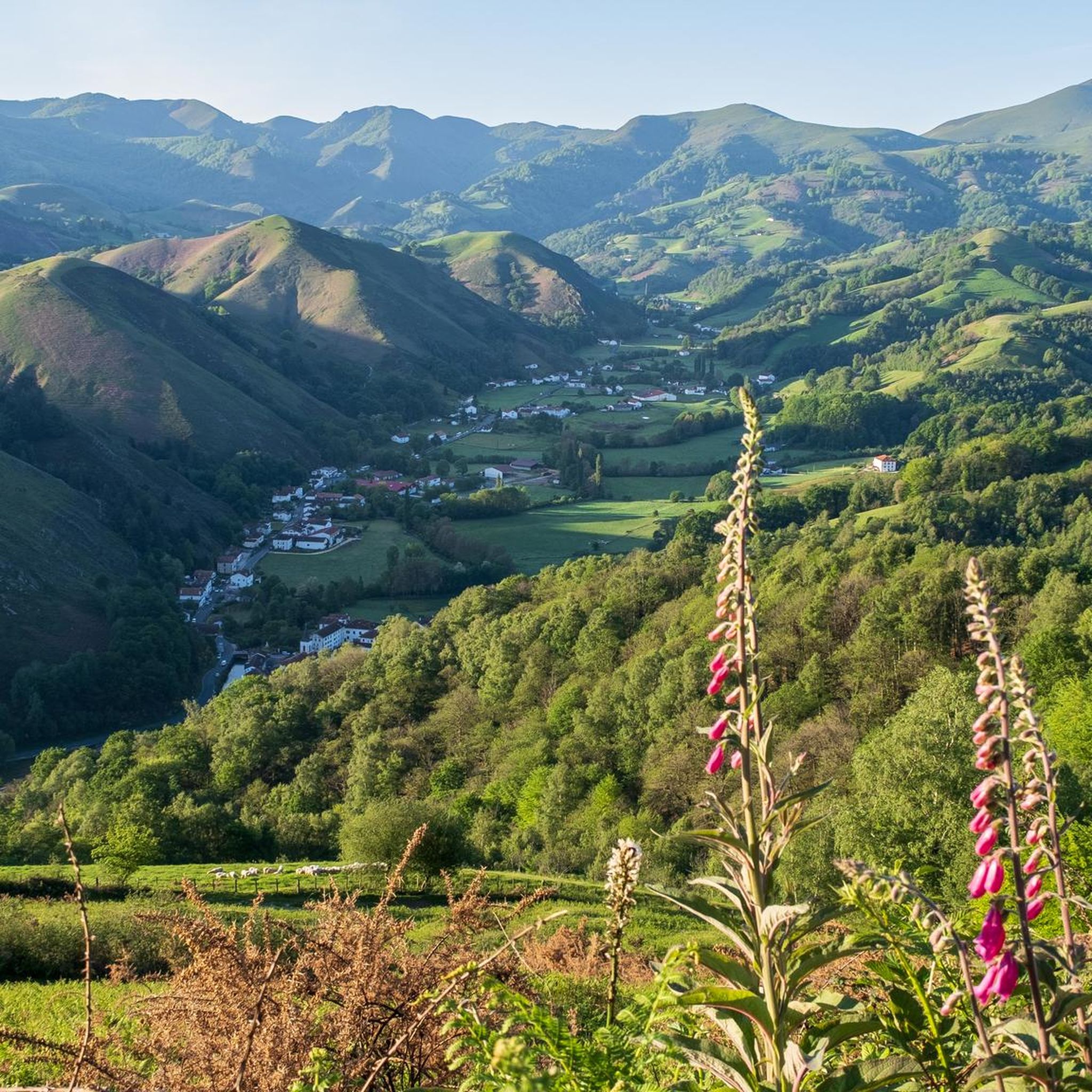
Hiking around Banca offers access to the green, rolling hills of the Pyrenees mountains in southwestern France. The region is characterized by a diverse landscape featuring Pyrenean foothills, expansive forests, and river valleys. This area provides varied terrain suitable for different hiking abilities, with trails winding through beech and chestnut trees.
Best hiking trails around Banca
- The most popular hiking route is Mendiaundi and Menditxuri Loop, a 6.4 miles (10.3 km) trail that takes 3 hours 23 minutes to…
Last updated: May 10, 2026
4.0
(9)
12
hikers
10.3km
03:23
380m
380m
Moderate hike. Good fitness required. Mostly accessible paths. Sure-footedness required.
4.3
(3)
22
hikers
5.33km
01:44
170m
170m
Moderate hike. Great for any fitness level. Mostly accessible paths. Sure-footedness required.

Sign up for free
2.5
(2)
7
hikers
8.95km
04:05
670m
670m
Moderate hike. Good fitness required. Mostly accessible paths. Sure-footedness required.
4.0
(1)
12
hikers
10.0km
03:31
570m
560m
Moderate hike. Good fitness required. Easily-accessible paths. Suitable for all skill levels.
5.0
(2)
6
hikers
15.7km
05:20
800m
800m
Hard hike. Very good fitness required. Easily-accessible paths. Suitable for all skill levels.
Get access to more routes and recommendations from other explorers.
Sign up for free
Already have an account?
Our route recommendations are based on thousands of hikes, rides, and runs completed by other people on komoot.
Start today with a free account
Your next adventure awaits.
Login or Signup
Popular around Banca


Other adventures around Banca


Tips from the Community

Munhoa is a peak in the French Basque Country which rises to 1,023 meters above sea level. Its toponymy finds its origin in the Basque word “muino” which means hill. From this mountain you can admire the valleys of Luzaide and Baïgorry separated by the Adartza massif.
1
0
The Munhoa is a peak in the French Basque Country which culminates at 1,023 meters above sea level. Its toponymy finds its origin in the Basque word muino which means hill. From this mountain you can admire the valleys of Luzaide and Baïgorry separated by the Adartza massif.
2
1

Nice walk through the green mountain back. Fairly flat, great view on Munhoa ahead.
1
1

The Aharza or Ahartza pass is on the GR 10 trail. This pretty belvedere is the access point to several peaks such as the Oilarandoi. It also has a nearby car park.
3
1
The Oilarandoi is a peak in the Basque Country which culminates at 933 meters above sea level. It is reached at the cost of a steep ascent from the Aharza pass.
4
1

The Mendiaundi is a small peak at 1,213 meters high. On clear days, it offers beautiful panoramic views of the Navarrese Pyrenees.
2
0
The Hautza or Autza culminates at 1,306 meters above sea level. It offers a beautiful panorama of the Basque Country and the other surrounding mountains. Hundreds of megalithic blocks give it a mystical side.
2
0
Hautza or Autza peaks at 1,306 meters above sea level. It offers a beautiful panorama of the Basque Country and the other surrounding mountains. Hundreds of megalithic blocks give it a mystical side.
3
0
Frequently Asked Questions
How many hiking trails are available around Banca?
Banca offers a wide variety of hiking experiences, with over 280 routes available. These trails cater to different skill levels, including easy strolls, moderate ascents, and more challenging hikes through the Pyrenean foothills.
Are there easy hiking options suitable for beginners or families in Banca?
Yes, Banca has 56 easy hiking routes, perfect for beginners or families. These trails often wind through picturesque Atlantic forests and along the Nive River, providing a gentle introduction to the region's natural beauty.
Can I find circular hiking routes in Banca?
Many of the trails around Banca are designed as loops to showcase the local biodiversity and magnificent viewpoints. For example, the Mendiaundi and Menditxuri Loop is a popular moderate circular route offering views of the surrounding Pyrenean landscape.
Are there any waterfalls accessible by hiking near Banca?
Yes, the beautiful Xorroxin Waterfall is located in the nearby Baztan Valley and is accessible from the French Basque Country. The hike to the waterfall is often described as family-friendly, winding through scenic Atlantic forests.
What are some notable viewpoints or panoramic spots to hike to in Banca?
For panoramic views, consider hiking to the Lindux Redoubt, which offers 360-degree vistas of the surrounding landscapes. The Munhoa Summit at 1,023 meters also provides a rewarding hiking destination with expansive views.
Are dogs allowed on the hiking trails in Banca?
While specific regulations can vary, many trails in the Pyrenees are generally dog-friendly, especially if kept on a leash. The region's diverse landscapes, including forests and riverbanks, offer pleasant environments for walks with your dog. Always check local signage for any restrictions.
What kind of natural features can I expect to see while hiking in Banca?
Hiking in Banca will immerse you in the green, rolling hills of the Pyrenees. You'll encounter dense beech forests like the expansive Hayra Forest, serene stretches along the Nive River, and various mountain passes and peaks. The area is rich in biodiversity and offers varied terrain.
Are there any historical or cultural landmarks accessible via hiking trails?
While the region is primarily known for its natural beauty, some trails lead to significant points like the Ibañeta Pass and the Roland Monument, which has historical significance. The Lindux Redoubt also has historical context as a defensive structure.
What do other hikers say about the trails in Banca?
The hiking routes in Banca are highly regarded by the komoot community, holding an average score of 4.5 stars from over 1,200 reviews. Hikers frequently praise the diverse terrain, the beauty of the Pyrenean foothills, and the well-maintained paths through forests and valleys.
Are there any challenging hikes for experienced trekkers in Banca?
Yes, Banca offers 68 difficult routes for experienced hikers. Trails like the Hauza Peak (1,304 m) – Hautza Summit loop from Ixtauzko Lepoa involve significant elevation gain and offer a more demanding experience with rewarding views.
What is the best time of year to go hiking in Banca?
The region's verdant hills and forests are beautiful throughout much of the year. Spring and autumn offer pleasant temperatures and vibrant colors, while summer provides longer daylight hours. Even in winter, some lower-altitude trails can be accessible, though conditions vary.
Where can I access higher mountain areas from Banca?
The Aharza Pass (Col d'Ahartza) serves as a key access point to higher elevations and more challenging hikes. From here, you can embark on routes like the Aharza Pass – Adartza (1,250 m) loop, leading into the Pyrenean foothills.
Most popular attractions around Banca

Get inspired with the komoot mobile app


Explore more
Browse the best Hikes in other regions.
