The best walks and hikes around Bonnevent-Velloreille
4.6
(44)
303
hikers
57
hikes
Hiking around Bonnevent-Velloreille offers a network of trails through varied landscapes. The region is characterized by a mix of open grasslands, agricultural fields, and pockets of woodland. Elevation changes are generally gentle, with some moderate climbs, making it accessible for various hiking abilities. The terrain often includes well-maintained paths and tracks, suitable for exploring the local natural environment.
Best hiking trails around Bonnevent-Velloreille
- The most popular hiking route is Grasslands loop, a 7.5 miles (12.1 km) trail that takes…
Last updated: July 6, 2026
4.8
(5)
25
hikers
12.1km
03:33
330m
330m
Moderate hike. Good fitness required. Easily-accessible paths. Suitable for all skill levels.
5.0
(3)
13
hikers
5.76km
01:33
70m
70m
Easy hike. Great for any fitness level. Easily-accessible paths. Suitable for all skill levels.

Sign up for free
4.0
(3)
14
hikers
8.38km
02:12
70m
70m
Moderate hike. Good fitness required. Easily-accessible paths. Suitable for all skill levels.
4.0
(2)
6
hikers
13.0km
03:33
200m
200m
Moderate hike. Good fitness required. Easily-accessible paths. Suitable for all skill levels.
5.0
(1)
7
hikers
5.46km
01:26
50m
50m
Easy hike. Great for any fitness level. Easily-accessible paths. Suitable for all skill levels.
Get access to more routes and recommendations from other explorers.
Sign up for free
Already have an account?
Our route recommendations are based on thousands of hikes, rides, and runs completed by other people on komoot.
Start today with a free account
Your next adventure awaits.
Login or Signup



Tips from the Community


The Vincent Cheviet vineyard stretches across the sunny slopes of the Monts de Gy. Replanted in 1999, it continues the local winemaking tradition with grape varieties such as Chardonnay and Pinot Noir.
0
0

This dirt path crosses limestone lawns. During the flowering season, the landscape takes on a yellow hue.
0
0
The Pelouses Trail, near Bucey-lès-Gy, crosses a landscape of limestone grasslands typical of the region. This open environment is home to rare and protected flora, including several wild orchids.
1
0

Water hole in a deep oak forest.
0
0

The Aurêtre pond is located north of Besançon in the commune of Geneuille. It presents a pretty bucolic setting when nature is in bloom.
0
0

An old oak tree beautifully located at the roundabout in a small village of Cordonnet. There are no supermarkets or cafes here, just a picturesque little hamlet with authentic houses.
1
0

Magnificent corner where nature takes over these rights little by little.
0
0
Frequently Asked Questions
How many hiking trails are available around Bonnevent-Velloreille?
There are over 60 hiking trails recorded in the Bonnevent-Velloreille region on komoot, offering a wide range of options for different preferences and fitness levels.
Are there any easy hiking routes suitable for beginners or a relaxed outing?
Yes, the region offers 19 easy routes. For a relaxed outing, consider the Coin relaxant loop from Boulot, an easy 3.6-mile (5.7 km) path that provides a pleasant experience through local scenery.
What kind of terrain can I expect on hikes in Bonnevent-Velloreille?
The terrain around Bonnevent-Velloreille is characterized by a mix of open grasslands, agricultural fields, and pockets of woodland. Elevation changes are generally gentle, with some moderate climbs, and paths are often well-maintained.
Are there any circular walks in the area?
Many routes in Bonnevent-Velloreille are circular. For example, the Aurêtre Pond loop from Cussey-sur-l'Ognon is a 5.2-mile (8.4 km) circular trail that takes you through woodland and past a pond.
What do other hikers say about the trails in Bonnevent-Velloreille?
The trails in Bonnevent-Velloreille are highly rated by the komoot community, with an average score of 4.6 stars from over 30 reviews. Hikers often praise the varied terrain, from open grasslands to peaceful woodlands, and the well-maintained paths.
Are there any family-friendly hiking options?
Given the prevalence of easy and moderate routes with gentle elevation changes, many trails are suitable for families. The Château de Boult loop from Boult is an easy 3.4-mile (5.5 km) route that could be a good option for a family outing.
What are some interesting places to see or landmarks along the trails?
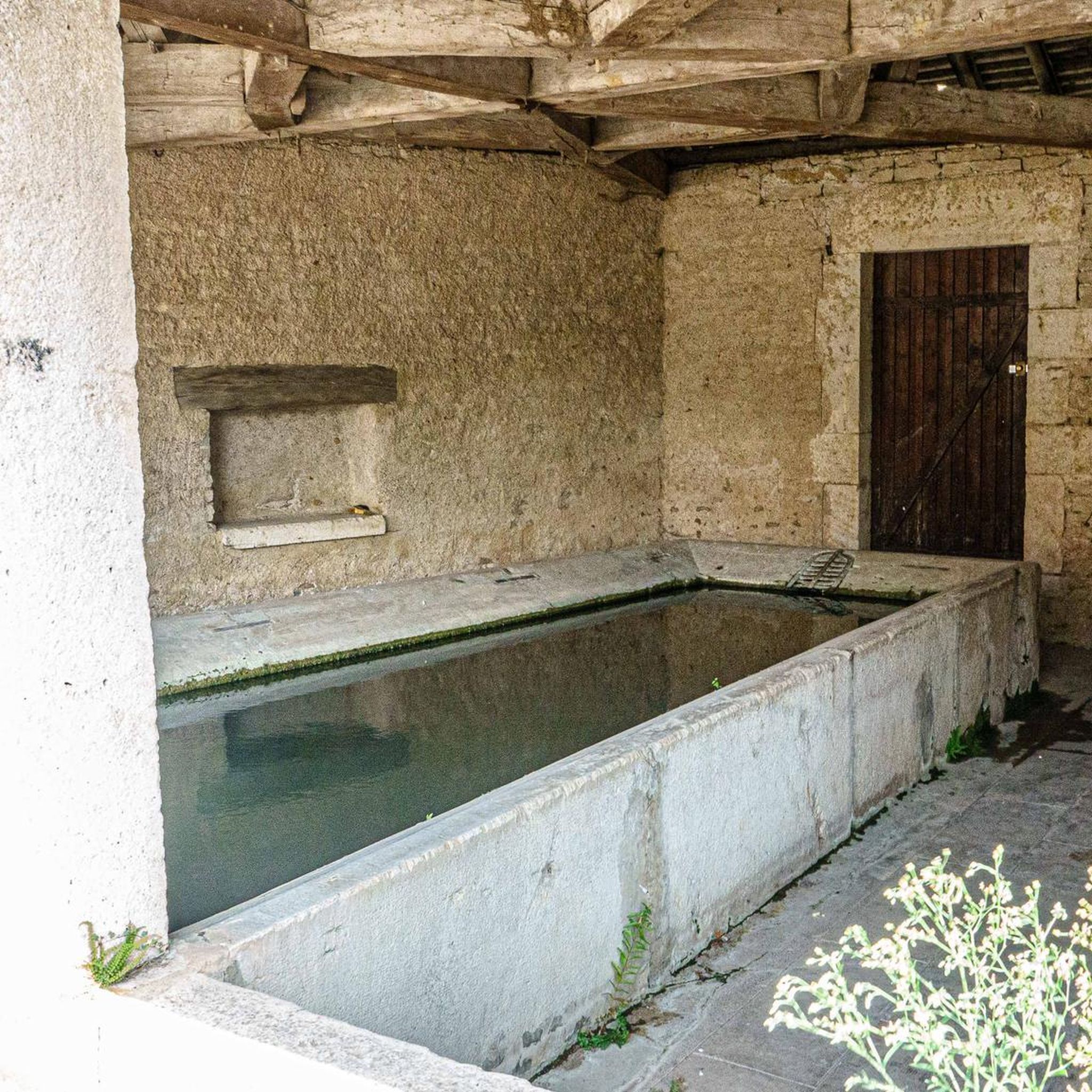
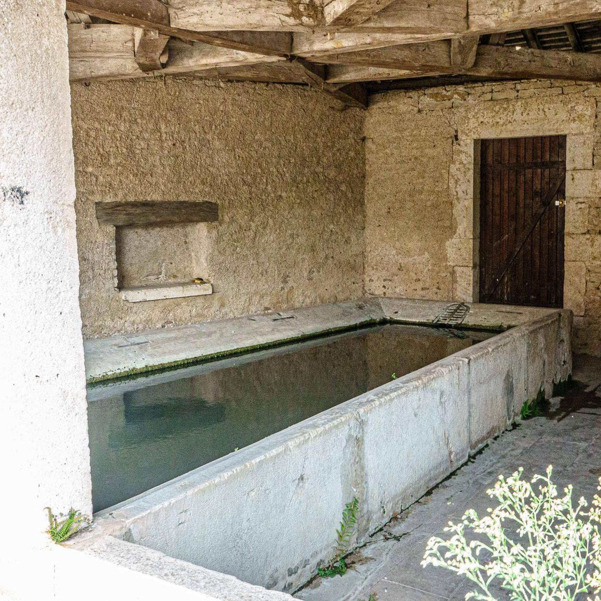
While hiking, you might encounter various local points of interest. Notable attractions include the large washhouse-trough and the Fortified manor of Sorans-lès-Breurey. The village of Etuz also features a charming Fountain and Washhouses.
Are the hiking trails in Bonnevent-Velloreille dog-friendly?
Most trails in this rural region are generally dog-friendly, especially those traversing open grasslands and woodlands. However, it's always advisable to keep dogs on a leash, particularly when passing through agricultural areas or near livestock, and to check local signage for any specific restrictions.
What is the typical duration for a moderate hike in this area?
Moderate hikes in Bonnevent-Velloreille can vary in length and duration. For instance, the Grasslands loop, which is 7.5 miles (12.1 km), typically takes around 3 hours and 30 minutes to complete.
Are there any longer, more challenging routes for experienced hikers?
While the region primarily features easy and moderate trails, there are 2 difficult routes available. For a longer, moderate challenge, consider the Old Oak of Cordonnet loop from Chaux-la-Lotière, which spans 9 miles (14.4 km) and involves more elevation gain.
Is public transport available to access hiking trailheads?
Access to specific trailheads in rural areas like Bonnevent-Velloreille by public transport can be limited. It's recommended to check local bus schedules for connections to nearby villages, but a car is often the most convenient way to reach many starting points.
Where can I find parking for hiking trails?
Parking is generally available in the villages where many routes begin, such as Boulot, Cussey-sur-l'Ognon, Chaux-la-Lotière, and Boult. Look for designated parking areas or roadside parking that respects local regulations.
Most popular routes around Bonnevent-Velloreille
Most popular attractions around Bonnevent-Velloreille

Get inspired with the komoot mobile app


Explore more
Browse the best Hikes in other regions.
