Saint-Pierre-D'Argençon
Saint-Pierre-D'Argençon
The best MTB trails around Saint-Pierre-D'Argençon
4.5
(127)
1,261
riders
57
rides
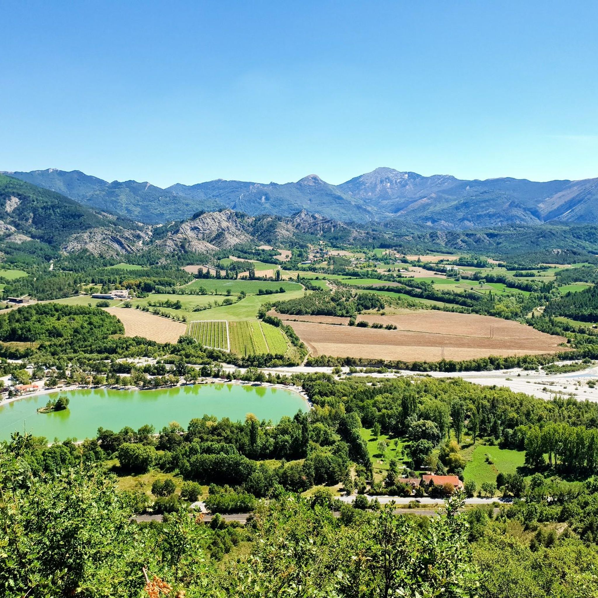
Mountain biking around Saint-Pierre-D'Argençon, nestled in the Hautes-Alpes department, offers diverse terrain within the Chauranne valley. The region features elevations ranging from 737 to 1,560 meters, providing varied landscapes from mountainous settings to more Provençal scenery. Riders can expect rugged mountains, pristine valleys, and lush forests, with the majestic Dévoluy massif forming a prominent backdrop. This area is known for its extensive network of mountain bike trails.
Best mountain bike trails around Saint-Pierre-D'Argençon
- The most popular mountain bike trail is…
Last updated: July 8, 2026
4.6
(12)
71
riders
Moderate mountain bike ride. Good fitness required. Advanced riding skills necessary.
2
riders
23.5km
02:47
840m
840m
Hard mountain bike ride. Good fitness required. Advanced riding skills necessary. Some portions of the route may require you to push your bike.

Sign up for free
4.0
(2)
10
riders
23.9km
02:02
400m
400m
Moderate mountain bike ride. Good fitness required. Suitable for all skill levels.
5.0
(1)
5
riders
23.9km
02:44
830m
830m
Hard mountain bike ride. Good fitness required. Advanced riding skills necessary. Some portions of the route may require you to push your bike.
6
riders
21.7km
02:06
510m
510m
Moderate mountain bike ride. Good fitness required. Advanced riding skills necessary.
Get access to more routes and recommendations from other explorers.
Sign up for free
Already have an account?
Our route recommendations are based on thousands of hikes, rides, and runs completed by other people on komoot.
Start today with a free account
Your next adventure awaits.
Login or Signup



Tips from the Community

"Saint-Marcellin" is a common name for several small villages in France, but in the regions of Alpes-de-Haute-Provence and Hautes-Alpes (near you) it mainly indicates a typical mountain hamlet, present in municipalities such as Vars or Châteauroux-les-Alpes.
9
0

This beautiful, unguarded wooden cabin is made up of 2 fixed tables downstairs and a bed upstairs. It is located at the edge of the path and is an ideal shelter to spend the night.
0
0
The Col d'Aron culminates at an altitude of 1,450 meters. It is easily accessible by the forest track. A cabin provides shelter. Picnic tables are also nearby.
0
0

mythical village to see absolutely
1
0

Hamlet of Saint Marcellin, full of charm, with its old church and its tiny streets.
1
0

Lots of hikers, few mountain bikers but worth it. Some portions where you have to push the bike, the rest rolling well.
0
0
Incredible track by its coating not without too much gravel and the incredible view. View of Mount Duffre
0
0

From here we have a superb view of the ridge, the valleys and the mountains!
0
0
Frequently Asked Questions
How many mountain bike trails are available around Saint-Pierre-D'Argençon?
There are over 50 mountain bike trails in the Saint-Pierre-D'Argençon area, catering to various skill levels. You'll find a good mix of easy, moderate, and difficult routes to explore.
What kind of terrain can I expect on mountain bike trails in Saint-Pierre-D'Argençon?
The terrain around Saint-Pierre-D'Argençon is highly varied, ranging from mountainous landscapes at the foot of the majestic Dévoluy massif to more Provençal scenery in the Chauranne valley. You can expect rugged mountains, pristine valleys, and lush forests, with elevations from 737 to 1,560 meters.
Are there any easy or family-friendly mountain bike trails in the area?
Yes, Saint-Pierre-D'Argençon offers 5 easy mountain bike trails suitable for families or those looking for a more relaxed ride. These routes provide a gentle introduction to the region's beautiful scenery.
Are there any loop mountain bike trails around Saint-Pierre-D'Argençon?
Many of the mountain bike trails in the region are loops. For example, the moderate View of Rives du Lac loop from Aspres-sur-Buëch is a popular choice, offering scenic views over 19.6 km. Another option is the challenging Pré Pourri Cabin – View of the Ridges loop from Le Vissac, which features panoramic ridge views.
What are some notable natural features or landmarks I can see while mountain biking?
The region is rich in natural beauty. You might encounter the deep The Shores of the Lake, or ride near the distinctive Isles Pond. The area is also known for its gorges, such as the Gorges du Rif d'Agnielles and Gorges du Saint-Pierre, which offer dramatic scenery.
What do other mountain bikers say about the trails in Saint-Pierre-D'Argençon?
The mountain bike routes in Saint-Pierre-D'Argençon are highly rated by the komoot community, with an average score of 4.5 stars from over 120 reviews. Riders often praise the diverse terrain, the stunning views of the Dévoluy massif, and the well-maintained network of trails that cater to all abilities.
Are there any challenging mountain bike routes for experienced riders?
Yes, for experienced riders seeking a challenge, there are 24 difficult mountain bike trails. A good example is the Pré Pourri Cabin – View of the Ridges loop from Le Vissac, a 23.5 km path with significant elevation gain and panoramic ridge views.
Can I find mountain bike trails that offer viewpoints?
Absolutely. The varied elevation and mountainous backdrop mean many trails offer superb viewpoints. The View of Rives du Lac loop from Aspres-sur-Buëch is specifically highlighted for its views of surrounding natural features, and the Pré Pourri Cabin – View of the Ridges loop from Le Vissac provides panoramic ridge views.
Are there any trails that pass through interesting villages or towns?
While the focus is on natural landscapes, some routes may pass near or through small communities. For instance, the Grotte de la Résurrection – Grotte de l'Ours loop from Aspres-sur-Buëch starts near Aspres-sur-Buëch, and the town of Serres is also a notable point of interest in the wider area.
What is the best time of year for mountain biking in Saint-Pierre-D'Argençon?
The region is generally excellent for outdoor activities from spring through autumn. Summer offers warm weather, while spring and autumn provide cooler temperatures and vibrant scenery. Always check local weather conditions before heading out, especially for higher elevation trails.
Are there any mountain passes accessible by bike in the area?
Yes, the mountainous terrain includes several passes. You can find routes like the Col de Montbrand loop from La Faurie or the Col de Seille loop from La Faurie. The Col de Carabès and Bachassette Pass are also notable points in the region.
Most popular routes around Saint-Pierre-D'Argençon
Most popular attractions around Saint-Pierre-D'Argençon

Get inspired with the komoot mobile app


Explore more
Browse the best MTB trails in other regions.
