Saint-Pierre-D'Argençon
Saint-Pierre-D'Argençon
The best walks and hikes around Saint-Pierre-D'Argençon
4.4
(241)
1,241
hikers
53
hikes
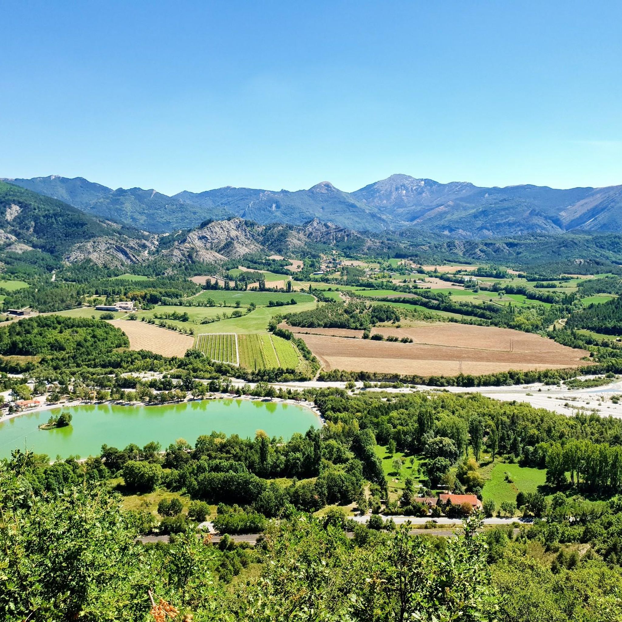
Hiking trails around Saint-Pierre-D'Argençon traverse a diverse landscape, situated within the Chauranne Valley at the foot of the Dévoluy Massif. The region features significant altitude variations, ranging from 737 meters to 1560 meters, offering varied topography. Forests cover a substantial portion of the area, complemented by open plains and dramatic gorges like the Gorges du Rif d'Agnielles. This environment provides a range of hiking experiences from valley strolls to more strenuous ascents.
Best hiking trails around Saint-Pierre-D'Argençon
- The most popular…
Last updated: June 25, 2026
4.6
(25)
96
hikers
6.68km
02:15
330m
330m
Moderate hike. Good fitness required. Easily-accessible paths. Suitable for all skill levels.
4.7
(6)
38
hikers
3.42km
01:01
100m
100m
Easy hike. Great for any fitness level. Easily-accessible paths. Suitable for all skill levels.

Sign up for free
4.0
(8)
24
hikers
6.66km
01:56
180m
180m
Easy hike. Great for any fitness level. Easily-accessible paths. Suitable for all skill levels.
4.7
(6)
18
hikers
Hard hike. Good fitness required. Sure-footedness, sturdy shoes and alpine experience required.
17
hikers
12.2km
03:53
520m
520m
Moderate hike. Good fitness required. Easily-accessible paths. Suitable for all skill levels.
Get access to more routes and recommendations from other explorers.
Sign up for free
Already have an account?
Our route recommendations are based on thousands of hikes, rides, and runs completed by other people on komoot.
Start today with a free account
Your next adventure awaits.
Login or Signup




Frequently Asked Questions
How many hiking trails are available in Saint-Pierre-D'Argençon, and what are their difficulty levels?
Saint-Pierre-D'Argençon offers a wide range of hiking experiences with over 50 trails. These include approximately 15 easy routes, 30 moderate routes, and 9 difficult routes, catering to various fitness levels and preferences.
What kind of landscapes and natural features can I expect to see while hiking in this region?
The region boasts diverse landscapes, from the open plains and forests of the Chauranne Valley to the dramatic alpine scenery at the foot of the imposing Dévoluy Massif. You'll encounter significant altitude variations, dense forests, and striking gorges like the Gorges du Rif d'Agnielles and Gorges du Gros Morel, offering varied vistas and ecological zones.
Are there any easy or family-friendly hikes suitable for beginners or those with children?
Yes, there are several easy routes perfect for families or beginners. The Via Ferrata – Gorges du Rif d'Agnielles loop from Grotte de l'Ours is a shorter, easy trail through a dramatic gorge, often completed in about an hour. Another accessible option is the Col de l'Angelus – Gorges du Rif d'Agnielles loop from Grotte de l'Ours, which is also rated easy.
What are some notable natural landmarks or points of interest to look out for on the trails?
Hikers can explore the dramatic Gorges du Rif d'Agnielles, a prominent natural feature. The historic 'La Font Vineuse' natural spring, known since Roman times, is also a unique point of interest. For panoramic views, routes like the 'Sommet de Banne' loop from Col de Cabre offer vistas encompassing Montagne de Lure, Ventoux, Vercors, and Dévoluy summits.
Are there any circular hiking routes available in Saint-Pierre-D'Argençon?
Yes, many routes in the area are circular, allowing you to start and end at the same point. Examples include the popular Torrent de Durbonas loop from La Faurie and the more challenging Roc de Beauvent loop from La Bâtie-des-Fonds.
What do other hikers say about the trails in Saint-Pierre-D'Argençon?
The trails in Saint-Pierre-D'Argençon are highly regarded by the komoot community, holding an average rating of 4.4 stars from over 200 reviews. Hikers often praise the varied terrain, from valley strolls to challenging ascents, and the stunning natural beauty of the Chauranne Valley and Dévoluy Massif.
Is Saint-Pierre-D'Argençon a good base for longer, multi-day hiking adventures?
Yes, Saint-Pierre-D'Argençon is crossed by the GR 94, a long-distance hiking trail originating from Vercors. This 65 km route integrates with the local circuit of the Pays du Grand Buëch, providing extensive trekking opportunities for experienced hikers looking for multi-day journeys.
Are there any specific attractions or places to visit near the hiking trails?
Beyond the trails, you can explore nearby attractions such as The Shores of the Lake, the scenic Col de Carabès, or the charming town of Serres. The Iscles Pond also offers a tranquil spot.
What is the best time of year to go hiking in Saint-Pierre-D'Argençon?
The region offers enjoyable hiking experiences across multiple seasons. Spring and autumn provide pleasant temperatures and vibrant scenery, while summer is ideal for exploring higher altitudes and enjoying the shade of the extensive forests. Winter can offer opportunities for snowshoeing, especially in higher elevations, but requires appropriate gear and conditions awareness.
Are there any hikes that offer significant elevation changes and panoramic views?
Absolutely. The area's altitude ranges from 737 meters to 1560 meters, providing ample opportunities for strenuous ascents with rewarding views. The Roc de Beauvent loop from La Bâtie-des-Fonds, for instance, offers sustained climbs and panoramic vistas over the surrounding landscape.
Is the area suitable for hikers looking for challenging routes?
Yes, Saint-Pierre-D'Argençon caters to experienced hikers with challenging routes. Approximately 9 difficult trails are available, often featuring significant elevation gains and rugged terrain, particularly towards the Dévoluy Massif. An example is the Gorges du Rif d'Agnielles – Col de l'Angelus loop from Vallée d'Agnielles - La Montagne, which is rated difficult.
Most popular routes around Saint-Pierre-D'Argençon
Most popular attractions around Saint-Pierre-D'Argençon

Get inspired with the komoot mobile app


Explore more
Browse the best Hikes in other regions.
