The best walks and hikes around Bénifontaine
4.5
(1002)
6,111
hikers
312
hikes
Hiking around Bénifontaine offers access to the diverse landscapes of the Pas-de-Calais department in the Hauts-de-France region. The area features rolling countryside, forests, and meadows, providing varied terrain for outdoor activities. While elevation changes are generally gentle, the region's natural parks offer opportunities to explore varied ecosystems.
Best hiking trails around Bénifontaine
- The most popular hiking route is The terrils 74 and 74A and the memorial of the côte 70 — loop from Loos-en-Gohelle, a 4.1 miles (6.5 km)…
Last updated: June 26, 2026
4.5
(4)
12
hikers
Easy hike. Great for any fitness level. Easily-accessible paths. Suitable for all skill levels.
4.6
(5)
29
hikers
10.6km
02:51
100m
100m
Hard hike. Good fitness required. Sure-footedness, sturdy shoes and alpine experience required.

Sign up for free
4.7
(12)
32
hikers
12.5km
03:11
40m
40m
Moderate hike. Good fitness required. Easily-accessible paths. Suitable for all skill levels.
4.0
(3)
14
hikers
13.0km
03:18
30m
30m
Moderate hike. Good fitness required. Easily-accessible paths. Suitable for all skill levels.
2.7
(7)
16
hikers
5.45km
01:23
10m
10m
Easy hike. Great for any fitness level. Easily-accessible paths. Suitable for all skill levels.
Get access to more routes and recommendations from other explorers.
Sign up for free
Already have an account?
Our route recommendations are based on thousands of hikes, rides, and runs completed by other people on komoot.
Start today with a free account
Your next adventure awaits.
Login or Signup



Tips from the Community

Eurovelo 5 cycle route which crosses Lens from a former railway line (3200 km cycle route from Italy to the United Kingdom crosses 7 countries including France, Belgium, Luxembourg, Germany, Switzerland and Italy).
0
0
Very interesting place to learn about the industrial history of the city
0
0
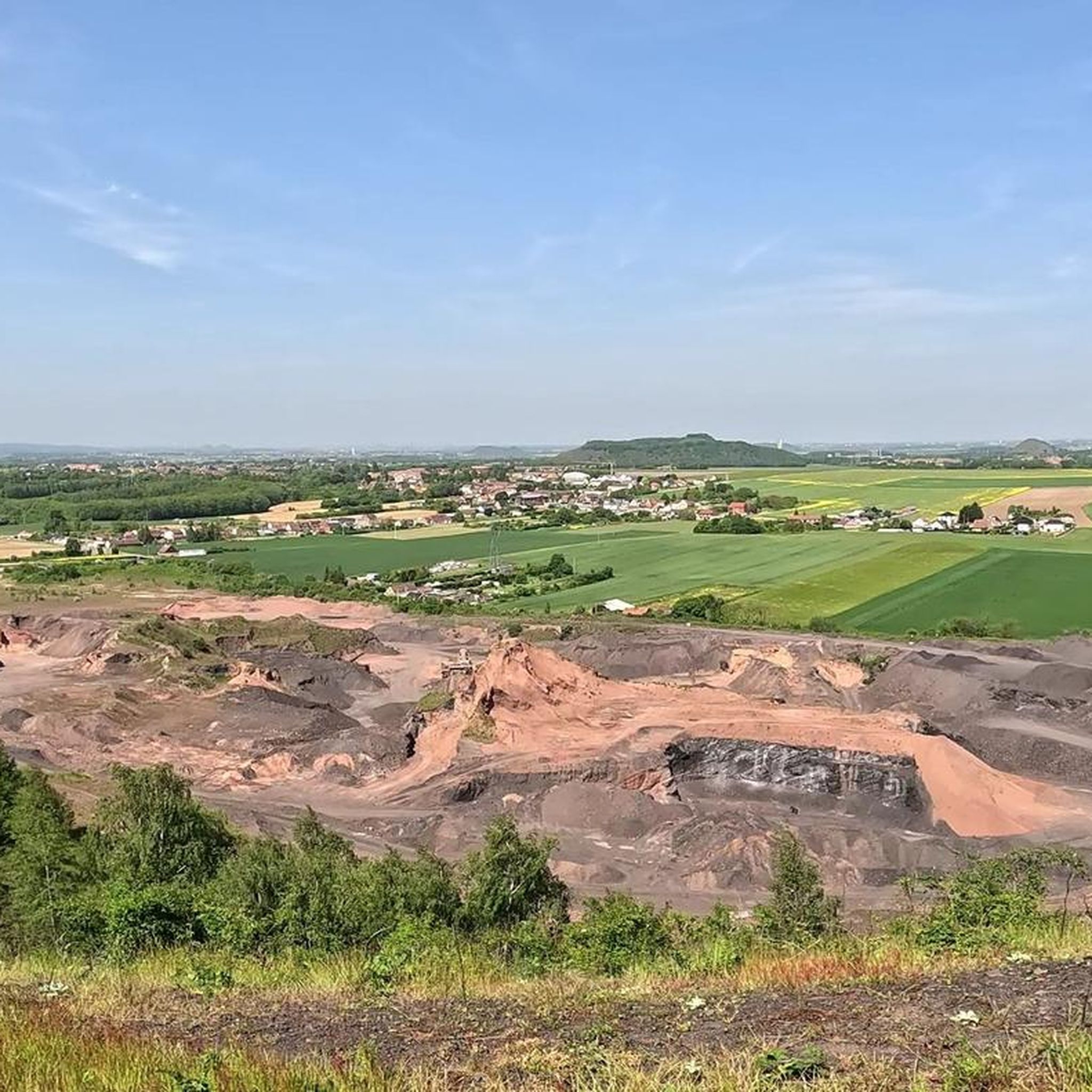
Beautiful panoramic view of Lens and the surrounding area. Be careful when you climb onto the spoil heap during a storm, it's a real hair-raiser!
1
0

Beautiful, easy-to-ride path along the lake. Can be done by mountain bike.
2
0

This country lane near Douvrin winds through fields. Surrounded by vast agricultural areas, this quiet path passes through wheat, corn and rapeseed crops that change colour with the seasons.
1
0

This historic mining site is a symbol of the region's industrial past. The 11/19 slag heaps, among the highest in Europe, offer impressive panoramic views. The site is today an example of successful reconversion, integrating economic and cultural activities.
0
0

be careful the steps are sometimes high
0
0
Frequently Asked Questions
What kind of terrain can I expect on hikes around Bénifontaine?
The hiking trails around Bénifontaine offer a diverse landscape, primarily characterized by rolling countryside, extensive forests, and tranquil meadows. You'll find varied terrain, including former mining landscapes with unique features like spoil heaps, which can offer panoramic views. The broader region also features areas with significant elevation changes and unique rock formations, though Bénifontaine itself is known for generally gentle elevation.
How many hiking trails are available around Bénifontaine?
There are over 320 hiking routes available around Bénifontaine, catering to a wide range of preferences and skill levels. This includes a mix of easy, moderate, and more challenging paths through the region's varied landscapes.
Are there hiking trails suitable for families or beginners in Bénifontaine?
Yes, Bénifontaine offers numerous easy trails perfect for families or those seeking a relaxed experience. With over 140 easy routes, you can find paths through open fields and near small bodies of water, such as the Small pond – What do you see?? loop from Douvrin, which is about 4.2 miles (6.8 km) long.
Are there any challenging hikes around Bénifontaine for experienced hikers?
For experienced hikers seeking a challenge, Bénifontaine offers several more demanding routes. An example is The 11/19 pit – Spoil heaps 74 and 74a loop from Loos-en-Gohelle, a difficult 6.6 miles (10.6 km) path that features more challenging sections around the spoil heaps and provides panoramic views.
What do other hikers enjoy most about the trails in Bénifontaine?
The trails around Bénifontaine are highly rated by the komoot community, with an average score of 4.5 stars from over 1000 reviews. Hikers often praise the diverse scenery, from historical mining sites to tranquil forests and meadows, and appreciate the variety of routes available for different skill levels.
Are there any circular hiking routes in Bénifontaine?
Yes, many of the trails around Bénifontaine are circular, allowing you to start and end at the same point. Examples include The terrils 74 and 74A and the memorial of the côte 70 — loop from Loos-en-Gohelle and Small pond – I love these woods loop from Bénifontaine, offering convenient options for exploration.
What natural features or landmarks can I see along the hiking trails?
While hiking around Bénifontaine, you can explore various natural and historical features. The region is known for its unique spoil heaps, which are remnants of the mining past and offer elevated viewpoints. You might also encounter serene lakes and ponds, such as Marsh Pond or Etang de Wingles, and explore areas like Marais de la Galance, which highlight the region's diverse ecosystems.
Are there any specific areas for wildlife spotting during a hike?
The extensive forests, meadows, and areas around lakes and ponds in the Bénifontaine region provide opportunities for wildlife spotting. Natural parks in the broader Hauts-de-France region, such as Parc Naturel Regional Scarpe-Escaut, are known for their pristine ecosystems, offering chances to observe local fauna in their natural habitats.
Are dogs allowed on the hiking trails around Bénifontaine?
Generally, dogs are welcome on many hiking trails in the Bénifontaine area, especially in open countryside and forest paths. However, it's always recommended to keep them on a leash, especially in nature reserves or areas with livestock, and to check specific trail regulations if available.
What is the best time of year to go hiking in Bénifontaine?
The Bénifontaine region offers pleasant hiking conditions throughout much of the year. Spring and autumn provide mild temperatures and beautiful scenery with blooming flowers or vibrant fall foliage. Summer is also suitable, though it can be warmer, while winter hikes can be enjoyed on less challenging routes, offering a different perspective of the landscape.
Are there any bike parks or cycling-related attractions near Bénifontaine?
Yes, for those interested in cycling, there are bike parks and related attractions nearby. You can find places like Terril de Drocourt, Cabiddu Park MTB Base, and Bois de Florimond Pumptrack, which offer dedicated facilities for mountain biking and other cycling activities.
How long do hikes typically take around Bénifontaine?
Hike durations vary significantly depending on the route's length and difficulty. Easy trails, like the 4.1-mile (6.5 km) The terrils 74 and 74A and the memorial of the côte 70 — loop from Loos-en-Gohelle, can be completed in under 2 hours. Longer or more challenging routes, such as the 6.6-mile (10.6 km) The 11/19 pit – Spoil heaps 74 and 74a loop from Loos-en-Gohelle, may take 3 hours or more.
Most popular routes around Bénifontaine
Most popular attractions around Bénifontaine

Get inspired with the komoot mobile app


Explore more
Browse the best Hikes in other regions.
