The best walks and hikes around Tortequesne
4.5
(336)
2,073
hikers
167
hikes
Hiking trails around Tortequesne traverse a landscape rich in waterways, marshlands, and historical sites. The area is defined by its extensive canal network, including the Canal du Nord and Canal de la Sensée, which offer scenic paths along their banks. Significant marshlands like the Sensée marshes and the Étangs communaux d'Arleux provide opportunities to explore former peat bogs and observe aquatic wildlife. Woodlands such as Bois Duquesnoy also feature in the region's varied terrain.
Best hiking trails around Tortequesne
- The…
Last updated: June 29, 2026
4.3
(19)
70
hikers
11.5km
02:55
30m
30m
Moderate hike. Good fitness required. Easily-accessible paths. Suitable for all skill levels.
5.0
(1)
19
hikers
23.0km
05:50
60m
60m
Hard hike. Very good fitness required. Easily-accessible paths. Suitable for all skill levels.

Sign up for free
5.0
(1)
9
hikers
20.2km
05:08
60m
60m
Hard hike. Very good fitness required. Easily-accessible paths. Suitable for all skill levels.
7
hikers
4.54km
01:10
20m
20m
Easy hike. Great for any fitness level. Easily-accessible paths. Suitable for all skill levels.
3
hikers
Moderate hike. Good fitness required. Easily-accessible paths. Suitable for all skill levels.
Get access to more routes and recommendations from other explorers.
Sign up for free
Already have an account?
Our route recommendations are based on thousands of hikes, rides, and runs completed by other people on komoot.
Start today with a free account
Your next adventure awaits.
Login or Signup

Tips from the Community

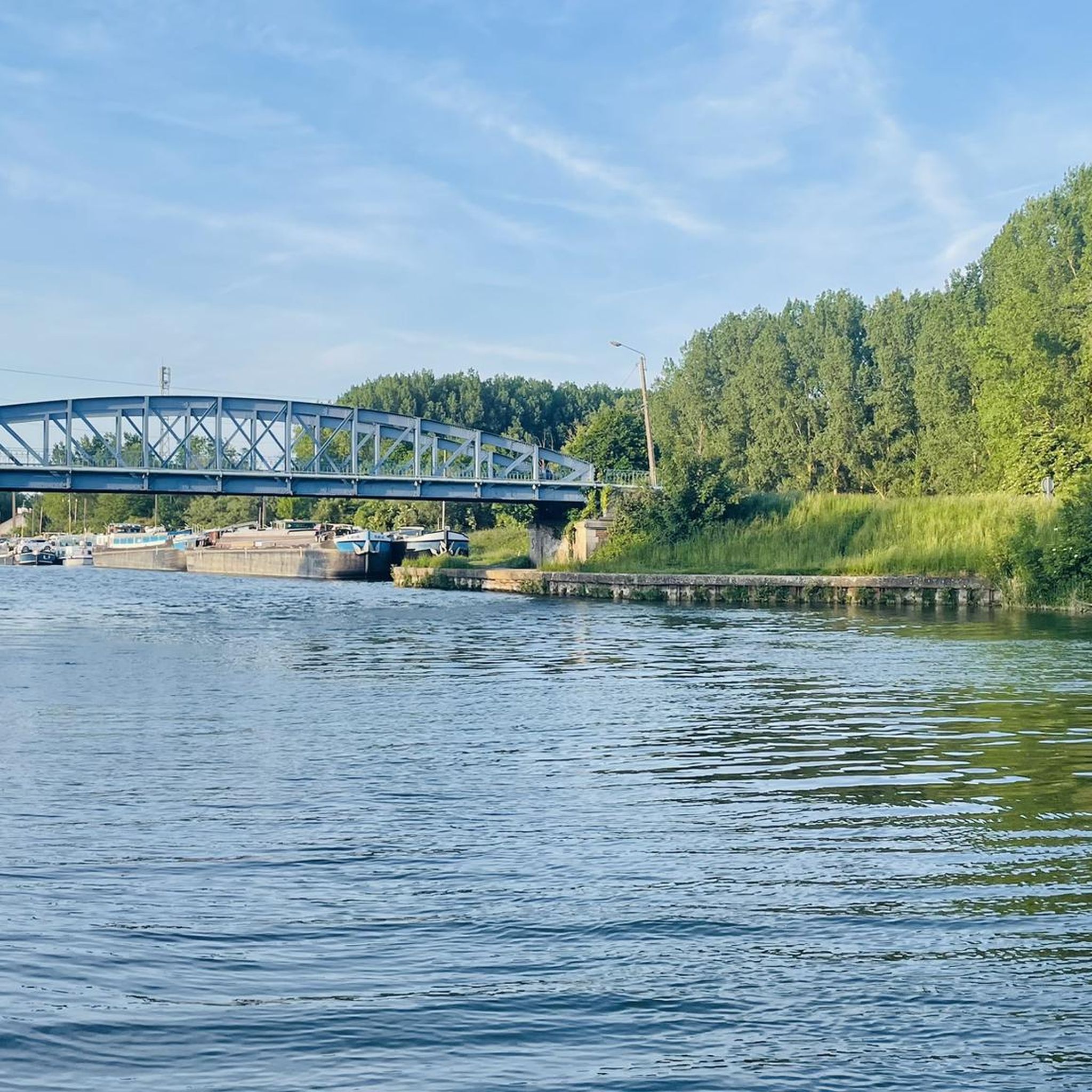
Bring high shoes for the passages in the fields; very pleasant hike which alternates between several panoramas (canal edge; fields; woods)
1
0

The menhir is located in the marsh of Aubigny-au-Bac, on a footpath leading to Brunémont. It is a block of Landenian sandstone 2.90 m high (including 1.48 m above ground) by 2.15 m wide and 0.70 m thick. It is said to have been sunk to about 2.40 m. Shaped like a horse's head, it is associated with a prehistoric megalith despite the absence of evidence.
0
0


Nice corner to take a break by the water 🦆
1
0
Very beautiful monument of local history to discover during a walk in nature.
1
0

It is a magical place, sheltered in a small clearing, which is accessed by a footbridge. Don't make (too much) noise ...
0
0
Frequently Asked Questions
How many hiking trails are available around Tortequesne?
There are over 160 hiking routes in the Tortequesne area, offering a wide variety of experiences. These trails are highly rated by the komoot community, with an average score of 4.5 stars from over 270 reviews.
Are there hiking trails for all skill levels in Tortequesne?
Yes, the Tortequesne area offers trails for various skill levels. You'll find over 80 easy routes perfect for a leisurely stroll, around 70 moderate trails for those seeking a bit more challenge, and a few difficult paths for experienced hikers looking for longer distances.
Are there many circular hiking routes in the Tortequesne area?
Many of the hiking routes around Tortequesne are circular, allowing you to start and end your journey in the same location. For example, the Paluel Lock – Étangs d'Arleux-Palluel loop from Hamel is a popular moderate option, and the Sensée Marsh loop from Lécluse offers an easy, shorter circular walk.
What kind of landscapes can I expect to see while hiking near Tortequesne?
The landscapes around Tortequesne are diverse, characterized by extensive waterways, marshlands, and woodlands. You'll hike along scenic canals like the Canal du Nord and Canal de la Sensée, explore the unique Sensée marshes with their rich biodiversity, and pass through wooded areas such as Bois Duquesnoy. The Étangs communaux d'Arleux also offer a peaceful green oasis.
Are there any interesting landmarks or historical sites along the trails?
Yes, the region is rich in history and folklore. You can discover ancient sites like the Menhir of Lécluse, also known as the Devil's Stone, a classified historical monument. Another fascinating spot is the Hamel Dolmen, or the Sorcerers' Kitchen, a rare example of a Neolithic covered alley. These sites add a unique historical dimension to your hike.
What do other hikers enjoy the most about hiking in Tortequesne?
The komoot community highly rates the hiking experience in Tortequesne, with an average score of 4.5 stars. Hikers often praise the peaceful atmosphere of the marshlands, the scenic paths along the canals, and the diverse terrain that combines natural beauty with historical interest. Many appreciate the well-maintained routes suitable for various abilities.
Are there any long-distance hiking options in the area?
For those seeking a longer challenge, Tortequesne offers several extended routes. The Étangs d'Arleux-Palluel – Paluel Lock loop from Hamel is a difficult 14.5-mile (23.3 km) path that explores the waterways and marshlands over a longer distance. Another option is the Paluel Lock – Lock on the Canal du Nord loop from Hamel, which covers 12.6 miles (20.3 km).
Can I observe wildlife while hiking in Tortequesne?
Absolutely. The marshlands, particularly the Sensée marshes and the Étangs communaux d'Arleux, are known for their significant biodiversity. These areas provide excellent opportunities for observing aquatic wildlife and various bird species, making them a true haven for nature lovers.
What are the main natural features to explore around Tortequesne?
The primary natural features are the extensive network of canals, including the Canal du Nord and Canal de la Sensée, which offer picturesque walking paths. The region is also defined by its marshlands, such as the Sensée marshes and the Étangs communaux d'Arleux, which are former peat bogs rich in flora and fauna. Additionally, woodlands like Bois Duquesnoy provide a contrasting natural environment.
Are there any specific routes that highlight the Étangs d'Arleux-Palluel?
Yes, the Étangs d'Arleux-Palluel are a central feature of several routes. The Paluel Lock – Étangs d'Arleux-Palluel loop from Gouy-sous-Bellonne is a moderate 8.5-mile (13.7 km) hike that allows you to fully experience this peaceful green oasis and its biodiversity.
What is the terrain like on the hiking trails in Tortequesne?
The terrain is varied, ranging from flat paths along the canals and through open fields to trails winding through marshlands and woodlands. You can expect a mix of surfaces, including compacted earth, gravel paths, and potentially some softer ground in marshy areas, offering a diverse hiking experience.
Most popular routes around Tortequesne
Most popular attractions around Tortequesne

Get inspired with the komoot mobile app


Explore more
Browse the best Hikes in other regions.
