The best running trails in the Wallowa Mountains
13
runners
11
runs
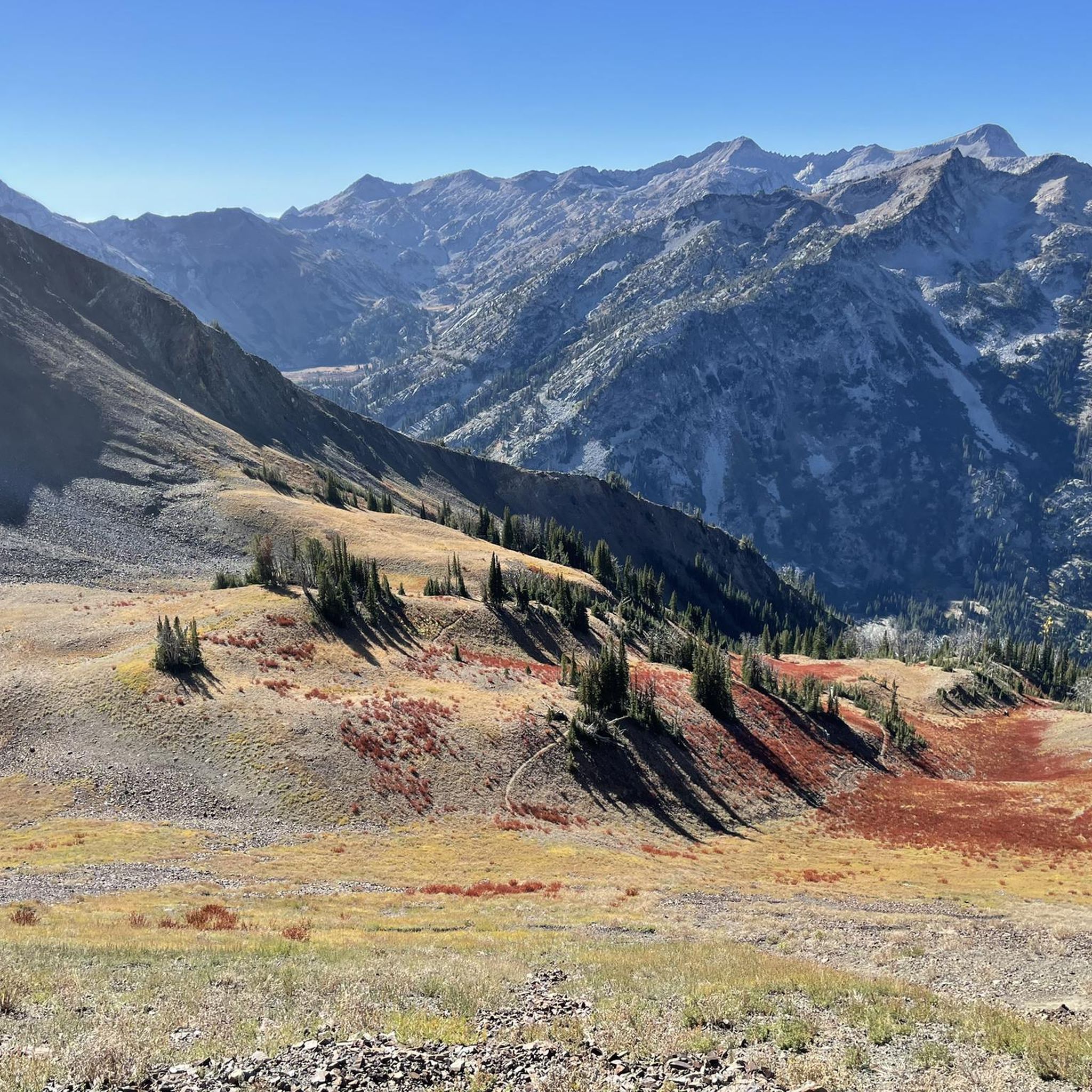
Jogging in the Wallowa Mountains offers diverse terrain, from river valleys to challenging mountain paths. This region, often called the "Swiss Alps of Oregon," features towering peaks, numerous alpine lakes, and dramatic canyons. An extensive network of trails, including those within the Eagle Cap Wilderness, provides varied running experiences. Runners can explore routes along rivers, through forests, and across open landscapes, with options for different fitness levels.
Best jogging routes in the Wallowa Mountains
- The most popular jogging route is…
Last updated: July 7, 2026
5.28km
00:33
20m
20m
Jog the 3.3-mile Richland loop via Sullivan Lane, a moderate, mostly paved route in Baker County, Oregon, with 72 feet of gain.
8.11km
00:50
50m
50m
Jog the moderate 5.0-mile Powder River via Robinette Road loop in Baker County, offering scenic river views and wildlife spotting opportunit

Sign up for free
7.16km
00:45
60m
60m
Jogging the 4.4-mile TransAmerica Trail in Hells Canyon National Recreation Area is a moderate 44-minute route with 209 feet of gain.
25.6km
02:54
660m
660m
Jogging the difficult 15.9-mile Hells Canyon via Indian Crossing Campground loop offers rugged terrain and dramatic canyon views.
5.89km
00:36
30m
30m
Jog the 3.7-mile Halfway loop Wallowa, a moderate route with 86 feet of elevation gain, offering scenic views near Halfway, Oregon.
32.4km
03:35
760m
760m
Fish Lake via NFDR 6625 is a difficult 20.1-mile jogging route in Baker County, Oregon, offering scenic views of Fish Lake and old-growth fo
14.8km
02:11
610m
610m
The Twin Lakes via South Fork Imnaha Trail is a difficult 9.2-mile jogging route in Eagle Cap Wilderness with significant elevation gain.
4
runners
7.53km
01:08
270m
270m
Hard run. Good fitness required. Sure-footedness, sturdy shoes and alpine experience required.
3
runners
8.72km
00:55
90m
90m
Moderate run. Good fitness required. Mostly paved surfaces. Suitable for all skill levels.
Get access to more routes and recommendations from other explorers.
Sign up for free
Already have an account?
Our route recommendations are based on thousands of hikes, rides, and runs completed by other people on komoot.
Start today with a free account
Your next adventure awaits.
Login or Signup
Popular around Wallowa Mountains
Tips from the Community

Twin Lakes get their names from being two lakes right next to each other. This spot is popular with campers, trail runners, and fishermen! There are toilets here for those mid-run emergencies and you can even pitch a hammock!
0
0
Fish Lake is a picturesque lake situated in an old-growth forest. There is a campground located here making for a great basecamp before heading out to run on the numerous trails spidering out from the lake. There are 3 flush toilets and potable water.
0
0
Halfway is a small city in the foothills of Wallowa Whitman National Forest. Located only 18 miles from the Idaho border, Halfway is primarily a ranching community. In the winter you can expect all the common snowsports, and in the spring you can take advantage of the rodeos, hiking, camping, and more!
0
0
Hells Canyon Overlook is a popular spot to see panoramic views of Hells Canyon and as far as the eye can see! There are signs here with information about the canyon and you can see the Seven Devil Mountains just across the border in Idaho. In the spring & summer there are tons of wildflowers here making it even more scenic.
0
0
Pine Creek Café is a great mid-run spot to grab some more fuel or cooldown. This cafe offers coffee, snacks, water, and you can grab some ice to cool down with. If you are an outdoorsy person, you can also grab a fishing license and some basic camping necessities here.
0
0
Powder River, a tributary of Snake River, is a rugged canyon with amazing views. This river is actually the border between Baker County and Union County. Boat floating is most popular in the spring, so you'll likely see people enjoying themselves on the water.
0
0
Richland is known as the 'banana belt' and is a friendly-folk/outdoorsy town. This small rural town has a population hovering around 1000 and has local markets to shop at, or amazing camping, fishing, and kayaking.
0
0

This short trail is located just "in the backyard" of the Wallowa Lake Campground. It connects to a faint trail that will take you the the Chief Joseph Trail. When you get closer to the boundary of the Eagle Cap Wilderness, you will find an information board with free permits.
3
0
Frequently Asked Questions
How many running routes are available in the Wallowa Mountains?
The Wallowa Mountains offer a diverse network of over 10 dedicated jogging routes. These range from moderate loops to challenging mountain ascents, catering to various fitness levels.
What kind of terrain can I expect when jogging in the Wallowa Mountains?
You'll find a wide variety of terrain, from relatively flat, mostly paved routes like the Richland loop via Sullivan Lane to rugged, mountainous paths. The region features river valleys, forests, and open landscapes, with some trails offering significant elevation gains, particularly in the Eagle Cap Wilderness.
Are there any easy or moderate running routes suitable for beginners or families?
Yes, there are several moderate options. For a gentle run through rural surroundings, consider the Richland loop via Sullivan Lane. Another moderate choice is the Halfway loop Wallowa, which offers a pleasant experience without extreme difficulty.
What are some challenging running routes in the Wallowa Mountains?
For experienced trail runners seeking a challenge, the Wallowa Mountains deliver. The Hells Canyon via Indian Crossing Campground loop is a difficult 15.9-mile route offering rugged landscapes and dramatic canyon vistas. Another demanding option is the Fish Lake via NFDR 6625, which involves significant elevation gain over its 32 km distance.
What natural features or attractions can I see along the running routes?
The Wallowa Mountains are renowned for their stunning natural beauty. Many routes offer views of towering peaks, pristine alpine lakes, and dramatic canyons. You might encounter Ice Lake, Mirror Lake, or the impressive Hells Canyon Overlook. Trails often follow rivers, providing soothing sounds and scenic river valley views.
Are there any loop running trails in the Wallowa Mountains?
Yes, many of the running routes are loops, offering varied scenery without retracing your steps. Examples include the Powder River via Robinette Road loop and the Nature Trail loop from Wallowa Lake State Park, which takes you through varied terrain near the lake.
What is the best time of year for running in the Wallowa Mountains?
The Wallowa Mountains are best for running from late spring through early fall. During these months, trails are generally free of snow, and the weather is more favorable. Early season running opportunities can be found along river trails like the East Fork Wallowa River. Always check local conditions, especially for higher elevation routes, as snow can persist into summer.
Are there any specific permits required for running on trails in the Wallowa Mountains?
While many trails are freely accessible, some areas, particularly within the Eagle Cap Wilderness, may require wilderness permits for overnight stays or specific entry points. It's always best to check with the Wallowa-Whitman National Forest or local ranger stations for the most current permit requirements before heading out, especially for longer or more remote runs.
What do other runners enjoy most about jogging in the Wallowa Mountains?
Runners frequently praise the Wallowa Mountains for their unparalleled natural beauty and diverse trail system. The region, often called the 'Swiss Alps of Oregon,' is loved for its towering peaks, pristine alpine lakes, and dramatic canyons. The variety of routes, from gentle river paths to strenuous mountain ascents, ensures there's an adventure for every skill level.
Are there opportunities for wildlife spotting while running?
Yes, the Wallowa Mountains are home to abundant wildlife. While running, you might spot deer, elk, various bird species, and if you're lucky, even a black bear or mountain goat in higher elevations. Maintaining a respectful distance and being aware of your surroundings is always recommended.
Can I find trails that are less crowded for a more solitary running experience?
While popular spots can see more visitors, the extensive trail network, particularly within the Eagle Cap Wilderness, offers many opportunities for solitude. Exploring some of the longer or more challenging routes, or visiting during off-peak times, can lead to a more secluded running experience amidst the wilderness.
Most popular routes in the Wallowa Mountains
Most popular attractions in the Wallowa Mountains

Get inspired with the komoot mobile app


