4.8
(65)
7,057
runners
532
runs
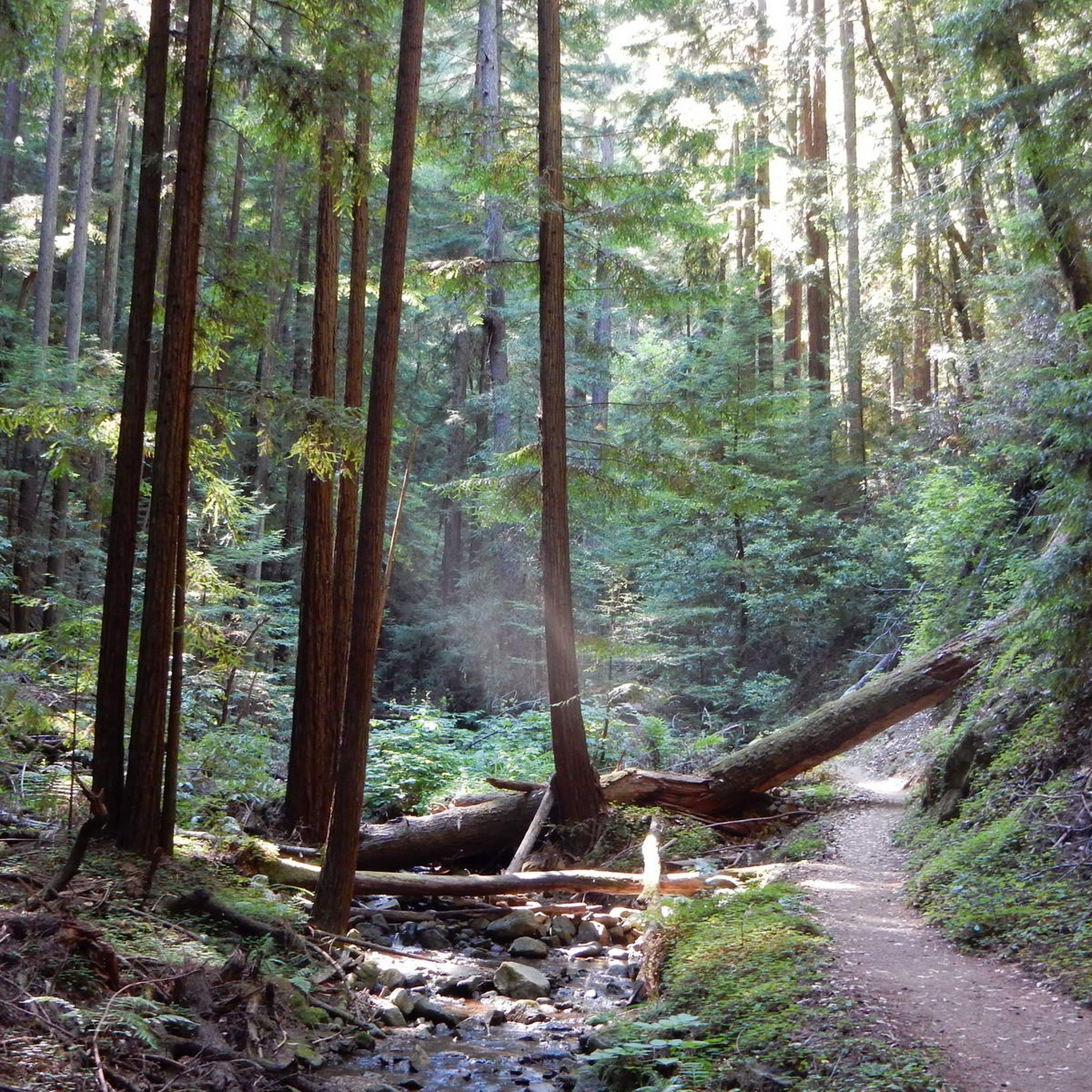
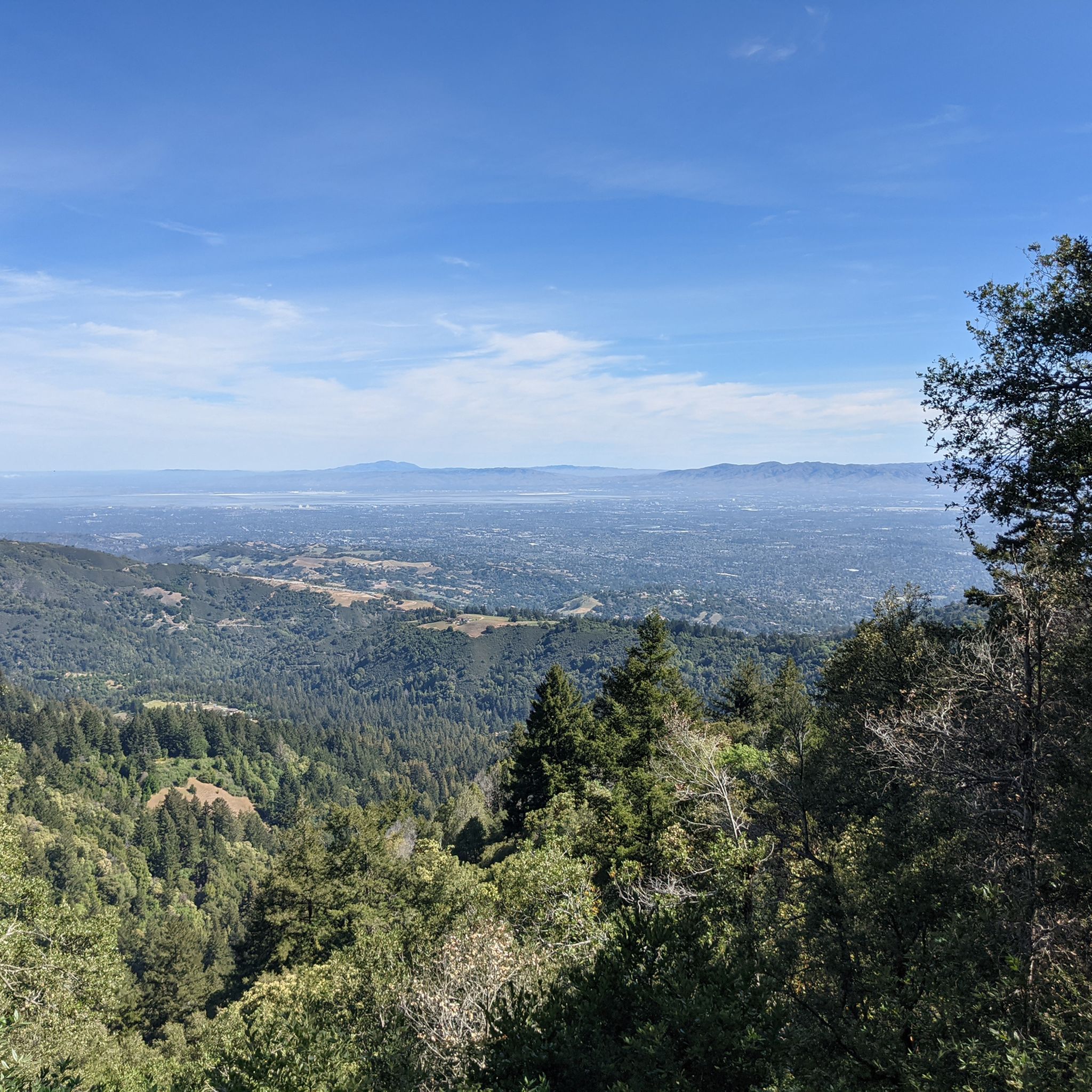
Jogging in the Santa Cruz Mountains offers diverse landscapes for runners, characterized by towering redwood forests, coastal bluffs, and varied mountain terrain. The region features extensive trail systems that traverse serene lakes and challenging ascents. This area provides a mix of environments, from shaded forest paths to open grasslands, suitable for various running preferences. The topography includes both gentle slopes and significant elevation changes, catering to different fitness levels.
Last updated: July 7, 2026
5.0
(1)
235
runners
6.12km
00:40
130m
130m
You can enjoy a moderate jogging experience on the Stanford Dish Loop Trail, covering 3.8 miles (6.1 km) with an elevation gain of 435 feet (133 metres). This route typically takes about 40 minutes to complete. As you jog, you will pass by rolling grassy hills dotted with Oak trees, offering a pleasant natural setting. The trail provides sweeping panoramic views of the Stanford University campus, including the prominent Hoover Tower, and on clear days, you might even spot San Francisco and the Bay Bridge in the distance. The most striking feature along the way is the iconic 150-foot-diameter radio telescope, known simply as The Dish, which stands out against the landscape.
When planning your visit, be aware that the trail is open from sunrise to sunset, with specific times changing seasonally. It is important to note that dogs and bicycles are not allowed on the route, which helps protect the local habitat and ensures safety for all users. Since there is very little shade along the entire path, you might find it more comfortable to jog during the cooler early mornings or late afternoons, especially if you are visiting in warmer months. Always check the current opening hours before you head out.
The Stanford Dish area is a significant ecological preserve, home to various native plants and wildlife, making it a valuable natural space within an urbanized region. The trail's unique character is largely defined by the presence of the 150-foot radio telescope, which has been used for scientific research since the 1960s. This blend of scientific history and natural beauty makes the Stanford Dish Loop Trail a distinctive and popular destination for outdoor activity.
4.0
(2)
95
runners
14.5km
01:51
350m
350m
Prepare for a challenging jogging experience on the Stephen E. Abbors and Upper Wildcat Canyon Loop, a difficult 9.0 miles (14.5 km) route that climbs 1154 feet (352 metres) over an estimated 1 hour and 50 minutes. You'll start by ascending a grassy, oak-studded hillside, then transition into a pleasantly wooded canyon. As you gain elevation, you'll enjoy increasingly scenic views of the Santa Clara Valley, especially from the High Meadow Vista Point, before descending into cool, shady bay laurel woods.
When planning your visit, be aware that parking at the trailhead can be challenging on nice summer weekends, often requiring a wait. Some sections of the trail are exposed, so it can get very hot if you jog on days above 85 degrees Fahrenheit. Consider an early start to avoid the midday heat and potential parking delays.
This route offers a dynamic journey through varied landscapes, moving between sunny chaparral and dense, lush woods with fern groundcover. A unique feature of the canyon is the subtle perfumed scent that sometimes emanates from the dense bay tree woods, adding an unexpected sensory element to your jog.

Sign up for free
5.0
(3)
79
runners
4.16km
00:26
10m
10m
The Los Gatos Creek Trail is a delightful escape, offering a varied and scenic jogging experience through riparian habitats and open spaces. You'll find yourself winding along the creek, with sections of paved path giving way to unpaved gravel and dirt, and even charming boardwalks. The route provides ample shade and picturesque views of Vasona Lake, making it a refreshing outing where you might even spot blue herons or turtles.
This easy 2.6-mile (4.2 km) route, with its gentle 43 feet (13 metres) of elevation gain, can be completed in about 26 minutes, making it perfect for a quick jog or a family-friendly run. The trail is well-maintained, featuring mile markers, restrooms, and drinking fountains at various access points. It's also dog-friendly, so your canine companion can join the fun.
Beyond its appeal for joggers, the Los Gatos Creek Trail is a multi-use pathway popular for walking, cycling, and skating. It connects to other local paths like the Jones Trail and Flume Trail, and provides access to St. Joseph's Hill, expanding your options for exploration in the area. This trail is a local favorite for its blend of natural beauty and urban accessibility.
5.0
(1)
66
runners
6.52km
00:49
160m
160m
Embark on a moderate jogging adventure along the Los Gatos Creek and Jones Trail Loop, covering 4.1 miles (6.5 km) with an elevation gain of 511 feet (156 metres). This route takes about 49 minutes to complete, offering a varied workout. You will begin along the Los Gatos Creek, enjoying a mostly paved path through lush green spaces. As you transition to the Jones Trail, the terrain shifts to unpaved sections, leading you on a gradual climb. Look forward to panoramic views of Lexington Reservoir and the surrounding hills as you ascend.
The Los Gatos Creek and Jones Trail Loop is conveniently located, making it easy to access from downtown Los Gatos. You will find parking available close to the trailhead, which is ideal for a quick outing. This accessibility allows you to combine your jogging session with exploring the local shops and dining options in Los Gatos. Consider starting your jog earlier in the day to enjoy cooler temperatures and fewer people on the path.
This loop offers a dynamic shift in scenery as you move through St. Joseph's Hill Open Space Preserve. The Los Gatos Creek section follows the waterway, providing a different experience from the unpaved, shaded canopy of the Jones Trail. Higher up, the trail rewards you with expansive vistas. Keep an eye out for wildflowers, which add vibrant color to the landscape, especially during spring.
5.0
(1)
56
runners
7.77km
00:55
190m
190m
Embark on the Guadalupe and Mine Hill Trail Loop for a moderate jogging experience that spans 4.8 miles (7.8 km) and includes a total elevation gain of 637 feet (194 metres). You can expect to complete this route in about 54 minutes, making it a great option for a focused workout. As you jog, you will encounter varied scenery, from open areas with expansive mountain views to shaded sections under tree cover. Keep an eye out for the tranquil glimpses of the Guadalupe Reservoir and the panoramic vistas of South San Jose from the Mine Trail lookout point. Wildflowers add seasonal color, enhancing your journey through this diverse landscape. The terrain offers a good mix for an engaging run.
When planning your visit to Almaden Quicksilver County Park, remember that the Guadalupe and Mine Hill Trail Loop is a shared-use path, so you will likely encounter mountain bikers and equestrians. Dogs are welcome on the trail, provided they remain on a leash, allowing you to bring your canine companion along for the jog. Parking is generally available at several access points within the park, making it convenient to start your adventure. Consider an early morning or late afternoon start to enjoy cooler temperatures and potentially fewer people on the route.
Beyond the natural beauty, this trail offers a unique historical dimension, winding past remnants of 19th-century quicksilver mining operations. These historical elements provide a fascinating glimpse into the region's past, adding an educational layer to your jogging routine. The park itself is rich in history, preserving a significant part of California's mining heritage. This blend of natural scenery and historical context makes the Guadalupe and Mine Hill Trail Loop a distinctive choice for your next outdoor activity in the area.
50
runners
23.7km
03:00
610m
610m
Prepare for a challenging jogging experience on the PG&E, Black Mountain, Chamise and Rogue Valley Trail Loop. This difficult route covers 14.7 miles (23.7 km) and demands a significant effort, with 2016 feet (614 metres) of elevation gain. You can expect to complete it in about 2 hours and 59 minutes. As you ascend the PG&E Trail, you will be treated to increasingly expansive views of the San Francisco Bay. From Black Mountain, panoramic vistas unfold, showcasing Silicon Valley to the north and the Santa Cruz Mountains to the south. The Chamise Trail, especially in spring, becomes a beautiful tunnel of white flowers, attracting various insects. Keep an eye out for wildlife like rabbits and deer along the Rogue Valley Trail.
When planning your visit, be aware that parking at the main trailhead can be quite challenging due to the park's popularity. To secure a spot, you should plan to arrive early in the day. Also, consider the season for your run, particularly if you are jogging in winter. The Rogue Valley Trail can experience heavy frost on winter mornings because it receives limited sun exposure. This makes seasonal conditions an important factor to consider for your comfort and safety.
This loop offers a diverse and rewarding experience for joggers seeking a serious workout with significant climbs. The trail provides a unique opportunity to witness the changing landscapes from the Bay Area to the Santa Cruz Mountains. It is a notable route in the Rancho San Antonio Open Space Preserve, known for its varied terrain and the chance to observe local flora and fauna. The combination of challenging ascents and scenic views makes it a standout option for those looking to push their limits.
5.0
(1)
45
runners
9.20km
01:09
250m
250m
Embark on the High Meadow and Wildcat Loop for a moderate jogging experience covering 5.7 miles (9.2 km) with an elevation gain of 818 feet (249 metres). This route typically takes about 1 hour and 8 minutes to complete, offering a varied landscape as you move through the preserve. You will encounter a mix of wider fire roads and narrower single-track paths, with sections providing welcome tree coverage. Keep an eye out for the High Meadow Vista Point, which offers expansive 360-degree views of the surrounding Bay Area.
Planning your visit to the High Meadow and Wildcat Loop is key, especially if you prefer a quieter experience. This trail system is quite popular, particularly on weekends, so consider starting your jog early in the morning or choosing a weekday. This approach helps you avoid the busiest times and enjoy the natural surroundings more peacefully. The preserve's diverse network of trails also allows you to extend or modify your route if you wish to explore further.
A unique highlight along the High Meadow and Wildcat Loop is Deer Hollow Farm, a working farm that features animals and an organic garden. This adds an interesting, pastoral element to your jogging adventure, setting it apart from many other trails in the region. The combination of natural beauty, varied terrain, and this distinctive farm makes the route a well-rounded option for joggers seeking both exercise and engaging scenery.
4.0
(1)
47
runners
9.86km
01:17
250m
260m
Embark on the Tony Look to Coyote Ridge Loop for a moderate jogging experience that blends shaded single-track paths with open fire roads. As you move along the Tony Look Trail, you will find yourself enjoying views of the Stevens Creek Reservoir. The route covers 6.1 miles (9.9 km) and involves an elevation gain of 816 feet (249 metres), typically taking about 1 hour and 16 minutes to complete.
When planning your visit, be aware that this loop is a popular spot for various outdoor enthusiasts. You will share the path with hikers, equestrians, and cyclists, so stay alert and be considerate of others. Parking is generally available at the trailhead, making access straightforward for your jogging session.
This loop offers more than just a workout; it provides expansive panoramic views of San Jose and the surrounding valley, especially as you climb the Coyote Ridge Trail towards Maisie's Peak. The varied terrain, including unpaved dirt and gravel sections, means you should be sure-footed, but it also adds to the diverse character of your jogging adventure.
5.0
(1)
41
runners
15.4km
01:54
260m
260m
Prepare for a challenging jogging experience on the Lisa Killough and Cottle Trail Loop, a difficult route spanning 9.6 miles (15.4 km). You will climb 843 feet (257 metres) over an estimated 1 hour and 53 minutes, making it a solid workout. As you jog, you will move through diverse landscapes, from open grasslands to cool, shaded oak woodlands. Keep an eye out for the Lisa Killough Lookout, offering sweeping views of Calero Reservoir and the distant Santa Cruz Mountains. In spring, the trail comes alive with colorful wildflower displays.
When planning your visit, be mindful of the season. During warmer months, the trail can be quite exposed and dusty, so remember to bring plenty of water and consider starting your jog early in the morning. In contrast, winter conditions can make the clay-based soil muddy and rutted, especially after rainfall. Always check local conditions before heading out to ensure a pleasant and safe experience.
This loop offers a fantastic opportunity to explore the natural beauty of Calero County Park. The trail's varied terrain and elevation changes provide an excellent test for experienced joggers seeking a rewarding workout. The expansive views from key points along the route highlight the unique landscape of the Bay Area, connecting you with both the reservoir and the distant mountain ranges.
5.0
(1)
38
runners
13.8km
01:44
250m
250m
Embark on the Lisa Killough and Cottle Trail Loop for a moderate jogging experience through Calero County Park. This route spans 8.6 miles (13.8 km) and involves an elevation gain of 815 feet (249 metres), typically taking about 1 hour and 43 minutes to complete. As you jog, you will pass through diverse landscapes, from open rolling grass hills to tranquil wooded areas. Keep an eye out for local wildlife like burrowing owls and coyotes. Make sure to pause at 'Lisa's Lookout' to enjoy sweeping panoramic views of the surrounding hills and the distant Santa Cruz Mountains.
The trail features a varied surface, including unpaved paths, gravel sections, and some singletrack. While not overly technical, be prepared for consistent elevation changes, especially on the Cottle Trail, which includes steep climbs. If you are hoping to see wildflowers, plan your visit for March and April when the golden grasses transform into vibrant green landscapes. Consider starting your jog early in the morning to avoid the midday sun and to increase your chances of spotting wildlife.
This loop offers a dynamic workout for those with moderate fitness, combining scenic beauty with physical challenge. You will experience the unique ecosystem of Calero County Park, with its distinctive blend of grasslands and woodlands. The route also provides excellent views of the Calero Reservoir, adding another layer to the visual appeal. It is a great option if you are looking for a substantial jogging trail that showcases the natural beauty of the Santa Cruz Mountains foothills.
Get access to more routes and recommendations from other explorers.
Sign up for free
Already have an account?
Our route recommendations are based on thousands of hikes, rides, and runs completed by other people on komoot.
Start today with a free account
Your next adventure awaits.
Login or Signup
Popular around Santa Cruz Mountains

Bay Area Ridge Trail — Circumnavigating the San Francisco Bay

Bay Area Ridge Trail — Hiking the backbone of The Bay

On the most beautiful route of California - The Pacific Coast Route

Chasing flow in the Bay Area

Classy road bike rides on the SF peninsula
Hiking in the Santa Cruz Mountains
MTB Trails in the Santa Cruz Mountains
Road Cycling Routes in the Santa Cruz Mountains
Cycling in the Santa Cruz Mountains
Gravel biking in the Santa Cruz Mountains
The Dish, or the Stanford Dish, is a huge, 150-foot-diameter radio antenna. Built in 1961 by the Stanford Research Institute, it is still in use by the university today and is a popular hiking destination. In addition to views of the Stanford Dish, you also get panoramic views of the surrounding foothills and, on clear days, the San Francisco skyline. The area is known for its wildlife, including various bird species, so be on the lookout as you explore The Dish.
1
0
This short spur off the Lisa Killough Trail leads ends at a wonderful lookout with some picnic tables. It's a great spot to stop and enjoy the view!
1
0
Stevens County Park is open year-round from 8am until sunset. Fishing boats, but must not be a power boat and must be off the water 30 minutes before the park closes. Check trail makings and be aware; some trails in the park are multi use for equestrians, hikers and bikers.
0
0
Calero County Park is a huge park covering over 4,400 acres and featuring a huge lake. Calero Reservoir is definitely the pinnacle of the park, but there are a number of trails and paths that offer different views and pass through different natural ecosystems. Being such a big park, there are a bunch of different trailheads and park entrances that you can utilize.
0
0
The Dish Trail is entirely paved making for a great spot to run laps or an easy hike. It is very exposed here, so you'll definitely need sunscreen and water. The trail is called the Dish Trail due to the giant satellite dish located here.
0
0
Quite steep on the south side but a really nice outlook over the south bay. Was a great little spot to stop in the shade in the afternoon and take in the view and the breeze
0
0
You can see great views from this spot along the High Meadow Trail. Views include the San Francisco Bay to the northwest and the opposing mountains to the east. There is a small bench to relax on and even enjoy a picnic.
0
0
You can see great views from this spot along the Upper High Meadows Trail. Views include the San Francisco Bay to the northwest and the opposing mountains to the east.
0
0
The Santa Cruz Mountains offer a vast network of running opportunities, with over 480 routes available for you to explore. These range from easy strolls to challenging mountain runs.
Yes, the region has many easy running options perfect for beginners. For example, the Los Gatos Creek Trail is an easy 2.6-mile path along pleasant creekside scenery, often completed in about 26 minutes. There are 47 easy routes in total.
Absolutely! The Santa Cruz Mountains are renowned for their diverse and scenic landscapes. Routes like the Stanford Dish Loop Trail offer scenic views of rolling hills. Many trails traverse towering redwood forests, coastal bluffs, and offer panoramic vistas from mountain peaks like Loma Prieta and Black Mountain.
You'll encounter a rich variety of natural features. The region is famous for its magnificent redwood forests, especially in parks like Henry Cowell Redwoods State Park. You can also find picturesque lakes such as San Andreas Lake and Lower Crystal Springs Reservoir, offering serene waterside runs. Additionally, there are beautiful waterfalls like Castle Rock Falls and Sempervirens Falls.
Many trails in the Santa Cruz Mountains are suitable for families. The Redwood Grove Loop Trail at Henry Cowell Redwoods State Park, for instance, offers an easy and accessible path among ancient giants, perfect for a peaceful run or walk with children. Look for easy-rated routes for the most family-friendly options.
The Santa Cruz Mountains offer great running conditions year-round. Spring and fall provide pleasant temperatures and vibrant scenery. Summer runs are often refreshing under the shade of redwood forests, which keep temperatures cooler. Even in winter, many trails remain accessible, though it's always wise to check local conditions for rain or potential closures.
Yes, many running routes in the Santa Cruz Mountains are designed as loops, allowing you to start and end at the same point. Examples include the Los Gatos Creek and Jones Trail Loop and the Guadalupe and Mine Hill Trail Loop, offering varied distances and difficulties.
The length of running trails varies significantly. You can find shorter paths like the 2.6-mile Los Gatos Creek Trail, moderate loops around 6-10 miles, and longer, more challenging routes such as the 14.7-mile PG&E, Black Mountain, Chamise and Rogue Valley Trail Loop, which is nearly 24 kilometers.
The running trails in the Santa Cruz Mountains are highly rated by the komoot community, with an average score of 4.7 stars from over 60 reviews. Runners often praise the diverse terrain, from shaded redwood forests to open coastal views, and the extensive, well-maintained trail networks that cater to all fitness levels.
Definitely. The Santa Cruz Mountains offer plenty of difficult routes for experienced runners seeking a challenge. For instance, the Stephen E. Abbors and Upper Wildcat Canyon Loop is a difficult 9.0-mile path with significant elevation changes. There are 143 difficult routes in the region, featuring strenuous climbs and descents.
Most state parks and open space preserves in the Santa Cruz Mountains offer designated parking areas at trailheads. However, during peak times, especially on weekends, popular spots can fill up quickly. It's always a good idea to arrive early or check park websites for specific parking information and potential fees.
While popular trails can get busy, the extensive network of routes in the Santa Cruz Mountains means you can often find quieter paths. Exploring trails in less-known sections of larger parks or visiting during off-peak hours (early mornings or weekdays) can provide a more serene running experience. Look for routes further from main access points.
The Santa Cruz Mountains are home to diverse wildlife. While jogging, you might spot deer, various bird species, and smaller mammals. Keep an eye out for banana slugs, a local icon. In more remote areas, there's a chance of seeing bobcats or coyotes, so it's always good to be aware of your surroundings and maintain a respectful distance.


Browse the best Running Trails & Routes in other regions.




