The best walks and hikes around Saint-Michel-De-Llotes
4.5
(1063)
5,386
hikers
183
hikes
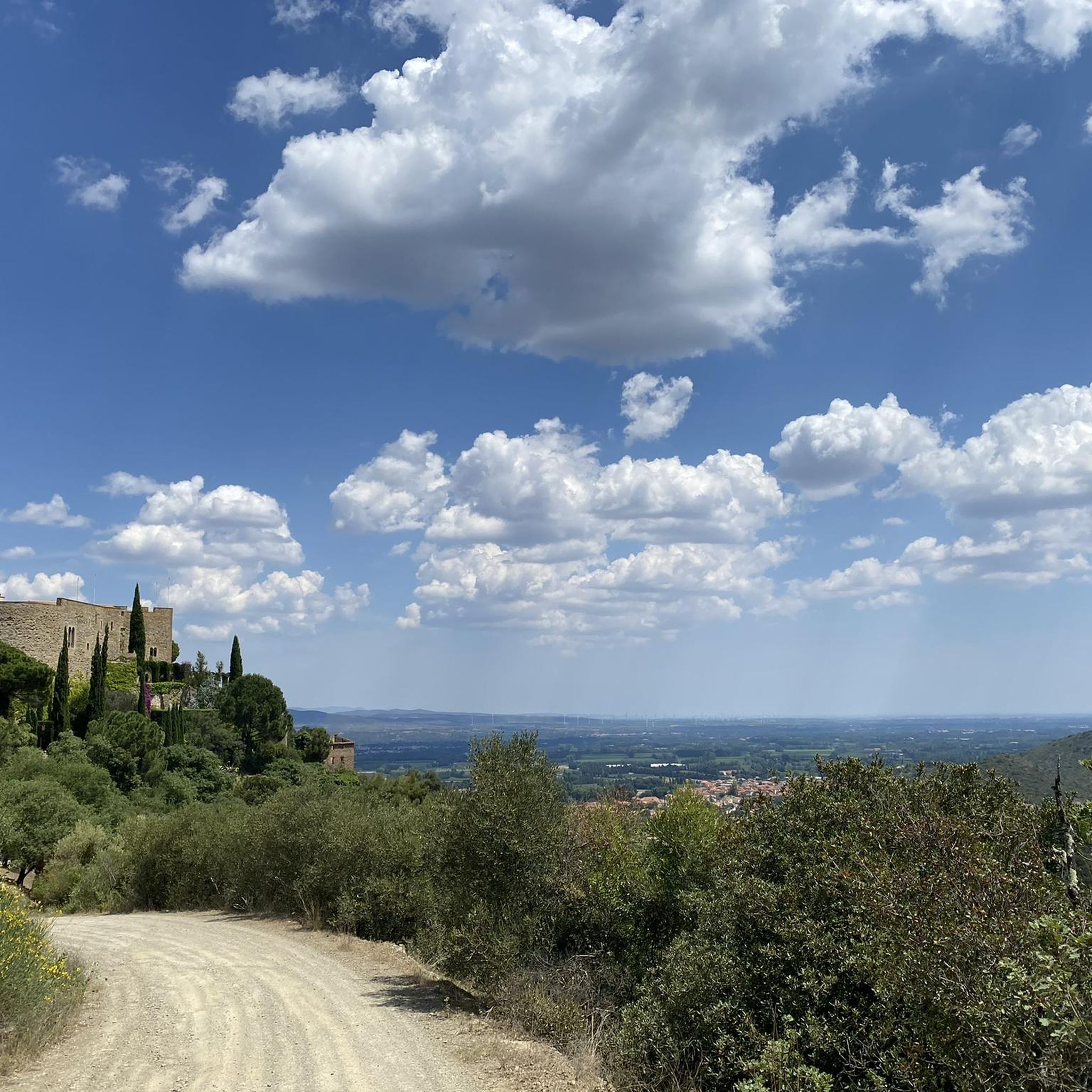
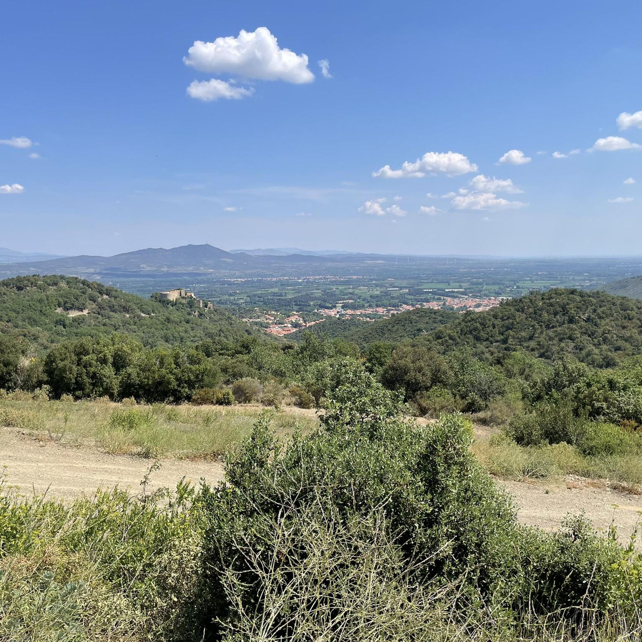
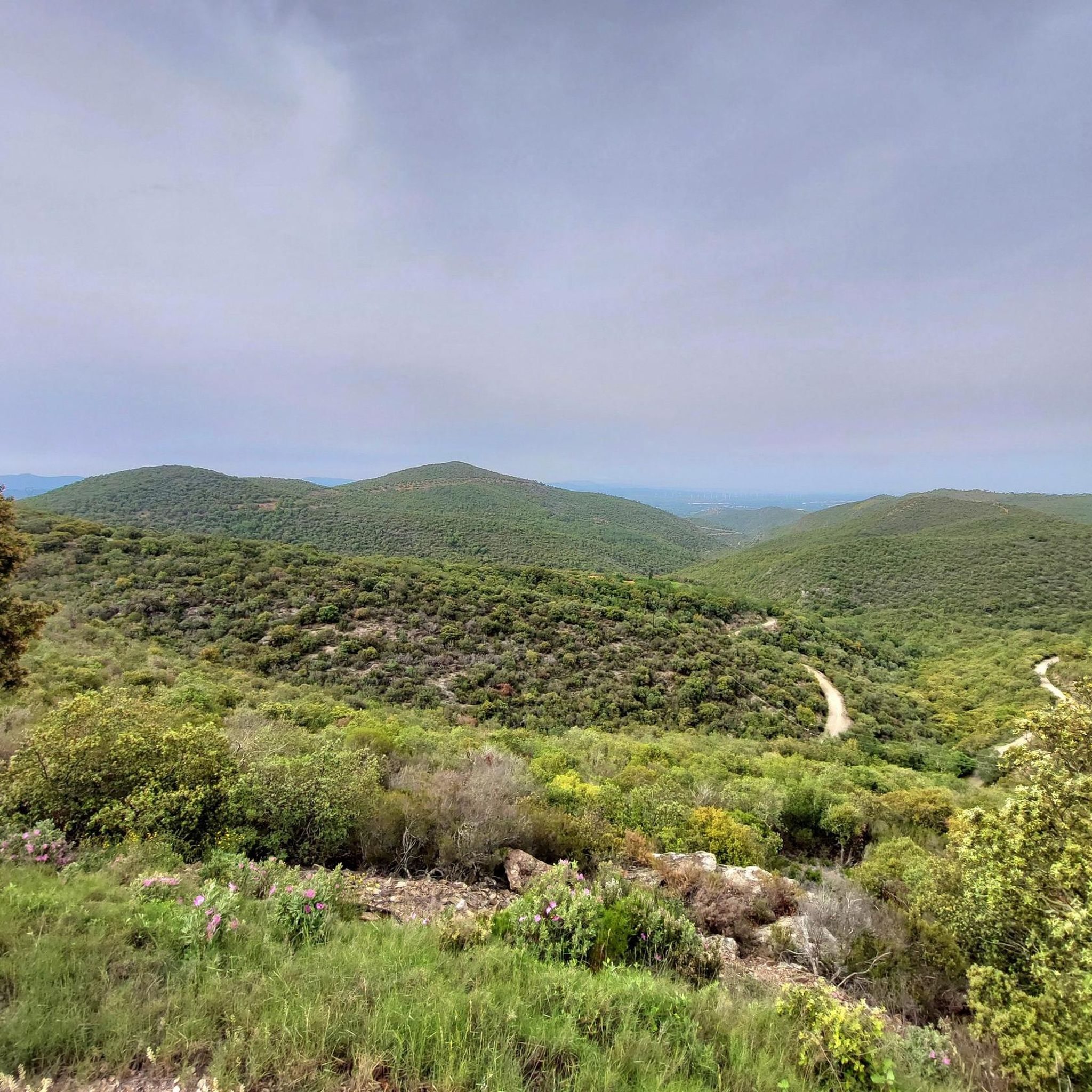
Hiking around Saint-Michel-De-Llotes offers diverse landscapes characterized by garrigue, forests of green oaks, and spectacular rock formations. The region provides views over the Riberal, the Roussillon Plain, and the Côte Vermeille, with the majestic Canigou massif often visible. Hikers can explore a blend of natural environments, including monumental piles of rounded stones amidst broom and Montpellier cistus. The terrain varies from gentle paths to more rugged areas, suitable for different hiking preferences.
Best hiking trails around Saint-Michel-De-Llotes
- The most popular…
Last updated: July 4, 2026
4.8
(62)
693
hikers
Easy hike. Great for any fitness level. Easily-accessible paths. Suitable for all skill levels.
4.5
(32)
90
hikers
15.9km
04:24
260m
260m
Moderate hike. Good fitness required. Easily-accessible paths. Suitable for all skill levels.

Sign up for free
4.7
(38)
43
hikers
8.09km
02:20
180m
190m
Moderate hike. Good fitness required. Easily-accessible paths. Suitable for all skill levels.
5.0
(6)
48
hikers
Moderate hike. Good fitness required. Easily-accessible paths. Suitable for all skill levels.
5.0
(2)
27
hikers
8.71km
02:15
40m
40m
Moderate hike. Good fitness required. Easily-accessible paths. Suitable for all skill levels.
Get access to more routes and recommendations from other explorers.
Sign up for free
Already have an account?
Our route recommendations are based on thousands of hikes, rides, and runs completed by other people on komoot.
Start today with a free account
Your next adventure awaits.
Login or Signup

Tips from the Community

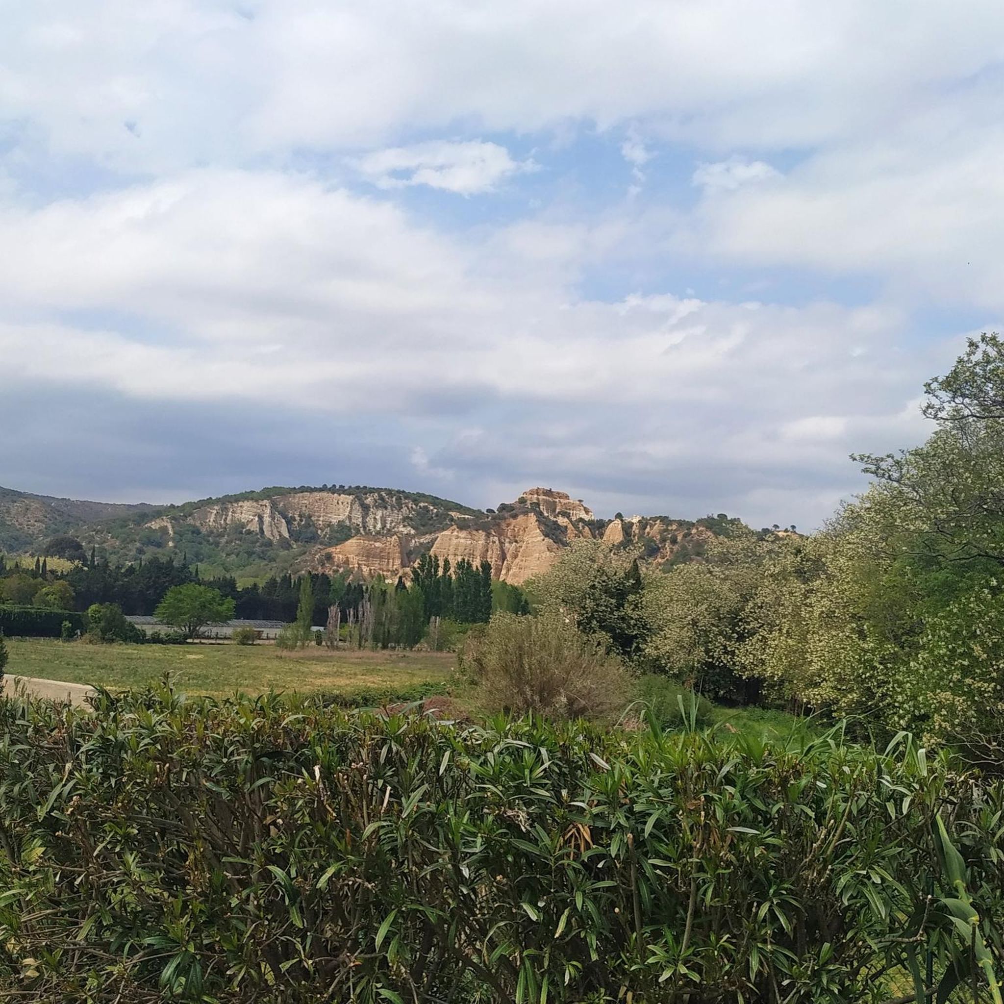
A fascinating landscape shaped by erosion, it offers magnificent views of the eastern Pyrenees with its highest peak, Canigou, at 2784 m.
2
0

Small park just a stone's throw away for a snack ✅
0
0
Magnificent view of an ancient aqueduct
0
0

There is much to read about this landscape, formed by erosion over 50 million years, but you simply have to see it for yourself, it is so beautiful and unique.
7
0
A unique place in France, a landscape of fairy chimneys with a fragile, ephemeral beauty. It shows the cliffs of sand and clay, patiently chiseled by the rain. Erosion has worked like an artist
9
0
A unique place in France, a landscape of fairy chimneys with a fragile, ephemeral beauty. It shows cliffs of sand and clay, patiently chiseled by the rain. Erosion has worked like an artist.
6
0
Frequently Asked Questions
How many hiking trails are available around Saint-Michel-De-Llotes?
There are nearly 180 hiking trails around Saint-Michel-De-Llotes, offering a wide range of options for different skill levels and preferences. You'll find everything from easy strolls to more challenging routes through varied landscapes.
What kind of terrain can I expect on hikes near Saint-Michel-De-Llotes?
The terrain around Saint-Michel-De-Llotes is quite diverse. You'll encounter garrigue, green oak forests, and spectacular rock formations. The region features considerable elevation changes, with paths ranging from gentle to rugged, including 'grosses côtes' (big climbs), 'terribles descentes' (terrible descents), steps, and pebbles, providing engaging hiking experiences.
Are there any easy hiking trails suitable for beginners or casual walkers?
Yes, Saint-Michel-De-Llotes offers over 60 easy hiking trails. A great option is the Fairy Chimneys – The Organ Pipes of Ille-sur-Têt loop from Ille-sur-Têt, an easy 6.6 km path that explores unique rock formations.
What are some notable natural features or landmarks to see while hiking?
Hikers can explore several unique natural features. The Organ Pipes of Ille-sur-Têt and the Fairy Chimneys are remarkable geological formations. You might also encounter the majestic Mount Canigou in the distance, which significantly shapes the local landscape.
Are there any circular walks available in the area?
Yes, many trails around Saint-Michel-De-Llotes are circular. For example, the Ancient Church of Casenoves – En Labau Aqueduct Bridge loop from Ille-sur-Têt is a moderate 15.7 km loop featuring historical sites and an aqueduct. Another moderate option is the Magnificent church – Ancient Church of Casenoves loop from Ille-sur-Têt, an 8.1 km trail through varied landscapes.
What do other hikers say about the trails in Saint-Michel-De-Llotes?
The hiking trails in Saint-Michel-De-Llotes are highly regarded by the komoot community, holding an average rating of 4.5 stars from nearly 1,000 reviews. Hikers often praise the diverse landscapes, from garrigue to green oak forests, and the spectacular rock formations like the Organ Pipes of Ille-sur-Têt.
Are there any historical or cultural sites accessible via hiking trails?
Absolutely. The region is rich in history. You can explore sites like the ancient church of Casenoves, which is part of the Ancient Church of Casenoves – En Labau Aqueduct Bridge loop from Ille-sur-Têt. The nearby villages of Castelnou, Eus, and Villefranche-de-Conflent also offer charming streets and fortified ancient settings to explore.
Can I find trails that lead to lakes or water features?
Yes, the area around Saint-Michel-De-Llotes features several beautiful lakes. While not directly on every hiking trail, you can find routes that offer views of or access to lakes such as Escoumes Lake and Lake Vinça. These can be great spots to relax after a hike.
What is the best time of year to go hiking in Saint-Michel-De-Llotes?
The region's climate makes it suitable for hiking across multiple seasons. Spring and autumn generally offer pleasant temperatures and vibrant scenery, with wildflowers blooming or autumn foliage. Summers can be warm, so early morning or late afternoon hikes are recommended. Winter hiking is also possible, especially at lower elevations, offering crisp air and clear views.
Are there any challenging hikes for experienced trekkers?
Yes, for those seeking a greater challenge, there are 11 difficult routes around Saint-Michel-De-Llotes. These trails often involve significant elevation gains and rugged terrain, sometimes requiring very good fitness and sure-footedness. They offer rewarding panoramic views, often including the majestic Mount Canigou.
Are there any specific routes that feature aqueducts or bridges?
Yes, you can find routes that incorporate interesting architectural features. The Brug over "la Têt – En Labau Aqueduct Bridge loop from Ille-sur-Têt is a moderate 8.8 km hike that includes an aqueduct bridge, offering a blend of natural beauty and historical engineering.
Most popular routes around Saint-Michel-De-Llotes
Most popular attractions around Saint-Michel-De-Llotes

Get inspired with the komoot mobile app


Explore more
Browse the best Hikes in other regions.
