The best mountain hikes around Betpouey
4.8
(25)
122
hikers
12
hikes
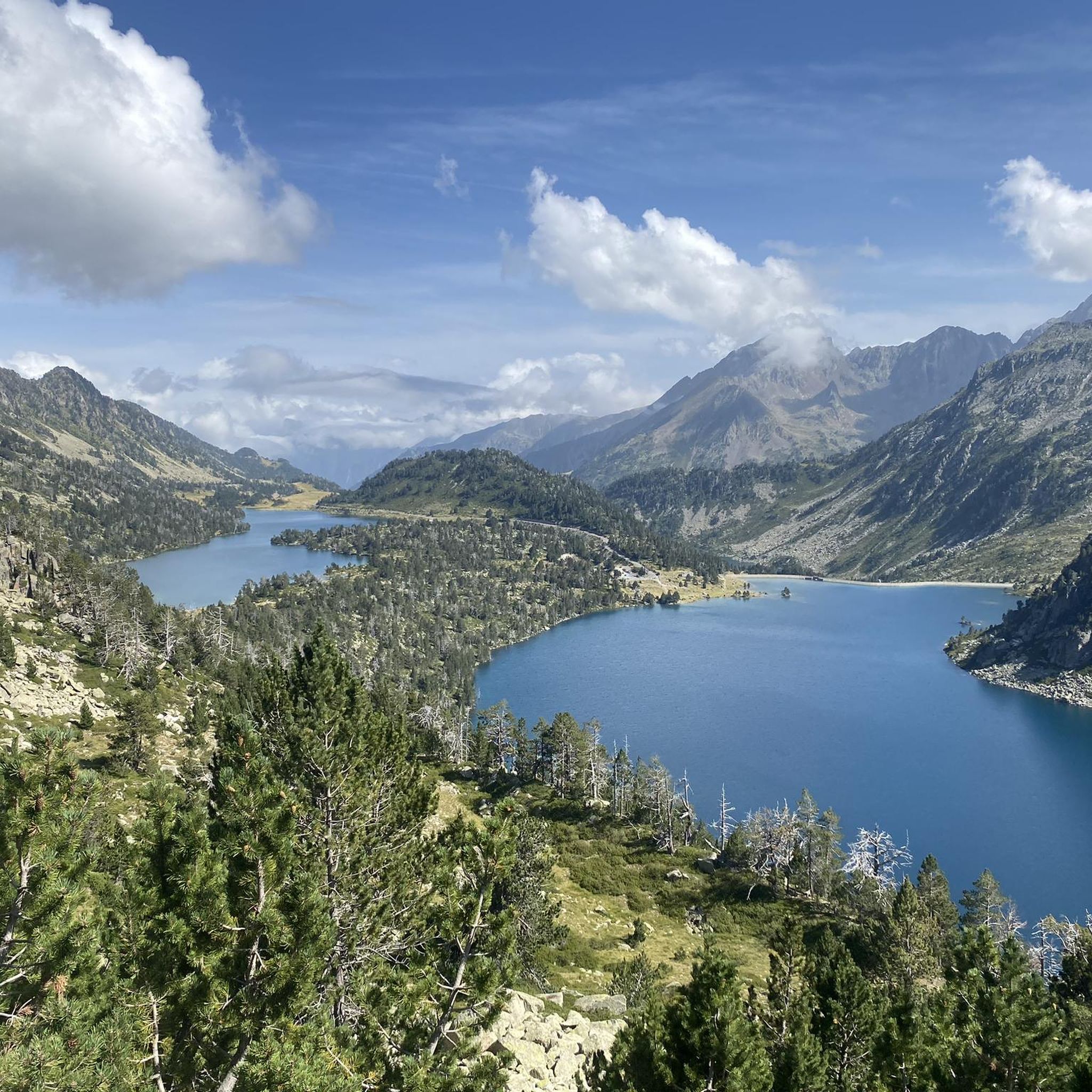
Mountaineering routes Betpouey are situated in the Hautes-Pyrénées, offering access to the diverse landscapes of the Pyrenees National Park. The region is characterized by significant peaks, high-altitude lakes, and glacial cirques, providing varied terrain for mountaineering. This area features a mix of verdant valleys, dense forests, and exposed alpine environments, with elevations reaching over 3,000 meters.
Best mountaineering routes around Betpouey
- The most popular mountaineering route is Col de Sencours loop from Col du Tourmalet, a 8.1 miles (13.0…
Last updated: August 27, 2026
5.0
(8)
36
hikers
Moderate mountaineering route. Good fitness required. Easily-accessible paths. Suitable for all skill levels.
14
hikers
16.6km
05:44
850m
850m
Hard mountaineering route. Very good fitness required. Mostly accessible paths. Sure-footedness required.

Sign up for free
4.8
(4)
8
hikers
8.69km
03:51
580m
580m
Moderate mountaineering route. Good fitness required. Mostly accessible paths. Sure-footedness required.
4.0
(1)
7
hikers
13.4km
05:03
660m
670m
Hard mountaineering route. Very good fitness required. Mostly accessible paths. Sure-footedness required.
5.0
(1)
7
hikers
Hard mountaineering route. Very good fitness required. Sure-footedness, sturdy shoes and alpine experience required.
Get access to more routes and recommendations from other explorers.
Sign up for free
Already have an account?
Our route recommendations are based on thousands of hikes, rides, and runs completed by other people on komoot.
Start today with a free account
Your next adventure awaits.
Login or Signup

Tips from the Community

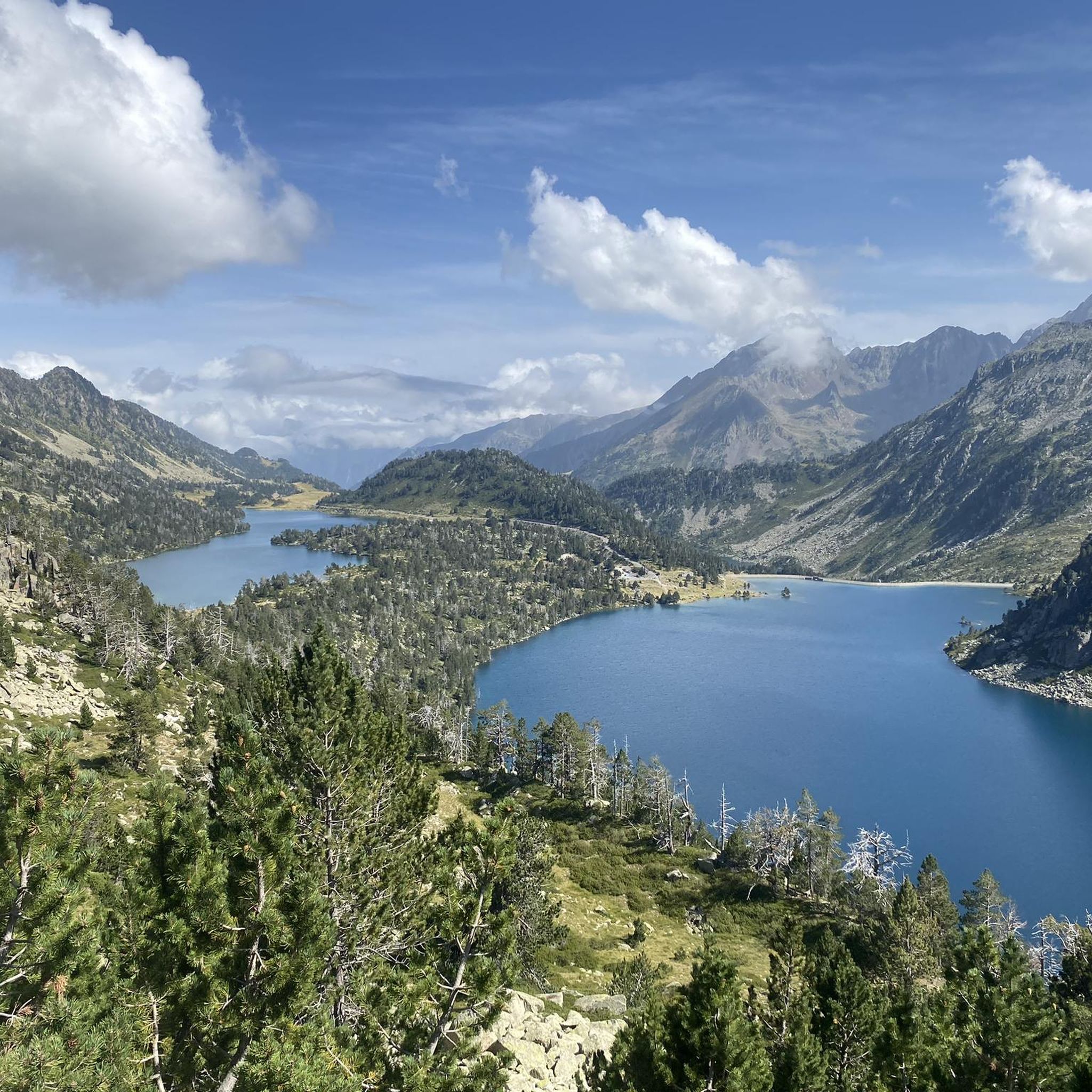
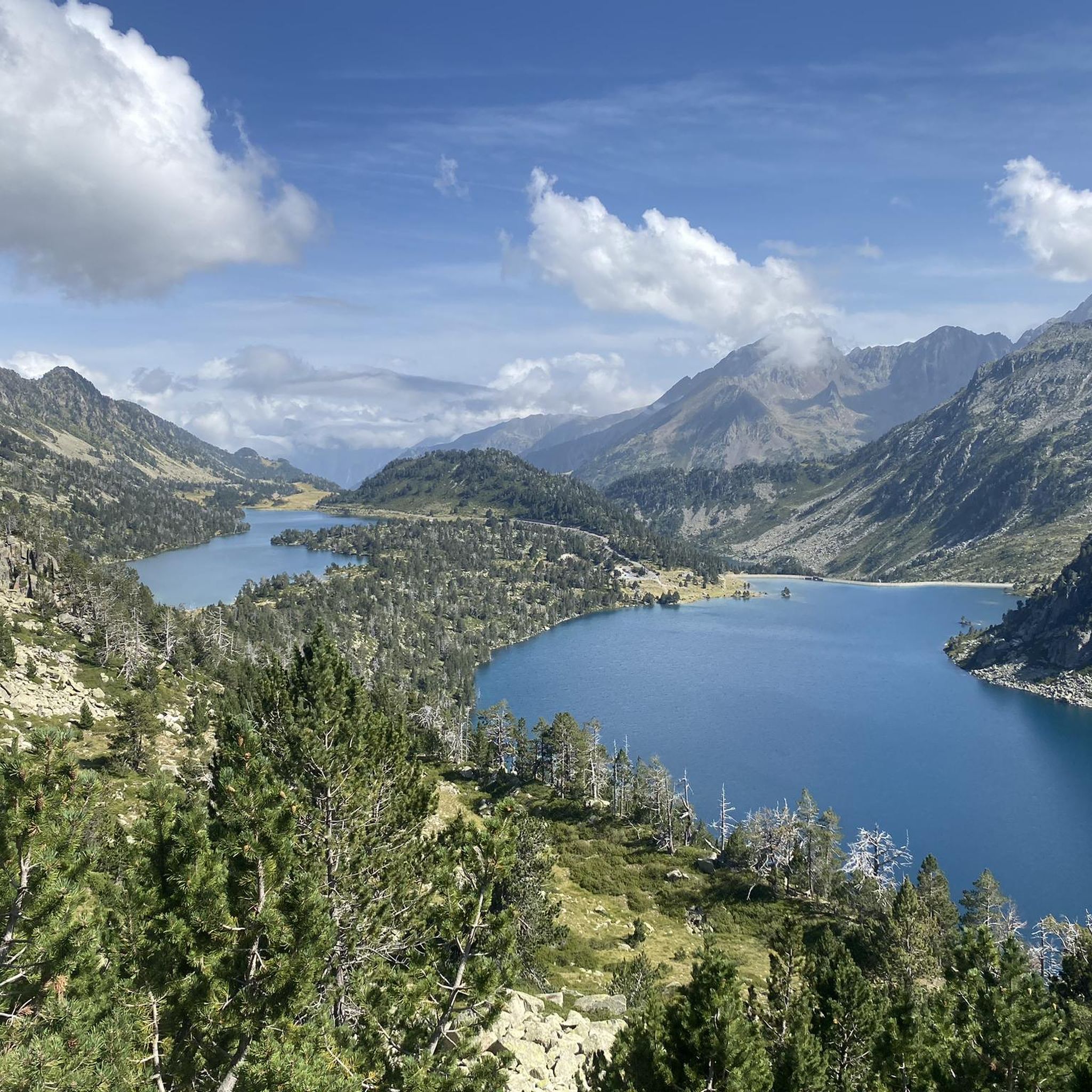
360-degree view over the Ayguecluze valley and the Deth Coubous valley
0
0

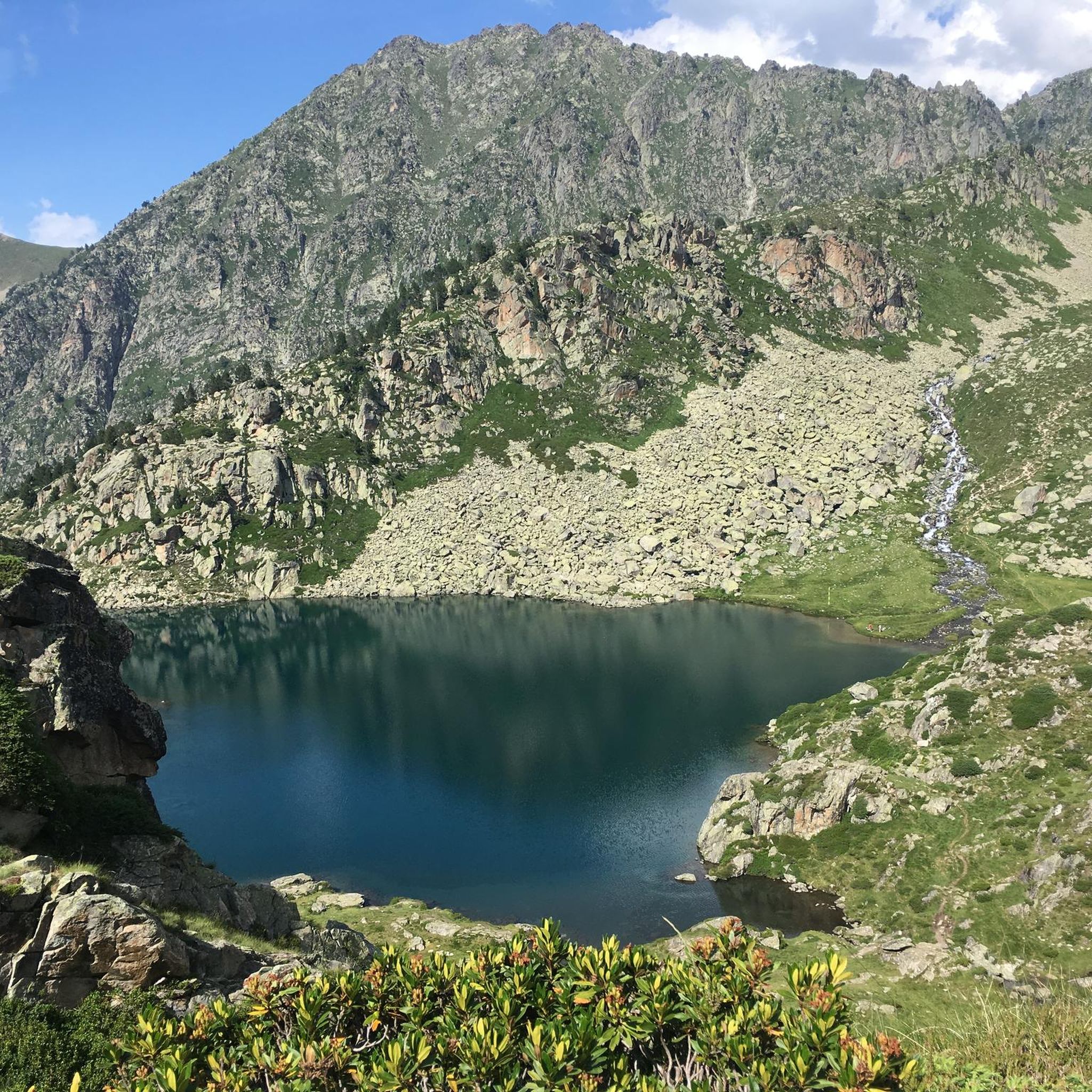
On the climb to Cap d'Long, a detour to this lake is highly recommended. The climb and the scenery above are even more beautiful than the first.
0
0

Magnificent lake with a path allowing you to admire it from all angles.
0
0
Large, welcoming refuge. An invigorating, cool shower during our stay. Very good meal and a great atmosphere in the evening. The caretaker was attentive. Maps, guidebooks, books, and board games are available in the common room.
1
0

An amazing view, with the added bonus of some spectacular fine dining (book in advance for dining!)
0
0

Large car park at the foot of the Tourmalet, there is a bike park here and there are opportunities to walk to the Néouveille lakes.
0
0

Ascent to the summit on foot; no cable car access until 2027. No access to the restaurant or restrooms, but drinking water is available.
0
1

Do it in the evening for the sunset, it's magnificent or conversely to admire the sunrise. The night of stars is magnificent! 🤩
0
1
Frequently Asked Questions
How many mountaineering routes are available around Betpouey?
There are 15 mountaineering routes available around Betpouey, offering a range of difficulties from moderate to difficult.
Are there any easier mountaineering routes for beginners in Betpouey?
While Betpouey is known for its more challenging terrain, there are 6 moderate routes that could be suitable for beginners with some prior experience and good physical condition. For example, the Col de Sencours loop from Col du Tourmalet is a moderate option that offers stunning views without extreme technical demands.
What are some challenging mountaineering routes for experienced climbers in Betpouey?
For experienced mountaineers seeking a challenge, Betpouey offers 9 difficult routes. A notable option is the Néouvielle Peak loop from Réserve naturelle du Néouvielle, which involves significant elevation gain and rewards with breathtaking views from the prominent Néouvielle Peak. Another demanding route is the Lac Dets Coubous – Col de Madamète loop from Tournaboup, traversing high mountain passes and glacial lakes.
Can I find circular mountaineering routes in the Betpouey area?
Yes, many of the mountaineering routes around Betpouey are designed as loops, allowing you to start and end at the same point. Examples include the Col de Sencours loop from Col du Tourmalet and the Néouvielle Peak loop from Réserve naturelle du Néouvielle, providing a convenient way to explore the diverse landscapes.
What natural features or landmarks can I expect to see on these routes?
The mountaineering routes around Betpouey are rich in natural beauty. You'll encounter the impressive Pyrenean mountain range, including significant peaks like Pic de Néouvielle and Mount Agut de Betpouey. The region is also dotted with picturesque high-altitude lakes such as Lake Orédon, Lac d'Aubert, and Lake Aumar, as well as glacial cirques and verdant forests.
Are there any specific lakes or waterfalls I might encounter?
Absolutely. The Pyrenees are known for their stunning water features. You might come across the magnificent Lac Bleu, Lac d'Ourrec, and Lac Vert. The Lac d'Aubert is another artificial lake at 2,148 meters, reflecting the Hourquette d'Aubert. The famous Cirque de Gavarnie, with its impressive waterfall, is also within reach, though not directly on these specific routes.
What is the best time of year for mountaineering in Betpouey?
The best time for mountaineering in Betpouey generally spans from late spring to early autumn (June to September) when the weather is more stable and high-altitude trails are clear of snow. However, the region offers diverse conditions, with some routes like the ascent of Mount Agut de Betpouey being popular for ski touring and snowshoeing in winter.
What are the conditions like for winter mountaineering in Betpouey?
Winter mountaineering in Betpouey can be challenging, with snowy conditions and colder temperatures. Routes like the ascent of Mount Agut de Betpouey are considered classic winter excursions for ski touring and snowshoeing, offering breathtaking views. Proper gear, experience, and awareness of avalanche risks are essential for winter ascents.
Is it possible to spot wildlife while mountaineering in Betpouey?
Yes, Betpouey is located within the Pyrenees National Park and is part of a Natura 2000 site, supporting a rich diversity of flora and fauna. Keep an eye out for various species of birds, chamois, and marmots, especially in the higher alpine meadows and forests.
What do other mountaineers enjoy most about the routes in Betpouey?
The mountaineering routes around Betpouey are highly rated by the komoot community, with an average score of 4.9 stars from 29 reviews. Mountaineers often praise the diverse terrain, from verdant valleys to high-altitude peaks, and the stunning panoramic views, especially from summits like Pic de Néouvielle and Mount Agut de Betpouey. The presence of picturesque lakes and glacial cirques also adds to the appeal.
Are there any huts or refuges along the mountaineering routes for overnight stays or breaks?
Yes, the region around Betpouey offers several huts and refuges that can serve as resting points or overnight accommodations. Notable options include Bastan Refuge, Glère Refuge, and Refuge de Campana de Cloutou. These can be valuable for longer tours like the Lac det Mail – Lac de la Glère loop from Barèges.
Where can I find information about permits or regulations for mountaineering in the Pyrenees National Park?
As Betpouey is close to the Pyrenees National Park, it's advisable to check for any specific regulations or permits required, especially for certain protected areas or during specific seasons. For official information regarding park rules, conservation efforts, and any necessary permits, it's best to consult the official Pyrenees National Park website or local information centers in villages like Luz-Saint-Sauveur.
Are there parking facilities available at the trailheads for these routes?
Many of the starting points for mountaineering routes around Betpouey, especially those near popular passes like Col du Tourmalet or villages like Barèges, typically have designated parking areas. However, availability can vary, particularly during peak season. It's recommended to arrive early or check local information for specific trailhead parking details.
Most popular attractions around Betpouey

Get inspired with the komoot mobile app


Explore more
Browse the best Mountain Hikes & Routes in other regions.
