The best walks and hikes around Écury-Le-Repos
4.6
(19)
131
hikers
12
hikes
Hiking around Écury-Le-Repos offers routes through the gently rolling landscapes of the Champagne region. The terrain features open fields, vineyards, and small woodlands, with modest elevation changes. Trails often lead to local viewpoints and historical markers, providing varied scenery for outdoor exploration.
Best hiking trails around Écury-Le-Repos
- The most popular hiking route is Mont Aimé Viewpoint – Mont-Aimé loop from Bergères-lès-Vertus, an easy 3.7 miles (6.0 km) trail that takes 1 hour 40 minutes to complete. This path offers…
Last updated: May 12, 2026
2
hikers
21.6km
05:44
210m
210m
Hard hike. Very good fitness required. Easily-accessible paths. Suitable for all skill levels.
7
hikers
6.04km
01:41
110m
110m
Easy hike. Great for any fitness level. Easily-accessible paths. Suitable for all skill levels.

Sign up for free
4.0
(1)
9
hikers
10.9km
03:01
180m
180m
Moderate hike. Good fitness required. Easily-accessible paths. Suitable for all skill levels.
5.0
(4)
11
hikers
8.37km
02:16
120m
120m
Moderate hike. Good fitness required. Easily-accessible paths. Suitable for all skill levels.
5.0
(1)
4
hikers
5.56km
01:33
100m
100m
Easy hike. Great for any fitness level. Easily-accessible paths. Suitable for all skill levels.
Get access to more routes and recommendations from other explorers.
Sign up for free
Already have an account?
Our route recommendations are based on thousands of hikes, rides, and runs completed by other people on komoot.
Start today with a free account
Your next adventure awaits.
Login or Signup
Popular around Écury-Le-Repos

Tips from the Community

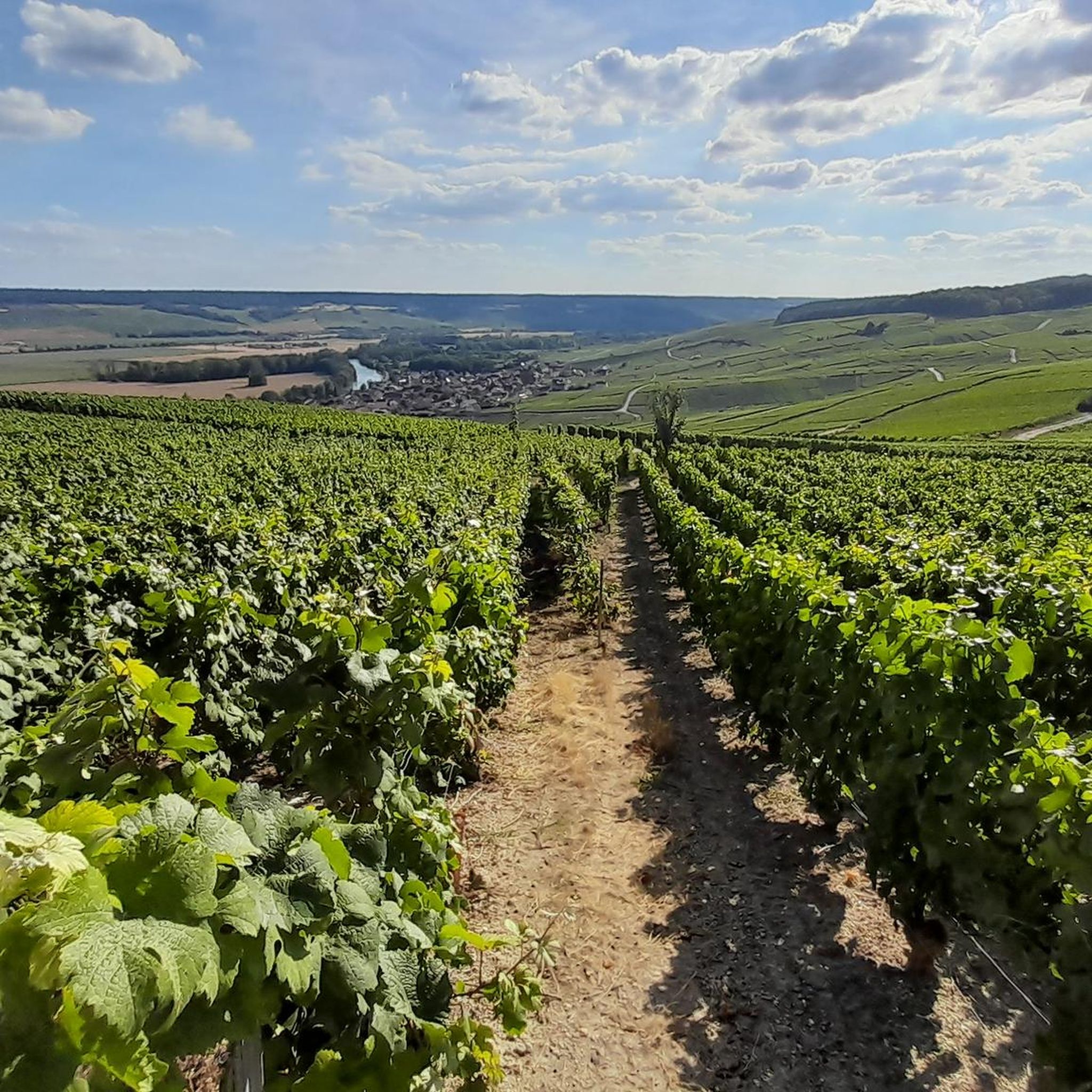
Beautiful view of Champagne, some passages at 13/14°.
0
0

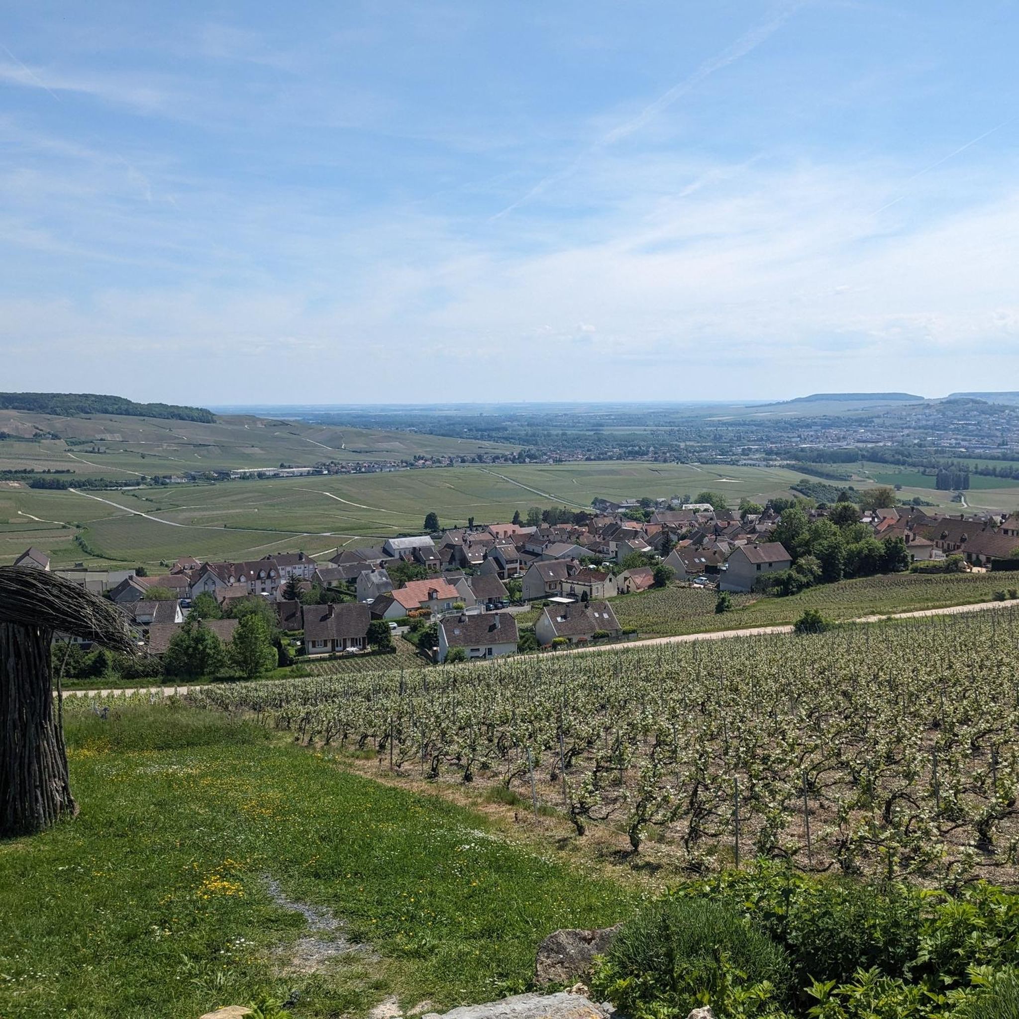
A hill with an altitude of 240 meters. It offers beautiful panoramic views of the Côte des Blancs vineyards, the surrounding villages and the fields.
0
0
Very beautiful Romanesque church. Very beautiful organ. The most spectacular are the crypts which you should not hesitate to discover: they are very well preserved. A very beautiful room is dedicated to Saint Anne. You can also discover an ancient sarcophagus. You can also see swans in the pond in front of the church.
1
1
It is a Gothic church in the Romanesque style, it has been classified as a Historic Monument since July 30, 1934. The beginning of the construction dates from the 12th century.
1
0
Menhir is a monument formed by a standing stone. This menhir is isolated and dates from the Neolithic period. It is classified as a historical monument and seems to indicate an ossuary located nearby (according to the anthropological society of Paris).
0
0
Frequently Asked Questions
How many hiking trails are available around Écury-Le-Repos?
There are over 10 hiking trails around Écury-Le-Repos, offering a variety of options for different skill levels. The komoot community has explored these routes over 100 times, providing an average rating of 4.7 stars.
Are there easy hiking trails suitable for beginners or families in Écury-Le-Repos?
Yes, Écury-Le-Repos offers several easy trails. There are 7 easy routes available, perfect for a relaxed outing. One popular choice is the Mont Aimé Viewpoint – Mont-Aimé loop from Bergères-lès-Vertus, an easy 3.7-mile (6.0 km) trail that takes about 1 hour 40 minutes to complete.
What kind of terrain can I expect on hikes around Écury-Le-Repos?
The terrain around Écury-Le-Repos features the gently rolling landscapes typical of the Champagne region. You'll encounter open fields, vineyards, and small woodlands, with modest elevation changes. Trails often lead to local viewpoints and historical markers.
Are there any challenging hikes in the Écury-Le-Repos area?
For those seeking a more challenging experience, there is at least one difficult route available. The Loop around Vert-Toulon — Menhir de l'étang de Chénevry is a 13.4-mile (21.6 km) trail that leads through varied terrain and typically takes about 5 hours 43 minutes to complete.
Are there any circular walks available near Écury-Le-Repos?
Yes, many of the trails around Écury-Le-Repos are circular, offering convenient starting and ending points. For example, the Aviz loop from Bergères-lès-Vertus is a moderate 5.2-mile (8.4 km) path that winds through the local countryside.
What do other hikers enjoy most about hiking in Écury-Le-Repos?
The area is highly rated by the komoot community, with an average score of 4.7 stars from over 17 reviews. Hikers often praise the varied terrain, which includes rolling hills, agricultural fields, and small forest sections, as well as the scenic viewpoints.
Are there any trails that offer good viewpoints in Écury-Le-Repos?
Yes, several trails provide excellent viewpoints. The Mont Aimé Viewpoint – Mont-Aimé loop from Bergères-lès-Vertus is specifically known for its views from Mont Aimé. Another route, View of Mont Aimée – Aviz loop from Bergères-lès-Vertus, also offers scenic vistas of Mont Aimée.
What is the typical duration for hikes around Écury-Le-Repos?
Hike durations vary depending on the trail's length and difficulty. Easy routes like the Mont Aimé Viewpoint – Mont-Aimé loop can be completed in under two hours, while longer, more challenging trails such as the Loop around Vert-Toulon can take over five hours.
Are there any trails that pass by interesting historical markers or natural features?
Yes, some routes incorporate historical markers and natural features. The Loop around Vert-Toulon, for instance, leads through varied terrain including a pond and passes by the Menhir de l'étang de Chénevry, a standing stone.
Are there any moderate difficulty trails for a longer walk?
Yes, there are 4 moderate trails available. The Bat cave – Eglise St. Martin and Swan loop from Vertus is a moderate 6.8-mile (10.9 km) route that takes around 3 hours to complete, offering a good option for a longer, yet not overly strenuous, walk.
Most popular routes around Écury-Le-Repos

Get inspired with the komoot mobile app


Explore more
Browse the best Hikes in other regions.
