The best walks and hikes around Mont-Le-Vignoble
4.4
(213)
1,173
hikers
112
hikes
Hiking around Mont-Le-Vignoble offers routes through vineyards, wooded plateaus, and rolling hills. The landscape is characterized by the "Côtes de Toul" vineyard region, with the village situated on a hillside overlooked by a wooded plateau at approximately 380 meters altitude. The territory is traversed by the Saussy and Nouelle streams, contributing to the local ecosystem. This geographical diversity provides varied scenery for exploration.
Best hiking trails around Mont-Le-Vignoble
- The most popular hiking route is Well Cave – Sainte-Reine Cave loop…
Last updated: May 25, 2026
4.0
(16)
61
hikers
12.2km
03:12
90m
90m
Moderate hike. Good fitness required. Easily-accessible paths. Suitable for all skill levels.
4.7
(3)
22
hikers
12.5km
03:19
120m
120m
Moderate hike. Good fitness required. Easily-accessible paths. Suitable for all skill levels.

Sign up for free
4.0
(3)
28
hikers
6.60km
01:41
20m
20m
Easy hike. Great for any fitness level. Easily-accessible paths. Suitable for all skill levels.
5.0
(2)
29
hikers
4.99km
01:16
10m
10m
Easy hike. Great for any fitness level. Easily-accessible paths. Suitable for all skill levels.
4.7
(3)
9
hikers
14.2km
03:56
240m
240m
Moderate hike. Good fitness required. Easily-accessible paths. Suitable for all skill levels.
Get access to more routes and recommendations from other explorers.
Sign up for free
Already have an account?
Our route recommendations are based on thousands of hikes, rides, and runs completed by other people on komoot.
Start today with a free account
Your next adventure awaits.
Login or Signup



Tips from the Community


From here you have a great view of the imposing cathedral of Toul.
1
0

Nice quiet place with cafes/restaurants.
2
0

One of the many caves in this Moselle valley. The cave is 370 meters long and 16 meters deep.
8
0

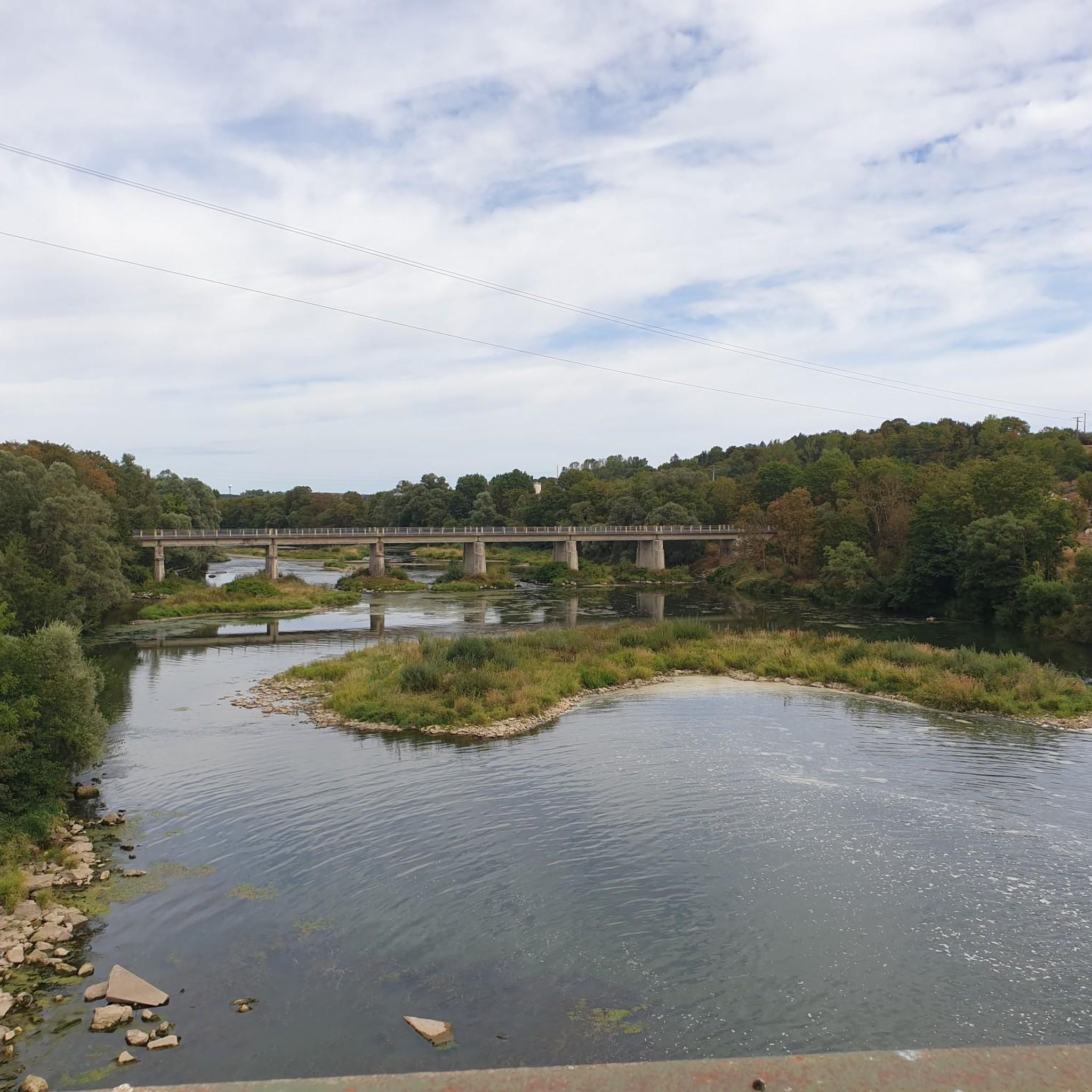
A little further towards the barrage you get a better impression of how powerful the river is here. With a bit of luck you can see cormorants.
3
0
In addition to the caves 'Grotte Sainte Reine' and 'Grotte de Sept Salles' in the immediate vicinity, there is another karst cave on the hiking trail.
5
1
The Sainte-Reine cave or Sainte-Reine hole is the second natural cavity in the department of Meurthe-et-Moselle in terms of known development and has been classified as a historic monument since 1910. It has several entrances classified under the general name of "Caves known as Trou de Sainte-Reine" and was originally part of an endokarst under the bottom of the Moselle valley.
3
0
Frequently Asked Questions
How many hiking trails are available in Mont-Le-Vignoble?
Mont-Le-Vignoble offers a wide selection of hiking trails, with over 100 routes available. These range from easy walks to more challenging hikes, catering to various fitness levels.
What kind of terrain can I expect when hiking in Mont-Le-Vignoble?
The landscape around Mont-Le-Vignoble is diverse, featuring picturesque vineyards, extensive wooded plateaus, and rolling hills. You'll also encounter natural water features like the Saussy and Nouelle streams, which contribute to the area's varied scenery.
What do other hikers say about the trails in Mont-Le-Vignoble?
The trails in Mont-Le-Vignoble are highly regarded by the komoot community, with an average rating of 4.4 stars from over 190 reviews. Hikers often praise the well-maintained paths and the beautiful views of the vineyards and forests.
Are there easy hiking trails suitable for beginners in Mont-Le-Vignoble?
Yes, there are plenty of easy hiking options. Approximately 45 of the trails are classified as easy, making them perfect for beginners or those looking for a relaxed stroll. An example is the Moselle Gate – Vauban Fortifications, Toul loop from Toul, which is an easy 4.1-mile route.
Are there challenging hikes in Mont-Le-Vignoble?
For those seeking a challenge, Mont-Le-Vignoble offers 14 difficult hiking routes. These trails typically feature more significant elevation changes and longer distances, providing a rewarding experience for experienced hikers.
Can I find circular hiking routes in Mont-Le-Vignoble?
Many of the hiking routes in Mont-Le-Vignoble are circular, allowing you to start and end at the same point. Popular circular options include the Well Cave – Sainte-Reine Cave loop from Pierre-la-Treiche and the Deuille de Crézilles loop from Crézilles.
Are there family-friendly hiking options in Mont-Le-Vignoble?
Yes, the region is well-suited for family outings. Many trails, particularly the easier ones, are suitable for families. The area's moderate elevation changes and picturesque scenery, such as the hillsides of Mont-le-Vignoble, make for enjoyable walks with children.
Are dogs allowed on the hiking trails in Mont-Le-Vignoble?
Generally, dogs are welcome on hiking trails in Mont-Le-Vignoble. However, it's always recommended to keep them on a leash, especially when passing through vineyards or near livestock, and to respect local signage regarding pet regulations.
What natural features or landmarks can I see while hiking in Mont-Le-Vignoble?
Hikers can enjoy stunning views of the "Côtes de Toul" vineyards, explore wooded plateaus, and follow the paths alongside the Saussy and Nouelle streams. You might also encounter the Lourdes Grotto, a notable natural gorge in the vicinity.
Are there any historical sites or points of interest near the hiking trails?
Absolutely. The region is rich in history. You can explore historical fortifications like the Vauban Fortifications in Toul. Other points of interest include Saint Stephen's Cathedral in Toul and the Fort de Villey-le-Sec.
What is the best time of year to go hiking in Mont-Le-Vignoble?
The best times to hike in Mont-Le-Vignoble are typically spring and autumn. Spring offers lush greenery and blooming vineyards, while autumn provides vibrant foliage and the grape harvest season. Summer can also be pleasant, but it's advisable to start early to avoid the midday heat.
Is parking available at the trailheads in Mont-Le-Vignoble?
While specific parking details vary by trailhead, most popular starting points for hikes in and around Mont-Le-Vignoble, especially in villages like Pierre-la-Treiche or Crézilles, offer designated parking areas. It's always a good idea to check local maps or komoot tour details for precise parking information.
How can I reach the hiking trails in Mont-Le-Vignoble using public transport?
Public transport options to Mont-Le-Vignoble are limited, as it is a rural commune. The nearest larger town with more extensive public transport links is Toul, approximately 8km away. From Toul, local bus services or taxis might connect to some of the villages near trailheads, but planning ahead is essential.
Most popular routes around Mont-Le-Vignoble
Most popular attractions around Mont-Le-Vignoble

Get inspired with the komoot mobile app


Explore more
Browse the best Hikes in other regions.
