The best running trails around Saint-Marsal
4.2
(51)
2,657
runners
144
runs
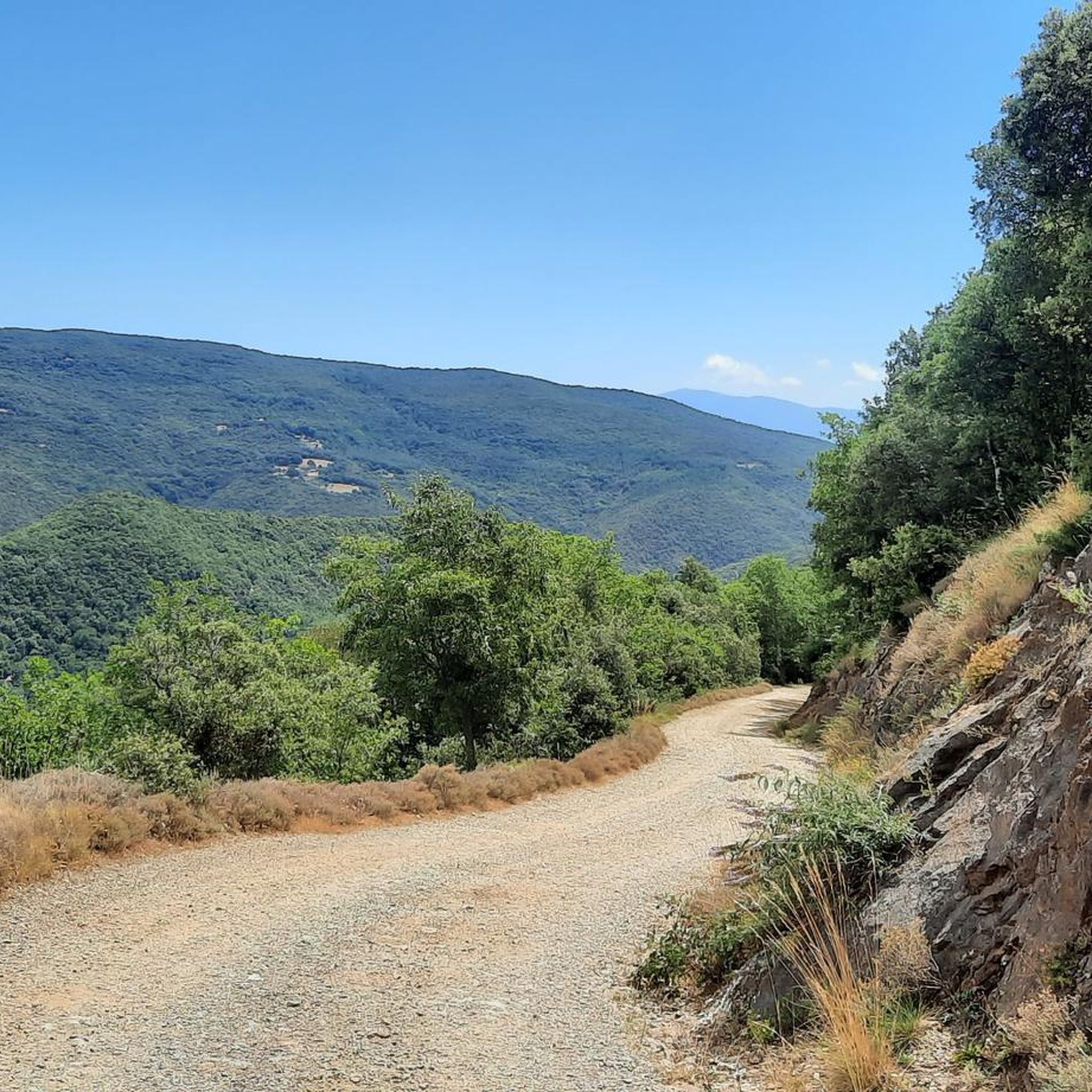
Jogging routes around Saint-Marsal offer a diverse range of terrains within the Pyrénées-Orientales department. The region is characterized by mountainous landscapes, including the lower slopes of prominent peaks, and dramatic gorges. Runners can explore a mix of open fields, gentle hills, and paths through forests and green valleys, providing varied environments for outdoor activity. This area provides routes with significant elevation changes as well as flatter sections along river greenways.
Best jogging routes around Saint-Marsal
- The most popular jogging route…
Last updated: July 12, 2026
54
runners
14.4km
01:32
180m
180m
Moderate run. Good fitness required. Mostly paved surfaces. Suitable for all skill levels.
5.0
(1)
19
runners
14.2km
02:00
710m
710m
Hard run. Very good fitness required. Mostly paved surfaces. Suitable for all skill levels.

Sign up for free
3.0
(1)
20
runners
Moderate run. Good fitness required. Mostly paved surfaces. Suitable for all skill levels.
5.0
(1)
16
runners
9.73km
01:09
190m
190m
Hard run. Good fitness required. Sure-footedness, sturdy shoes and alpine experience required.
14
runners
22.7km
02:57
820m
820m
Hard run. Very good fitness required. Sure-footedness, sturdy shoes and alpine experience required.
Get access to more routes and recommendations from other explorers.
Sign up for free
Already have an account?
Our route recommendations are based on thousands of hikes, rides, and runs completed by other people on komoot.
Start today with a free account
Your next adventure awaits.
Login or Signup


Tips from the Community

The Romanesque Priory of Serabonna (founded in 1082) is a masterpiece of sculpture. Good and evil clash on the capitals. The building materials, such as marble, slate, and iron, came from the surrounding area.
1
0

The linguistic proximity of the "Pont Eiffel", which spans the valley here, and the low mountain range "Eifel" in the far west of Germany is no coincidence: The family of the designer - whose world-famous Tower of Paris (named after its builder) is probably known to everyone - has German roots. The ancestors of the Eiffel Tower builder Gustave EIFFEL come from the Eifel town of Marmagen (in the Euskirchen district, North Rhine-Westphalia). The village square there - if you are interested, see the following hiking highlight https://www.komoot.com/de-de/highlight/1830307 - is named after him.
0
0

Old railway line along the Tech with a magnificent panorama of the Pyrenees.
1
1

The Tech River between Palalda and Reynès flows through a picturesque landscape in the Vallespir, a mountainous area of the Pyrénées-Orientales. This stretch of the river is known for its serenity and natural setting, with green mountains and Mediterranean forests on both sides.
2
0
For a moment on the bridge, you might like it.
1
0

Friends walkers, cyclists or hikers, you will find here a shaded picnic area and above all a refreshing water point!
0
0

The original construction of the bridge was two-story. The lower lane was for road traffic, the upper one for rail traffic. The bridge girder consisted of two massive metal girders in a truss construction. The span of the bridge is 60 m, the carriageway widths of the underpasses measure 8 m and 13.5 m.
11
0

Part of the cycle-track from Ceret to Amelie-les-Bains
0
0
Frequently Asked Questions
How many running routes are available around Saint-Marsal?
There are over 120 dedicated running routes around Saint-Marsal, offering a wide variety of terrains and distances. These include options ranging from easy paths to more challenging trails with significant elevation changes.
What types of terrain can I expect on jogging trails near Saint-Marsal?
Jogging trails near Saint-Marsal feature a diverse range of terrains. You'll find everything from gentle paths through open fields and green valleys to more challenging routes with significant elevation gain in mountainous areas. Many trails also follow scenic river greenways and wind through forests within the Pyrénées-Orientales department.
Are there any easy jogging routes suitable for beginners or a relaxed run?
Yes, while many routes are moderate to difficult, there are a few easier options. For instance, some sections along the Tech Greenway offer flatter, more accessible paths. Overall, there are 5 easy routes available, perfect for beginners or those looking for a less strenuous run.
What do other runners say about the trails in Saint-Marsal?
The running trails in Saint-Marsal are highly regarded by the komoot community, holding an average rating of 4.2 stars from over 40 reviews. Runners often praise the varied terrain, stunning natural landscapes, and the opportunity to explore both challenging mountain paths and serene river routes.
Can I find long-distance running trails around Saint-Marsal?
Absolutely. For a longer run, consider the Tech Greenway – Le Tech loop from Amélie-les-Bains-Palalda. This difficult 19.4 km (12.0 miles) path follows the scenic Tech Greenway, providing an excellent long-distance running experience alongside the river.
Are there any circular running routes in the area?
Yes, many routes are designed as loops. A popular moderate option is the Reynès Iron Bridge – Tech Greenway loop from Puig Llober, which is 8.6 km (5.3 miles) and takes you through river valleys and past a historic iron bridge. For a more challenging circular run, the Serradell Peak – Prieuré Serrabone loop from Boule-d'Amont offers 14.2 km (8.8 miles) with significant elevation gain and expansive mountain views.
What natural attractions or landmarks can I see while jogging near Saint-Marsal?
The region is rich in natural beauty. You can encounter dramatic geological features like the Gorges de la Fou (9 km away) or the unique rock formations of the Orgues d'Ille-sur-Tet (15 km away). The trails also offer views of prominent peaks like Pic du Canigou and Pic de Fontfrède, and you'll often run through mountain forests and green valleys within the Catalan Pyrenees Regional Nature Park.
Are there any historical or cultural points of interest near the running paths?
While jogging, you might pass by or be near several historical sites. The Col de la Brousse (860 m) and other mountain passes offer historical significance. The Batère Mountain Hut is also a notable point. The region is also home to historic villages like Castelnou and religious sites such as the Serrabone Priory (7.4 km away) and Abbaye Sainte Marie d'Arles (9.1 km away), which can be explored post-run.
Are there any routes that follow a river or offer waterside views?
Yes, several routes utilize the scenic river greenways. The Pedestrian bridge over the Tech river – Pirinexus le Tech loop from Amélie-les-Bains-Palalda is a moderate 10.58 km (6.6 miles) route that follows the Tech river, offering pleasant waterside views and a relatively flat profile.
What is the best season for running in Saint-Marsal?
Saint-Marsal offers good running conditions for much of the year. Spring and autumn provide pleasant temperatures and vibrant scenery, ideal for exploring the diverse landscapes. Summer can be warm, so early morning or late afternoon runs are recommended. Winter running is also possible, especially on lower elevation trails, though higher mountain routes may require more preparation due to snow or colder conditions.
Are there any routes that are particularly scenic or offer great viewpoints?
Many routes in Saint-Marsal are incredibly scenic. The Serradell Peak – Prieuré Serrabone loop from Boule-d'Amont is renowned for its expansive mountain views. Trails in the vicinity of Pic du Canigou also offer breathtaking vistas of the Pyrénées-Orientales landscape.
Are there options for more advanced or challenging running experiences?
Saint-Marsal is an excellent destination for advanced runners, with 66 difficult routes available. These often feature significant elevation gains and cover longer distances. The Pedestrian bridge over the Tech river loop from Amélie-les-Bains-Palalda, for example, is a challenging 9.73 km (6.0 miles) route with notable ascents, providing a good workout.
Most popular routes around Saint-Marsal
Most popular attractions around Saint-Marsal

Get inspired with the komoot mobile app


Explore more
Browse the best Running Trails & Routes in other regions.
