The best walks and hikes around L'Estréchure
4.4
(736)
4,282
hikers
170
hikes
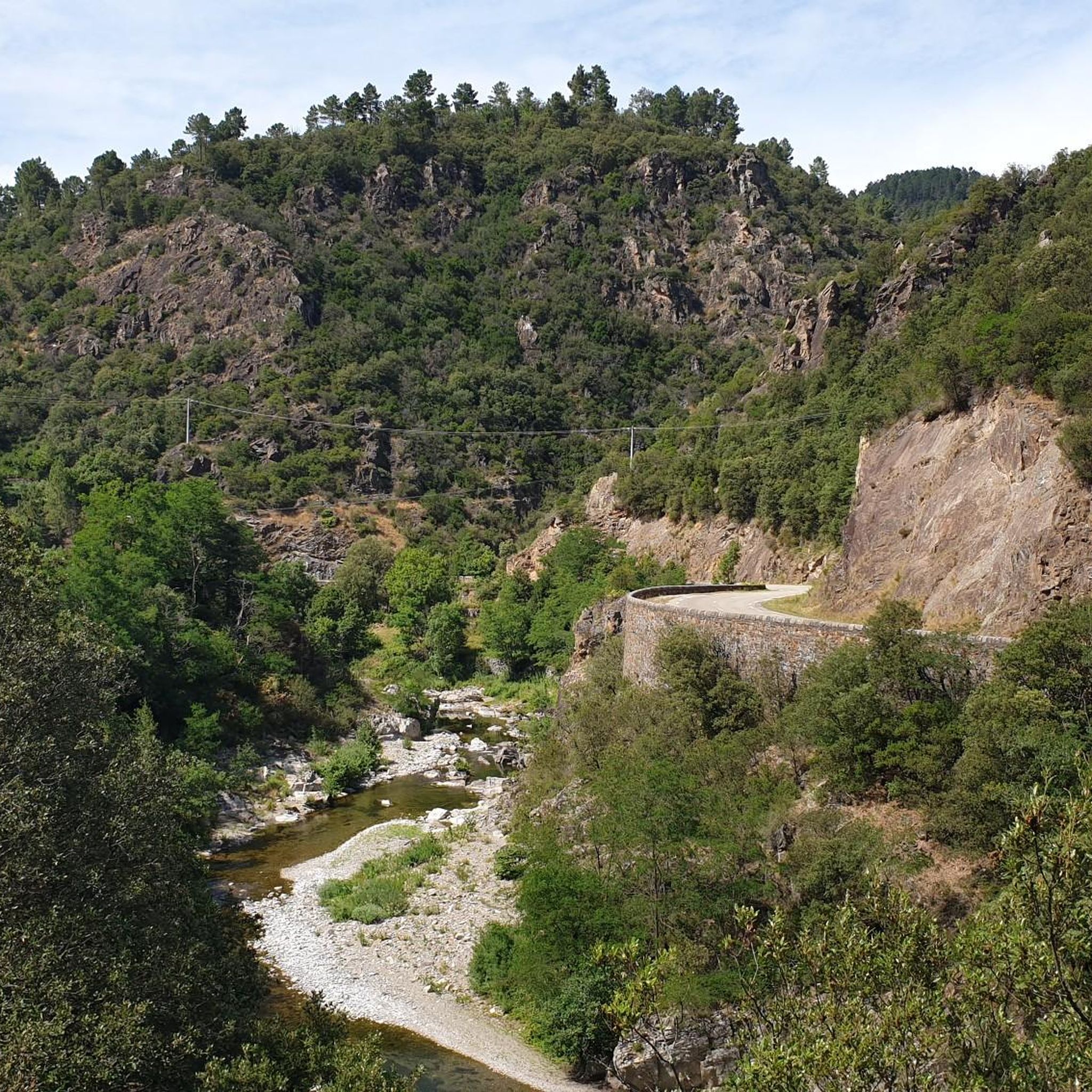
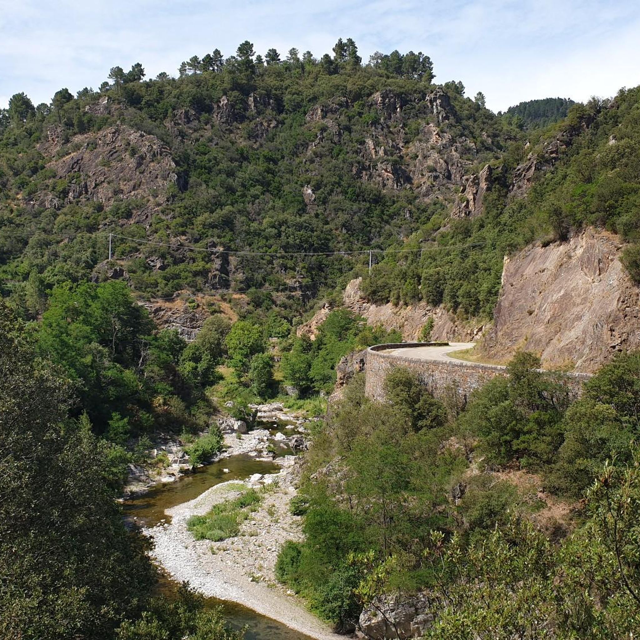
Hiking around L'Estréchure offers access to the diverse landscapes of the Cévennes region in Occitanie, France. The area is characterized by dense forests of chestnut, oak, and coniferous trees, particularly along trails that climb into the surrounding hills. The Gardon River flows through the village, providing riverside paths, while higher elevations near Mont Liron offer panoramic views. This varied topography includes gentle climbs and more challenging routes with significant elevation changes.
Best hiking trails around L'Estréchure
- The most popular hiking…
Last updated: May 12, 2026
4.8
(12)
53
hikers
14.8km
05:01
600m
600m
Hard hike. Very good fitness required. Mostly accessible paths. Sure-footedness required.
4.8
(6)
73
hikers
4.96km
01:51
260m
280m
Hard hike. Great for any fitness level. Sure-footedness, sturdy shoes and alpine experience required.

Sign up for free
4.8
(25)
101
hikers
14.7km
04:36
490m
490m
Moderate hike. Good fitness required. Mostly accessible paths. Sure-footedness required.
4.7
(3)
50
hikers
11.7km
04:12
570m
570m
Moderate hike. Good fitness required. Mostly accessible paths. Sure-footedness required.
5.0
(3)
24
hikers
12.2km
04:18
540m
540m
Moderate hike. Good fitness required. Mostly accessible paths. Sure-footedness required.
Get access to more routes and recommendations from other explorers.
Sign up for free
Already have an account?
Our route recommendations are based on thousands of hikes, rides, and runs completed by other people on komoot.
Start today with a free account
Your next adventure awaits.
Login or Signup

Tips from the Community

Michel Soubeyran, a sculptor based in Favières, has proposed a statue of a shepherd, practically life-size. The work is made of resin covered with bronze powder. The artist donated his work, and the town hall and the association provided the materials for its creation.
0
0
Very beautiful pass offering sumptuous viewpoints and starting points for walks.
0
0
Beautiful views of the Cévennes. Be careful, the rock is slippery when wet.
0
0

Caution: difficult hike for the last 2 kilometers.
0
0


Magnificent view of the Cévennes. Unforgettable.
0
0

Located in the Massif Central, the Col de l'Asclier is a privileged place for hikers and cyclists. Nestled at an altitude of 911 meters, it offers scenic trails and breathtaking scenery. You can enjoy panoramic views of the Gard mountains.
0
0

The Signal Saint-Pierre, a few hundred meters from the Col Saint-Pierre, allows you to contemplate the Cévennes at an altitude of 695m.
0
0
Frequently Asked Questions
How many hiking trails are there around L'Estréchure?
L'Estréchure offers a wide variety of hiking opportunities, with over 175 routes available. These trails range from easy riverside walks to more challenging mountain ascents within the Cévennes region.
Are there any easy or family-friendly hiking trails in L'Estréchure?
Yes, L'Estréchure provides options for all skill levels, including 33 easy routes. The old stagecoach path along the Gardon River is a pleasant, gentle walk suitable for families, offering views of Bussas castle. The region's diverse topography ensures there are trails for various fitness levels.
Are there any circular hiking routes in L'Estréchure?
Many trails around L'Estréchure are designed as loops, allowing you to start and end in the same location. For example, the View into the canyon – Pont de Soucy loop from L'Estréchure is a moderate 8 km route that offers scenic views.
What kind of natural landscapes can I expect to see while hiking in L'Estréchure?
The region is characterized by diverse landscapes. You'll find dense forests of chestnut, oak, and coniferous trees, especially on trails like the Sentier de Soult. The Gardon River offers pleasant riverside walks, while higher elevations near Mont Liron provide panoramic views over the Cévennes mountains. You can also discover serene waterfalls like La Cascade de l'Étoucy.
Are there any waterfalls or opportunities for wild swimming after a hike?
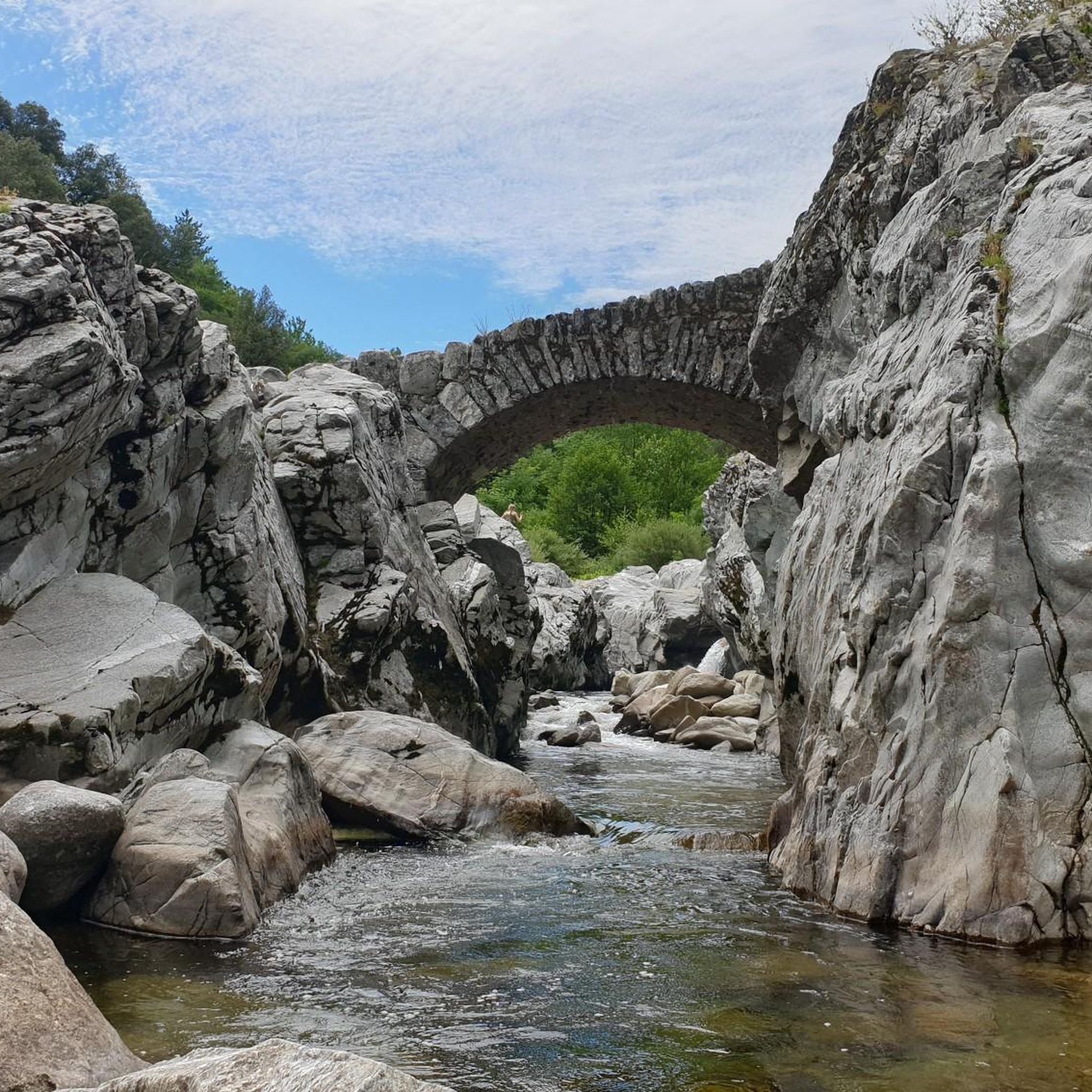
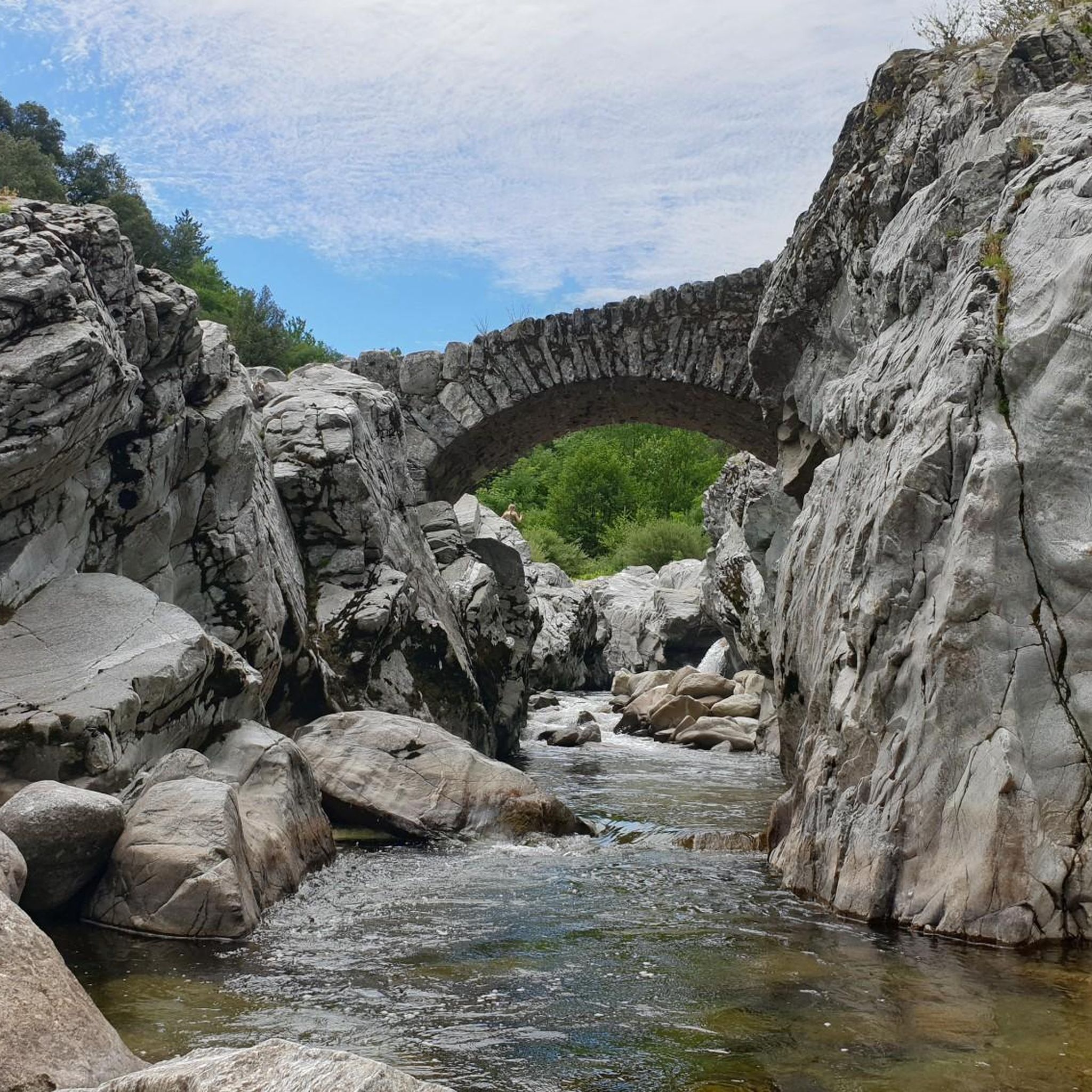
Yes, the region boasts natural water features. La Cascade de l'Étoucy is a serene waterfall perfect for relaxation. The Gardon River, which flows through the village, also offers unsupervised swimming opportunities and tranquil picnic spots along its banks, ideal for cooling off after a hike.
What historical or cultural points of interest can I find along the trails?
L'Estréchure and its surroundings are rich in history. Along the trails, you might spot Bussas castle, visible from the old stagecoach path. The Sentier de Soult offers glimpses of typical Cévenol hamlets like La Bécédelle and views of the Château de l'Hom. The village itself is a charming 'street village' with a history of sericulture, featuring two historic silk mills.
What do other hikers say about the trails in L'Estréchure?
The hiking trails in L'Estréchure are highly rated by the komoot community, with an average score of 4.4 stars from over 790 reviews. Hikers often praise the varied terrain, from river valleys to mountain ascents, and the immersive experience within the Cévennes National Park.
Is L'Estréchure a good destination for winter hiking?
While the Cévennes region offers diverse terrain, winter conditions can vary. Higher elevations may experience snow and colder temperatures. It's advisable to check local weather forecasts and trail conditions before planning winter hikes and ensure you have appropriate gear.
Are there any specific viewpoints or scenic spots recommended for hikers?
Absolutely. Trails like the Eagle Rock Trail feature ascents to viewpoints offering expansive vistas over the surrounding valleys and mountains. The interpretive trail at the Col de l'Asclier also provides beautiful panoramic views. Additionally, the Signal de Saint-Pierre Orientation Table is a notable viewpoint.
What is the best time of year to go hiking in L'Estréchure?
The Cévennes region is beautiful throughout the year, but spring and autumn generally offer the most pleasant hiking conditions with mild temperatures and vibrant foliage. Summer can be warm, making riverside walks or early morning hikes ideal. Always check local weather conditions before your trip.
Are there any mountain passes I can explore near L'Estréchure?
Yes, the area around L'Estréchure is home to several mountain passes that offer challenging hikes and scenic views. Notable passes include Col de Saint-Pierre, Asclier Pass, and Exile Pass. These passes are often part of longer routes like the Pont Moutonnier – Asclier Pass loop from Col de l'Asclier.
Is public transport available to reach hiking trailheads in L'Estréchure?
While L'Estréchure is a charming village, public transport options directly to all trailheads might be limited due to its rural location within the Cévennes. It's generally recommended to have personal transportation for maximum flexibility when exploring the various hiking routes in the area.
Most popular attractions around L'Estréchure

Get inspired with the komoot mobile app


Explore more
Browse the best Hikes in other regions.
