The best walks and hikes around Rilhac-Xaintrie
4.2
(74)
395
hikers
25
hikes
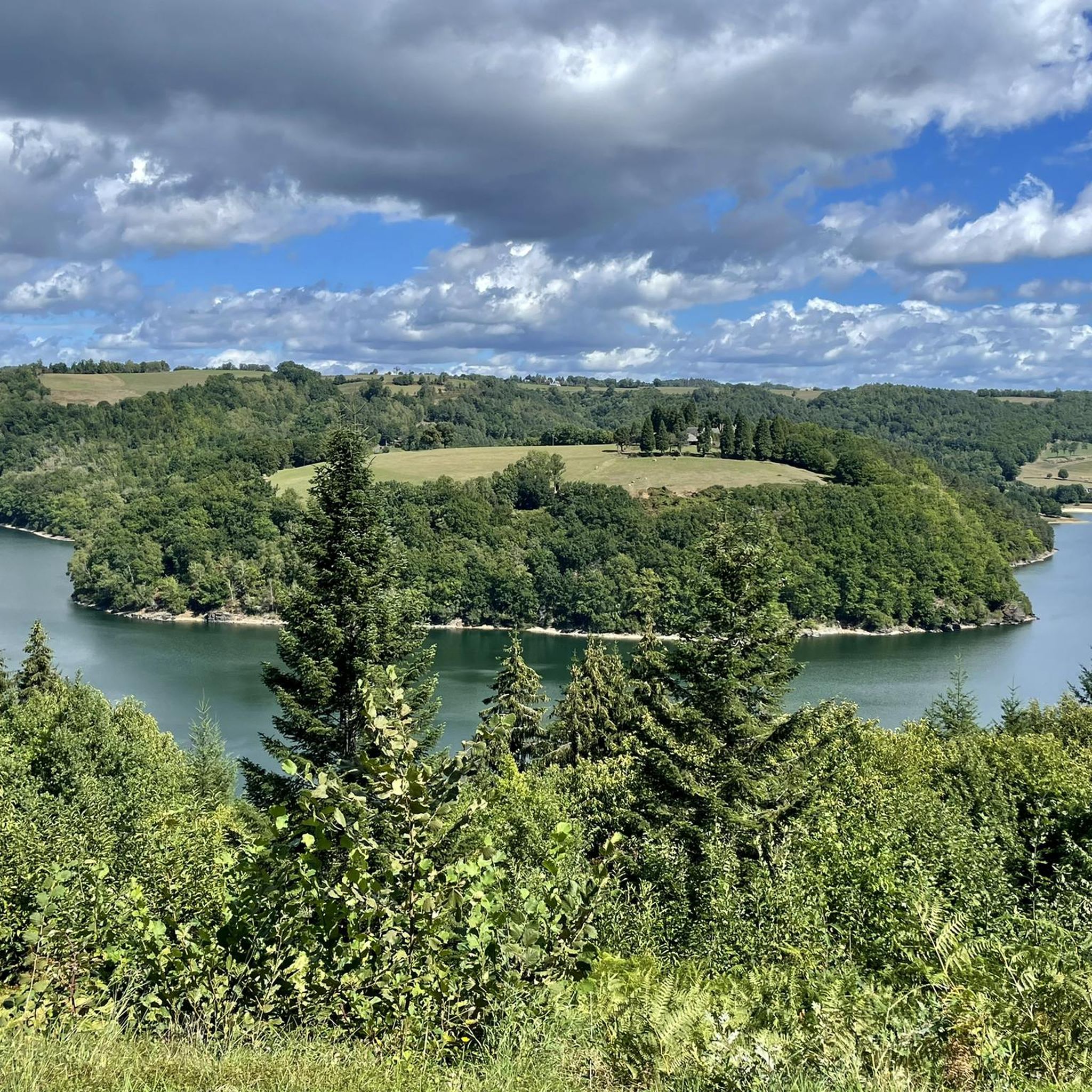
Hiking around Rilhac-Xaintrie offers varied terrain shaped by the Dordogne, Maronne, and Cère rivers, which carve deep valleys and gorges. The region features a mix of dense forests, expansive meadows, and numerous water features. This topography provides diverse landscapes for hikers, from gentle riverside paths to more challenging ascents and descents.
Best hiking trails around Rilhac-Xaintrie
- The most popular hiking route is The black rock viaduct – The Himalayan Gateway loop from Soursac, a 3.9 miles (6.3 km) trail…
Last updated: June 29, 2026
4.6
(11)
58
hikers
6.42km
01:58
220m
230m
Easy hike. Great for any fitness level. Easily-accessible paths. Suitable for all skill levels.
4.5
(2)
12
hikers
9.14km
02:33
170m
170m
Moderate hike. Good fitness required. Easily-accessible paths. Suitable for all skill levels.

Sign up for free
4.5
(6)
30
hikers
3.30km
01:08
180m
180m
Easy hike. Great for any fitness level. Easily-accessible paths. Suitable for all skill levels.
3.7
(3)
13
hikers
6.47km
01:51
150m
150m
Easy hike. Great for any fitness level. Easily-accessible paths. Suitable for all skill levels.
5.0
(1)
8
hikers
25.1km
07:27
720m
720m
Hard hike. Very good fitness required. Easily-accessible paths. Suitable for all skill levels.
Get access to more routes and recommendations from other explorers.
Sign up for free
Already have an account?
Our route recommendations are based on thousands of hikes, rides, and runs completed by other people on komoot.
Start today with a free account
Your next adventure awaits.
Login or Signup


Tips from the Community

This is the correct walking path. The (proposed) path slightly further south through the meadows ends in a dead end.
1
0

Luzeges Gorges Viaduct Construction began in 1911 and was completed two years later. The structure is composed of an impressive metal structure, a testament to the engineering of the time. It once provided a passageway for trains crossing the region. Today, it has become a popular tourist attraction.
0
0

Linking Lapleau to Soursac, downstream from the Himalayan-style Rochers Noirs viaduct, hikers, mountain bikers and simple walkers can take the entire Transcorrézien trails, a total of 114 linear kilometers between Tulle and Ussel.
0
0

The Jardin de Firmin is the ideal place for anyone wishing to discover the local grape varieties and plants of Haute-Corrèze. An educational tour will also take you to discover the apiary.
0
0
This viaduct spans the Luzège Gorges at a height of 92 meters. Originally a railway viaduct, this structure was used for a long time by the Transcorrézien railway, which connected the Tulle countryside to Ussel. It has been renovated to serve as a greenway and allow the inauguration of cycling and hiking trails.
1
0

nice hike with magnificent views of the Black Rocks Viaduct
1
0
Frequently Asked Questions
How many hiking trails are available around Rilhac-Xaintrie?
There are over 25 hiking routes around Rilhac-Xaintrie, offering a range of options from easy strolls to more challenging treks. The komoot community has explored these trails over 300 times.
What kind of terrain can I expect on hikes in Rilhac-Xaintrie?
The terrain around Rilhac-Xaintrie is incredibly diverse, shaped by the Dordogne, Maronne, and Cère rivers. You'll encounter deep river valleys, dense forests, expansive meadows, and numerous water features. This creates a mix of gentle riverside paths and more challenging routes with significant ascents and descents.
Are there easy hiking options suitable for beginners or casual walkers?
Yes, Rilhac-Xaintrie offers plenty of easy hiking options. Approximately 12 of the routes are classified as easy. An example is the Blue Route loop from Pleaux, which is 4.0 miles (6.5 km) and leads through varied terrain, typically completed in under two hours.
Can I find circular hiking routes in the area?
Many of the trails around Rilhac-Xaintrie are designed as circular routes, allowing you to start and end at the same point. For instance, the Chapelle du Puy du Bassin loop from Le Mons is a moderate 5.7 miles (9.1 km) circular path that takes you through forested areas and open landscapes.
What natural features or landmarks can I see along the hiking trails?
The region is rich in natural beauty and historical landmarks. You can explore stunning river valleys like the Cère and Maronne, and discover numerous waterfalls. A notable man-made landmark is The black rock viaduct, an impressive metal structure offering picturesque views of the Luzège Valley. The Cascade du Saut Sali loop from Barrage de l'Aigle leads to a beautiful waterfall.
Are there any waterfalls accessible on hikes in Rilhac-Xaintrie?
Yes, the Cère Valley, which is part of the wider Xaintrie region, is known for its numerous waterfalls. You can hike to the Cascade du Saut Sali via an easy loop trail starting from Barrage de l'Aigle.
What do other hikers enjoy most about hiking in Rilhac-Xaintrie?
The hiking trails in Rilhac-Xaintrie are highly rated by the komoot community, with an average score of 4.1 stars from over 60 reviews. Hikers often praise the diverse scenery, from deep river valleys to dense forests and open meadows, as well as the well-maintained paths and the opportunity to discover impressive landmarks like the Black Rock Viaduct.
Is Rilhac-Xaintrie a good destination for family-friendly hikes?
Yes, the region offers several routes suitable for families. Many of the easy and moderate trails provide accessible paths through varied landscapes, allowing families to enjoy the natural beauty together. The presence of lakes and meadows also adds to the appeal for younger explorers.
Are dogs allowed on the hiking trails in Rilhac-Xaintrie?
Generally, dogs are welcome on most hiking trails in the Rilhac-Xaintrie area. However, it's always advisable to keep them on a leash, especially when passing through areas with grazing cattle (common between May and October) or near protected wildlife habitats. Please ensure you clean up after your pet.
When is the best time of year to go hiking in Rilhac-Xaintrie?
The best time to hike in Rilhac-Xaintrie is typically from spring through autumn (April to October). During these months, the weather is generally pleasant, and the landscapes are vibrant. Spring brings blooming wildflowers, while autumn offers stunning fall foliage. Summer is also popular, but trails can be busier, and it's wise to start early to avoid the midday heat.
Are there any historical sites or points of interest to explore near the trails?
Beyond the natural beauty, you can find historical points of interest. The The black rock viaduct is a significant historical structure. Additionally, the town of Rilhac-Xaintrie itself features the Château de Rilhac-Xaintrie, adding a touch of historical charm to your visit.
Where can I park when visiting the hiking trails?
Many trailheads in the Rilhac-Xaintrie area, particularly for popular routes, offer designated parking spaces. For example, routes like the The black rock viaduct – The Himalayan Gateway loop from Soursac often have parking available near their starting points in villages or at specific scenic viewpoints.
Most popular attractions around Rilhac-Xaintrie

Get inspired with the komoot mobile app


Explore more
Browse the best Hikes in other regions.
