Routes

Planner

Features

Updates

App

Login or Signup

Get the App

Login or Signup

Login or Signup

Routes
Hikes
France
Hauts-De-France
Saint-Quentin

Annois

The best walks and hikes around Annois

4.4

(74)

231

hikers

48

hikes

Hiking around Annois offers exploration of a rural landscape in the Aisne department of northern France. The area is characterized by agricultural fields, interspersed with forested areas like the Bois d'Annois on its northern and southern edges. A significant natural feature is the Canal de Saint-Quentin, accompanied by connected ponds and a stream flowing through the commune. The terrain is generally gentle, with elevations ranging from approximately 63 to 158 meters, providing diverse conditions for hiking.

Best hiking trails around…

Last updated: May 18, 2026

4.6

(23)

47

hikers

#1.

Canal de St Quentin et cimetière britannique de Grand-Seraucourt — boucle depuis Seraucourt-le-Grand

9.72km

02:31

50m

50m

Moderate hike. Good fitness required. Easily-accessible paths. Suitable for all skill levels.

Navigate with device

Send to Phone

Save

Moderate

Easy hike. Great for any fitness level. Easily-accessible paths. Suitable for all skill levels.

Easy
guide_signup
Let us show you the way with the komoot mobile app
With a free komoot account, you can easily find, customize, and navigate endless outdoor adventures.

Sign up for free

Moderate hike. Good fitness required. Easily-accessible paths. Suitable for all skill levels.

Moderate

Moderate hike. Good fitness required. Easily-accessible paths. Suitable for all skill levels.

Moderate

Moderate hike. Good fitness required. Easily-accessible paths. Suitable for all skill levels.

Moderate
Sign up for free to see 44 more hikes around Annois.

Get access to more routes and recommendations from other explorers.

Sign up for free

Already have an account?

Our route recommendations are based on thousands of hikes, rides, and runs completed by other people on komoot.

Start today with a free account

Your next adventure awaits.

Login or Signup

Popular around Annois

Road Cycling Routes around Annois

Cycling around Annois

Running Trails around Annois

MTB Trails around Annois

Tips from the Community

JakobusPilger
October 4, 2024, Cimetière Britannique de Seraucourt le Grand

"God loves every soul with an undying love. He approaches each one with repeated, unspeakably patient offers of redemption. Even a small sign of love is enough for him to forgive and redeem. Our dear departed ones lacked a life preserver for the body; but the spiritual life preserver was not lacking, the breath of God in which the soul can clothe itself in a tiny moment, much more quickly than the body could." (Text by Albino Luciani / Pope John Paul I)

Translated by Google

0

0

Very nice varied circuit with elevation changes and beautiful clear views. I recommend it.

Translated by Google

0

0

The British cemetery of Seraucourt was created from 1920 to 1926, where the remains of soldiers buried in graves located on the nearby battlefield were grouped together, most of them killed in 1918. The cemetery contains 1,378 bodies including: 1 371 British, 5 Canadians and 2 Australians. Among them are around twenty airmen shot down in 1944. Only 496 bodies have been identified.

Translated by Google

7

1

The Grand-Seraucourt British Cemetery is a historic site dating from the First World War, where nearly 2,000 British soldiers and airmen are buried. The cemetery covers an area of 4,732 m² and is surrounded by a stone wall. You can run along the paths that connect the different sections of the cemetery and admire the memorial stones and flowers that adorn them. You can also learn more about the history of the cemetery and the people buried there by reading the information panels or scanning the QR codes with your smartphone. The cemetery is open daily from 8 a.m. to 6 p.m. and entry is free. Running in the Grand-Seraucourt British Cemetery is a way to honor the memory of those who fought for freedom, and to appreciate the beauty and tranquility of this place.

Translated by Google

3

0

Paul_C
October 1, 2023, Canal de St Quentin

If you're looking for a scenic and historic route, you can try the Saint-Quentin Canal in northern France. This canal connects the Escaut, the Oise and the Somme, and crosses the watershed at a summit level 20.4 km long with two tunnels. You can run along the towpath, admire the views of the countryside and the waterway, and discover the towns and villages along the route. The canal was built in the 18th century and was an important link for trade and transport. You can learn more about its history and engineering at the Musée du Touage in Riqueval, where you can also see the electric tugboats that pull the boats through the long tunnel. The Saint-Quentin canal is an ideal destination for runners who love culture and adventure.

Translated by Google

2

0

If you are interested in the history of the First and Second World Wars, you can visit the Grand-Seraucourt British Cemetery, a British military cemetery located in the commune of Seraucourt-le-Grand, in the department of Aisne. The cemetery contains 1,378 graves of soldiers who died mostly in 1918, as well as a few airmen shot down in 1944. The information panels and memorial stones will allow you to learn more about the battles that took place in this region and on the history of fallen soldiers. The cemetery is open daily from 8 a.m. to 6 p.m. and entry is free. The cemetery is surrounded by a stone wall and has a staircase and a building at the entrance. There you can take a peaceful and respectful walk among the rows of white tombstones and admire the flowers and trees that adorn the site.

Translated by Google

3

0

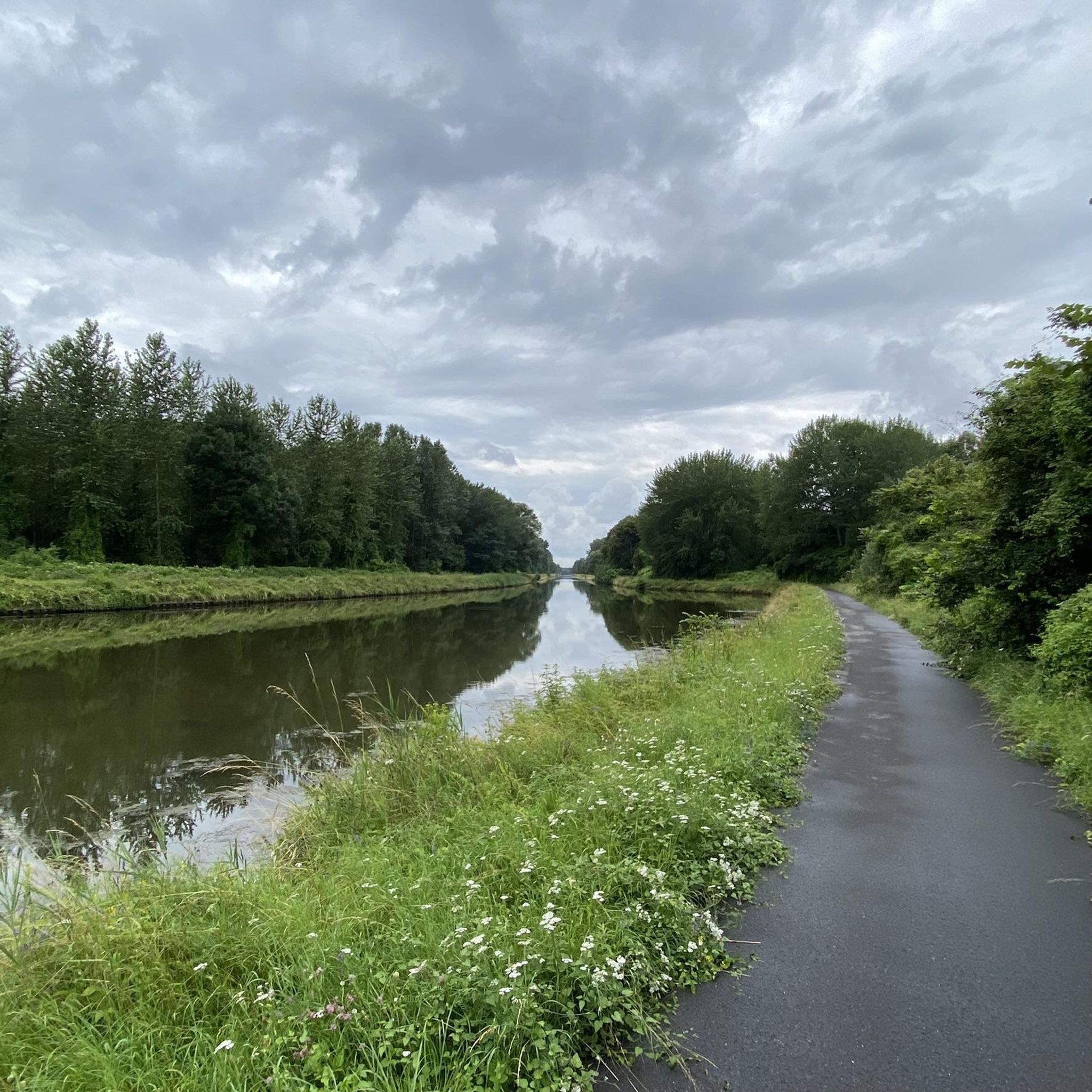
The path that follows the Saint-Quentin Canal from Saint-Quentin to Fontaine-lès-Clercs is approximately 13 kilometers long and will allow you to enjoy views of the water, bridges, locks and the surrounding countryside. The trail is largely flat and easy, with some gentle inclines.

Translated by Google

3

0

Most of the soldiers who died senselessly in the First World War only lived to be 22 years old.

Translated by Google

2

0

Frequently Asked Questions

How many hiking trails are available around Annois?

There are over 60 hiking trails around Annois, offering a wide range of options for different skill levels. You'll find everything from easy strolls to more challenging, longer paths through the varied landscape.

What kind of terrain can I expect on hikes in Annois?

The terrain around Annois is quite varied, characterized by agricultural fields, interspersed with forested areas on its northern and southern edges. You'll also encounter waterways like the Canal de Saint-Quentin and connected ponds. Elevations range from approximately 63 to 158 meters, providing gentle ascents and descents.

Are there any easy hiking routes suitable for beginners or casual walkers?

Yes, Annois offers a good selection of easy routes. Out of the over 60 trails, 28 are classified as easy, making them perfect for beginners or those looking for a relaxed walk through the rural landscape.

What natural features or landmarks can I see while hiking near Annois?

While hiking near Annois, you'll encounter significant natural features such as the Canal de Saint-Quentin, which passes just north of the commune, along with its connected ponds and a stream. You can also explore the surrounding agricultural landscapes and forested areas. For specific points of interest, consider visiting the Cycle path along the Canal de Saint-Quentin or the Seraucourt le Grand British Cemetery.

Are there any circular hiking routes in the Annois area?

Yes, many of the trails around Annois are circular, allowing you to start and end at the same point. An example is the moderate Pont de Braye loop from Flavy-le-Martel, which covers 11.5 kilometers.

What is the best time of year to go hiking in Annois?

The Hauts-de-France region, including Annois, is ideal for outdoor activities for much of the year. Spring and autumn offer pleasant temperatures and beautiful scenery, with lush greenery or vibrant fall colors. Summer is also suitable, though it can be warmer. The rural and forested areas provide a refreshing escape in any season.

Are there any dog-friendly hiking trails around Annois?

Many of the rural paths and trails in the Annois area are suitable for walking with dogs. It's generally recommended to keep dogs on a leash, especially when passing through agricultural land or near livestock, and to be mindful of local regulations. The natural environment of the Aisne department is very welcoming to pets.

Are there any family-friendly hiking options in Annois?

Yes, with 28 easy routes available, Annois offers several family-friendly hiking options. These trails typically feature gentle terrain and shorter distances, perfect for walks with children. The varied landscape of forests and open fields provides an engaging environment for all ages.

Where can I find parking for hiking trails in Annois?

Many hiking routes in the Annois area, especially those starting from nearby villages like Flavy-le-Martel or Cugny, will have designated parking areas. For instance, the Bois d'Annois – Bois de Foy loop starts from Flavy-le-Martel, where parking is typically available for hikers.

What do other hikers enjoy most about hiking in Annois?

The hiking experience in Annois is highly rated by the komoot community, with an average score of 4.5 stars from over 60 reviews. Hikers often praise the tranquil rural landscapes, the mix of agricultural fields and forested edges, and the peaceful presence of waterways like the Canal de Saint-Quentin. The variety of routes for different skill levels is also frequently appreciated.

Are there any longer or more challenging hikes for experienced hikers?

Yes, for experienced hikers seeking a greater challenge, Annois offers a few more difficult routes. The Bois d'Annois – Bois de la Coudre loop from Place de dépôt is a difficult 19.8-kilometer path that takes approximately 5 hours to complete, offering a longer adventure through wooded areas.

Most popular routes around Annois

Road Cycling Routes around Annois

Most popular attractions around Annois

Places to see

Store rating

Get inspired with the komoot mobile app

With a free komoot account, you can easily find, customize, and navigate endless outdoor adventures.

or

Join komoot Now

Store rating

Explore more

Browse the best Hikes in other regions.

Neuville-Saint-AmandOmissyGricourtFayetItancourtGauchyBenayBeauvois-En-VermandoisVaux-En-VermandoisÉtreillersCaulaincourtTrefconSavyLe VerguierEssigny-Le-GrandAttillyHinacourtGibercourtJussyVermandDouchyVillers-Saint-ChristopheContescourtArtempsClastresMontescourt-LizerollesHolnonSaint-SimonFluquièresSeraucourt-Le-GrandAubigny-Aux-KaisnesMorcourtVendhuileVendellesMaissemySerainLehaucourtJeancourtLevergiesAubencheul-Aux-BoisEstréesRoupyFontaine-Lès-ClercsBellicourtTugny-Et-PontBray-Saint-ChristopheHappencourtGermaineHargicourtSequehartGouyBonyMont-D'OrignyBeaurevoirLe CateletOrigny-Sainte-BenoiteRemaucourtEssigny-Le-PetitPrémontNauroyFontaine-UterteVendeuilHarlyAlaincourtMoÿ-De-L'AisneCerizyCroix-FonsommeFieulaineMontigny-En-ArrouaiseBerthenicourtMagny-La-FosseCastresPontruetFonsommeFontaine-Notre-DameLesdinsLanchyRibemontParpevilleMontbrehainBois De GenlisHomblièresSurfontaineBrancourt-Le-GrandLy-FontaineCugnyPontruForesteLempireFlavy-Le-MartelBellengliseOllezyNeuvilletteThenellesRemignyFrancilly-SelencyBrissy-HamégicourtRenansartRamicourtBrissay-ChoignyVilleretFresnoy-Le-GrandJoncourtGrugiesSommette-EaucourtChâtillon-Sur-OiseMézières-Sur-OiseSéry-Lès-MézièresDallonPithonÉtaves-Et-BocquiauxVillers-Le-SecPleine-SelveUrvillersDuryBohain-En-VermandoisRegnySissySeboncourtChevresis-MonceauMesnil-Saint-LaurentLa Ferté-ChevresisRouvroyBecquignyMarcy

Nearby adventure guides

Things to Do around Flavy-Le-Martel

background

Get ready to conquer new peaks

Sign up for Free

Explore
RoutesRoute plannerFeaturesHikesMTB TrailsRoad cycling routesBikepackingSitemap
Download the app
Follow Us on Socials

© komoot GmbH

Privacy Policy