The best walks and hikes around Rilly-Sainte-Syre
4.6
(14)
69
hikers
12
hikes
Hiking around Rilly-Sainte-Syre offers exploration of a rural landscape within France's Aube department, characterized by its position in the Seine river basin. The area features a network of waterways, including the Seine, the old Canal de la Haute Seine, and the Beauregard river, providing opportunities for riverside walks. The terrain consists of open spaces, fields, and small woodlands, with gentle elevation changes ranging from 84 to 168 meters. This setting provides a tranquil environment for outdoor activities.
Best hiking trails…
Last updated: July 5, 2026
4.0
(1)
15
hikers
5.48km
01:23
10m
10m
Easy hike. Great for any fitness level. Easily-accessible paths. Suitable for all skill levels.
4.5
(2)
9
hikers
13.9km
03:31
20m
20m
Moderate hike. Good fitness required. Easily-accessible paths. Suitable for all skill levels.

Sign up for free
4.5
(2)
9
hikers
15.7km
03:58
20m
20m
Moderate hike. Good fitness required. Easily-accessible paths. Suitable for all skill levels.
5.0
(2)
8
hikers
9.22km
02:20
10m
10m
Moderate hike. Good fitness required. Easily-accessible paths. Suitable for all skill levels.
3
hikers
9.43km
02:24
30m
30m
Moderate hike. Good fitness required. Easily-accessible paths. Suitable for all skill levels.
Get access to more routes and recommendations from other explorers.
Sign up for free
Already have an account?
Our route recommendations are based on thousands of hikes, rides, and runs completed by other people on komoot.
Start today with a free account
Your next adventure awaits.
Login or Signup

Tips from the Community

In the middle of the village there is a church with Joan of Arc
0
0

A "chemin de halage", in German "treidelpfad", which runs alongside the waterway right next to the bed of the river or canal, was an indispensable part of the transport infrastructure in earlier times. Before ships could move using motor power, horses ran along the bank and pulled the ship against the current. This was called "treideln", and this is how the "treidelpfads" got their name, which has been passed down to this day. Where these paths directly on the bank have been preserved, they are often used by hikers and cyclists.
0
0

do not hesitate to return to the main road then onto the canal at each crossing
0
0

The long paths of the Grande Pâture in Payns are a natural site which offers great opportunities for walks. You can admire the diversity of fauna and flora, as well as the historical heritage of the region.
2
0
This path, which was used to tow barges from the shore, offers a variety of landscapes, from forests to fields. The path is largely flat and easy to follow, and you can enjoy views of the river and surrounding countryside.
3
0
Frequently Asked Questions
How many hiking trails are available around Rilly-Sainte-Syre?
There are over 10 hiking trails around Rilly-Sainte-Syre, offering a variety of experiences. These routes are highly rated by the komoot community, with an average score of 5.0 stars.
What types of landscapes can I expect to see while hiking in Rilly-Sainte-Syre?
Hiking in Rilly-Sainte-Syre offers a tranquil rural landscape. You'll find yourself exploring open spaces, agricultural fields, and small woodlands. The area is also characterized by its rich hydrographic network, including the Seine River, the old Canal de la Haute Seine, and the Beauregard River, providing scenic riverside walks.
Are there any easy hiking trails suitable for beginners or families?
Yes, Rilly-Sainte-Syre offers several easy trails. For example, the Church with Joanne d'Arc loop from Méry-sur-Seine is an easy 5.3 km route that takes about 1 hour 20 minutes to complete, perfect for a leisurely stroll through the countryside.
Are there any circular walking routes in the Rilly-Sainte-Syre area?
Many of the trails around Rilly-Sainte-Syre are designed as circular routes, allowing you to start and end in the same location. Examples include the Château de Droupt-Saint-Basle loop from Droupt-Sainte-Marie and the Château de Droupt-Saint-Basle loop from Vallant-Saint-Georges, both offering views of the historic château.
What interesting sights or landmarks can I discover along the hiking trails?
Along the trails, you can explore various points of interest. Keep an eye out for the historic Le Chateau, and enjoy walks along the Towpath and the Upper Seine Canal, which are prominent features of the local landscape.
Are there any moderate or longer distance hikes available?
Absolutely. For those seeking a longer challenge, moderate routes like the Towpath loop from Mergey (9.2 km) or the Towpath loop from Villacerf (9.4 km) provide engaging walks through the region's varied terrain.
What is the best time of year to go hiking in Rilly-Sainte-Syre?
The rural character and gentle terrain of Rilly-Sainte-Syre make it suitable for hiking through much of the year. Spring and autumn offer pleasant temperatures and beautiful scenery, while summer provides longer daylight hours for extended walks. Even winter can be enjoyable for crisp, quiet hikes, though conditions may vary.
Is Rilly-Sainte-Syre located near any larger natural parks or forests?
While Rilly-Sainte-Syre itself is a rural commune, it is situated in the heart of the Regional Natural Park of the Orient Forest. This proximity means you have access to broader natural areas with significant ecological interest and additional opportunities for outdoor recreation, though the main forest and lakes are a short drive away.
What are the elevation changes like on the trails around Rilly-Sainte-Syre?
The terrain around Rilly-Sainte-Syre features gentle slopes and varied topography. Elevations range from a minimum of 84 meters to a maximum of 168 meters, meaning most hikes involve relatively small elevation gains and losses, making them accessible for a wide range of fitness levels.
Are there any places to stop for refreshments or a meal near the trails?
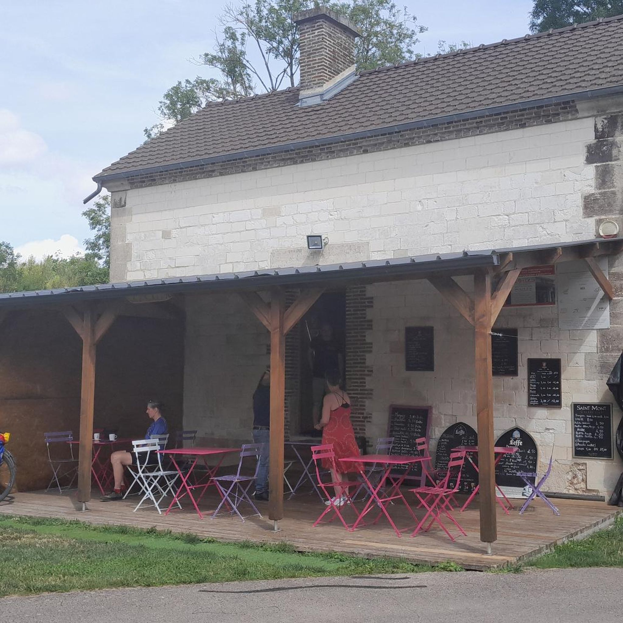
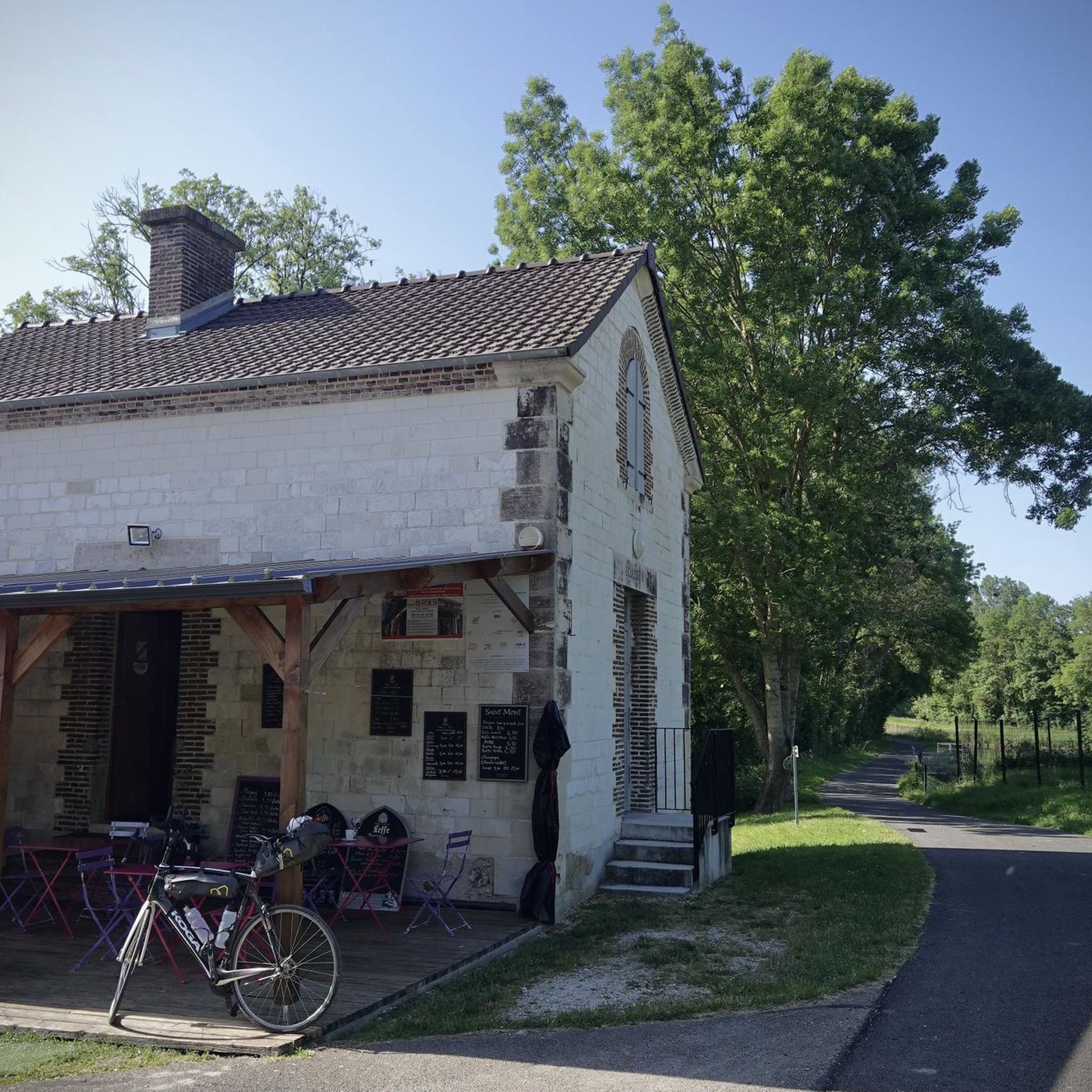
While Rilly-Sainte-Syre is a rural area, you might find local establishments in nearby villages. For example, the Café de l'Écluse No. 8 is a highlight that could offer a stop for refreshments along some routes.
What do other hikers say about the trails in Rilly-Sainte-Syre?
The trails in Rilly-Sainte-Syre are highly regarded by the komoot community, holding an impressive average rating of 5.0 stars from over 7 reviews. Hikers often praise the peaceful rural environment, the well-maintained paths along the waterways, and the opportunity to explore the charming French countryside.
Most popular attractions around Rilly-Sainte-Syre

Get inspired with the komoot mobile app


Explore more
Browse the best Hikes in other regions.
