The best walks and hikes around Vermandovillers
4.6
(109)
425
hikers
17
hikes
Hiking around Vermandovillers trails offers access to the diverse landscapes of the Somme region in Northern France. The area is characterized by its river valleys, including the Somme, and features a mix of natural settings and historical sites. Trails often follow canal paths and traverse flat to gently rolling terrain, providing varied options for outdoor activity.
Best hiking trails around Vermandovillers
- The most popular hiking route is Canal de la Somme Cycle Path – Château de Suzanne loop from Cappy…
Last updated: June 29, 2026
4.4
(13)
28
hikers
10.8km
02:46
50m
50m
Moderate hike. Good fitness required. Easily-accessible paths. Suitable for all skill levels.
4.4
(8)
29
hikers
5.68km
01:30
50m
50m
Easy hike. Great for any fitness level. Easily-accessible paths. Suitable for all skill levels.

Sign up for free
4.5
(4)
14
hikers
Hard hike. Very good fitness required. Easily-accessible paths. Suitable for all skill levels.
4.8
(4)
13
hikers
9.29km
02:28
100m
100m
Moderate hike. Good fitness required. Easily-accessible paths. Suitable for all skill levels.
4.8
(4)
17
hikers
Easy hike. Great for any fitness level. Easily-accessible paths. Suitable for all skill levels.
Get access to more routes and recommendations from other explorers.
Sign up for free
Already have an account?
Our route recommendations are based on thousands of hikes, rides, and runs completed by other people on komoot.
Start today with a free account
Your next adventure awaits.
Login or Signup



Tips from the Community

The castle served for centuries as a meeting place for the regional nobility and thinkers.
10
0
This lock also has a fish ladder / bypass.
14
0

A small tourist train departs from the Railway Museum. The train takes passengers to Dompierre. More information is available on the website: https://www.petittrainhautesomme.fr/le-parcours/
0
0
Departure point for the Little Train of the Upper Somme from the Railway Museum. A small tourist train running along the towpath to Dompierre. More information on the website: https://www.petittrainhautesomme.fr/le-parcours/
0
0

In the middle of nowhere on the canal – the whistle of a steam locomotive. These steam locomotives and the layout are simply beautiful to behold.
0
0

A railway zig zag or switchback is a railway operation in which a train is required to switch its direction of travel in order to continue its journey. While this may be required purely from an operations standpoint, it is also ideal for climbing steep gradients with minimal need for tunnels and heavy earthworks. For a short distance (corresponding to the middle leg of the letter "Z"), the direction of travel is reversed, before the original direction is resumed.
0
0
Écluse de Cappy No 10 is a minor waterways place on the Canal de la Somme (Grande Somme) between Mouth of River Somme (105.77 kilometres and 16 locks to the west) and Nord - Grande Somme Jonction (Junction of Canal du Nord with the Grande Somme at Halles) (14.23 kilometres and 3 locks to the east). The nearest place in the direction of Mouth of River Somme is Pont de Froissy; 1.78 kilometres away. The nearest place in the direction of Nord - Grande Somme Jonction is Pont Élévateur de Cappy; 0.57 kilometres away. Mooring here is unrated. This is a lock, the rise of which is not known.
0
0

museum and the opportunity to ride the steam train yourself.
0
0
Frequently Asked Questions
How many hiking trails are available around Vermandovillers?
There are over 15 hiking trails around Vermandovillers, offering a variety of experiences. These routes are highly rated by the komoot community, with an average score of 4.5 stars from nearly 100 reviews.
What are the difficulty levels of hiking trails in the Vermandovillers area?
The trails around Vermandovillers cater to various fitness levels. You'll find a good mix of easy (7 routes) and moderate (9 routes) paths, perfect for relaxed strolls or more active outings. There is also one difficult route for those seeking a greater challenge.
Are there any family-friendly hiking routes near Vermandovillers?
Yes, several routes are suitable for families. For an easy and gentle walk along the canal, consider the 3.5-mile (5.6 km) Froissy Lock – Écluse de Cappy No 10 loop from Cappy. Its flat terrain makes it accessible for all ages.
Can I bring my dog on the hiking trails around Vermandovillers?
Many of the paths around Vermandovillers, especially those along the Canal de la Somme, are generally dog-friendly. It's always recommended to keep your dog on a leash, especially in areas with wildlife or near agricultural land. The region's diverse natural settings, including river valleys and forests, offer pleasant walks for you and your canine companion.
What kind of landscapes can I expect to see while hiking in Vermandovillers?
The Vermandovillers area is characterized by the diverse landscapes of the Somme region. You'll encounter picturesque river valleys, particularly along the Somme River and its canals, as well as a mix of natural settings and historical sites. The terrain is generally flat to gently rolling, offering views of water, fields, and occasional woodlands.
Are there any circular walks available in Vermandovillers?
Yes, many routes in the area are circular, allowing you to start and end at the same point. An example is the 6.7-mile (10.8 km) Canal de la Somme Cycle Path – Château de Suzanne loop from Cappy, which follows the scenic Canal de la Somme.
What historical sites or landmarks can I explore while hiking in the area?
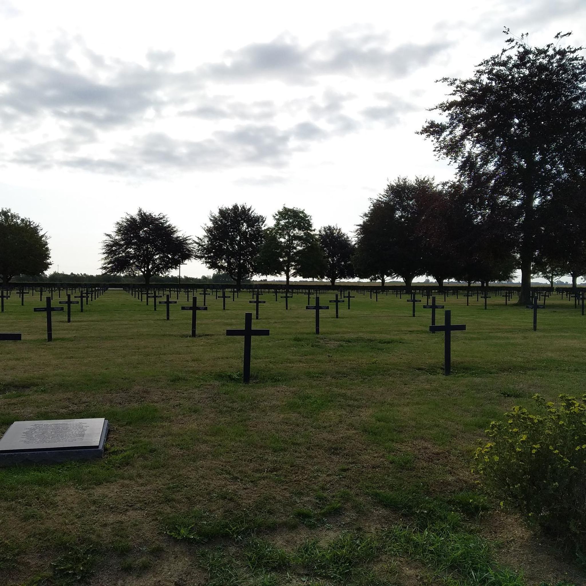
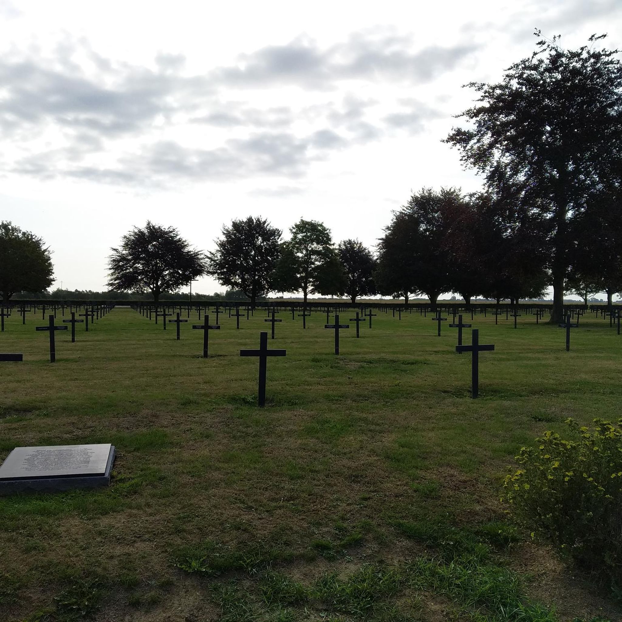
The region holds significant historical weight, particularly concerning World War I. You can visit the Vermandovillers German Military Cemetery, which offers a contemplative setting. The broader Somme Valley also features preserved trench networks and memorials. For a scenic view of the valley and visible trenches, consider visiting the Frise Viewpoint.
What are some natural attractions or wildlife I might encounter?
The Somme region is rich in natural beauty. You might spot various bird species along the river valleys and canals. Nearby nature reserves like the Réserve naturelle de l'Étang Saint-Ladre and the Réserve naturelle des Marais d'Isle offer opportunities for birdwatching and appreciating local flora and fauna. The Canal du Nord is another notable waterway in the vicinity.
Is there parking available near the hiking trailheads?
While specific parking details for each trailhead are best checked on individual route pages, many starting points in villages like Cappy or near popular attractions along the Canal de la Somme typically offer parking options. It's advisable to look for designated parking areas in these locations.
What is the best season for hiking around Vermandovillers?
The Somme region offers pleasant hiking conditions throughout much of the year. Spring and autumn provide mild temperatures and beautiful scenery, with blooming flora or vibrant fall colors. Summer is also suitable, though it can be warmer. Winter hiking is possible, but conditions may vary, so checking local weather is always recommended.
Are there any cafes or restaurants near the hiking trails?
While Vermandovillers itself is a small village, nearby towns and villages along the Somme River, such as Cappy, often have local cafes or restaurants where you can refresh yourself after a hike. It's a good idea to plan your route to pass through these settlements if you're looking for amenities.
What do other hikers enjoy most about the trails in Vermandovillers?
The area is highly rated by the komoot community, with an average score of 4.5 stars. Reviewers often praise the peaceful canal paths, the gentle terrain suitable for various abilities, and the opportunity to combine nature walks with historical exploration of the Somme region.
Are there any longer, more challenging routes for experienced hikers?
Yes, for those seeking a longer and more challenging experience, the 15.2-mile (24.5 km) Froissy Lock – Canal de la Somme Cycle Path loop from Arrêt du Plateau leads through the Somme River Valley and is classified as difficult, typically taking over six hours to complete.
Most popular routes around Vermandovillers
Most popular attractions around Vermandovillers

Get inspired with the komoot mobile app


Explore more
Browse the best Hikes in other regions.
