The best running trails around Waldrach
4.4
(482)
9,775
runners
593
runs
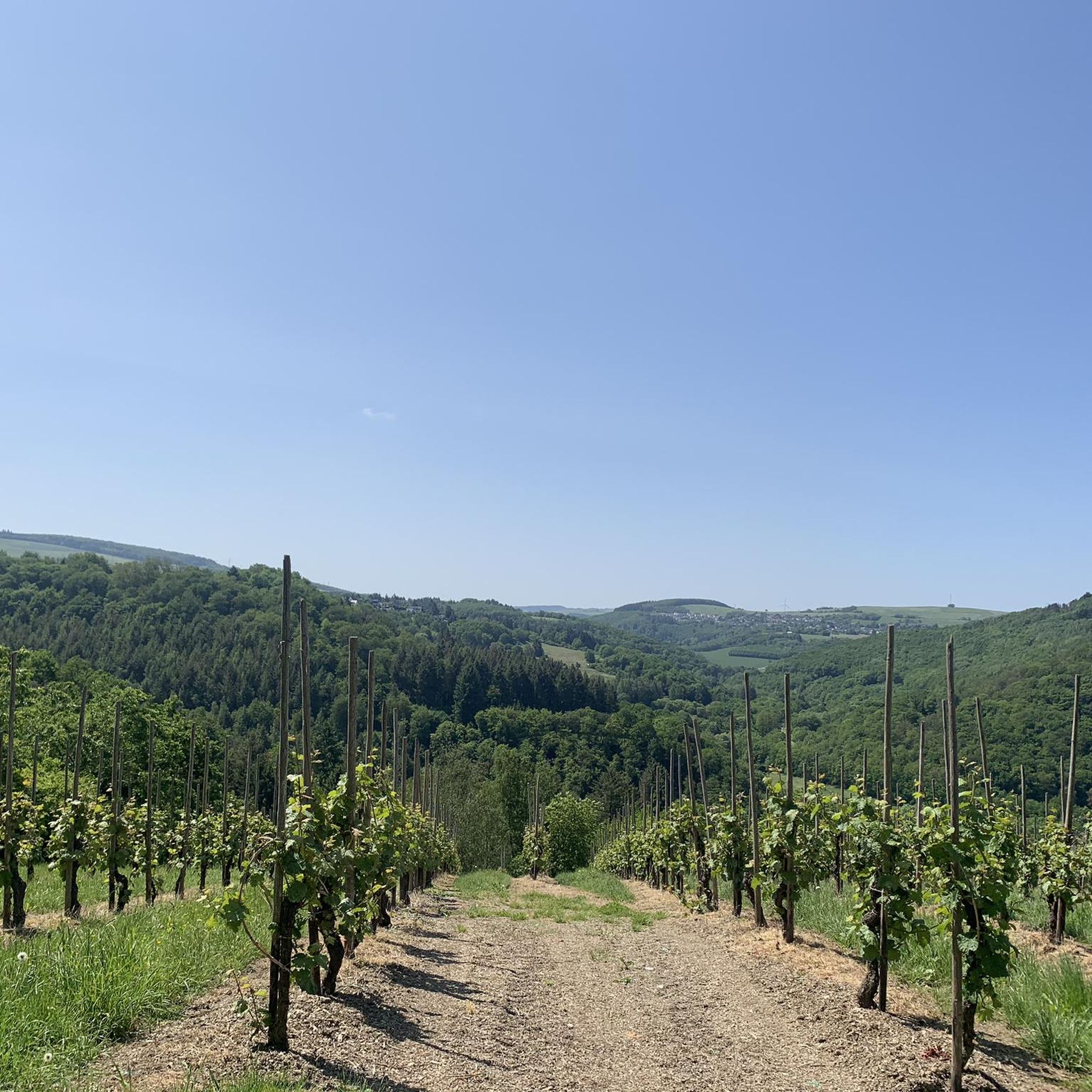
Jogging routes around Waldrach are set in the Trier-Saarburg district, where the Hunsrück and Moselle regions converge. The area features a landscape of idyllic vineyards, dense forests, and the Ruwer valley, providing varied terrain for runners. Paths often follow former railway lines or wind through wooded areas, offering both gentle and more challenging elevation changes. This natural setting makes Waldrach a suitable destination for diverse running experiences.
Best jogging routes around Waldrach
- The most popular jogging route is Covered bridge…
Last updated: October 3, 2026
3.0
(1)
27
runners
20.4km
02:33
560m
560m
Hard run. Very good fitness required. Mostly paved surfaces. Suitable for all skill levels.
40
runners
5.20km
00:33
50m
50m
Moderate run. Good fitness required. Mostly paved surfaces. Suitable for all skill levels.

22
runners
4.81km
00:31
50m
50m
Easy run. Great for any fitness level. Mostly paved surfaces. Suitable for all skill levels.
16
runners
3.94km
00:25
30m
30m
Easy run. Great for any fitness level. Mostly paved surfaces. Suitable for all skill levels.
5.0
(1)
14
runners
10.1km
01:13
220m
220m
Moderate run. Good fitness required. Mostly paved surfaces. Suitable for all skill levels.
Get access to more routes and recommendations from other explorers.
Already have an account?
Our route recommendations are based on thousands of hikes, rides, and runs completed by other people on komoot.
Start today with a free account
Your next adventure awaits.
Tips from the Community

Path of the "1000" Bridges
0
0

The Ruwer-Hochwald-Radweg is a well-developed cycle path on a former railway line, therefore only a moderate gradient of on average (!) one percent - but you can still feel it, both when cycling from Trier-Ruwer to Hermeskeil (uphill, about 400 meters of altitude difference over the 50-kilometer route) and vice versa downhill. The lower section goes through beautiful forest, the upper section through more open landscape - always along the course of the Ruwer river. In the villages along the way, there are places to stop for refreshments. If you only want to cycle the route in one direction, you can use the RadBus line 222 for the other direction (from April 1st to November 1st on weekends and public holidays; daily during Rhineland-Palatinate school holidays; e-bikes also possible). Attention - it is advisable to book in advance to secure your space for the bicycle. Info at https://www.radbusse.de/pages/radbusse/hunsrueck/ruwer-hochwald-222.php, timetable inquiries at https://www.vrt-info.de/fahrt-planen.
0
0

If you want to drive to the Hunsrück, e.g. Mandern or Kell am See, without electronic assistance, you have to be prepared for kilometers of slight incline. Absolutely doable, but also monotonous. The path is in great shape, however.
0
0

The castle served as a provostry for the Trier monastery of St. Martin. The estate managers of the monastic economy, which was located in Irsch, lived here. The castle and its outbuildings were, as it were, the farmstead of the abbey located in the city.
0
0

Added to the collection: https://www.komoot.com/de-de/collection/3600632/-naturen-denkmaeler-besondere-baeume-und-weitere-schaetze-der-natur
0
0
A very rare specimen
0
0

Very nice there with a wonderful view of Trier and Trier-Land
0
0
Frequently Asked Questions
How many running routes are available around Waldrach?
Waldrach offers a diverse selection of over a dozen dedicated running routes. These include options for various fitness levels, with 4 easy routes, 7 moderate routes, and 2 challenging routes for experienced runners.
What kind of terrain can I expect on the jogging trails in Waldrach?
The jogging trails in Waldrach feature varied terrain, ranging from relatively flat paths along the Ruwer valley to more challenging ascents and descents through wooded areas and vineyards. Many routes utilize well-maintained paths, including sections of the Ruwer-Hochwald Cycle Path and former railway lines, providing a mix of paved and natural surfaces.
Are there any easy or beginner-friendly running routes in Waldrach?
Yes, Waldrach has several easy running routes suitable for beginners or those looking for a less strenuous run. An example is the Old Railway Track – Ruwer-Hochwald Cycle Path loop from Waldrach, which is approximately 4.8 km long with minimal elevation gain.
Can I find long-distance or more challenging running trails near Waldrach?
Absolutely. For experienced runners seeking a challenge, the Thick Oak (Old Oak Tree) – Irscher Burg loop from Waldrach is a difficult 20.6 km path with significant elevation gain through forested areas. This route is ideal for those with good basic fitness looking for a longer, more demanding run.
Are there any circular running routes in Waldrach?
Many of the running routes in Waldrach are designed as loops, offering convenient circular paths. For instance, the Old Railway Track – Götter Hut loop from Waldrach is a popular 10 km circular trail that takes you through varied terrain.
What natural features or landmarks can I see along the running routes?
Waldrach's running routes are rich in natural beauty. You can enjoy picturesque vineyards, dense forests, and riverside scenery along the Ruwer valley. Notable attractions nearby include the Sirzenich Waterfall and the View of the Moselle Vineyards, offering scenic points of interest during your run.
Are there any family-friendly jogging routes in Waldrach?
Yes, the Ruwer-Hochwald Cycle Path, which passes through the idyllic Ruwer valley, is generally family-friendly due to its relatively gentle elevation changes and accessible paths. Routes like the Covered bridge over the Ruwer River – Ruwer-Hochwald Cycle Path loop from Kasel offer a pleasant experience for families.
What do other runners enjoy most about jogging in Waldrach?
The running routes in Waldrach are highly rated by the komoot community, with an average score of 4.4 stars from over 450 reviews. Runners frequently praise the scenic vineyards, extensive forests, and the variety of terrain that caters to different ability levels, from easy paths to more challenging ascents.
Are there specific routes that offer great viewpoints?
Many routes winding through the vineyards and higher elevations of the Hunsrück region will offer excellent viewpoints. The region's position at the confluence of the Hunsrück and Moselle regions naturally provides stunning vistas, especially over the Moselle vineyards. Look for routes that traverse higher ground or mention 'view' in their descriptions.
Is it possible to access jogging trails in Waldrach using public transport?
Waldrach is situated in the Trier-Saarburg district, and public transport options are available to reach the area. Once in Waldrach, many trails, especially those following the Ruwer-Hochwald Cycle Path or starting directly from the village, are easily accessible on foot from public transport stops.
Are there any specific running routes that follow old railway lines?
Yes, the area around Waldrach is known for trails that utilize former railway lines, offering relatively flat and well-maintained paths. The Ruwer-Hochwald Cycle Path – Old Railway Track loop from Waldrach is a good example, providing a comfortable running experience on these historic routes.
Most popular routes around Waldrach
Most popular attractions around Waldrach

Get inspired with the komoot mobile app


Explore more
Browse the best Running Trails & Routes in other regions.
