The best walks and hikes around Sainte-Foy
4.5
(298)
1,482
hikers
167
hikes
Hiking around Sainte-Foy offers diverse landscapes, from high mountains and lush forests to expansive alpine pastures. The region features significant elevation changes, ranging from 890 meters in the Isère valley to 3,747 meters at the Grande Sassière needle. Glacial lakes and distinct mountain valleys characterize the terrain, providing varied scenery for hikers. The area's trails traverse these features, offering views of snow-capped peaks and traditional villages.
Best hiking trails around Sainte-Foy
- The most popular hiking route is Saint Peter's Church…
Last updated: June 25, 2026
4.5
(8)
55
hikers
10.8km
02:59
190m
190m
Moderate hike. Good fitness required. Easily-accessible paths. Suitable for all skill levels.
4.9
(8)
26
hikers
6.72km
01:50
100m
100m
Easy hike. Great for any fitness level. Easily-accessible paths. Suitable for all skill levels.

Sign up for free
4.3
(6)
24
hikers
14.1km
03:54
250m
240m
Moderate hike. Good fitness required. Easily-accessible paths. Suitable for all skill levels.
5.0
(1)
9
hikers
12.0km
03:19
210m
210m
Moderate hike. Good fitness required. Easily-accessible paths. Suitable for all skill levels.
4
hikers
6.94km
01:49
60m
60m
Easy hike. Great for any fitness level. Easily-accessible paths. Suitable for all skill levels.
Get access to more routes and recommendations from other explorers.
Sign up for free
Already have an account?
Our route recommendations are based on thousands of hikes, rides, and runs completed by other people on komoot.
Start today with a free account
Your next adventure awaits.
Login or Signup



Tips from the Community

Very pleasant course!!
0
0

Beautiful layout of the path. Pleasant hike
0
0

The path is very pleasant. You follow the embankment (typical of clos-masures) bordering the Château de Montigny. The beeches there are remarkable for their presence.
0
0
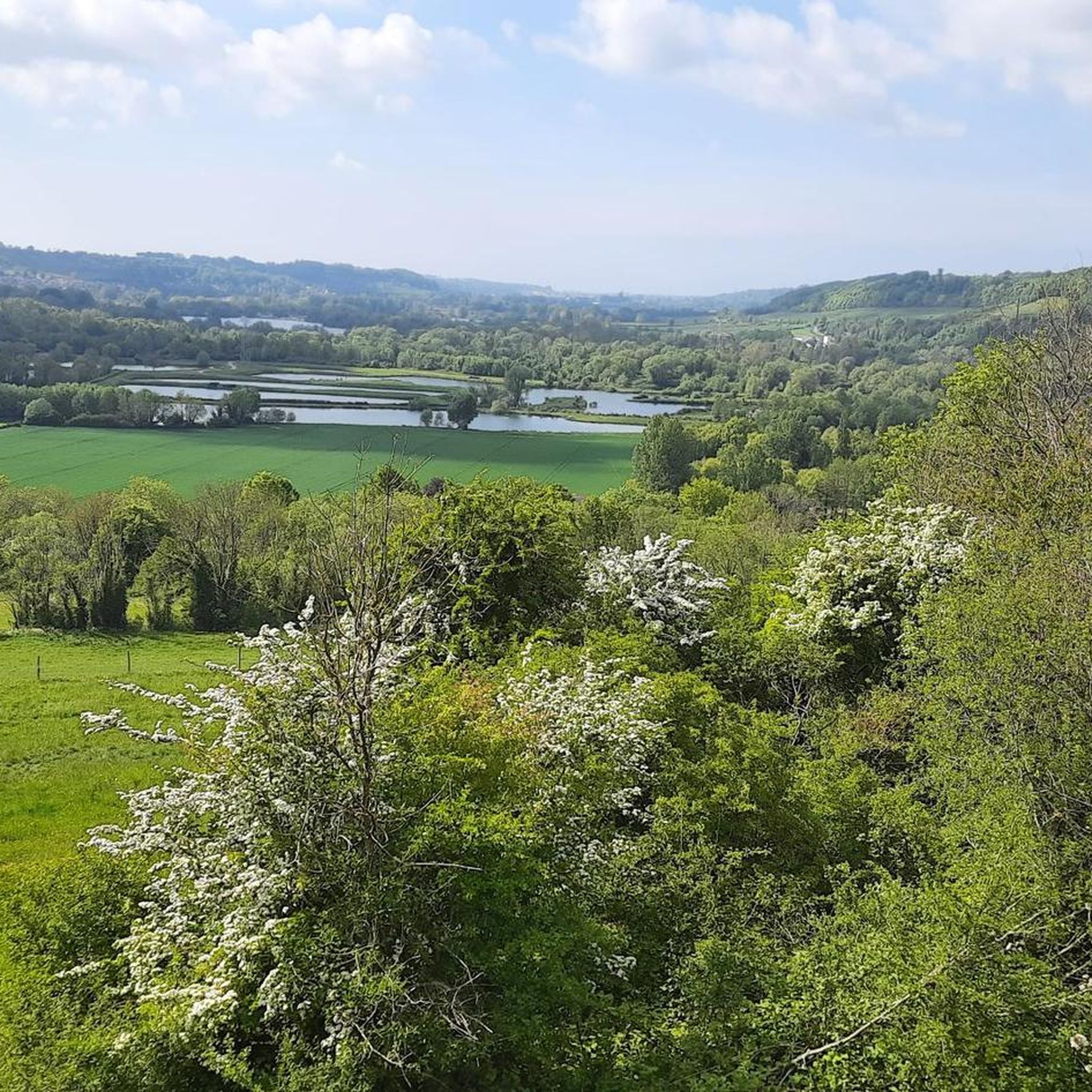
Here is a very pleasant little path which runs along the edge of the woods while overlooking the railway line and the Saw.
0
0
La Scie is a coastal river with a length of 37 km. La Scie has its source in Saint-Maclou-de-Folleville to the east of Tôtes. Its narrow valley, which goes quite deeply into the Pays de Caux plateau, is occupied by the Rouen-Dieppe railway line. It flows, at the end of a winding course, into the English Channel at Pourville-sur-Mer. Benefiting from a fast current, La Scie is popular with fishermen, but also with canoeing enthusiasts.
0
0
This trail connects the hamlet of Cent Acres to the Saw valley. Pleasant, the wood offers beautiful vegetation.
0
0
the Saint-Pierre church is distinguished by its large walled arcades dating from medieval times.
0
0
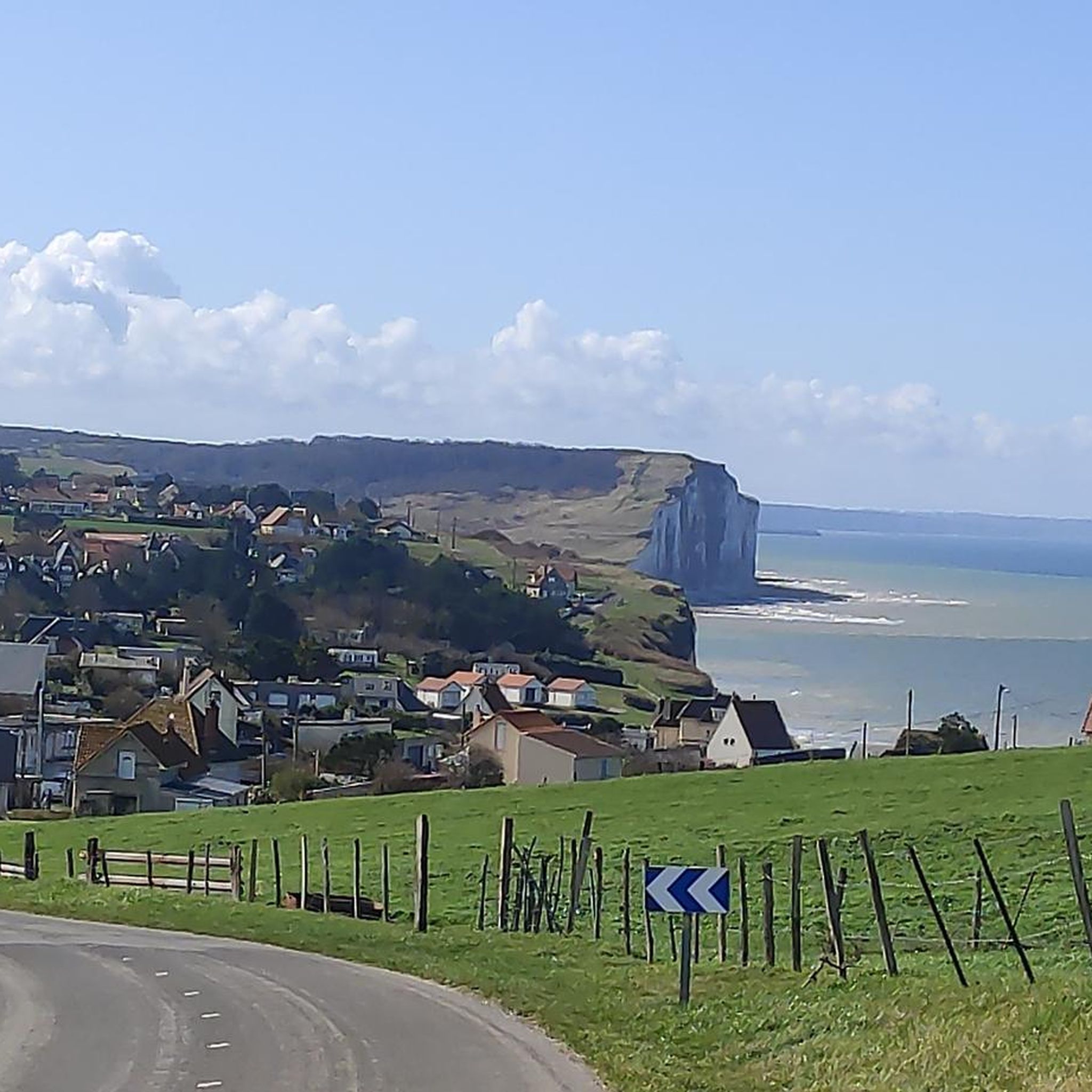
This viewpoint will allow you to contemplate the Scie valley, Longueville and the Saint-Pierre church. Know that Longueville-sur-Scie was formerly called Longueville-la-Giffarde, from the name of the lords of the place!
1
0
Frequently Asked Questions
How many hiking trails are available in Sainte-Foy?
Sainte-Foy offers a wide selection of hiking trails, with over 160 routes recorded on komoot. These range from easy strolls to challenging alpine treks, ensuring options for every fitness level.
Are there hiking trails suitable for families or beginners?
Yes, Sainte-Foy has numerous family-friendly and easy trails. Out of the 162 routes, 51 are classified as easy, perfect for a relaxed outing. These often traverse lush forests and alpine pastures, providing gentle gradients and beautiful scenery.
What kind of scenery can I expect to see while hiking in Sainte-Foy?
Hikers in Sainte-Foy can expect incredibly diverse scenery. The region features high mountains, lush forests, and expansive alpine pastures. You'll encounter stunning glacial lakes like Lac du Retour and Lac du Clou, dramatic valleys, and breathtaking panoramas of snow-capped peaks like Mont Pourri. Tiered waterfalls and gorges, such as the Nantcruet gorges, also add to the natural beauty.
Are there any circular hiking routes in Sainte-Foy?
Yes, many of the trails in Sainte-Foy are circular, allowing you to start and end at the same point. For example, you could explore the St. Honoré Church – Sainte-Foy Church loop from Sainte-Foy, which offers a moderate 11.1 km journey through the local landscape.
Can I find hikes that feature waterfalls or glacial lakes?
Absolutely. The region is known for its stunning natural water features. You can find trails leading to beautiful glacial lakes like Lac du Retour and Lac du Clou, offering magnificent views. There are also routes that pass by impressive tiered waterfalls, some reaching up to 150 meters high, and dramatic natural formations like the Nantcruet gorges.
What are some notable landmarks or attractions to see along the trails?
Beyond the natural beauty, Sainte-Foy offers cultural and historical points of interest. A must-visit is the picturesque hamlet of Le Monal, protected for its architectural and historical significance. You might also encounter charming traditional Savoyard villages. For those interested in history, highlights like Longueville-sur-Scie Castle or Arques-la-Bataille Castle are nearby.
What is the best time of year for hiking in Sainte-Foy?
Sainte-Foy offers a continuous spectacle of nature through the seasons. While summer provides lush green landscapes, autumn is particularly stunning with its golden larch forests. The diverse terrain means you can find suitable trails from spring through autumn, with specific high-altitude routes best enjoyed in warmer months once snow has melted.
Are hiking trails in Sainte-Foy dog-friendly?
Many trails in Sainte-Foy are suitable for hiking with dogs, especially those through forests and lower alpine pastures. However, it's always recommended to check local regulations, especially in protected areas or near livestock, and to keep your dog on a leash for their safety and to protect wildlife.
What do other hikers enjoy most about hiking in Sainte-Foy?
The area is highly rated by the komoot community, with an average score of 4.5 stars from over 270 reviews. Hikers frequently praise the diverse landscapes, from high mountain paths to tranquil forests, and the breathtaking panoramic views. The variety of trails, catering to all abilities, is also a common highlight.
Are there challenging hikes for experienced trekkers?
Yes, Sainte-Foy offers challenging alpine treks for experienced hikers. Out of the 162 routes, 14 are classified as difficult, featuring significant elevation gains and rugged terrain. These trails often lead to higher elevations, providing rewarding views and a true alpine experience.
What kind of wildlife can I expect to see on the trails?
Sainte-Foy is rich in biodiversity, offering excellent opportunities for wildlife watching. Hikers often spot marmots, ibexes, and chamois. Golden eagles can be seen soaring overhead, and the region is home to a variety of rare and protected Alpine plants.
How can I access trailheads, especially regarding public transport or parking?
While specific public transport options vary by trailhead, many routes are accessible from villages within the Sainte-Foy region. Parking is often available at or near popular trailheads. It's advisable to check local transport schedules and parking availability for your chosen route in advance.
Most popular routes around Sainte-Foy
Most popular attractions around Sainte-Foy

Get inspired with the komoot mobile app


Explore more
Browse the best Hikes in other regions.
