The best walks and hikes around Champs-Sur-Tarentaine-Marchal
4.5
(452)
3,384
hikers
114
hikes
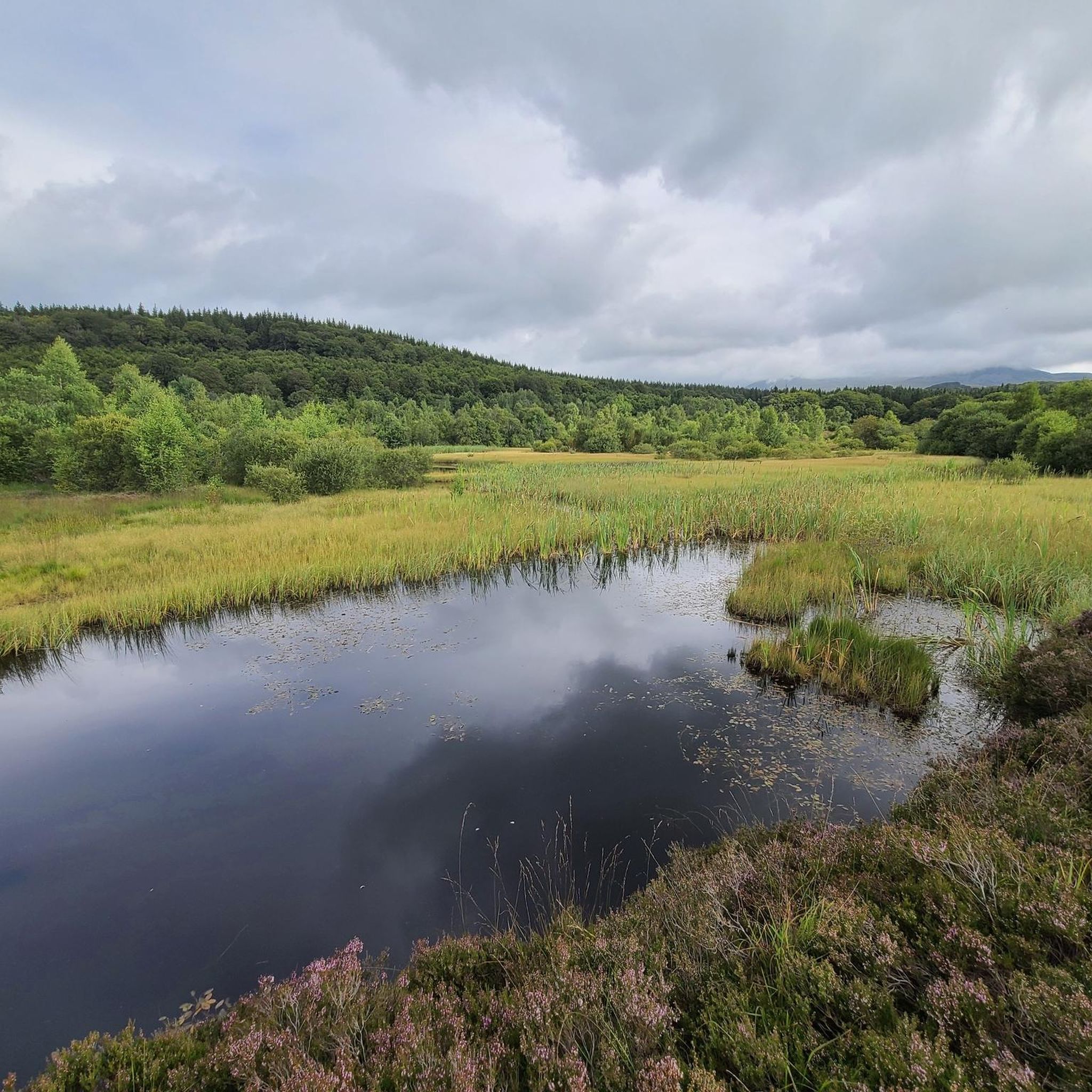
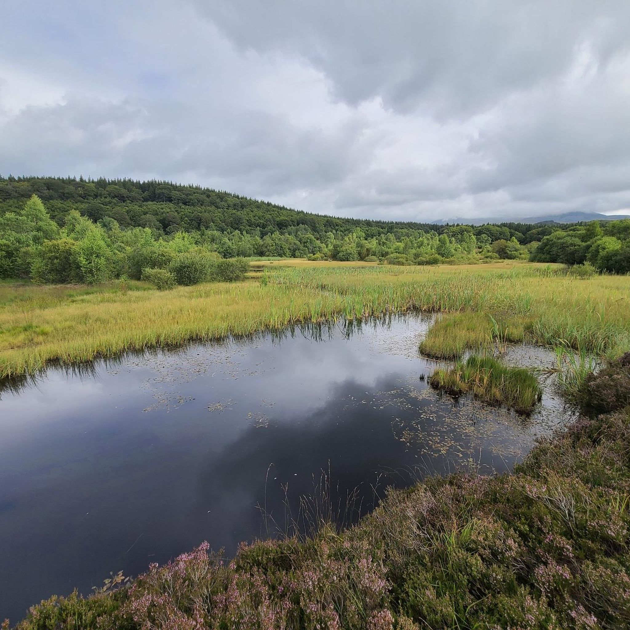
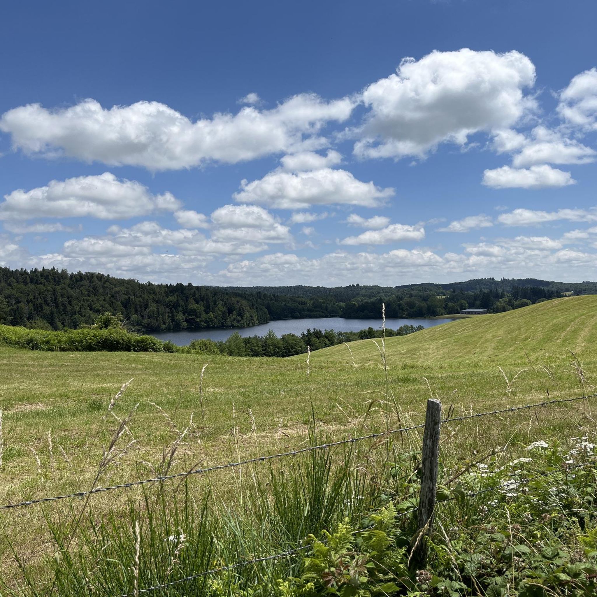
Hiking around Champs-Sur-Tarentaine-Marchal offers diverse landscapes within the Parc Naturel Régional des Volcans d'Auvergne. The region is characterized by extensive forests, numerous lakes, and significant peat bogs, including the Lac de la Crégut. Terrain varies from shaded valleys along rivers like the Tarentaine and Rhue to the vast panoramas of the Artense plateau, with views towards the Cantal Mountains and Sancy Massif. Geological features such as basalt columns and the Gorges de la Rhue add to the varied environment.
Best…
Last updated: July 9, 2026
4.5
(13)
68
hikers
5.16km
01:23
60m
60m
Easy hike. Great for any fitness level. Easily-accessible paths. Suitable for all skill levels.
4.8
(15)
76
hikers
12.3km
03:20
170m
170m
Moderate hike. Good fitness required. Easily-accessible paths. Suitable for all skill levels.

Sign up for free
5.0
(9)
63
hikers
3.73km
00:59
40m
40m
Easy hike. Great for any fitness level. Easily-accessible paths. Suitable for all skill levels.
4.5
(6)
19
hikers
6.65km
01:49
100m
100m
Easy hike. Great for any fitness level. Easily-accessible paths. Suitable for all skill levels.
4.0
(2)
17
hikers
9.70km
03:02
360m
360m
Moderate hike. Good fitness required. Easily-accessible paths. Suitable for all skill levels.
Get access to more routes and recommendations from other explorers.
Sign up for free
Already have an account?
Our route recommendations are based on thousands of hikes, rides, and runs completed by other people on komoot.
Start today with a free account
Your next adventure awaits.
Login or Signup
Popular around Champs-Sur-Tarentaine-Marchal
Other adventures around Champs-Sur-Tarentaine-Marchal

Tips from the Community

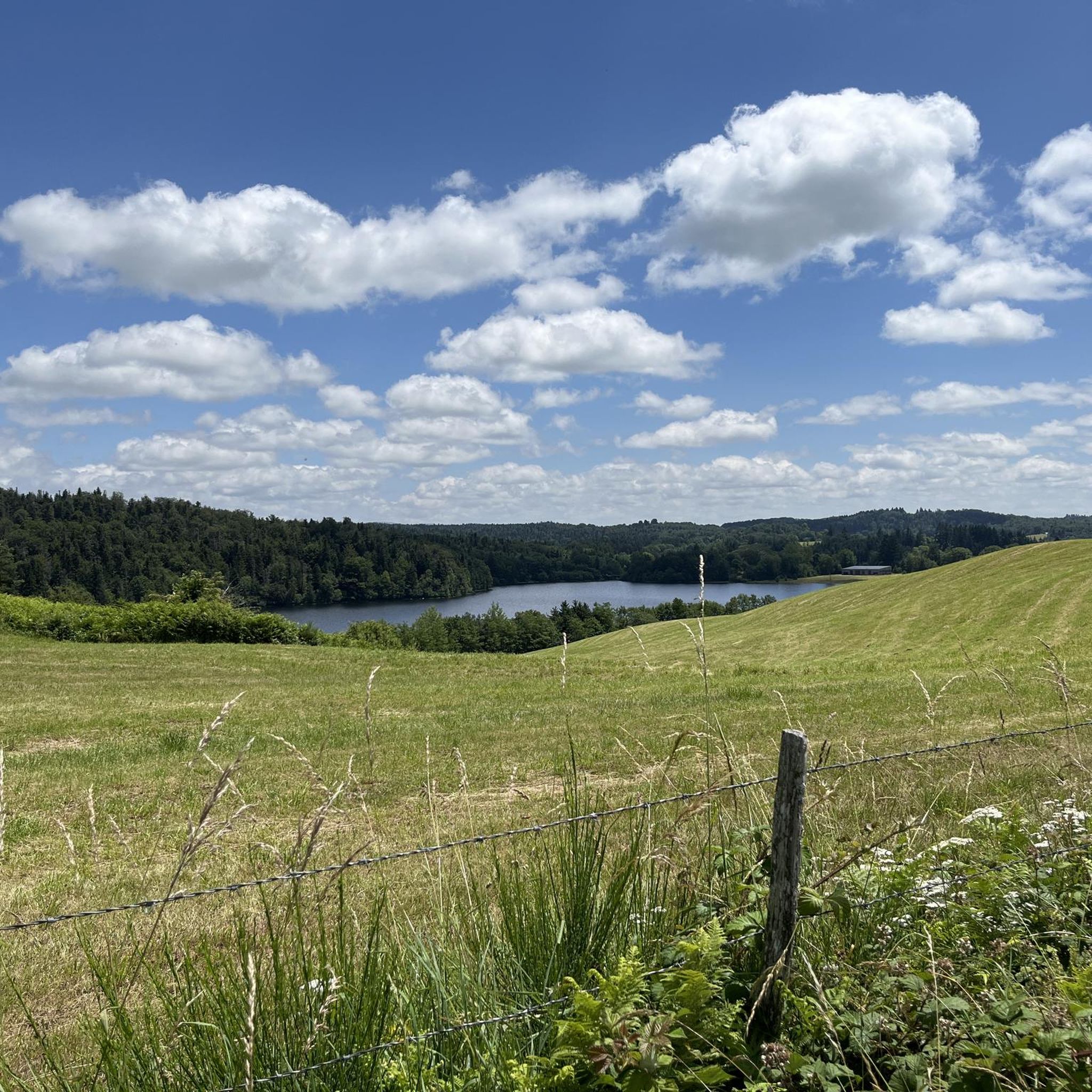
Lac de la Crégut is the largest natural lake of glacial origin in the Massif Central. From its banks, you can enjoy magnificent views of the Monts du Cantal and the surrounding lakes. It is now part of a whole system of reservoirs that supply water to the Rhue hydroelectric power station, at the Bort dam.
0
0
Lac de la Crégut is the largest natural lake of glacial origin in the Massif Central. From its banks, you can enjoy magnificent views of the Cantal mountains and the surrounding lakes. It is now part of a whole system of reservoirs that supply water to the Rhue hydroelectric power station, at the Bort dam.
3
0
Lac du Tact is an artificial lake that flows into Lac de la Crégut via a weir. It is part of a whole system of reservoirs that supply water to the Rhue hydroelectric power station, at the level of the Bort dam.
0
0
These remains are those of an important resistance camp (several thousand men). The site is highlighted by various commemorative and explanatory plaques. At the end of June 1944, clashes took place throughout the sector and other plaques were affixed throughout the town for those who would like to deepen their knowledge.
2
0

A Mecca of the Maquisard resistance, this place is well highlighted with panels explaining the history - the ruins of the headquarters of the maquisards as well as their cars destroyed by the Germans in 1944 are still visible. Warning: the path is difficult to practice and is not very pleasant for mountain biking (in May 2021) since this sector has been partially deforested by large machines. Results: Lots of fallen trees on the path / to step over, and large ruts filled with water at this time. No problem for hiking!
2
0

The three large lakes, along with all the small lakes, impress with their location and the landscape that surrounds them. For a travel eagle a little paradise. Steady, but easy climbs are the price, but you like to pay.
0
0
Frequently Asked Questions
How many hiking trails are available in Champs-Sur-Tarentaine-Marchal?
Champs-Sur-Tarentaine-Marchal offers a wide array of hiking opportunities, with over 110 trails available. These routes cater to various preferences, from easy strolls to more challenging treks through diverse landscapes.
What kind of difficulty levels can I expect on the hiking trails?
The trails in Champs-Sur-Tarentaine-Marchal offer a good mix of difficulty levels. You'll find approximately 39 easy routes, 65 moderate paths, and 15 more difficult trails, ensuring options for every hiker's experience and fitness level.
What natural features or landmarks can I discover while hiking in the region?
The region is rich in natural beauty. You can explore significant lakes like Lac de la Crégut and Lac de Lastioulles, discover the dramatic Saut de la Saule Waterfall within the Gorges de la Rhue, or visit the impressive Bort-les-Orgues Dam. Panoramic viewpoints, such as the esplanade above Marchal's church or the Croix Bastide, offer stunning vistas of the Cantal Mountains and Sancy Massif.
Are there many circular hiking routes in Champs-Sur-Tarentaine-Marchal?
Yes, Champs-Sur-Tarentaine-Marchal is an excellent destination for circular walks. Many trails, including popular options like the Lac de la Crégut Loop, are designed as circuits, allowing you to start and end at the same point without retracing your steps.
Are there family-friendly hiking options in Champs-Sur-Tarentaine-Marchal?
Absolutely. The region offers several easy trails suitable for families, including some that are designed for people with reduced mobility. These routes often feature gentle terrain around lakes or through forests, providing an enjoyable experience for all ages. An example is the Lac de la Crégut – Lake La Crégut loop from La Crégut, which is relatively short and easy.
Can I bring my dog on the hiking trails in Champs-Sur-Tarentaine-Marchal?
While many trails in natural areas are generally dog-friendly, it's always recommended to keep your dog on a leash, especially within the Parc Naturel Régional des Volcans d'Auvergne, to protect local wildlife and ensure a pleasant experience for all hikers. Please check specific trail regulations for any restrictions.
What is the best time of year to hike in Champs-Sur-Tarentaine-Marchal?
The region offers beauty year-round. Spring and autumn provide a mosaic of changing colors, especially with the abundant forests and peat bogs. Summer is ideal for enjoying the lakes and water activities. Even winter hiking can be rewarding, with snow-covered landscapes, though conditions may require appropriate gear and caution.
Are there any trails that feature peat bogs or unique ecosystems?
Yes, the region is known for its significant peat bogs. The Tourbière de la Pignole is a particularly noteworthy example, showcasing various stages of lacustrine peat bog evolution with unique flora like sundew. While specific trails directly through the most sensitive areas might be restricted, many routes offer views and access to the surrounding heathlands and diverse ecosystems.
What do other hikers enjoy the most about hiking in Champs-Sur-Tarentaine-Marchal?
The area is highly rated by the komoot community, with an average score of 4.5 stars from over 450 reviews. Hikers often praise the diverse landscapes, from lush forests and serene lakes to panoramic views of the Cantal Mountains and Sancy Massif. The well-maintained trails and the sense of natural preservation are frequently highlighted.
Are there any trails that offer views of the Cantal Mountains or Sancy Massif?
Yes, many trails provide stunning panoramic views. The region is situated between the Rhue valley and the Artense plateau, offering alternating shaded valleys and vast open vistas. Locations like the esplanade above Marchal's church or the Croix Bastide are known for their magnificent panoramas over the Artense and towards the Monts Dore and the Cantal mountains.
Can I find trails that combine lake views with forest walks?
Absolutely. Many routes in Champs-Sur-Tarentaine-Marchal beautifully combine these elements. For instance, the Lake La Crégut – Lake du Tact loop from La Crégut connects two significant lakes while traversing varied terrain, often passing through wooded areas, offering a rich and varied hiking experience.
Is there public transport available to access hiking trailheads?
While specific public transport options directly to every trailhead might be limited in this rural area, it's advisable to check local bus services or regional transport networks that connect to Champs-sur-Tarentaine-Marchal. For detailed information on reaching specific starting points, planning your journey in advance is recommended.
Are there any historical or cultural points of interest along the trails?
Beyond natural beauty, the region has some historical elements. For example, the village of Marchal itself lies on the Artense plateau, with an esplanade above its church on the site of a former castle. You might also encounter structures like the Val Castle or the Château de Saint-Ilpize in the wider area, offering glimpses into the local heritage.
Most popular routes around Champs-Sur-Tarentaine-Marchal
Most popular attractions around Champs-Sur-Tarentaine-Marchal

Get inspired with the komoot mobile app


Explore more
Browse the best Hikes in other regions.
