The best running trails around La Besseyre-Saint-Mary
5.0
(1)
88
runners
10
runs
Jogging routes around La Besseyre-Saint-Mary traverse the diverse landscapes of the Haute-Loire department in France. The region is characterized by the Margeride plateaus, offering varied terrain with altitudes ranging from 749 meters to nearly 1,500 meters. Runners can explore a mix of deep forests, open spaces, and historical paths, including sections of the Via Podiensis. This area provides an engaging backdrop for physical activity, featuring both challenging climbs and scenic, winding trails.
Best jogging routes around La Besseyre-Saint-Mary
- The most…
Last updated: July 1, 2026
1
runners
20.4km
02:35
640m
640m
This difficult 12.7-mile jogging loop from Paulhac-en-Margeride offers panoramic views from Mont Mouchet and historical sites.
11
runners
7.39km
00:59
230m
230m
Moderate run. Good fitness required. Mostly paved surfaces. Suitable for all skill levels.

Sign up for free
9
runners
11.1km
01:20
300m
300m
Moderate run. Good fitness required. Mostly paved surfaces. Suitable for all skill levels.
3
runners
6.52km
00:45
80m
80m
Moderate run. Good fitness required. Mostly paved surfaces. Suitable for all skill levels.
4
runners
16.8km
02:00
500m
500m
Hard run. Very good fitness required. Mostly paved surfaces. Suitable for all skill levels.
Get access to more routes and recommendations from other explorers.
Sign up for free
Already have an account?
Our route recommendations are based on thousands of hikes, rides, and runs completed by other people on komoot.
Start today with a free account
Your next adventure awaits.
Login or Signup
Tips from the Community

Historical wealth - Magnificent landscapes - Slightly difficult hike, good physical condition required.
0
0

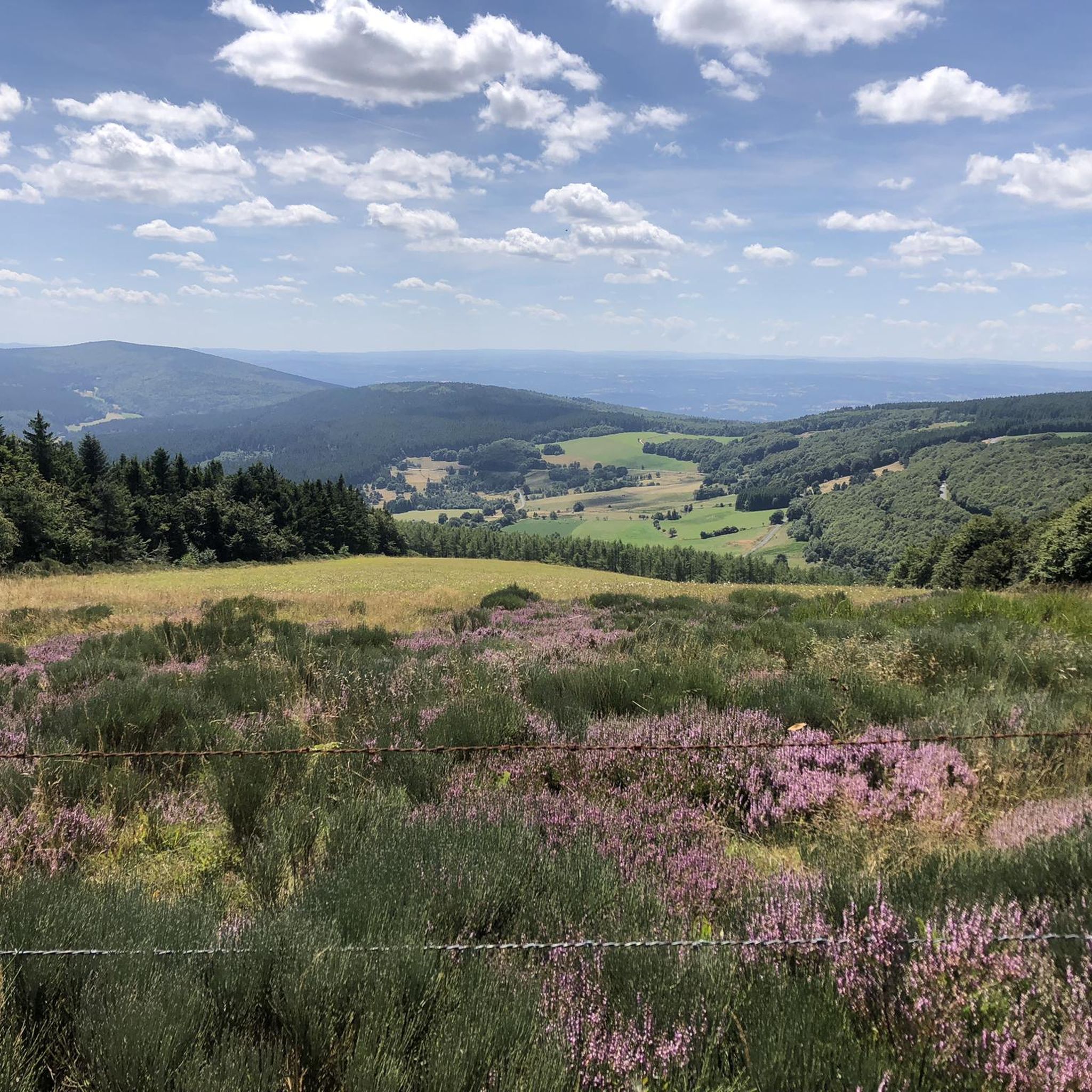
Mont Mouchet is a peak that is part of the Margeride massif. There, you'll find very rocky areas and other more wooded areas, composed of beech and fir forests. As a result, the landscapes are fabulous. Mont Mouchet is also a site classified as a High Place of the Resistance in Auvergne. From here, you can enjoy a superb 360° panorama.
0
0

The 18th-century story of a beast that kills humans at night, localized in Auvers and handed down in local history, has endured through the ages and found its way into the fantasy series "Teen Wolf." The story surrounding the heroine, Marie-Jeanne Valet, is described in detail on an online fan site. If you're interested, see =>> https://www.myfanbase.de/teen-wolf/charakterbeschreibungen/?pid=23497
0
0
Very nice hike, I recommend starting in the opposite direction in order to finish by going down the scree rather than going up... otherwise the hike is mainly on shaded paths...
0
0
The 18th-century story of a beast that kills humans at night, localized in Auvers and handed down in local history, has endured through the ages and found its way into the fantasy series "Teen Wolf." The story surrounding the heroine, Marie-Jeanne Valet, is described in detail on an online fan site. If you're interested, see =>> https://www.myfanbase.de/teen-wolf/charakterbeschreibungen/?pid=23497
0
0

Mont Mouchet, like many other isolated and wild places in France (whether for example the Vercors plateau or the Albion plateau) served as a maquis for resistance fighters during the Second World War. It culminates at 1,497 meters in the Margeride massif. It offers very beautiful views of the unspoiled landscape that surrounds it. It borders three very sparsely populated departments of France: Haute-Loire, Cantal and Lozère.
0
0

Mont Mouchet, at 1,497 meters in the heart of Margeride, is a high place of the Resistance during the 2nd World War. It was notably the scene in June 1944 of the Battle of Mont Mouchet. A memorial and a museum pay homage to the Resistance fighters of this maquis.
0
0
The statue of the Beast of Gévaudan in Auvers commemorates Marie-Jeanne Vallet's fight against the Beast in 1765.
0
0
Frequently Asked Questions
What kind of terrain can I expect on the running trails around La Besseyre-Saint-Mary?
The running trails in La Besseyre-Saint-Mary traverse the diverse landscapes of the Margeride plateaus. You can expect a mix of deep forests, open spaces, and varied terrain with altitudes ranging from 749 meters to nearly 1,500 meters. Some routes, like those around Mont Mouchet, feature significant elevation changes, while others follow historical paths such as sections of the Via Podiensis, offering a blend of natural beauty and cultural heritage.
Are there challenging running routes for experienced runners in La Besseyre-Saint-Mary?
Yes, La Besseyre-Saint-Mary offers several challenging running routes. For instance, the Mont Mouchet and the Beast of Gévaudan Loop is a difficult 20.4 km (12.7 miles) trail with significant elevation gain, offering panoramic views over the Margeride region. Another demanding option is the Saint-Roch Chapel – Sauvage Estate loop from Grèzes, a difficult 46.2 km (28.7 miles) path that includes varied terrain and expansive views.
Are there any easy running routes suitable for beginners or a more relaxed jog?
While many routes offer a challenge, there are options for easier jogs. The region features 1 easy route and 8 moderate routes among its 12 total running tours. A good example of a moderate route is the Running loop from Saugues, which is 6.5 km (4 miles) long with a relatively low elevation gain, making it suitable for a more relaxed pace.
What natural landmarks can I see while running in the area?
Runners can enjoy stunning natural landmarks. The prominent Mont Mouchet, part of the Margeride massif, offers expansive panoramic views of the surrounding unspoiled landscape. You might also encounter the scenic Margeride plateaus with their varied terrain and small forest areas. The Summit of Mont Mouchet is a notable highlight.
Are there any historical points of interest along the running trails?
Absolutely. The area is rich in history. You can run sections of the historic Via Podiensis (GR65), one of the oldest pilgrimage routes to Santiago de Compostela. Trails also pass by sites like the Chapelle St-Roch, which provides magnificent 180-degree views. The Mont Mouchet area itself holds historical significance as a site for the French Resistance during World War II.
Are the running trails in La Besseyre-Saint-Mary well-marked?
Many of the established paths, especially sections of the historic Via Podiensis (GR65), are known for being well-marked. Komoot routes generally provide clear navigation, ensuring you can focus on your run and the beautiful scenery without worrying about getting lost.
What do other runners say about the trails in La Besseyre-Saint-Mary?
The running routes in La Besseyre-Saint-Mary are highly rated by the komoot community, with an average score of 5.0 stars from 1 review. Nearly 100 runners have used komoot to explore the varied terrain, often praising the diverse landscapes and engaging backdrop for physical activity.
Can I find circular running routes in this region?
Yes, many of the running routes around La Besseyre-Saint-Mary are designed as loops, offering convenient circular options. Examples include the Running loop from Clavières, a moderate 11.1 km (6.9 miles) trail, and the more challenging Mount Mouchet loop from Amourettes, which covers 16.8 km (10.4 miles).
Is there parking available near the trailheads for running routes?
While specific parking details vary by trailhead, many rural running routes in France, especially those near villages or popular natural sites like Mont Mouchet, typically have designated or informal parking areas available. It's advisable to check the starting point of your chosen komoot route for more precise parking information.
What is the best time of year for running in La Besseyre-Saint-Mary?
The best time for running in La Besseyre-Saint-Mary generally aligns with pleasant weather for outdoor activities. Spring and autumn offer cooler temperatures and beautiful scenery, ideal for longer runs. Summer can also be excellent, especially in the mornings or evenings, though some higher altitude trails might be more exposed to sun. Winter running is possible but requires appropriate gear for potentially colder and snowier conditions, particularly at higher elevations like Mont Mouchet.
Are the running trails in La Besseyre-Saint-Mary family-friendly?
For families, especially those with younger children or those seeking a less strenuous experience, it's best to choose the easier or moderate routes. The region offers 1 easy route and 8 moderate routes. Look for trails with lower elevation gain and shorter distances, such as the Running loop from Saugues, which is a moderate 6.5 km (4 miles) path.
Are dogs allowed on the running trails in La Besseyre-Saint-Mary?
Generally, dogs are permitted on most public trails in rural France, including those around La Besseyre-Saint-Mary. However, it is always recommended to keep your dog on a leash, especially in areas with livestock, wildlife, or near villages, to ensure their safety and respect for other trail users and local regulations. Always carry water for your dog, especially on longer routes.
Most popular attractions around La Besseyre-Saint-Mary

Get inspired with the komoot mobile app


Explore more
Browse the best Running Trails & Routes in other regions.
