The best walks and hikes around Badefols-Sur-Dordogne
4.5
(478)
1,859
hikers
173
hikes
Hiking around Badefols-Sur-Dordogne offers diverse landscapes shaped by the Dordogne River and its valley. The region features impressive natural cliffs, extensive rural areas, and varied terrain including forests, hills, and open fields. This area is characterized by its riverine setting and proximity to historical villages, providing a rich backdrop for outdoor activities.
Best hiking trails around Badefols-Sur-Dordogne
- The most popular hiking route is Cingle de Trémolat Loop, a 7.6 miles (12.3 km) trail that takes 3 hours 20 minutes to complete. This route offers panoramic views of the Dordogne River and its scenic meanders.
- Another top favourite among local hikers is Château de la Reine Blanche loop from Badefols-sur-Dordogne, a moderate 8.7 miles (14.1 km) path. This trail leads through varied landscapes, including woodlands and open countryside, with historical points of interest.
- Local hikers also love the Mauzac Port loop from Mauzac-et-Grand-Castang, a 3.0 miles (4.9 km) trail leading through riverside areas and past the port, often completed in about 1 hour 20 minutes.
- Hiking around Badefols-Sur-Dordogne is defined by the Dordogne River, natural cliffs, and diverse woodlands. The network of routes offers options for easy strolls, moderate treks, and more challenging hikes.
- The routes in Badefols-Sur-Dordogne are highly rated by the komoot community with an average score of 4.6 stars from over 400 reviews. More than 1700 hikers have used komoot to explore Badefols-Sur-Dordogne's varied terrain.
Last updated: August 23, 2026
4.3
(11)
30
hikers
12.3km
03:20
180m
180m
Hike the moderate 7.6-mile "On the path of the Mauzac cliffs" trail for panoramic Dordogne valley views and charming riverside scenery.
4.6
(10)
29
hikers
4.91km
01:23
100m
100m
Easy hike. Great for any fitness level. Easily-accessible paths. Suitable for all skill levels.

Sign up for free
5.0
(4)
26
hikers
14.2km
03:54
230m
230m
Moderate hike. Good fitness required. Easily-accessible paths. Suitable for all skill levels.
5.0
(1)
6
hikers
23.5km
06:31
420m
420m
Hard hike. Very good fitness required. Easily-accessible paths. Suitable for all skill levels.
4.8
(4)
11
hikers
12.5km
03:14
70m
70m
Moderate hike. Good fitness required. Easily-accessible paths. Suitable for all skill levels.
Get access to more routes and recommendations from other explorers.
Sign up for free
Already have an account?
Our route recommendations are based on thousands of hikes, rides, and runs completed by other people on komoot.
Start today with a free account
Your next adventure awaits.
Login or Signup


Tips from the Community

Good walk but the view from the cingle is inaccessible, due to private property that prohibits visitor passage. But it remains a good little loop accessible to children.
0
0

The church nave is composed of three cupola or domes.
0
0

very nice walk we could have gone further but it was hot, there and back, to go to the viewpoint you have to take a path on the right but we preferred to go straight
0
0

In midsummer, a shady route under deciduous trees!
0
0

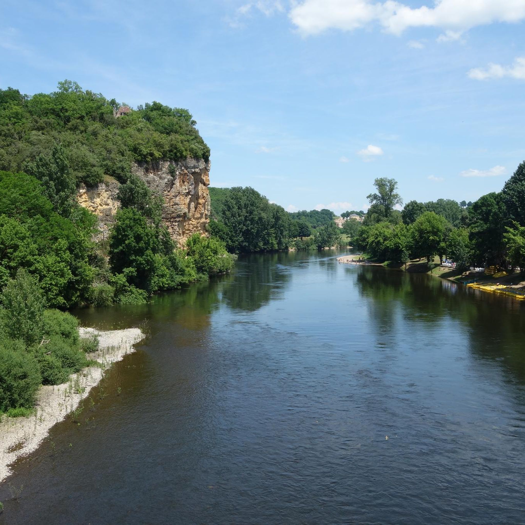
Located between Le Buisson upstream and Lalinde downstream, two elongated curves of the Dordogne are known as the Cingles de Limeuil and Trémolat. The term cingle means a belt, and is used locally to describe these distinctive meanders. From the hill, the view of the river and the cliffs is magnificent!
0
0

The village of Mauzac stretches on both banks of the Garonne and is connected by a bridge that bears his name. The original construction, a metal structure and masonry supports dating from 1877, received a major reinforcement in 1933 to accompany the evolution of traffic. Located in a protected heritage site related to the classification of the interior of the Saint-Etienne church, the work allows the RD 53 to cross the river at a height of 14 meters and a length of 150 meters.
1
1
The Mauzac Bridge over the Mauzac Dam Reservoir
1
0
Frequently Asked Questions
How many hiking trails are available around Badefols-Sur-Dordogne?
There are nearly 150 hiking trails around Badefols-Sur-Dordogne, offering a wide variety of options for all skill levels. You'll find everything from easy riverside strolls to more challenging treks through the varied landscapes.
What kind of terrain can I expect on hikes in Badefols-Sur-Dordogne?
The terrain around Badefols-Sur-Dordogne is diverse, shaped by the Dordogne River. You can expect picturesque riverside paths, impressive natural cliffs, and trails winding through extensive rural areas, forests, hills, and open fields. Some routes, like the Mauzac Port – Trémolat Meander loop, offer more challenging sections with varied elevation.
Are there any easy or family-friendly hiking options in the area?
Yes, Badefols-Sur-Dordogne offers many easy and family-friendly hikes. Over 50 routes are classified as easy, perfect for a leisurely walk. An example is the Mauzac Port loop from Mauzac-et-Grand-Castang, which is an easy 3-mile (4.9 km) trail leading through pleasant riverside areas.
What are some notable landmarks or natural features to see while hiking?
Hikers can discover a rich tapestry of natural and historical features. The Dordogne River and its valley are central, offering scenic views. You might encounter impressive natural cliffs, dry stone huts (bories), and charming historical villages. The confluence of the Dordogne and Vézère rivers at Limeuil is a significant natural landmark, and you can explore the village itself, which is classified as one of the 'Most Beautiful Villages in France'. You can also visit Limeuil or Mauzac Port.
Are there any circular hiking routes around Badefols-Sur-Dordogne?
Yes, many of the trails in the region are circular, allowing you to start and end at the same point. A popular example is the Cingle de Trémolat Loop, which offers panoramic views of the Dordogne River's meanders. Another is the Château de la Reine Blanche loop from Badefols-sur-Dordogne, leading through varied landscapes and historical points.
What do other hikers say about the trails in Badefols-Sur-Dordogne?
The hiking routes in Badefols-Sur-Dordogne are highly regarded by the komoot community, with an average rating of 4.6 stars from over 400 reviews. More than 1,700 hikers have used komoot to explore the area, often praising the diverse terrain and the beautiful riverine setting.
Is it possible to hike with dogs in Badefols-Sur-Dordogne?
Generally, dogs are welcome on trails in the Périgord region. However, it's always advisable to keep them on a leash, especially near livestock or in protected natural areas. Specific regulations might apply to certain trails or natural reserves, so check local signage.
What is the best time of year for hiking in Badefols-Sur-Dordogne?
The spring and autumn months are generally ideal for hiking in Badefols-Sur-Dordogne, offering pleasant temperatures and beautiful scenery. Summer can be warm, so early morning or late afternoon hikes are recommended. Winter offers a quieter experience, though some paths might be muddy after rain.
Where can I find parking for hiking trailheads?
Parking is typically available near popular trailheads and in the villages. For instance, you can often find parking in Mauzac-et-Grand-Castang for routes like the Mauzac Port loop, or in Badefols-sur-Dordogne for the Château de la Reine Blanche loop. Many villages in the area, such as Trémolat and Limeuil, also have designated parking areas for visitors.
Are there any permits required for hiking in this region?
No specific hiking permits are generally required for the trails around Badefols-Sur-Dordogne. The area is not within a national park that typically requires permits. However, always respect private property and local regulations, especially when passing through agricultural land.
Are there places to eat or stay near the hiking trails?
Yes, Badefols-Sur-Dordogne and nearby villages like Trémolat and Limeuil offer various options for dining and accommodation. You'll find local restaurants, cafes, and guesthouses. There are also campsites, such as Le Port de Limeuil Campsite, for those looking for outdoor lodging.
Can I reach hiking trailheads using public transport?
While public transport options exist in the wider Dordogne region, direct access to specific hiking trailheads in Badefols-Sur-Dordogne can be limited. It's often more convenient to use a car to reach the starting points of many routes. However, local bus services might connect larger towns, from which you could potentially access some trails.
Most popular routes around Badefols-Sur-Dordogne
Most popular attractions around Badefols-Sur-Dordogne

Get inspired with the komoot mobile app


Explore more
Browse the best Hikes in other regions.
