The best running trails around Daleiden
4.6
(37)
574
runners
71
runs
Jogging routes around Daleiden offer a diverse landscape for runners, situated in the Eifel region. The area is characterized by rolling hills, dense woodlands, and river valleys, providing varied terrain for different fitness levels. Runners can expect a mix of forest paths and open country trails, with elevations generally under 200 meters. This natural setting makes Daleiden a suitable destination for outdoor activities, including running and exploring the Eifel's natural beauty.
Best jogging routes around Daleiden
- The most popular jogging…
Last updated: May 22, 2026
4.0
(5)
25
runners
7.42km
00:51
170m
170m
Moderate run. Good fitness required. Mostly paved surfaces. Suitable for all skill levels.
5.0
(1)
10
runners
30.6km
03:38
540m
540m
Hard run. Very good fitness required. Mostly paved surfaces. Suitable for all skill levels.

Sign up for free
4.0
(2)
7
runners
8.24km
01:03
250m
250m
Moderate run. Good fitness required. Mostly paved surfaces. Suitable for all skill levels.
5.0
(1)
6
runners
Hard run. Very good fitness required. Mostly paved surfaces. Suitable for all skill levels.
5.0
(2)
6
runners
7.34km
00:48
110m
110m
Moderate run. Good fitness required. Mostly paved surfaces. Suitable for all skill levels.
Get access to more routes and recommendations from other explorers.
Sign up for free
Already have an account?
Our route recommendations are based on thousands of hikes, rides, and runs completed by other people on komoot.
Start today with a free account
Your next adventure awaits.
Login or Signup

Tips from the Community

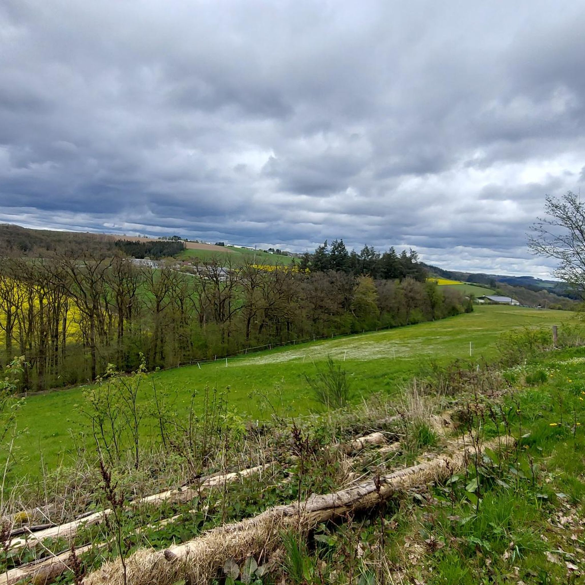
Beautiful view and opportunity to take a break on a bench.
1
0

Very quiet, well-kept campsite. The manager is very attentive. Please note: no food on site! But there is a small, well-stocked bar.
0
0

You can't get in, it's locked with a gate.
0
0
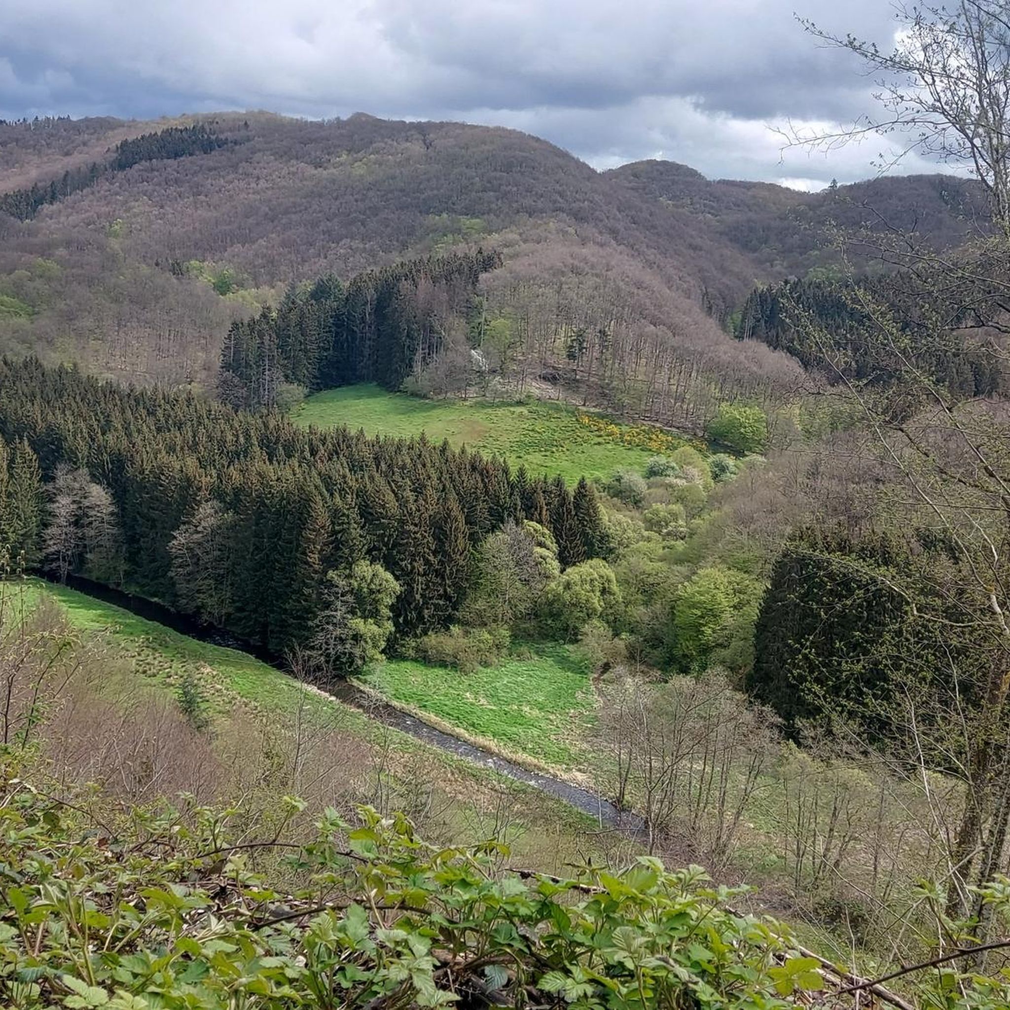
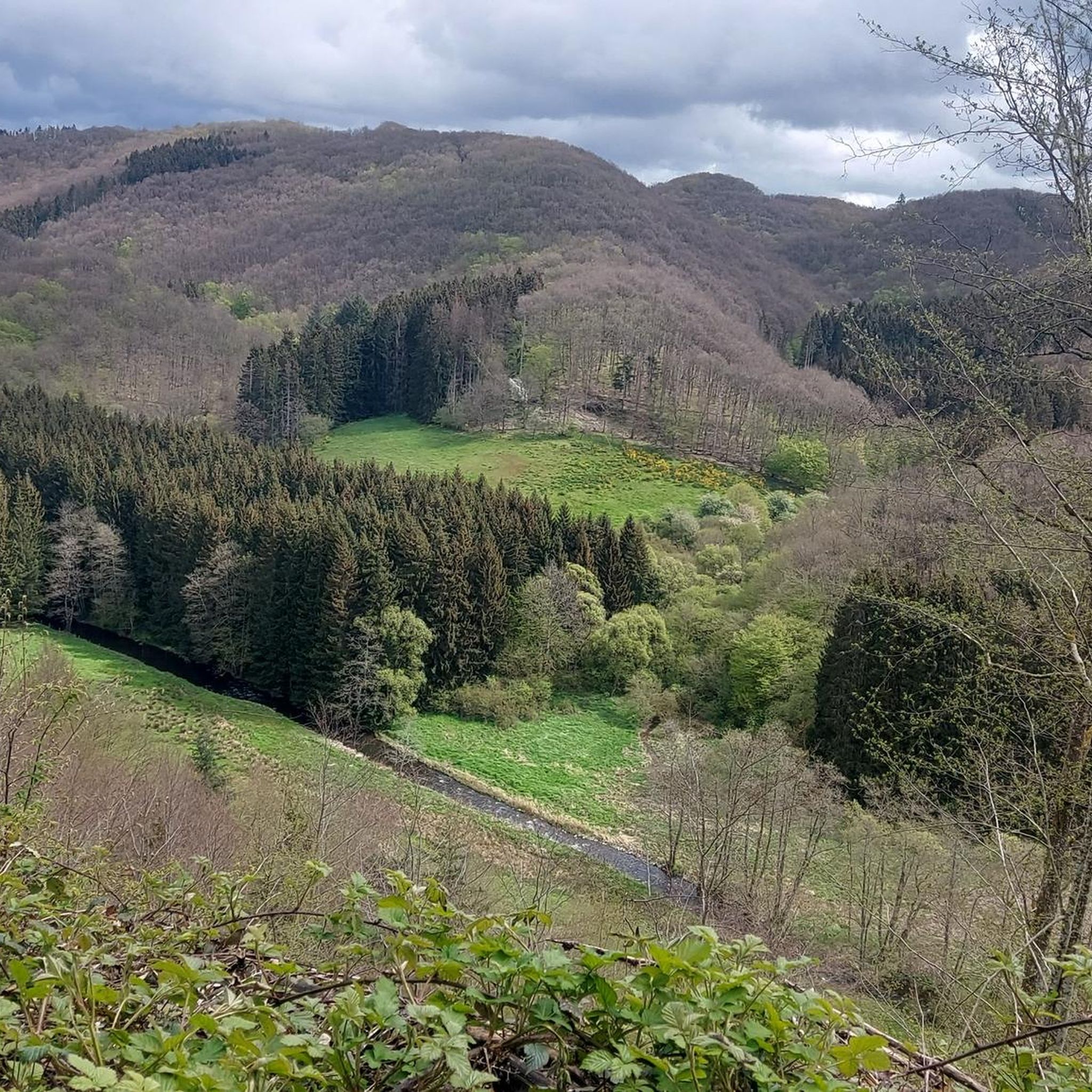
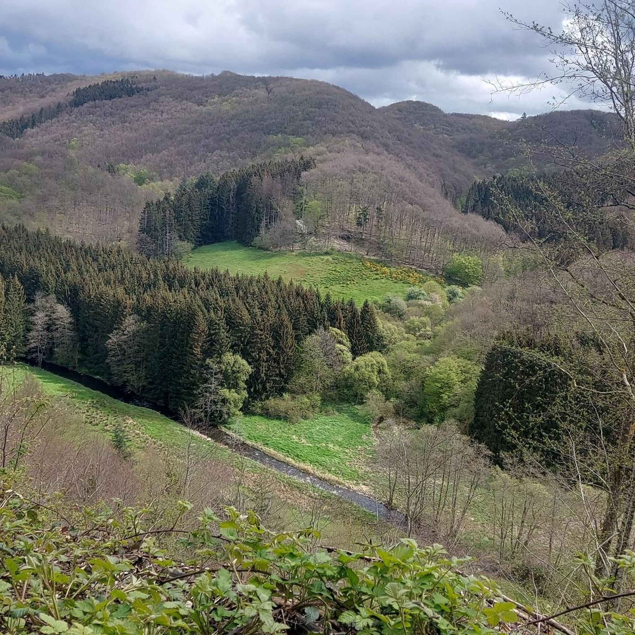
From the Kasselslay you have a beautiful view over the Our valley.
1
0

NOTE: Although signs along the way indicate food is available, this is incorrect! Only drinks and small snacks like chips are served. CLOSED on Mondays during the season!
1
0

I want to go in there... I love black holes🫶
0
0

Beautiful campsite right on the Our https://www.campingtintesmuehle.lu/
3
0

The monument owes its existence to the President of the Association of the Eifel and Ardennes, Georg Wagner, who suggested its construction as a member of parliament and President of the Chamber in Luxembourg. The memorial consists of four stones bearing the names of the »pioneers for a united Europe« (Konrad Adenauer, Joseph Bech, Paul-Henri Spaak and Robert Schuman). The memorial stones come from the respective countries of origin of the named founding fathers. Gneiss boulder from the Lüneburg Heath for Adenauer, a sandstone block from the Müllerthal-Waldbillig for Bech, blue slate from the High Fens for Spaak and a slate block from the Vosges for Schuman. The fifth stone represents the Treaties of Rome and the signatories from the six countries involved. Near the European Monument and directly at the actual three-country point, a pedestrian bridge connecting Germany and Belgium leads over the Our, which was named after Georg Wagner. Source: https://eifelfuehrer.de/touristische-zielen/neuere-geschichte/europadenkmal
9
0
Frequently Asked Questions
What kind of terrain can I expect on the running trails around Hayden and Coeur d'Alene?
The region offers a diverse landscape for runners, characterized by stunning waterfront views along Lake Coeur d'Alene and Hayden Lake, as well as varied forested and mountainous trails. You'll find a mix of paved multi-use paths, like sections of the North Idaho Centennial Trail, and natural forest paths with rolling hills and river valleys. Elevations generally vary, with some routes offering gentle changes and others, like the Black Hole Cave – Our Valley loop from Dasburg, featuring significant climbs.
How many running routes are available in the Hayden and Coeur d'Alene area?
There are over 50 dedicated running routes available in the Hayden and Coeur d'Alene area, catering to various fitness levels. This includes 7 easy routes, 33 moderate routes, and 11 more challenging trails for experienced runners.
Are there any easy jogging routes suitable for beginners or a relaxed run?
Yes, there are several easy jogging routes. While specific easy routes aren't detailed in the top picks, the region offers 7 routes classified as easy. Look for trails with minimal elevation gain and shorter distances, often found in local parks or along flatter sections of the lakefront paths. The North Idaho Centennial Trail also has segments suitable for all fitness levels.
Can I find long-distance running trails in this region?
Absolutely. For those seeking a longer challenge, routes like the Black Hole Cave – Our Valley loop from Dasburg offer over 30 kilometers (19 miles) with significant elevation changes. The North Idaho Centennial Trail itself spans 23 miles, providing ample opportunity for extended runs, with options to combine segments for even longer distances.
Are there any circular running routes available?
Many of the running routes in the area are designed as loops, offering a convenient circular experience. Examples include the popular Enz Waterfalls, Neuerburg loop from Plascheid, the Running loop from Arzfeld, and the Running loop from Affler. These loops allow you to start and finish at the same point, often providing varied scenery throughout your run.
What do other runners say about the trails in Hayden and Coeur d'Alene?
The running trails in the Hayden and Coeur d'Alene area are highly rated by the komoot community, with an average score of 4.5 stars from over 20 reviews. Runners often praise the diverse terrain, scenic views, and the well-maintained paths that cater to different abilities. Over 400 runners have used komoot to explore the region's varied landscape.
Are there any trails with waterfalls or unique natural features?
Yes, the region's natural beauty includes features like waterfalls. The Enz Waterfalls, Neuerburg loop from Plascheid is a moderate route that specifically highlights scenic views along the Enz river, likely including waterfall features. The area's rivers and canyons, such as the Spokane River, also offer unique natural settings for runs.
Are the running routes in Hayden and Coeur d'Alene family-friendly?
Many routes, especially the easier and moderate ones, are suitable for families. Paved multi-use paths like sections of the North Idaho Centennial Trail are excellent for family outings, offering flat surfaces and scenic views. Parks such as McEuen Park and City Park in Coeur d'Alene also provide green spaces and walking paths perfect for a refreshing jog with family.
What are some notable landmarks or points of interest I might see while jogging?
While jogging, you can enjoy stunning views of Lake Coeur d'Alene and Hayden Lake. The Floating Boardwalk on Lake Coeur d'Alene offers a unique experience over the water. You might also encounter features like the Upper Reservoir of the Vianden Pumped Storage Plant or the Riverside Path Along the Our Reservoir with Views of Vianden Castle, which are points of interest along some routes. The region is also surrounded by mountains and dense forests, providing natural landmarks.
Is there public transport access to the jogging trails, or is parking readily available?
While specific public transport details for individual trailheads are not provided, the Hayden and Coeur d'Alene area is generally accessible. Many popular trailheads, especially those around the lakes and in city parks, typically offer parking facilities. For more detailed information on local transport options, you might consult local tourism resources like visitnorthidaho.com.
What is the best time of year for jogging in the Hayden and Coeur d'Alene region?
The Hayden and Coeur d'Alene region is beautiful year-round, but the best time for jogging is typically from spring through fall (April to October) when the weather is mild and the trails are clear. Summers offer warm, sunny days perfect for lakeside runs, while spring and fall provide cooler temperatures and vibrant foliage. Winter jogging is possible, but some trails may be snowy or icy, requiring appropriate gear.
Are there any particularly challenging running routes for experienced runners?
Yes, for experienced runners seeking a challenge, there are 11 difficult routes in the area. The Black Hole Cave – Our Valley loop from Dasburg is a prime example, covering over 30 kilometers with more than 500 meters of elevation gain. Another challenging option is the Mountain Trail in the Eifel – Bannert Communication Tower loop from Affler, which is over 12 kilometers with significant climbs.
Most popular attractions around Daleiden

Get inspired with the komoot mobile app


Explore more
Browse the best Running Trails & Routes in other regions.
