The best running trails around Roussillon-En-Morvan
4.1
(18)
361
runners
114
runs
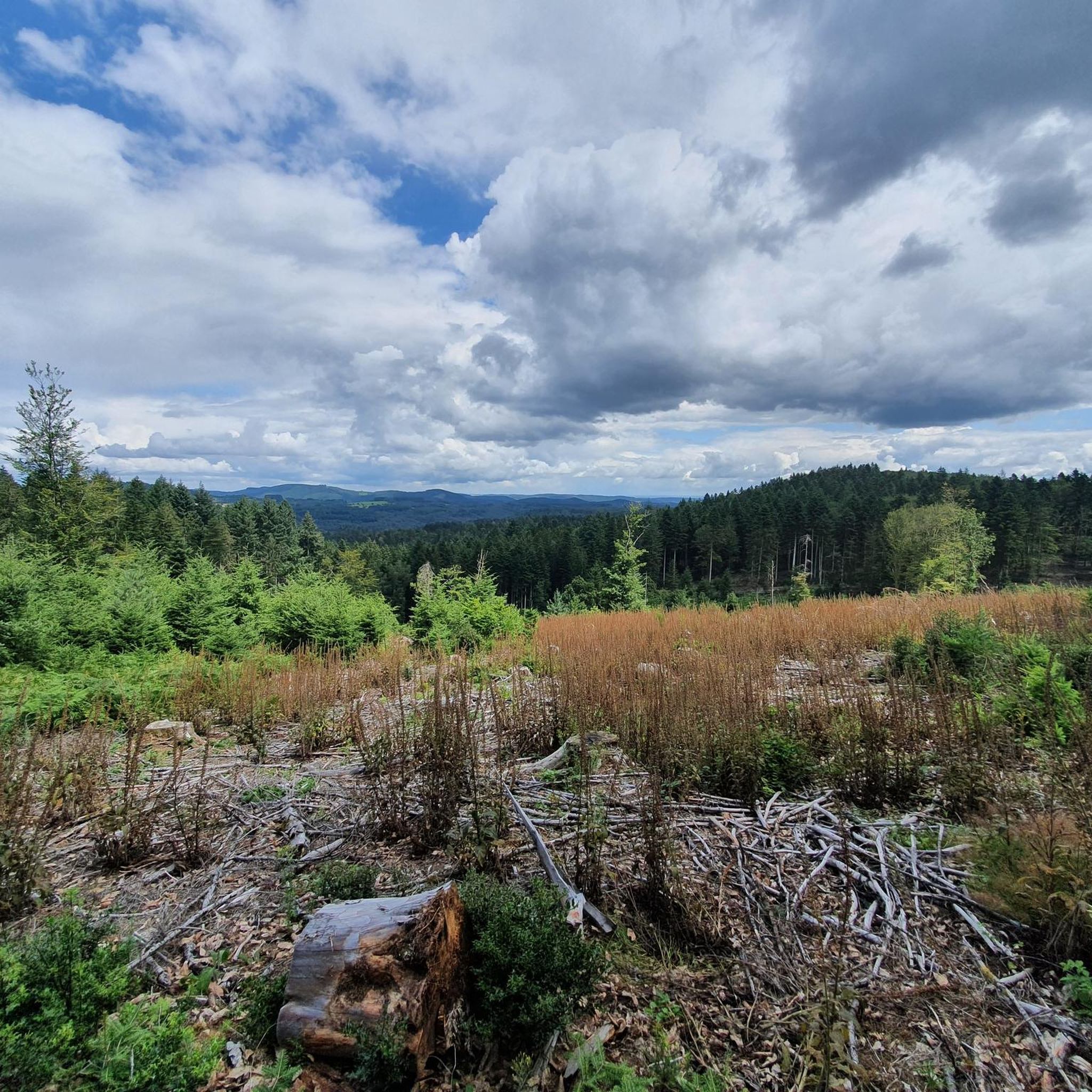
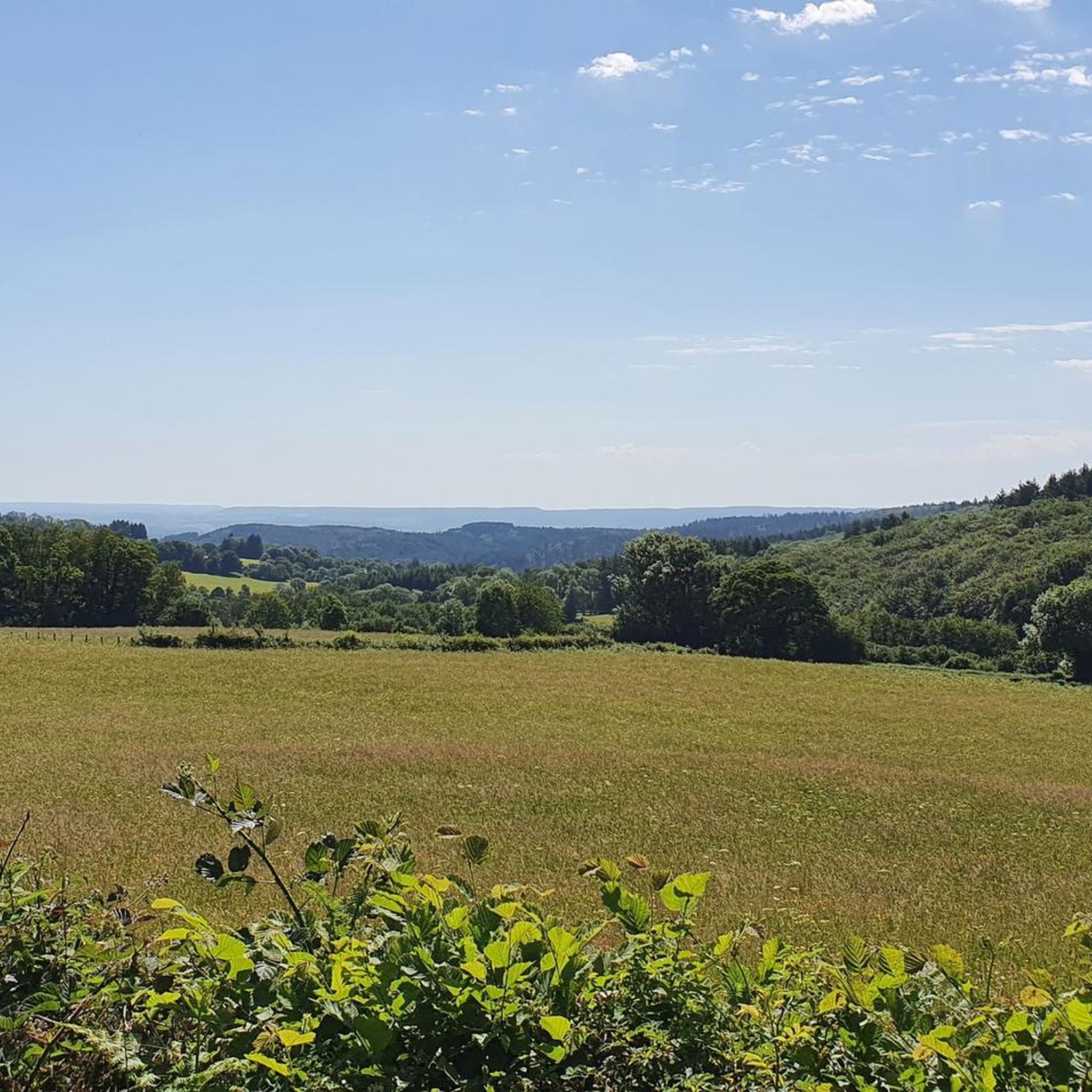
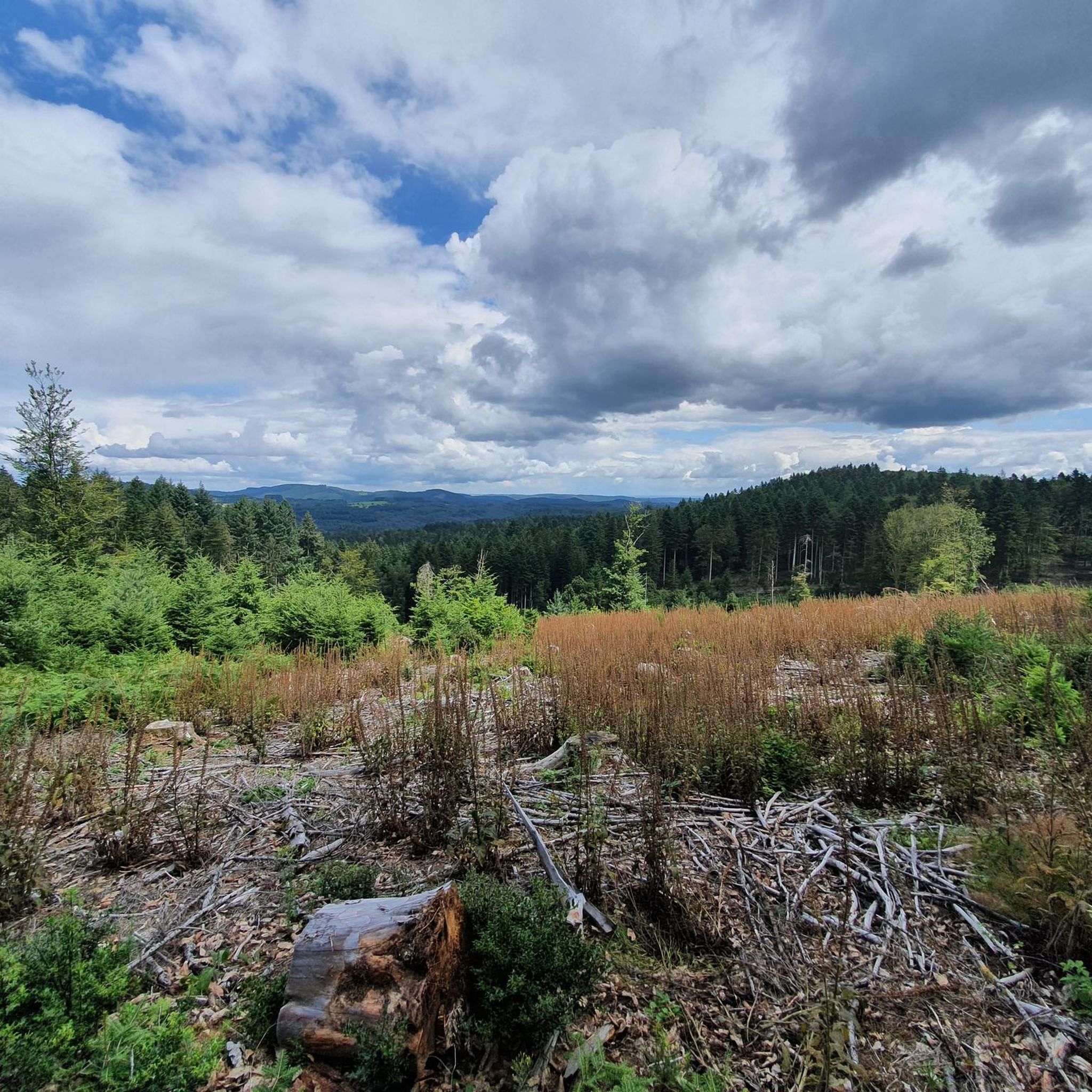
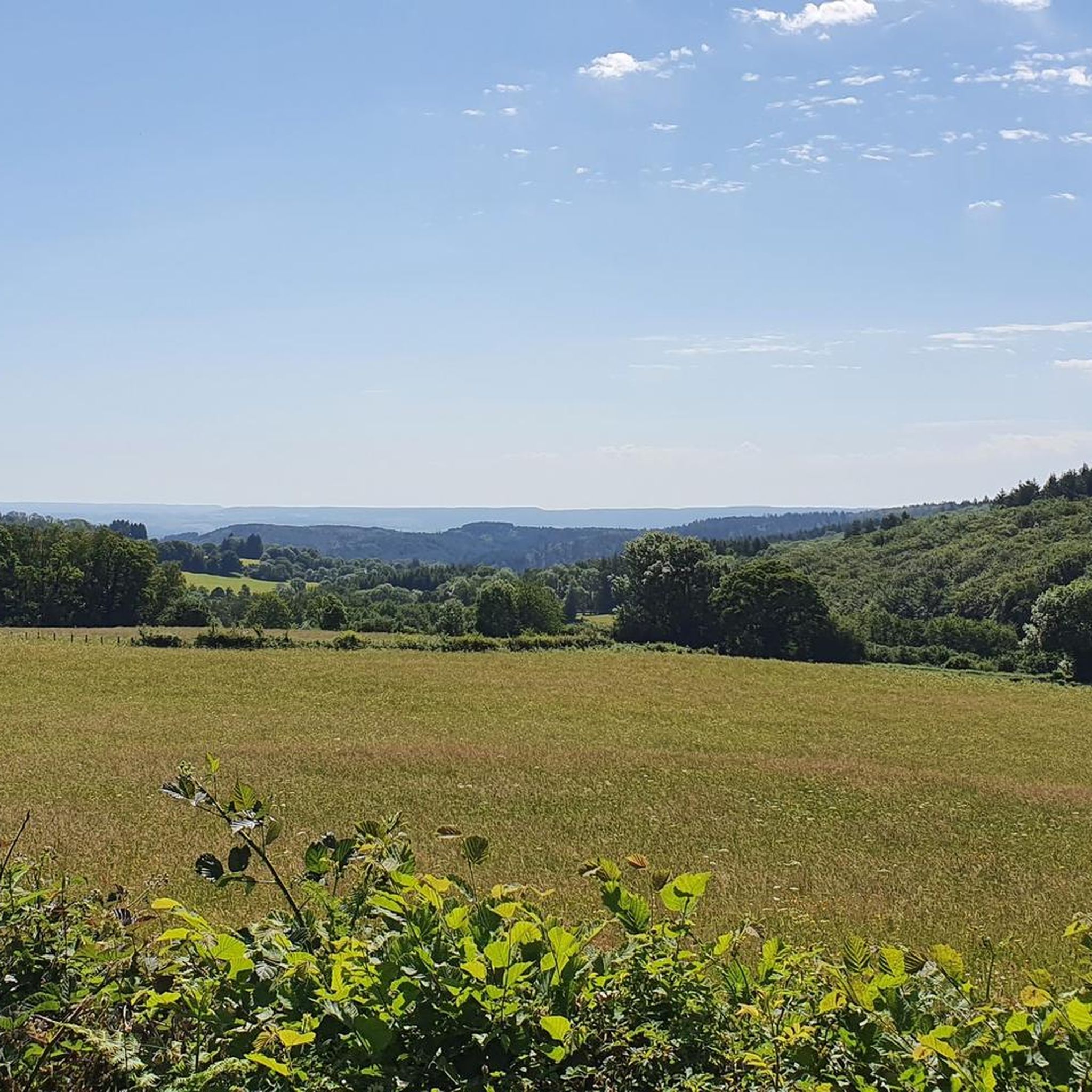
Jogging around Roussillon-En-Morvan offers diverse landscapes within the Morvan Regional Natural Park, characterized by extensive forests, lakes, and hilly terrain. The region features undulating hills and dense forests, providing varied terrain for running. Elevations range from approximately 370 to 845 meters, with the Morvan being a granite mountain range. The Gorges de la Canche, a biological reserve, provides routes along the Canche river.
Best jogging routes around Roussillon-En-Morvan
- The most popular jogging route is Haut-Folin Summit – Étang de Préperny…
Last updated: August 27, 2026
19
runners
12.6km
01:34
340m
340m
Hard run. Very good fitness required. Mostly paved surfaces. Suitable for all skill levels.
4.7
(3)
13
runners
Moderate run. Good fitness required. Mostly paved surfaces. Suitable for all skill levels.

Sign up for free
5.0
(1)
9
runners
Hard run. Very good fitness required. Mostly paved surfaces. Suitable for all skill levels.
4
runners
15.0km
01:46
360m
360m
Hard run. Very good fitness required. Mostly paved surfaces. Suitable for all skill levels.
6
runners
14.8km
01:44
330m
330m
Hard run. Very good fitness required. Mostly paved surfaces. Suitable for all skill levels.
Get access to more routes and recommendations from other explorers.
Sign up for free
Already have an account?
Our route recommendations are based on thousands of hikes, rides, and runs completed by other people on komoot.
Start today with a free account
Your next adventure awaits.
Login or Signup
Tips from the Community

A very beautiful hike, I did this barefoot
0
0

Haut-Folin is the highest point in the Morvan region and, more broadly, in Burgundy, at 901 meters above sea level. This mountain boasts a beautiful natural setting with areas covered in deciduous and coniferous trees. It is also the starting point for numerous hiking and cycling trails.
1
0


I highly recommend changing the direction of the hike from east to west. The ascent is easier than the descent through the gorge, and after the comfortable, but somewhat monotonous, forest paths, it's a perfect ending!
0
0

Highest point of Morvan, Saône-et-Loire and Burgundy at 901m. Up there is a teletransmission antenna in the middle of the forest.
0
0
Nice viewpoint overlooking the Morvan mountains towards La Celle-en-Morvan and Roussillon-en-Morvan.
0
0


The summit of Haut-Folin is not to be confused with the nearby pass of the same name. The pass at an altitude of 873 meters, while the summit culminates at 901 meters. This summit of the Morvan goes almost unnoticed, because it is located in a forest, you pass it without really noticing it. Fortunately, there is an indication on a granite stele.
4
0
Frequently Asked Questions
How many running routes are available in Roussillon-En-Morvan, and what are their difficulty levels?
Roussillon-En-Morvan offers a wide selection of running routes within the Morvan Regional Natural Park. There are over 80 routes available, catering to various fitness levels. You'll find 2 easy routes, 48 moderate routes, and 39 difficult routes, ensuring options for both casual joggers and experienced trail runners.
What kind of terrain can I expect on the jogging trails in Roussillon-En-Morvan?
The terrain in Roussillon-En-Morvan is quite varied, characterized by undulating hills, dense forests, and river valleys. As part of the Morvan, a granite mountain range, you can expect significant elevation changes, with altitudes ranging from approximately 370 to 845 meters. This makes for a dynamic running experience, from riverside paths to challenging ascents.
Are there any family-friendly jogging paths in Roussillon-En-Morvan?
Yes, while many routes offer a challenge, there are options suitable for families. The region's diverse landscape includes easier paths, particularly along river valleys like the Canche. For a moderate option that offers scenic views without extreme difficulty, consider the View of the Morvan Hills – Path along the Canche loop from Le Grand Mizieux, which is 8.7 km long.
Can I bring my dog on the running trails in Roussillon-En-Morvan?
Generally, the trails within the Morvan Regional Natural Park are dog-friendly, making Roussillon-En-Morvan a great place to run with your canine companion. It's always recommended to keep your dog on a leash, especially in areas with wildlife or near livestock, and to respect local regulations.
Which running routes offer the best scenic views or viewpoints?
For breathtaking panoramic views, consider routes that ascend to higher elevations. The Haut-Folin Summit – Étang de Préperny loop from Haut Folin takes you towards the highest point in the Morvan, offering expansive vistas. Another excellent option is the Path along the Canche – View of the Morvan Hills loop from Roussillon-en-Morvan, which provides panoramic views alongside river valleys.
Are there any jogging routes that pass by waterfalls or other natural monuments?
Yes, the region is rich in natural beauty. While jogging, you might encounter highlights such as the Dragne Waterfall or the Sources of the Yonne. The La Canche Pond is also a beautiful spot that some routes pass by, offering serene waterside running.
What do other runners enjoy the most about jogging in Roussillon-En-Morvan?
The running routes in Roussillon-En-Morvan are highly rated by the komoot community, with an average score of 3.9 stars from over 10 reviews. Reviewers often praise the diverse landscapes, the tranquility of the dense forests, and the varied terrain that provides both challenging ascents and scenic riverside paths.
Are there many circular running routes available in the Roussillon-En-Morvan area?
Yes, the majority of running routes in Roussillon-En-Morvan are designed as loops, allowing you to start and finish at the same point without retracing your steps. This is ideal for exploring the diverse landscapes, from the Gorges de la Canche to the hilly forests, efficiently.
Are there any historical landmarks or interesting places to explore along the running paths?
Beyond natural beauty, Roussillon-En-Morvan has historical significance. The village itself sits on an ancient Gallo-Roman road. You can also find highlights like the Mount Beuvray, an ancient Gaul settlement, or the Old Hydroelectric Power Station, offering glimpses into the region's past while you run.
What is the best time of year for jogging in Roussillon-En-Morvan?
The Morvan Regional Natural Park, including Roussillon-En-Morvan, is beautiful year-round. Spring and autumn offer pleasant temperatures and vibrant foliage, making them ideal for running. Summer can be warm but the dense forests provide ample shade. Winter running is also possible, especially for those who enjoy the quiet, crisp air, though some higher elevation trails might require more appropriate gear.
Are there any longer, more challenging running routes for experienced trail runners?
Absolutely. For experienced trail runners seeking a challenge, Roussillon-En-Morvan offers several difficult routes with significant elevation gain. The Running loop from Roussillon-en-Morvan is a demanding 14.9 km trail with over 360 meters of ascent, providing a great workout through the hilly terrain.
Are there any running routes that follow the Canche river?
Yes, the Gorges de la Canche is a significant natural highlight, and several routes follow the path along the Canche river. The Path along the Canche loop from Roussillon-en-Morvan is a 14.7 km difficult route that allows you to experience this beautiful biological reserve.
Most popular routes around Roussillon-En-Morvan
Most popular attractions around Roussillon-En-Morvan

Get inspired with the komoot mobile app


Explore more
Browse the best Running Trails & Routes in other regions.
