The best running trails around Bois-Sainte-Marie
4.7
(24)
383
runners
77
runs
Jogging routes around Bois-Sainte-Marie traverse a tranquil rural landscape, characterized by vast prairies and diverse agricultural zones. The area features gently rolling hills, offering varied terrain for different running intensities. Runners can explore quiet country roads and paths, often passing through the historical village with its preserved medieval architecture. This setting provides an open and serene environment, blending natural beauty with cultural heritage.
Best jogging routes around Bois-Sainte-Marie
- The most popular jogging route is Running loop from Gibles, an…
Last updated: July 1, 2026
10
runners
13.0km
01:27
230m
230m
Moderate run. Good fitness required. Mostly paved surfaces. Suitable for all skill levels.
9
runners
10.5km
01:12
230m
230m
Moderate run. Good fitness required. Mostly paved surfaces. Suitable for all skill levels.

Sign up for free
4.0
(1)
9
runners
14.5km
01:42
440m
440m
Hard run. Very good fitness required. Mostly paved surfaces. Suitable for all skill levels.
8
runners
9.75km
01:10
190m
190m
Moderate run. Good fitness required. Mostly paved surfaces. Suitable for all skill levels.
8
runners
10.2km
01:12
180m
180m
Moderate run. Good fitness required. Mostly paved surfaces. Suitable for all skill levels.
Get access to more routes and recommendations from other explorers.
Sign up for free
Already have an account?
Our route recommendations are based on thousands of hikes, rides, and runs completed by other people on komoot.
Start today with a free account
Your next adventure awaits.
Login or Signup
Tips from the Community

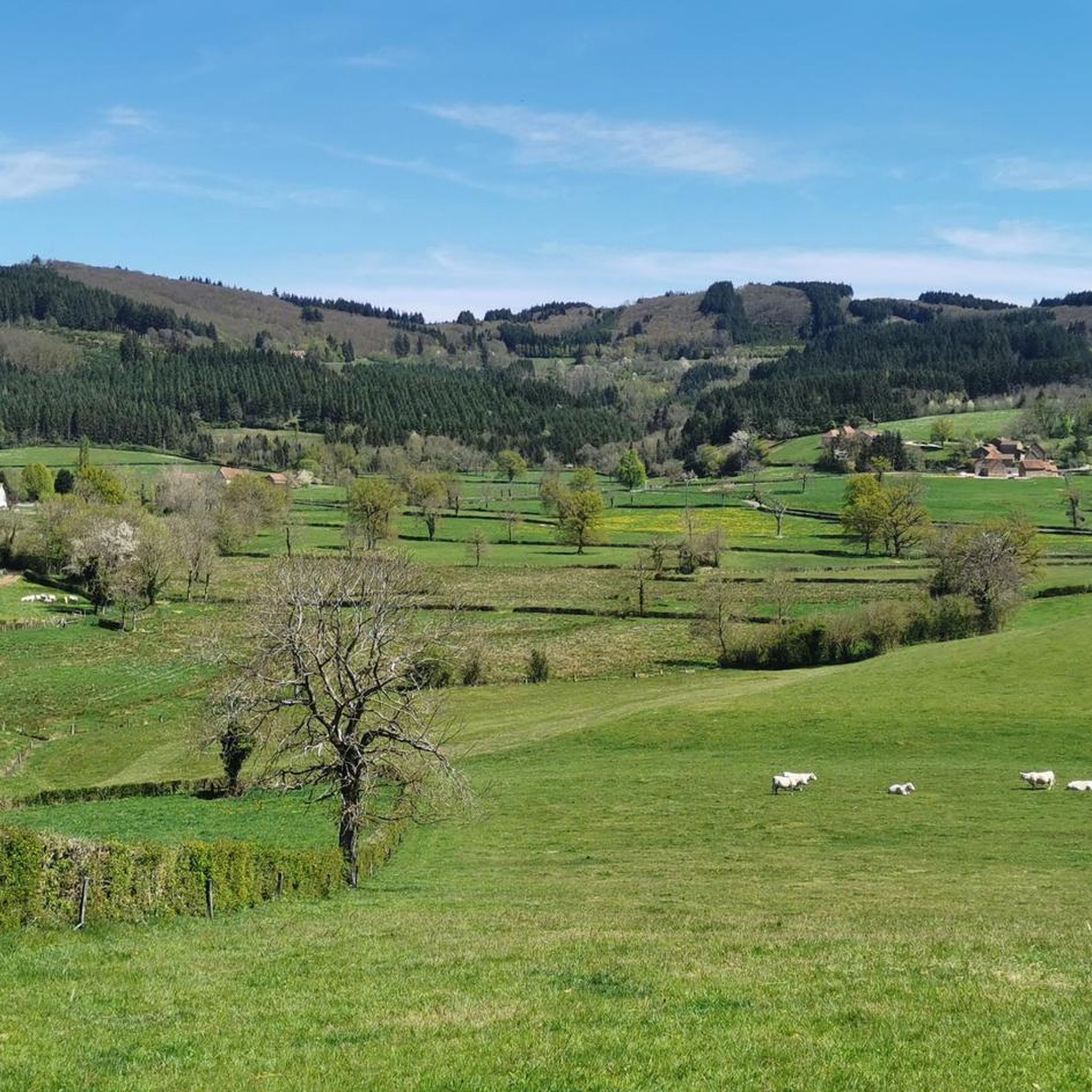
Mont Saint-Cyr is located in southern Burgundy (Département Saône-et-Loire) in the municipality of Montmelard and, at 771 meters, is the highest point in the Mâconnais mountains. From the summit, there is a wide panoramic view of the surrounding landscapes of Charolais, Brionnais, and Clunisois. In very clear weather, the view to the east even extends to Mont Blanc in the Alps. On the mountain are the historical remains of a 10th-century monastery that was destroyed during the Huguenot Wars. There is a picnic area in the forest, as well as orientation panels that are helpful in identifying the surrounding peaks and valleys.
0
0
Mont Saint-Cyr is located in southern Burgundy (Saône-et-Loire department) in the municipality of Montmelard and, at 771 meters, is the highest point of the Mâconnais mountains. From the summit, there is a wide panoramic view of the surrounding landscapes of Charolais, Brionnais, and Clunisois. In very clear weather, the view extends eastwards to Mont Blanc in the Alps. On the mountain are the historical remains of a 10th-century monastery, which was destroyed during the Huguenot Wars. There is a picnic area in the forest as well as orientation panels that are helpful in identifying the surrounding peaks and valleys.
0
0

Impressive views over southern Burgundy and Haut-Beaujolais
1
0

A very steep climb from Montmelard, not much fun by bike. View is good, best very early or in the evening.
1
0

Mont Saint-Cyr, with its 771 m, is the highest point of the Mâconnais mountains. From its summit, you can enjoy a 360° view of the surroundings and even of the Alps when the weather allows it.
3
0
Mont Saint-Cyr, at 771 m, is the highest point of the Mâconnais mountains. From its summit, you can enjoy a 360° view of the surroundings and even of the Alps when the weather allows it.
4
0


It is a tough climb to the viewpoint, but the reward is a superior view on the landscape and a nice are to take a rest
2
0
Frequently Asked Questions
How many running routes are available around Bois-Sainte-Marie?
There are over 70 running routes around Bois-Sainte-Marie, catering to various fitness levels. The komoot community has explored these trails more than 200 times, highlighting the area's popularity for outdoor activities.
What kind of terrain can I expect on the jogging trails in Bois-Sainte-Marie?
The jogging trails around Bois-Sainte-Marie primarily traverse a tranquil rural landscape, characterized by vast prairies and diverse agricultural zones. You'll encounter gently rolling hills, offering varied terrain suitable for different running intensities, from leisurely jogs to more challenging efforts with slight elevation changes.
Are there any easy running routes suitable for beginners or a relaxed jog?
Yes, Bois-Sainte-Marie offers several easier running options. While many routes are moderate, there are 3 routes classified as easy. These typically follow quiet country roads and paths, providing a serene environment for a relaxed run through the pastoral scenery.
Can I find longer running trails for endurance training in the area?
Absolutely. For those looking for longer distances, routes like the Montagne Saint-Cyr – Mount St. Cyr loop from Gibles offer a challenging 9.0 miles (14.5 km) with significant elevation gain. Another excellent option is the Running loop from Gibles, which covers 8.1 miles (13.0 km) through the rural landscape.
Are there any circular running routes around Bois-Sainte-Marie?
Yes, many of the running routes in the region are circular, allowing you to start and finish at the same point. For example, the Étang des Clefs loop from Gibles is a popular moderate 6.5-mile (10.5 km) circular path that winds around the Étang des Clefs, offering a peaceful waterside experience.
What historical landmarks or natural sights can I see while running in Bois-Sainte-Marie?
Jogging through Bois-Sainte-Marie offers a unique blend of natural beauty and historical charm. You can run amidst the village's preserved fortified town plan, medieval plots, and 16th-century residences. The impressive 11th-century Romanesque church, Église Notre-Dame-de-la-Nativité, is a central landmark. Nearby attractions include Mount Dun and Mount St. Cyr, offering scenic viewpoints, and historical sites like Drée Castle and View of Château de La Clayette.
What do other runners enjoy most about jogging in Bois-Sainte-Marie?
The running routes in Bois-Sainte-Marie are highly rated by the komoot community, with an average score of 4.4 stars from over 10 reviews. Runners often praise the tranquil rural setting, the blend of natural beauty with the historical village architecture, and the variety of paths through prairies and agricultural land that provide a serene and enriching experience.
Are the running trails in Bois-Sainte-Marie suitable for families?
The tranquil rural setting and the presence of easier routes make many paths around Bois-Sainte-Marie suitable for families. The quiet country roads and paths, away from urban traffic, provide a safe and pleasant environment for family outings. Consider the shorter, less challenging routes for a comfortable experience with children.
Is Bois-Sainte-Marie a good place for trail running, or are the routes mostly paved?
Bois-Sainte-Marie offers a mix, but it's particularly well-suited for trail running due to its extensive rural landscape. The routes often follow quiet country roads and paths through prairies and agricultural zones, which can be unpaved or gravel. For a more immersive natural experience, the broader area around Bois-Sainte-Marie is rich in hiking opportunities that can easily be adapted for trail running, winding through forests and along ridgelines.
What is the best time of year to go jogging in Bois-Sainte-Marie?
The region's rural charm and natural landscapes are enjoyable throughout much of the year. Spring and autumn offer pleasant temperatures and beautiful scenery with blooming fields or colorful foliage. Summer can be warm but is ideal for early morning or late afternoon runs. Winter running is also possible, with the quiet paths offering a peaceful, crisp experience, though checking local weather conditions is always advisable.
Are there any challenging running routes for experienced runners?
Yes, for experienced runners seeking a challenge, Bois-Sainte-Marie offers routes with more significant elevation changes. The Montagne Saint-Cyr – Mount St. Cyr loop from Gibles is classified as difficult, featuring 9.0 miles (14.5 km) with over 439 meters of ascent, providing a vigorous workout through rolling hills.
Where can I find information about parking for the running routes?
While specific parking areas for each route are not detailed, as a rural commune, Bois-Sainte-Marie and its surrounding villages typically offer public parking options, especially near central points or trailheads. It's advisable to check the starting point of your chosen route on komoot for any specific parking notes or to look for general village parking upon arrival.
Most popular attractions around Bois-Sainte-Marie

Get inspired with the komoot mobile app


Explore more
Browse the best Running Trails & Routes in other regions.
