The best road cycling routes around Bouchavesnes-Bergen
3.9
(14)
393
riders
147
rides
Road cycling routes around Bouchavesnes-Bergen are primarily characterized by the gentle terrain of the Somme river valley. The landscape features a mix of open agricultural fields, historical sites, and tranquil waterways. Elevations are generally low, making the area suitable for varied road cycling experiences. The region offers a network of paths that cater to different skill levels.
Best road cycling routes around Bouchavesnes-Bergen
- The most popular road cycling route is Étang du Brochet loop from Péronne, an easy 19.2…
Last updated: July 2, 2026
6
riders
50.9km
02:13
260m
260m
Moderate road ride. Good fitness required. Mostly well-paved surfaces and easy to ride.
17
riders
Moderate road ride. Good fitness required. Mostly well-paved surfaces and easy to ride.

Sign up for free
5
riders
Easy road ride. Great for any fitness level. Mostly well-paved surfaces and easy to ride.
6
riders
Moderate road ride. Good fitness required. Mostly well-paved surfaces and easy to ride.
3.0
(1)
4
riders
53.8km
02:21
350m
350m
Moderate road ride. Good fitness required. Mostly well-paved surfaces and easy to ride.
Get access to more routes and recommendations from other explorers.
Sign up for free
Already have an account?
Our route recommendations are based on thousands of hikes, rides, and runs completed by other people on komoot.
Start today with a free account
Your next adventure awaits.
Login or Signup


Tips from the Community

The Somme 245 km is a river in Hauts-de-France (France). The old Gallic name of the river is "Samara", meaning "the calm one". It is the river from which the Somme department derives its name.
8
0
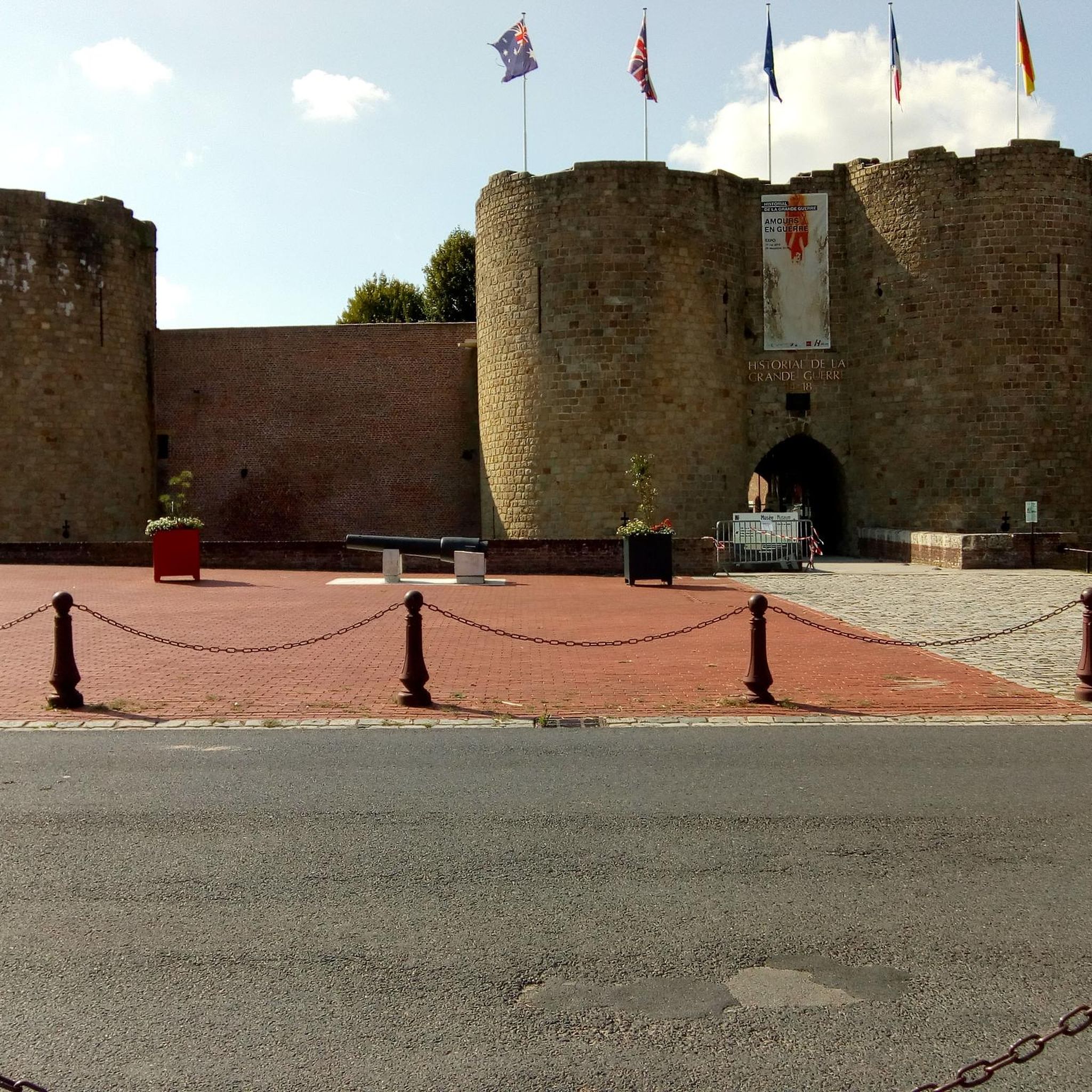
The castle served for centuries as a meeting place for the regional nobility and thinkers.
10
0
There are several locks near Frise, all with fish ladders.
14
0

In addition to the exceptional viewpoint, the landscape interpretation table allows you to better understand the environment that unfolds before you.
0
0

Magnificent viewpoint overlooking the Somme Valley. The climb is quite steep to get there from Péronne.
0
0

Also a bicycle repair and electric bike charging point
0
0

magnificent view
0
0

There are several of these bridges - unfortunately I didn't see any of them in action.
0
0
Frequently Asked Questions
How many road cycling routes are available around Bouchavesnes-Bergen?
There are over 120 road cycling routes available around Bouchavesnes-Bergen on komoot, offering a wide range of options for different skill levels and preferences.
Are there easy road cycling routes suitable for beginners or families?
Yes, the region's gentle terrain and low elevations make it suitable for beginners and families. There are 18 easy routes available. For example, the Historial de la Grande Guerre loop from Péronne is an easy 23.9-mile (38.4 km) trail that passes by significant historical landmarks.
What kind of terrain can I expect on road cycling routes in Bouchavesnes-Bergen?
Road cycling routes around Bouchavesnes-Bergen are primarily characterized by the gentle terrain of the Somme river valley. You'll find a mix of open agricultural fields, historical sites, and tranquil waterways. Elevations are generally low, offering a comfortable riding experience.
Are there challenging routes for experienced road cyclists?
Yes, for more experienced road cyclists, there are 13 difficult routes and 92 moderate routes. The Château de Péronne – Doingt Greenway loop from Nécropole nationale de France à l'Ouvrage des Bois is a longer, more challenging option at 43.5 miles (69.9 km) leading through greenways and historical areas.
What historical sites or attractions can I see along the road cycling routes?
Many routes pass by significant historical sites. You can explore attractions like the Château de Péronne and the Historial of the Great War – Château de Péronne. The region is rich in history, particularly related to the Great War.
Are there scenic viewpoints along the road cycling routes?
Yes, the area offers several scenic spots. You might encounter viewpoints such as Vaux Viewpoint and Frise Viewpoint, providing picturesque views of the Somme valley and surrounding landscapes.
When is the best time of year to go road cycling in Bouchavesnes-Bergen?
The gentle terrain makes road cycling enjoyable for much of the year. Spring and autumn offer pleasant temperatures and beautiful scenery. Summer is also popular, though it can be warmer. Winter conditions can vary, so checking local forecasts is advisable.
Are most road cycling routes in the area circular?
Many of the popular road cycling routes around Bouchavesnes-Bergen are designed as loops, allowing you to start and finish at the same point. Examples include the Étang du Brochet loop from Péronne and the Péronne – Château de Péronne loop from Biaches.
What do other road cyclists say about the routes in Bouchavesnes-Bergen?
The routes in Bouchavesnes-Bergen are highly rated by the komoot community, with an average score of 4.1 stars from more than 10 reviews. Over 400 road cyclists have used komoot to explore the varied terrain, often praising the historical significance and tranquil waterways.
Can I find routes that follow waterways or greenways?
Absolutely. The region is characterized by tranquil waterways like the Somme River. Routes such as the Château de Suzanne – Towpath Along the Somme River loop from Cléry-sur-Somme offer scenic rides along river towpaths and through greenways.
Is it possible to download GPX tracks for the road cycling routes?
Yes, for all routes available on komoot, you can easily download the GPX track to navigate offline. This ensures you can follow your chosen route without needing a constant internet connection.
Most popular routes around Bouchavesnes-Bergen
Most popular attractions around Bouchavesnes-Bergen

Get inspired with the komoot mobile app


Explore more
Browse the best Road cycling routes in other regions.
