The best walks and hikes around Arvillers
4.4
(16)
99
hikers
32
hikes
Hiking around Arvillers, situated in the Somme department of France, offers access to diverse natural landscapes. The region is characterized by a blend of forests, rivers, and limestone hillsides known as "larris," which provide elevated perspectives. Wetlands and ponds are also present, contributing to varied terrain for outdoor activities. This area provides a network of trails suitable for exploring its natural features.
Best hiking trails around Arvillers
- The most popular hiking route is Davenescourt Castle loop from Davenescourt, a 6.5 miles (10.5 km) trail that takes 2 hours 45 minutes to complete, passing by the historic castle.
- Another top favourite among local hikers is Wooden bridge loop from Fignières, a moderate 5.4 miles (8.7 km) path. This route features a distinctive wooden bridge and offers views of the surrounding natural environment.
- Local hikers also love the Ruins of the Cemetery Chapel loop from Guerbigny, a 6.9 miles (11.2 km) trail leading through historical sites, often completed in about 2 hours 55 minutes.
- Hiking around Arvillers is defined by forests, rivers, and limestone hillsides (larris). The network offers options for both easy and moderate ability levels.
- The routes in Arvillers are highly rated by the komoot community with an average score of 4.6 stars from over 10 reviews. More than 80 hikers have used komoot to explore Arvillers's varied terrain.
Last updated: June 29, 2026
4.5
(2)
13
hikers
10.5km
02:45
90m
90m
Moderate hike. Good fitness required. Easily-accessible paths. Suitable for all skill levels.
4.5
(2)
6
hikers
8.74km
02:17
70m
70m
Moderate hike. Good fitness required. Easily-accessible paths. Suitable for all skill levels.

Sign up for free
7
hikers
11.2km
02:56
90m
90m
Moderate hike. Good fitness required. Easily-accessible paths. Suitable for all skill levels.
5.0
(1)
7
hikers
12.2km
03:15
130m
130m
Moderate hike. Good fitness required. Easily-accessible paths. Suitable for all skill levels.
4
hikers
9.90km
02:37
90m
90m
Moderate hike. Good fitness required. Easily-accessible paths. Suitable for all skill levels.
Get access to more routes and recommendations from other explorers.
Sign up for free
Already have an account?
Our route recommendations are based on thousands of hikes, rides, and runs completed by other people on komoot.
Start today with a free account
Your next adventure awaits.
Login or Signup



Tips from the Community

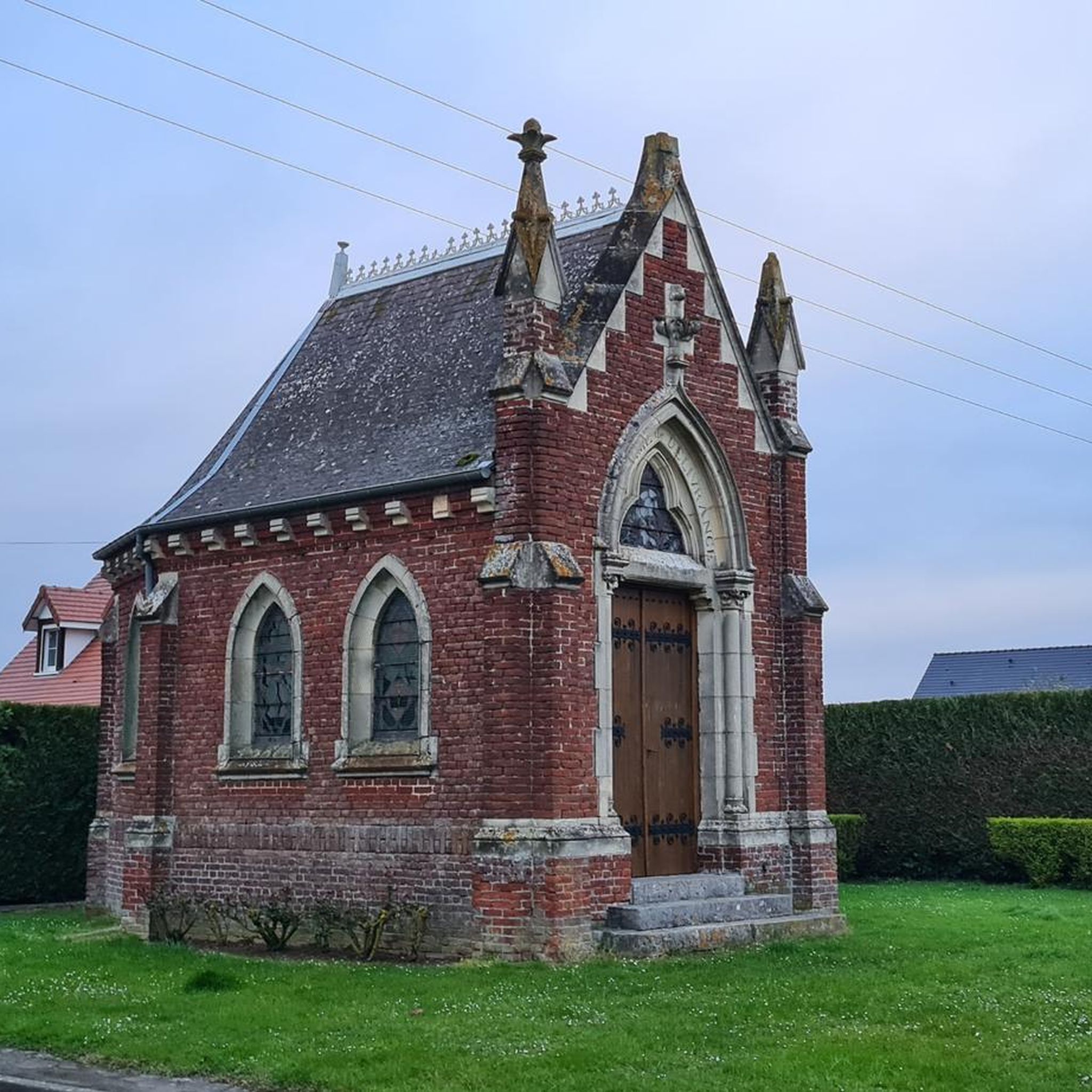
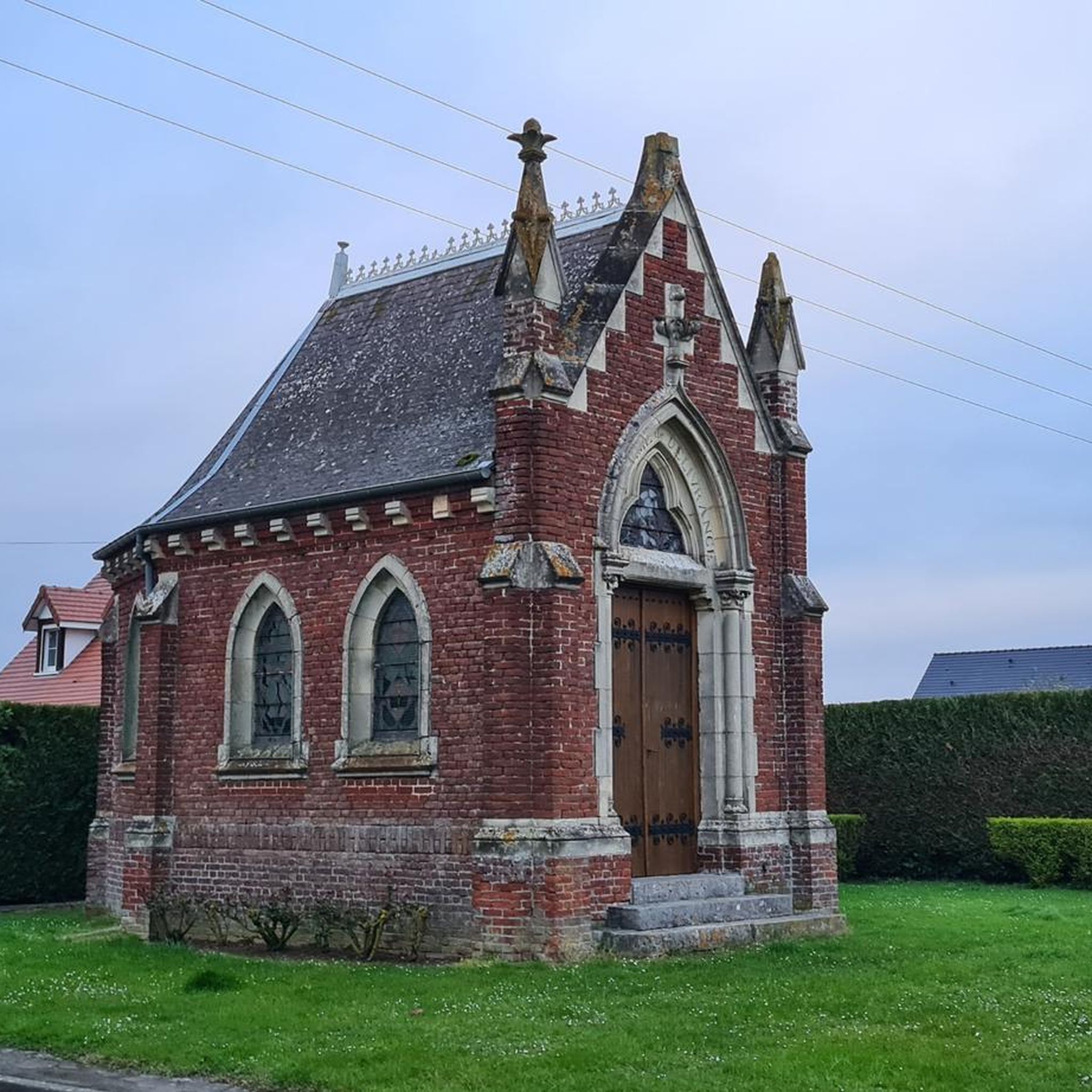
Under rehabilitation, a donation of € 100,000, already 30,000 committed to clearing or secured. it will take 300,000 € in total
0
0
Frequently Asked Questions
How many hiking trails are available around Arvillers?
There are over 30 hiking routes around Arvillers, offering a mix of easy and moderate options. You'll find 15 easy trails and 18 moderate trails to explore the diverse landscapes of the region.
Are there any family-friendly hiking options near Arvillers?
Yes, the Réserve Naturelle de l'Étang Saint-Ladre, located about 23 kilometers from Arvillers, offers an easy, circular path roughly 1.6 kilometers long. It's suitable for all ages and fitness levels, with viewpoints for observing wildlife.
Can I bring my dog on the hiking trails in Arvillers?
Many trails in the Somme region are dog-friendly, especially in areas like the Forêt de Compiègne. However, for nature reserves such as the Réserve Naturelle de l'Étang Saint-Ladre, it's advisable to check specific regulations regarding pets to ensure a pleasant visit for everyone and to protect local wildlife.
Are there circular walks available around Arvillers?
Yes, many routes around Arvillers are designed as circular walks. For example, the Davenescourt Castle loop from Davenescourt is a popular 10.5 km circular trail, and the Wooden bridge loop from Fignières is another moderate circular option.
What natural features or landmarks can I expect to see while hiking?
The region offers diverse natural features. You can explore wetlands and ponds at the Réserve Naturelle de l'Étang Saint-Ladre, vast forests like the Forêt de Compiègne with its beech and oak trees, and limestone hillsides known as 'larris' which provide elevated viewpoints over the landscape. Historic sites, such as the Ruins of the Cemetery Chapel loop from Guerbigny, also add to the experience.
What is the best time of year to go hiking in Arvillers?
The Somme region, including Arvillers, is enjoyable for hiking throughout much of the year. Spring and autumn offer pleasant temperatures and beautiful scenery with blooming flowers or vibrant foliage. Summer is also suitable, though it's best to start early to avoid the midday heat. Winter hikes can be serene, especially in the forests, but require appropriate gear.
Are there any accessible trails for people with limited mobility or wheelchairs?
The Réserve Naturelle de l'Étang Saint-Ladre, while not explicitly wheelchair-accessible in all sections, features a marked trail that is generally easy and flat, making it suitable for many visitors with limited mobility. It's always recommended to check specific trail conditions before visiting.
Where can I find parking for hiking trails near Arvillers?
Parking is generally available at the starting points of many popular trails and near villages. For example, trails originating from Davenescourt or Fignières typically have designated parking areas. It's advisable to check the specific route details on komoot for parking information related to your chosen hike.
Can I reach hiking trails near Arvillers using public transport?
While Arvillers itself is a smaller commune, public transport options in the Somme department can connect you to larger towns. From there, local buses or regional services might provide access closer to some trailheads. However, for direct access to many rural hiking starting points, a car is often the most convenient option.
What do other hikers enjoy most about hiking in Arvillers?
The hiking routes around Arvillers are highly rated by the komoot community, with an average score of 4.6 stars from over 10 reviews. Hikers often praise the quiet woodlands, the varied terrain that includes forests and 'larris' (limestone hillsides), and the well-maintained paths that make exploring the natural environment enjoyable.
Are there opportunities for wildlife spotting during hikes?
Absolutely. The Réserve Naturelle de l'Étang Saint-Ladre is a prime location for observing diverse wildlife, including dragonflies, butterflies, frogs, and various water birds in its wetlands. The Forêt de Compiègne is also home to larger fauna such as deer, roe deer, and wild boars, offering opportunities for wildlife encounters.
Are there any longer, more challenging hikes available?
While most trails around Arvillers are categorized as easy to moderate, some routes offer longer distances. For instance, the Ruins of the Cemetery Chapel loop from Lignières is an 11.1 km moderate trail. The vast network of paths in the Forêt de Compiègne also allows for combining sections to create longer, more challenging excursions.
Most popular routes around Arvillers

Get inspired with the komoot mobile app


Explore more
Browse the best Hikes in other regions.
