The best mountain hikes around Mayschoß
4.8
(50)
112
hikers
9
hikes
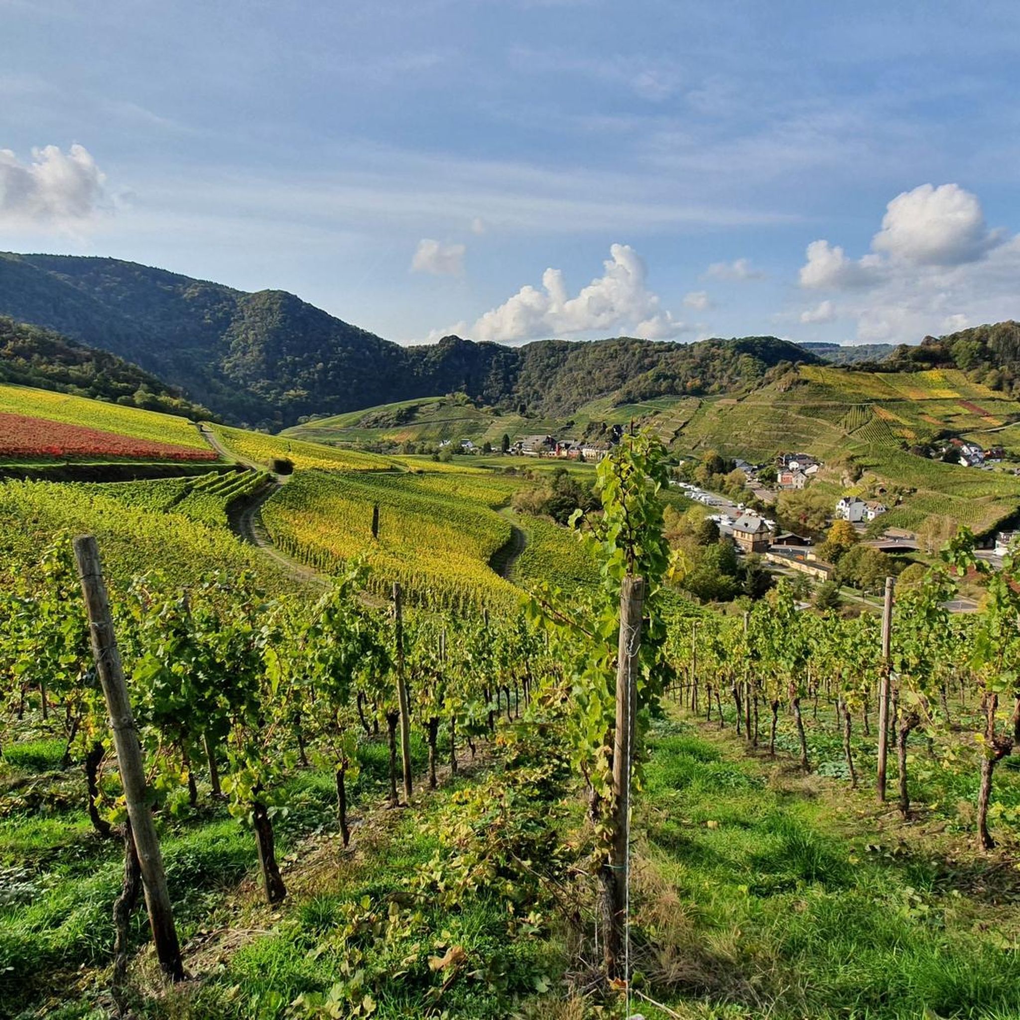
Mountaineering around Mayschoß offers routes through the varied terrain of the Ahrweiler region. The landscape is characterized by its mountainous features, including prominent summits and deep valleys. Dense woodlands often line the paths, providing a natural setting for ascents and descents. The area provides a range of challenging mountaineering routes suitable for experienced adventurers.
Best mountaineering routes around Mayschoß
- The most popular mountaineering route is Teufelsley summit – Engelsley Summit Cross loop from Altenahr, an 8.2 miles (13.2 km) trail that takes 4 hours 23 minutes to complete. This difficult route features significant elevation gain and panoramic views from multiple summits.
- Another top favourite among local mountaineers is Devil's Hole – Teufelsley summit loop from Kesseling, a difficult 9.2 miles (14.8 km) path. This route includes varied terrain, from forest sections to open areas with expansive vistas.
- Local mountaineers also love the Teufelsley summit – Altenahrer Eck loop from Altenahr, a 10.9 miles (17.6 km) trail leading through challenging ascents and descents, often completed in about 5 hours 46 minutes.
- Mountaineering around Mayschoß is defined by its prominent summits, deep valleys, and dense forest sections. The network offers options primarily for experienced mountaineers seeking challenging ascents and demanding terrain.
- The routes in Mayschoß are highly rated by the komoot community with an average score of 4.8 stars from over 40 reviews. More than 100 mountaineers have used komoot to explore Mayschoß's varied terrain.
Last updated: July 2, 2026
4.5
(13)
35
hikers
14.3km
04:39
550m
550m
Hard mountaineering route. Good fitness required. Sure-footedness, sturdy shoes and alpine experience required.
5.0
(15)
22
hikers
16.6km
05:33
660m
660m
Hard mountaineering route. Very good fitness required. Sure-footedness, sturdy shoes and alpine experience required.

Sign up for free
4.5
(2)
8
hikers
16.2km
05:03
550m
550m
Hard mountaineering route. Very good fitness required. Sure-footedness, sturdy shoes and alpine experience required.
5.0
(1)
2
hikers
22.7km
06:58
740m
740m
Hard mountaineering route. Very good fitness required. Sure-footedness, sturdy shoes and alpine experience required.
5.0
(1)
3
hikers
11.0km
03:08
250m
250m
Moderate mountaineering route. Good fitness required. Easily-accessible paths. Suitable for all skill levels.
Get access to more routes and recommendations from other explorers.
Sign up for free
Already have an account?
Our route recommendations are based on thousands of hikes, rides, and runs completed by other people on komoot.
Start today with a free account
Your next adventure awaits.
Login or Signup

Tips from the Community

During wine week there will be a wine kiosk here and you can buy a holder to put your wine glass in 😀
17
1
The devil once went to the Ahr valley and was so pleased with the land and its people, but especially the excellent red wine, that he forgot his way home. One day, while he was resting on the mountain opposite Are Castle, his grandmother approached him in the form of a beautiful girl. In the arms of the lovesick devil, she quickly changed back into the disgusting old woman he knew all too well. Angrily, he grabbed his grandmother and threw her back through the rock face into hell. This is how the Teufelsloch came into being, which can still be seen above Altenahr today.
20
0

Probably the most beautiful part of the panoramic path above Pützfeld. From here you have a very nice view of the Ahr valley.
6
0

Really alpine trail with easier climbing sections, not always very stable rock and sometimes finding the way requires a bit of intuition.
4
0

Former witch hunt/execution site and current barbecue area... sounds a bit macabre at first. Past and present seem to be in flux here. In 1609, 62 people were executed there on six days of executions for alleged witchcraft.1512, among others, Simon von der Leyen, the 22nd abbot of the Benedictine abbey of Maria Laach, was allegedly murdered by a witch using poisoned cheese. In Antweiler alone, nine alleged witches were executed. Given the small population, this is a fairly high number of victims. In the dioceses of Trier and Cologne, the witch craze raged particularly cruelly. During the Thirty Years' War, the Saffenburg was repeatedly the scene of witch trials - until the witch hunters were driven out by Swedish troops in 1632.
2
0
In 1609, 62 people were executed there on six days for alleged witchcraft. In 1512, among others, Simon von der Leyen, the 22nd abbot of the Benedictine abbey of Maria Laach, was allegedly murdered by a witch using poisoned cheese. In Antweiler alone, nine alleged witches were executed. Given the small population, this is a fairly high number of victims. In the dioceses of Trier and Cologne, the witch craze raged particularly cruelly. During the Thirty Years' War, the Saffenburg was repeatedly the scene of witch trials - until the witch hunters were driven out by Swedish troops in 1632.
2
0

The dwarf or angel hole at Engelsley is significantly smaller and more difficult to reach than the devil's hole. The Engelsley is not suitable for inexperienced hikers!
1
0

The corner far above the river offers a very nice view of the Ahr valley.
19
1
Frequently Asked Questions
How many mountaineering routes are available around Mayschoß?
There are 10 dedicated mountaineering routes around Mayschoß, offering a range of challenging ascents and descents through the region's mountainous terrain.
Are there any easy mountaineering routes for beginners in Mayschoß?
While Mayschoß is primarily known for its challenging routes, there is one route classified as easy. However, most mountaineering options here are designed for experienced adventurers, featuring significant elevation changes and demanding terrain.
What kind of terrain can I expect on mountaineering routes in Mayschoß?
The terrain around Mayschoß is characterized by prominent summits, deep valleys, and dense woodlands. You'll encounter varied paths, from forest sections to open areas with expansive vistas, often involving challenging ascents and descents.
Are there any circular mountaineering routes in Mayschoß?
Yes, many of the mountaineering routes around Mayschoß are circular. For example, the difficult Teufelsley summit – Engelsley Summit Cross loop from Altenahr is an 8.2-mile loop, and the Devil's Hole – Teufelsley summit loop from Kesseling is a 9.2-mile circular path.
What are some notable viewpoints or landmarks along the mountaineering routes?
Many routes offer stunning views. You can find highlights such as the View from Schrock, the Teufelsley summit, and the Engelsley Summit Cross. The View of Saffenburg and the Ahr Valley is another popular spot.
What do other mountaineers say about the routes in Mayschoß?
The mountaineering routes in Mayschoß are highly regarded by the komoot community, boasting an average rating of 4.8 stars from over 40 reviews. Users frequently praise the challenging nature of the trails and the rewarding panoramic views from the summits.
Are there any less crowded mountaineering options if I prefer solitude?
While specific crowd levels vary, routes like the Teufelsley summit loop from Ahrbrück might offer a more secluded experience compared to the most popular starting points. Exploring routes that begin slightly further from the main towns can often lead to quieter paths.
What is the typical duration and elevation gain for a mountaineering route in Mayschoß?
The routes vary, but you can expect significant challenges. For instance, the Teufelsley summit – Altenahrer Eck loop from Altenahr is 10.9 miles long, takes nearly 6 hours, and involves over 680 meters of elevation gain. Most difficult routes range from 4 to 6 hours with similar elevation profiles.
Can I find cafes or places to rest near the mountaineering trails in Mayschoß?
Mayschoß and the surrounding villages in the Ahr Valley offer various establishments where you can find refreshments. It's advisable to check local listings for cafes and restaurants in towns like Altenahr or Mayschoß itself, which are often starting or ending points for many routes.
Is public transport available to reach the starting points of mountaineering routes in Mayschoß?
Mayschoß and nearby towns like Altenahr are accessible by regional train services, particularly the Ahr Valley Railway. This can provide convenient access to several trailheads. It's recommended to check current train schedules and bus connections to plan your journey to specific starting points.
What is the best season for mountaineering in Mayschoß?
Spring and autumn generally offer the most pleasant conditions for mountaineering in Mayschoß, with milder temperatures and vibrant scenery. Summer can be enjoyable, but be prepared for warmer weather. Winter mountaineering is possible but requires appropriate gear and awareness of potentially icy or snowy conditions on higher sections.
Are there any longer, more challenging mountaineering routes for experienced hikers?
Absolutely. For experienced mountaineers seeking a longer challenge, the Teufelsley summit loop from Altenahr spans over 19 kilometers (11.9 miles) with more than 660 meters of elevation gain, typically taking nearly 6 hours to complete. This route offers a demanding experience through varied terrain.
Most popular routes around Mayschoß
Most popular attractions around Mayschoß

Get inspired with the komoot mobile app


Explore more
Browse the best Mountain Hikes & Routes in other regions.
