The best running trails around Aguiar Da Beira
21
runners
8
runs
Jogging around Aguiar Da Beira offers diverse terrain across an elevated plateau, characterized by extensive forests and rolling hills. The region, situated in Portugal's Guarda District, provides varied running routes with scenic views. Water bodies such as the Barragem de Santa Maria de Aguilar and the Fumadinha reservoir enhance the natural scenery, offering picturesque paths for runners. Historical sites like the Megalithic Dolmen also provide points of interest along some routes.
Best jogging routes around Aguiar Da Beira
- The most…
Last updated: June 28, 2026
6
runners
28.2km
03:24
540m
540m
Hard run. Very good fitness required. Mostly paved surfaces. Suitable for all skill levels.
4
runners
7.31km
00:47
100m
100m
Moderate run. Good fitness required. Mostly paved surfaces. Suitable for all skill levels.

Sign up for free
3
runners
6.53km
00:42
60m
60m
Moderate run. Good fitness required. Mostly paved surfaces. Suitable for all skill levels.
2
runners
13.2km
01:38
270m
270m
Moderate run. Good fitness required. Mostly paved surfaces. Suitable for all skill levels.
2
runners
5.79km
00:37
90m
90m
Moderate run. Good fitness required. Mostly paved surfaces. Suitable for all skill levels.
Get access to more routes and recommendations from other explorers.
Sign up for free
Already have an account?
Our route recommendations are based on thousands of hikes, rides, and runs completed by other people on komoot.
Start today with a free account
Your next adventure awaits.
Login or Signup
Tips from the Community

Sad UPDATE: Unfortunately, the area around Vila da Ponte was hit by a severe forest fire on August 15, 2025. The bridge and footbridge are destroyed—nothing is as it was. We wish the residents strength (and sources of funding) to rebuild!
0
0
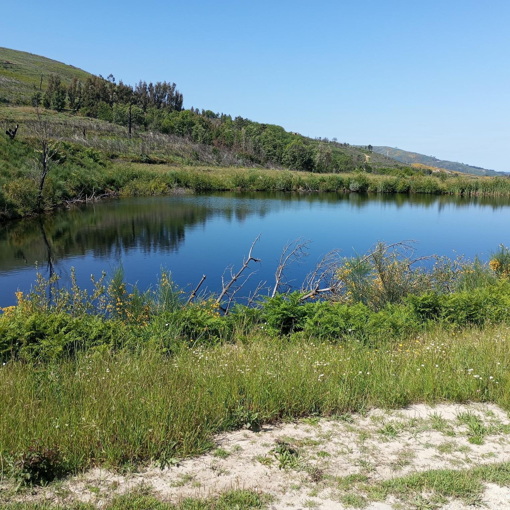
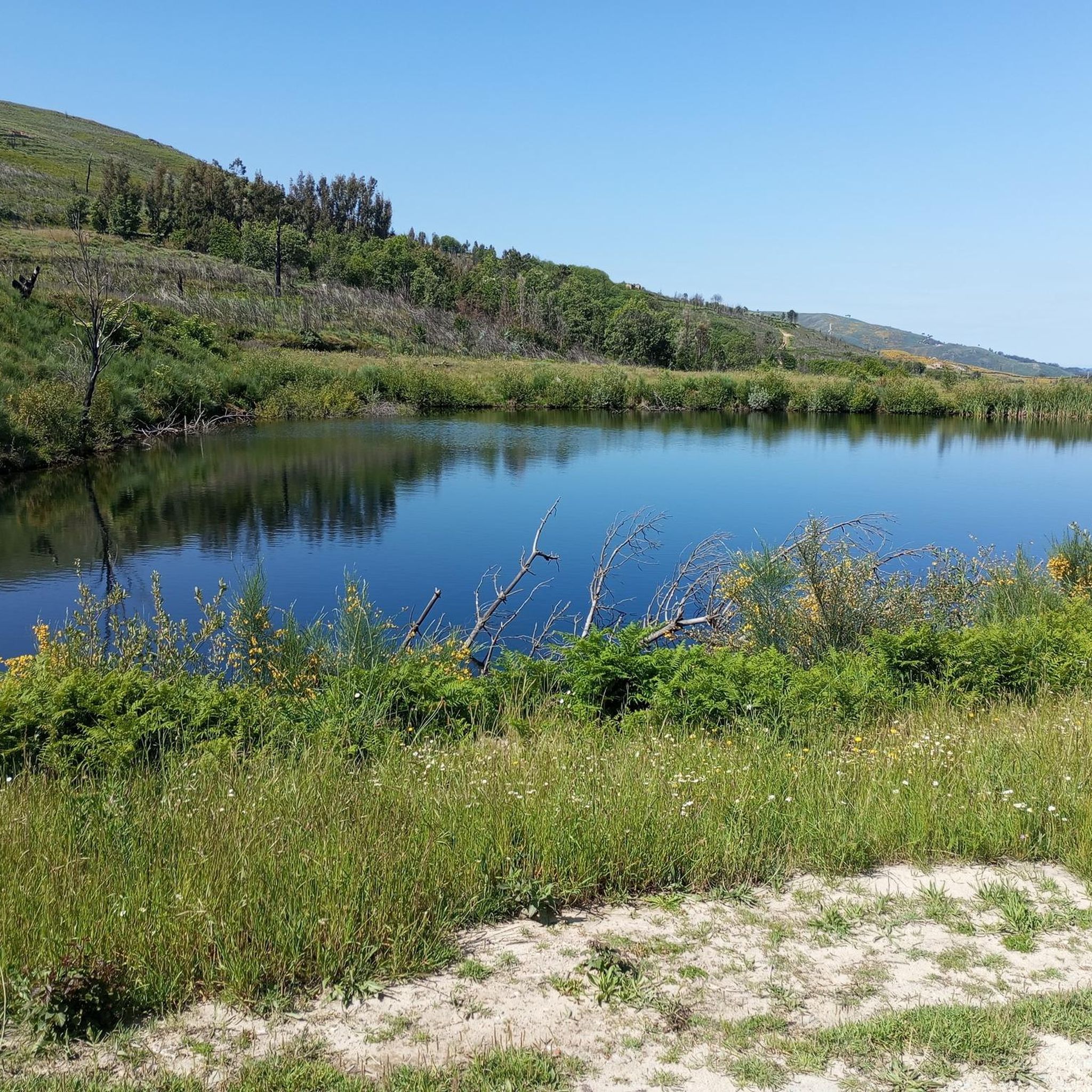
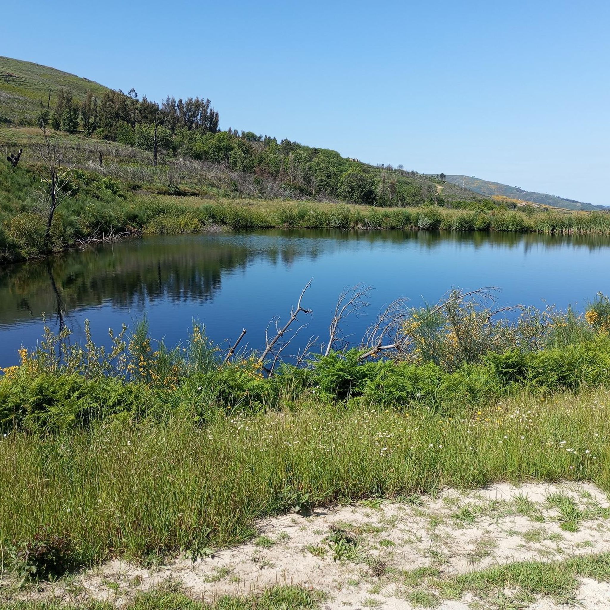
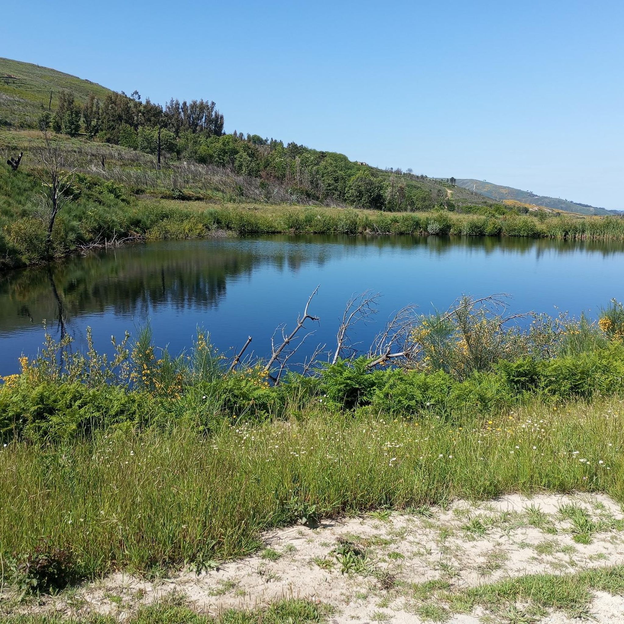
The river Távora, dammed to form the lake, is the ideal starting point. Vila da Ponte is the ideal starting point. Swimming is possible at various spots.
1
0

Its ancient castle contrasts with the fears and fears experienced by the people of yesteryear. It was a border town, the scene of many important battles and struggles for the formation and independence of the kingdom. It received important privileges. D. Afonso Henriques granted it a charter and D. Afonso III the charter of Feira. D. Dinis ordered the construction of the walls that still protect a village where Christians and Jews lived together. The ring of walls that still surround the old medieval town, as well as the vast civil and religious architectural heritage, give the Historic Centre a unique image.
3
0
The Castle of Trancoso is erected atop a hill in the North-Easternmost extreme of the city of Trancoso, within the district of Guarda, Portugal. It is a castle build in between the 10th and 13th centuries, featuring towers and the characteristic walls inclined to the tower of Moorish connotations. From the primitive castle appears the walled fortress with five towers and an homage one, the walls featuring several gates as well. Among these, the Porta do Rei stands out the most for being flanked by two towers.
2
0

The Távora walkways have been given a new lease of life with the bridge that now spans the Ferreirim river, connecting the villages of Freixinho and Ferreirim for the first time. With it, new possibilities emerge, creating circular routes that make longer walks a possibility.
3
0
The Távora walkways create a fascinating route along the banks of the Távora River and the Vilar Reservoir, a body of water that has transformed this landscape into a true natural refuge. In summer, the perfect plan is to get up early, walk the trails before the heat sets in and, at the end, cool off with a dip in one of the river beaches, a simple pleasure that feels so good on hot days.
1
0
The river beach of Vila de Ponte is one of the most beautiful secrets in the North of Portugal. With stunning views over the immense lake, it is the perfect refuge on hot days. At the end of May, the waters invite you to swim in the floating pools — one for adults, one for children. Ideal for families, the area also offers numerous spots for a pleasant picnic by the river.
1
0
Frequently Asked Questions
What kind of terrain can I expect on running routes in Aguiar da Beira?
Aguiar da Beira is situated on an elevated plateau over 700 meters high, offering diverse and invigorating terrain. You'll find extensive forests, rolling hills, and scenic views, including glimpses of the Serra da Estrela mountain range. The natural qualities of these environments make for excellent trail running experiences.
How many running routes are available in Aguiar da Beira?
There are 8 dedicated running routes detailed in this guide for Aguiar da Beira. These include a mix of moderate and difficult trails, catering to various fitness levels.
Are there any easy or moderate running paths for beginners or those looking for a relaxed jog?
Yes, while there are no routes specifically graded as 'easy', there are 5 moderate running paths that are suitable for fit beginners or those seeking a less strenuous experience. For example, the Running loop from Vila da Ponte is a moderate 4.1-mile (6.5 km) trail that can be completed in about 42 minutes.
What are some notable landmarks or points of interest I might encounter on a run?
Several routes pass by interesting historical and natural features. For instance, the Dólmen de Matança loop from Matança takes you near the ancient Megalithic Dolmen. You might also encounter the Pedestrian Bridge of Ribeira de Ferreirim, which is part of the Távora walkways, offering picturesque views.
Are there any running routes that feature water bodies or reservoirs?
Yes, the region's landscape is enhanced by several water features. The Barragem de Santa Maria de Aguilar and the Fumadinha reservoir (albufeira da Fumadinha) are notable, surrounded by pine forests, providing picturesque settings for a peaceful run. While specific routes in this guide might not directly follow their banks, the presence of these water bodies contributes to the overall scenic beauty of the area.
When is the best time of year for running in Aguiar da Beira?
Spring and autumn are considered ideal seasons for outdoor activities like running in Aguiar da Beira. The temperatures are milder during these periods, making for more comfortable and enjoyable conditions on the trails.
Are there any circular running routes in Aguiar da Beira?
Yes, many of the running paths in Aguiar da Beira are designed as loops, allowing you to start and finish in the same location. Examples include the Running loop from Aguiar da Beira and the Historic Village of Trancoso loop from Trancoso.
What is the longest running route available in this guide?
The longest running route featured is the Pelourinho de Aguiar da Beira loop from Aguiar da Beira, which spans 17.5 miles (28.2 km). This difficult trail includes significant elevation changes and typically takes around 3 hours and 23 minutes to complete.
What do other runners say about the trails in Aguiar da Beira?
Over 20 runners have used komoot to explore Aguiar da Beira's varied terrain. While specific ratings aren't available for all routes, the community generally appreciates the region's diverse landscapes, from elevated plateaus to dense forests and rolling hills, which offer a range of running experiences.
Are there any historical sites near the running routes?
Yes, the region is rich in history. Besides the Megalithic Dolmen, which is a national monument, you can find other archaeological sites, including ancient castros (hill forts), integrated into the landscape. The Historic Village of Trancoso, with its Castle Walls, is also accessible via a running loop.
Are there routes with significant elevation gain for a challenging workout?
Absolutely. The region's elevated plateau and rolling hills provide excellent opportunities for challenging runs. The Pelourinho de Aguiar da Beira loop from Aguiar da Beira, for example, features over 540 meters of elevation gain, making it a demanding option for experienced runners.
Most popular attractions around Aguiar Da Beira

Get inspired with the komoot mobile app


Explore more
Browse the best Running Trails & Routes in other regions.
