The best road cycling routes around Derryware
50
riders
6
rides
Road cycling routes around Derryware traverse a landscape characterized by diverse natural features, including coastal vistas, challenging mountain terrain, and serene countryside. The region features the Sperrin Mountains, offering significant elevation gains, alongside the River Foyle and its surrounding valley. Cyclists can also find routes through lush parklands and woodlands, providing varied settings for rides.
Best road cycling routes around Derryware
- The most popular road cycling route is Lough Neagh loop from Dungiven - Sperrins, a 60.0 miles (96.5…
Last updated: May 17, 2026
1
riders
96.5km
04:29
1,110m
1,110m
A difficult 59.9-mile road cycling route in the Sperrin AONB, combining mountain climbs with views of Lough Neagh.
33
riders
109km
05:46
1,720m
1,720m
Hard road ride. Very good fitness required. Mostly well-paved surfaces and easy to ride.

Sign up for free
5
riders
44.4km
02:03
430m
430m
Moderate road ride. Good fitness required. Mostly well-paved surfaces and easy to ride.
3
riders
48.2km
02:21
530m
530m
Moderate road ride. Good fitness required. Mostly well-paved surfaces and easy to ride.
3
riders
98.8km
04:34
840m
840m
Moderate road ride. Good fitness required. Some segments of this route may be unpaved and difficult to ride.
Our route recommendations are based on thousands of hikes, rides, and runs completed by other people on komoot.
Start today with a free account
Your next adventure awaits.
Login or Signup
Popular around Derryware

Tips from the Community


Mountsandel Fort is a prehistoric fort dating to the Mesolithic period that was reused in the Irish Middle Ages (10th to 11th centuries). Located in Coleraine, County Derry, the fort consists of a huge grassy mound hollowed out in the middle, overlooking the River Bann. A must-see for lovers of mysterious monuments!
1
0

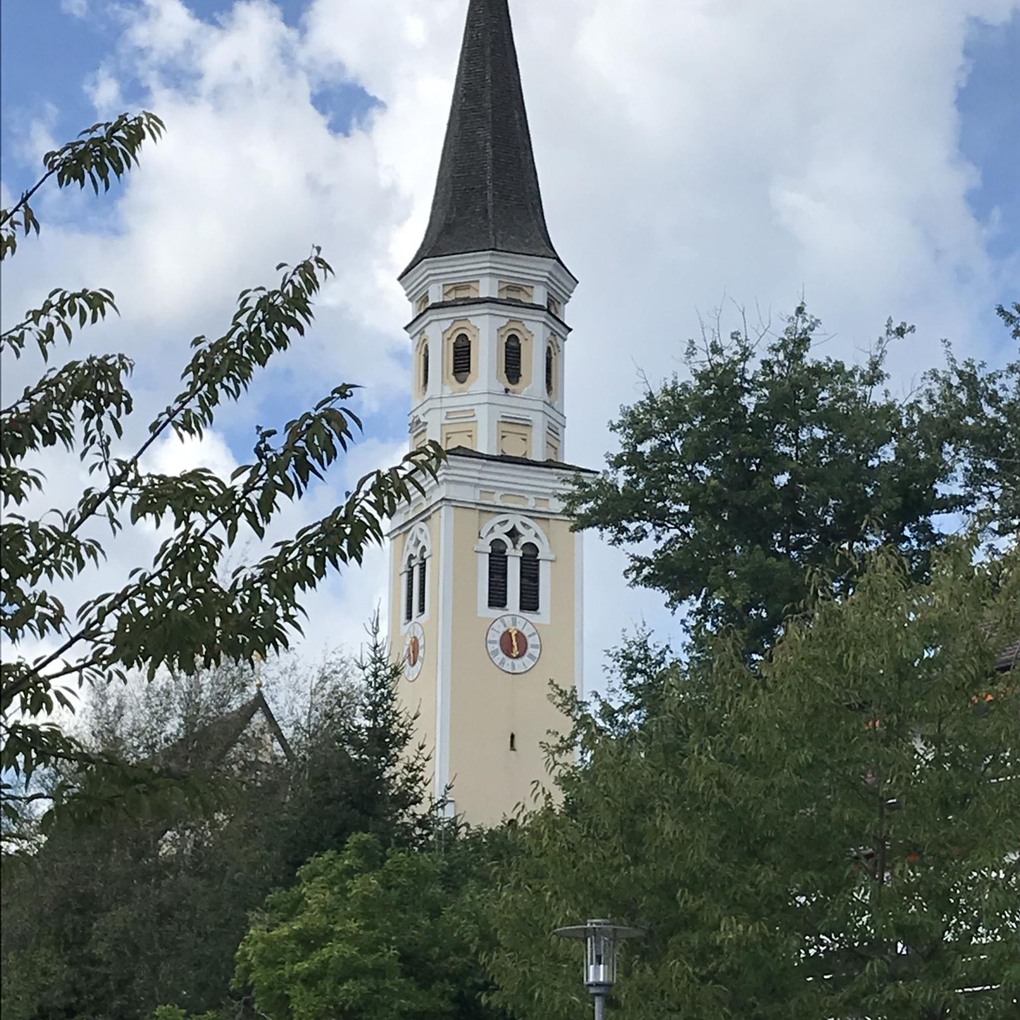
The church is located in the pedestrian area and the park is behind it, with playgrounds and a nice lawn.
1
0
In a very nice little square, with benches and many shops in the pedestrian area.
1
0

Contained within the ruins is a sculpture of the crucifixion, which is thought to date from the 10th Century, making it one of the oldest in Ireland. St Lurach founded an important church here in the 6th century. It was plundered by Vikings in 832 and burned in 1135. Following the 12th-century ecclesiastical reforms this was the seat of a bishop from the mid 12th to the mid 13th century, then served as parish church until the new church across the road was built in the early 19th century. This long history is reflected in the much patched and altered fabric, and the big uneven graveyard.
0
0

Altinaghree Castle is also known as Liscloon House and it thought to have been built in 1860 by William Ogilby
1
0


With Barnes Top and Knockanbane Mountain to the east and Sawel Mountain to the south east, Sperrins Road carves through the landscape with cracking views all around. There is some descent climbing to get here but it's worth it.
0
0
Frequently Asked Questions
What types of road cycling routes can I find in Derryware?
Derryware offers a diverse range of road cycling experiences. You can explore stunning coastal routes with refreshing sea breezes, tackle challenging climbs in the Sperrin Mountains, or enjoy serene rides along the River Foyle and through lush parklands. The region's varied terrain caters to different preferences and fitness levels.
Are there challenging road cycling routes for experienced riders in Derryware?
Yes, for experienced riders seeking a challenge, the Sperrin Mountains offer significant elevation gains and expansive panoramic views. Routes like the Lough Neagh loop from Dungiven - Sperrins (96.5 km with over 1100m elevation) and the Lough Lark – Goles Stone Row loop from Feeny Road Bus Stop (109.1 km with over 1700m elevation) are classified as difficult and will test your endurance.
Are there any moderate or easier road cycling options in Derryware?
Absolutely. Derryware also provides moderate routes suitable for those looking for a less strenuous ride. For example, the Graffiti Art loop from Limavady is a 44.4 km route that takes about 2 hours to complete, offering varied terrain without extreme climbs. Another moderate option is the Roadbike loop from Feeny, which covers 48.1 km.
What are the best times of year for road cycling in Derryware?
The best time for road cycling in Derryware is generally from spring through autumn (April to October) when the weather is milder and daylight hours are longer. During these months, you can fully enjoy the coastal vistas and mountain scenery. Always check local weather forecasts before heading out.
What kind of scenic viewpoints or natural features can I expect along the routes?
Derryware's routes are rich in scenic beauty. You can expect panoramic views of the Atlantic Ocean along coastal paths, expansive vistas across the Sperrin Mountains, and tranquil scenes along the River Foyle. Many routes also pass through lush parklands and woodlands, offering a refreshing natural backdrop for your ride. Keep an eye out for landmarks like Mussenden Temple on coastal routes.
Are there loop trails available for road cyclists in Derryware?
Yes, many of the road cycling routes in Derryware are designed as loops, allowing you to start and finish at the same point. Examples include the challenging Lough Neagh loop from Dungiven - Sperrins and the moderate Graffiti Art loop from Limavady. These circular routes make planning your ride more convenient.
What is the cycling infrastructure like in Derryware?
Derry~Londonderry and its surrounding areas are actively developing their cycling network. You'll find a mix of traffic-free greenways, roadside traffic-free routes, and dedicated park cycle paths. There are also quiet roads shared with limited motorized traffic. The local council is expanding the network, and public cycle parking and bike repair stations with pumps and basic tools are increasingly available.
Are there any specific attractions or points of interest near the road cycling routes?
Beyond the natural beauty, you can find historical landmarks and charming towns. The 'Downhill Demesne Coastal Path' area, for instance, features the iconic Mussenden Temple. The Foyle Valley Cycle Route connects Derry City to border towns like Lifford and Strabane, offering cultural exploration. For more information on local attractions, you can visit Visit Derry's outdoors and nature section.
Can I find places to stop for refreshments or cafe breaks along the routes?
While specific cafe stops are not detailed for every route, the region's charming towns and villages, especially along coastal routes like the 'Molville and Buncrana from Derry loop' or those connecting to Derry City, offer opportunities for refreshment. Planning your route with komoot allows you to identify potential stops in advance.
How long do road cycling routes in Derryware typically take to complete?
The duration varies significantly depending on the route's length and difficulty. For example, a moderate route like the Graffiti Art loop from Limavady (44.4 km) can be completed in about 2 hours. More challenging routes, such as the Garvagh Pyramid – Mountsandel Fort loop from Coleraine (98.7 km), might take around 4 hours 30 minutes, while the longest routes can take over 5 hours.
What makes road cycling in Derryware a unique experience?
Road cycling in Derryware is unique due to its exceptional blend of diverse landscapes. You can transition from rugged coastlines and sandy beaches to the challenging ascents of the Sperrin Mountains, and then to the peaceful river valleys and lush parklands. This variety, combined with developing cycling infrastructure, offers a rich and engaging experience for all road cyclists.
Most popular routes around Derryware

Get inspired with the komoot mobile app


Explore more
Browse the best Road cycling routes in other regions.
