Redenhall With Harleston
Redenhall With Harleston
The best walks and hikes around Redenhall With Harleston
4.3
(131)
682
hikers
49
hikes
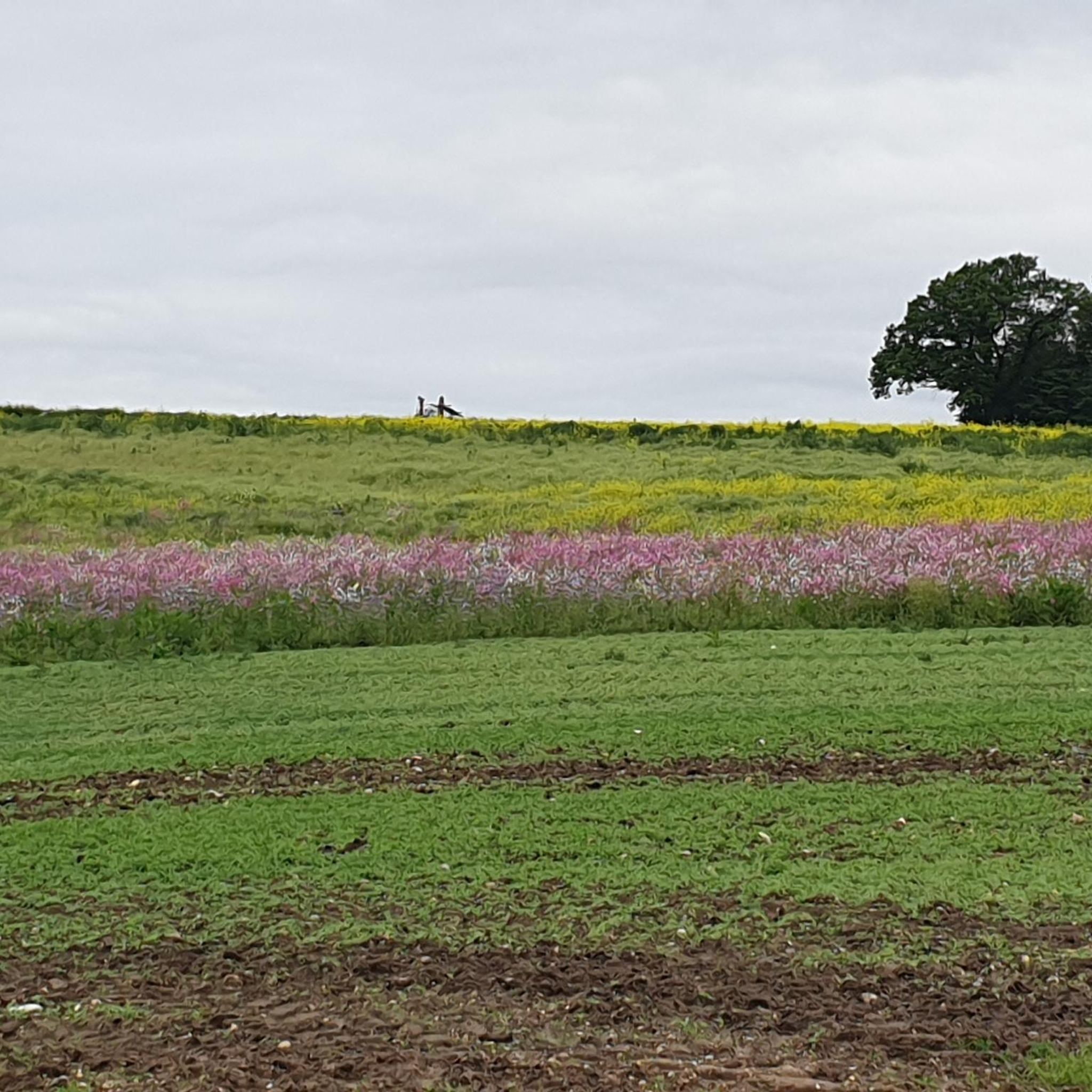
Hiking around Redenhall With Harleston offers diverse natural landscapes and historical richness. The area is characterized by an unspoilt natural landscape, with the Waveney Valley bordering the parish to the south. The terrain includes a network of irregular fields, old hedgerows, remnants of ancient woodlands, and wetlands, with the town of Harleston situated on a plateau. Land descends towards the River Waveney and Starston Beck, providing varied elevations for hiking.
Best hiking trails around Redenhall With Harleston
- The most popular…
Last updated: August 19, 2026
4.8
(6)
14
hikers
8.04km
02:03
30m
30m
Moderate hike. Good fitness required. Easily-accessible paths. Suitable for all skill levels.
5.0
(2)
18
hikers
4.66km
01:11
20m
20m
Easy hike. Great for any fitness level. Easily-accessible paths. Suitable for all skill levels.

Sign up for free
5.0
(1)
7
hikers
Easy hike. Great for any fitness level. Easily-accessible paths. Suitable for all skill levels.
3
hikers
7.04km
01:48
20m
20m
Easy hike. Great for any fitness level. Easily-accessible paths. Suitable for all skill levels.
4
hikers
6.94km
01:49
50m
50m
Easy hike. Great for any fitness level. Easily-accessible paths. Suitable for all skill levels.
Get access to more routes and recommendations from other explorers.
Sign up for free
Already have an account?
Our route recommendations are based on thousands of hikes, rides, and runs completed by other people on komoot.
Start today with a free account
Your next adventure awaits.
Login or Signup
Popular around Redenhall With Harleston

Tips from the Community

The more scenic alternative to the modern road bridge on the adjacent B1062. A popular swim and picnic spot in the summer.
0
0

I was there today and was attacked by horseflies which started biting my legs as soon as I arrived, so I beat a hasty retreat. The river by the bridge at Homersfield is easier access.
0
0

A great place to canoe from if heading into Bungay and the variousMills and maltings. Heading out towards Earsham its a little shallow so I'd recommend plastic boats only.
0
1

Before Flixton quarry was put into use, an archeological survey discovered numerous evidence of Neolithic activity in the immediate area, including pits, ditches and ceramic artefacts. A mammoth tusk was also found here during excavations. Today, a large area of the pits is a thriving habitat for birds and wildlife. You’ll find an information board just above the quarry and keep an eye out for the birds that call this open water area home.
0
0
The oldest concrete bridge in Great Britain, Homersfield bridge has one foot in Suffolk and one in Norfolk as it crosses the River Waveney. A grade II listed structure, this charming span is a lovely place to pause and admire the river and it chuckles along its wandering path. Built in 1869, it’s made of concrete and has a wrought iron frame within. It was restored in the 90s and now hosts only foot and bike traffic.
0
0
A short but beautiful section of the Angles Way leading from Homersfield village to Mendham. Read the signs and take heed as there on occasion bulls in the fields.
0
0
A first class lunch stop a minute from the Angles Way footpath. Just be aware that from time to time there could be a bull in the field and the obvious danger of deep water.
0
0
Quite a nice place to get in to the water if you have a plastic canoe as the water is shallow. The Black Swan pub or The Dirty Duck as its known by the locals is a stones throw away too and a quite excellent pub
0
0
Frequently Asked Questions
How many hiking trails are available around Redenhall With Harleston?
There are over 45 hiking routes available around Redenhall With Harleston, offering a variety of experiences from easy strolls to more moderate treks. The komoot community has explored more than 600 of these routes.
What kind of landscape can I expect when hiking in Redenhall With Harleston?
The region is characterized by an unspoilt natural landscape, particularly the picturesque Waveney Valley. You'll encounter a network of irregular fields, old hedgerows, remnants of ancient woodlands, winding lanes, hay meadows, pastures, rivers, and wetlands. The town of Harleston itself is on a plateau, with land descending towards the River Waveney and Starston Beck.
Are there any circular hiking routes in the area?
Yes, many of the routes around Redenhall With Harleston are circular. For example, the Homersfield Bridge loop from Wortwell is an easy circular trail, and the Tyrrel's Wood loop from Shelton and Hardwick also offers a pleasant circular walk through woodlands.
What do other hikers say about the trails in Redenhall With Harleston?
The trails in Redenhall With Harleston are highly rated by the komoot community, with an average score of 4.3 stars from over 100 reviews. Hikers often praise the diverse natural landscapes, the quiet ancient woodlands, and the well-maintained paths that offer a mix of easy and moderate options.
Are there easy hiking options suitable for beginners?
Absolutely. Nearly 20 easy routes are available. A great option for beginners is the Homersfield Bridge loop from Wortwell, which is 2.9 miles (4.7 km) long and offers pleasant views by the River Waveney. Another easy choice is the Tyrrel's Wood loop from Shelton and Hardwick.
Can I find more challenging or longer hikes around Redenhall With Harleston?
Yes, there are around 30 moderate routes for those seeking a longer or more challenging experience. The Hawkers Hall – Soul Café loop from Wortwell is a moderate 6.1 miles (9.8 km) path with varied terrain, ideal for hikers with good fitness. Another moderate option is The Angles Way – Homersfield Bridge loop from Mendham.
Are there any historical sites or landmarks to see while hiking?
Yes, the area is rich in history. You can visit the Homersfield Bridge, a Grade II listed concrete structure and the oldest of its kind in Great Britain, often found along routes by the River Waveney. Nearby, you can also explore the ruins of Bungay Castle in Bungay Town Centre.
Where can I experience the Waveney Valley's natural beauty?
The Waveney Valley borders the parish to the south and is a defining feature of the region. Many trails, such as the Homersfield Bridge loop from Wortwell, offer views and access to the River Waveney. The valley's ancient landscape includes a network of fields, hedgerows, and wetlands, perfect for nature observation.
Are the hiking trails around Redenhall With Harleston suitable for families with children?
Many of the easy routes are suitable for families. The gentle terrain and shorter distances of trails like the Homersfield Bridge loop from Wortwell make them enjoyable for children. The presence of nature reserves and historical sites also adds interest for younger hikers.
Can I bring my dog on the trails?
Yes, many trails in the Redenhall With Harleston area are dog-friendly. However, always keep dogs under control, especially when passing through fields with livestock, and be mindful of local signage regarding leash requirements or areas where dogs may not be permitted, such as certain nature reserve sections.
Where can I find parking for the trailheads?
Parking is generally available in or near the villages that serve as starting points for many routes, such as Wortwell, Shelton, and Harleston. Specific parking information can often be found on individual route descriptions on komoot or local council websites. For general information about the area, you might find details on the Harleston Town Council website: Harleston Town Guide.
Are there places to eat or drink near the hiking routes?
Yes, the town of Harleston and surrounding villages offer various cafes and pubs where hikers can refuel. For example, Étude Coffee at The Silo is a local cafe. Many routes pass through or near these settlements, providing convenient stops.
What is the best time of year to go hiking in Redenhall With Harleston?
Hiking is enjoyable year-round, but each season offers a different experience. Spring brings blooming wildflowers and fresh greenery, while autumn showcases vibrant foliage. Summer is ideal for longer days, and winter offers crisp, quiet walks, though some paths might be muddy. Always check local weather conditions before heading out.
Most popular routes around Redenhall With Harleston
Most popular attractions around Redenhall With Harleston

Get inspired with the komoot mobile app


Explore more
Browse the best Hikes in other regions.
